Thought of as an essential transport link in the plan to transform the wild and undeveloped west into the industrial heart of Singapore, the Jurong railway line, which was launched in 1966, was one component of the grand scheme that never quite took off. Built with the intention to carry finished goods out of the huge manufacturing hub to the then domestic market in the Peninsula and to move raw materials to the new factories, the railway’s usefulness was to be surpassed by the efficient road transport network that was also in the works.

A remnant of the western reaches of the line in an area now taken over by nature.

An overlay of the western reaches of the industrial railway shown on a 1980 1:25,000 road map of Singapore over a Google Map by cartographer Mr Mok Ly Yng.
The first train that ran, on a 9 mile (14.5 kilometre) journey from Bukit Timah to Shipyard Road on 11 November 1965, was greeted with much anticipation. Some $5.5 million had been invested on the railway. A total of 12 miles (19 kilometres) of tracks were being laid for the project. Passing over eight bridges and through three tunnels, the railway was expected to handle up to 2 to 3 million tons of cargo a year (see Straits Times report dated 12 November 1965, Jurong Railway makes first public run). It does seem that the railway, even in its first decade, fell short in terms of the anticipated amount of cargo it handled. A Report in the New Nation’s 2 June 1975 edition mentions that only 128,000 tons of cargo had been carried by the railway in 1974. The railway’s last whistle blew unnoticed, possibly some time in the early 1990s, barely a quarter of a century after its inauguration. The land, leased from the Jurong Town Corporation (JTC), was returned and lay relatively untouched and the railway left abandoned and largely forgotten.

The first train coming to a halt at the western reach of the line next to the Mobil refinery (still under construction) at Shipyard Road (photo: National Archives online).
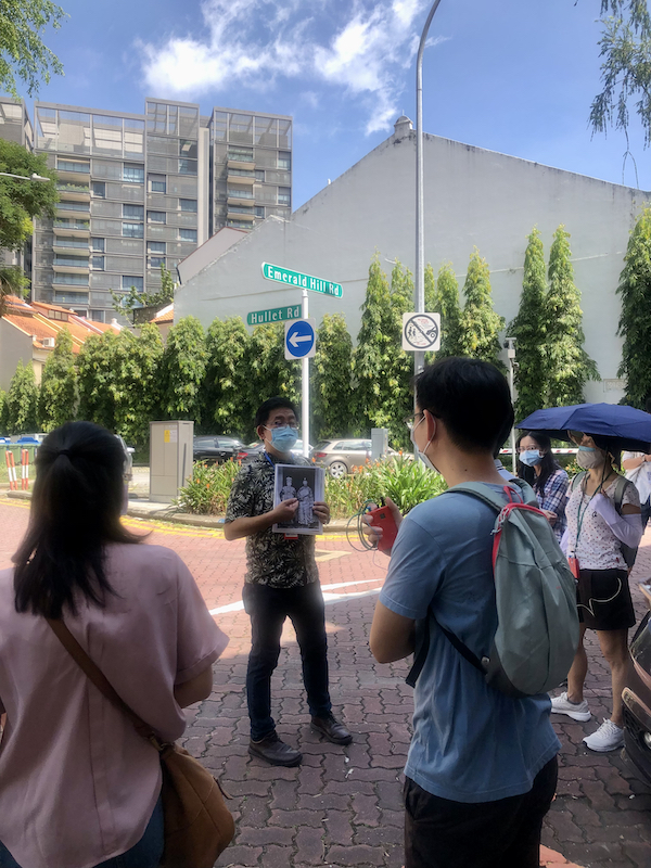
Now, some two decades after its abandonment, we are seeing what’s left of the railway fade further away. Large portions of the land on which it ran has in more recent times been turned over to more productive use. With the pace of this quickening of late, it may not be long before we see what is left of it lost to the now rapidly changing landscape of the industrial west. This was in fact very much in evidence during a recent walk I took with a few friends along the line’s western reaches. The once continuous corridor we had hope to walk along, is now interrupted by recent development activity, many of which take the shape of the multi-level ramp-up logistics facilities that increasingly seem to flavour the west.

What seems to dominate the industrial landscape of the west – the new ramp-up logistics facilities that now rise up above the zinc factory roofs.
The more visible reminders of the railway, at least in the area west of Teban Gardens, are probably found in its final kilometre close to where it came to a halt at Shipyard Road. A scattering of broken concrete, possibly the broken foundations of the railway buffers, marks what would have been the journey’s end. Following the line eastwards towards Tanjong Kling Road from that point will be rewarded with the former corridor’s western reaches’ largest sections of tracks and a concentration of railway signs. The section just east of refinery Road, would have been where several cement factories, which the railway was known to serve, were located.

Tracing the western reaches ….

Nature having its way over what’s left of the tracks.

The western end of what is left of the tracks.

Nature taking over.

A section of the tracks.

More signs of nature taking over.
The now widened Tanjong Kling Road, where a level crossing was located at, marks the end of the section in which the rusting tracks can be found west of Teban, that is until Jurong Port Road. The curious sounding Tanjong Kling, a cape down the road of the same name, formerly Jalan Besi Baja, is where one finds a significant landmark in the industrialisation of Jurong, the National Iron and Steel Mills. The factory, was Jurong Industrial Estate’s first to start production on 2 August 1963. It has since been bought over by Tata Steel.

Tracks close to where the crossing at Tanjong Kling Road would have been.

A level crossing sign before Tanjong Kling Road.
There are several suggestions as to how the tanjong got its name. A rather intriguing suggestion is one that links it to one of the many fascinating tales of the Sejarah Melayu or Malay Annals, the story of Badang. A 14th century champion of the king of Singapura whose strength was legendary, his reputation had reached the shores of the Kling kingdom (the term “Kling”, while regarded today as a derogatory reference to Indians, was commonly used term in the Malay language thought to have been derived from Kalinga, a southern Indian kingdom). This prompted the Rajah of Kling to send his strongman to Singapura to challenge Badang. The challenge, which some have it as having taken place at Tanjong Kling (hence its name), was won with ease by Badang. The champion of Singapura was not only able to lift a huge stone that the Kling strongman could only lift to the height of his knees, but also toss it, as the tale would have it, to the mouth of what is thought to be the Singapore River. There is a suspicion that this stone, was the same stone – the Singapore Stone, that once stood at the mouth of the Singapore River.

A break in the continuity of the former corridor where a ramp-up logistics facility is being built just across the former crossing at Tanjong Kling Road.
Badang, if he were to take up the same challenge up today, might have required just a little more effort to send the stone in the same direction. Man-made obstacles of a different stone now surround the area around Tanjong Kling, one of which, a tall ramp-up logistics facility, now straddles the path the trains once took – just across Tanjong Kling Road. The newly built structure, cut our intended path off towards the western most of Singapore’s railway bridges. A concrete girder bridge across Sungei Lanchar, its somewhat modern appearance tells us that it is a more recent replacement, possibly made necessary by canal widening, for what would have been one of the line’s original bridges.

The western most railway bridge – a modern concrete bridge over Sungei Lanchar.

On the bridge over Sungei Lanchar.
Our attempt to follow the path of the railway was further hampered by recent extensions of factory spaces into the former corridor and a detour was required to take us to the location of the westernmost rail tunnel under Jalan Buroh. The tunnel, now a series of tunnels, lies under the huge roundabout and under the shadow of the bridge linking Jurong Pier Road to Jurong Island. This was to be the last we were to see of the former railway before we came to another former crossing that carried the trains across Jurong Port Road. We were to discover that all traces of the two southbound spur lines on either side of Jurong Port Road we had hope to walk along, still around until fairly recent times, have also all but disappeared.

In search of the tunnel under the Jurong Pier Circus.

A view of the tunnel, now obscured by vegetation.

Another logistics facility standing where the line ran along Jurong Pier Road.

A southward view from Jalan Buroh towards what was the corridor along which the spur line west of Jurong Port Road ran.

Where the same spur line ran northwards.

The southward view to where the spur line east of Jurong Port Road ran.

A new road, evident from the plastic protection still on the road sign, running northward along what was the spur line east of Jurong Port Road.
Unable to follow our intended path, we settled for a walk up Jurong Port Road. This was rewarded with a rather interesting find in a factory building with its name in Chinese made using characters attributed to the hand of a renowned calligrapher, the late Pan Shou. The far end of the road from the factory, just south of what would have been Jalan Ahmad Ibrahim (now the Ayer Rajah Expressway or AYE), we find evidence of the former level crossing in a pair of metal rails embedded into the road. Close by are also several remnants of the tracks running east into what now seems to be a space for parking of heavy vehicles.

The detour we had to take along Jurong Port Road threw up an interesting find – a factory building with its characters in Chinese made by the strokes of a renowned calligrapher Pan Shou.

Tracks of the former level crossing are in evidence at Jurong Port Road.

Tracks seen in what seems to be used as a lorry parking space just south of the former Jurong Bus Interchange.
The end of the lorry park, which lies south of the site of another one time Jurong landmark, the former Jurong Bus Interchange, is where another girder bridge, is to be found. Possibly one of the original steel bridges, the railway tracks one the bridge is still largely intact. Further east, traces of the line disappear until the area just past the pedestrian overhead bridge across the AYE from Taman Jurong. Here, some sleepers can be seen, embedded into a seemingly well trodden path.

The steel girder bridge close to the former Jurong Bus Interchange.

A view on top of the bridge.

The area once occupied by the former interchange.

Evidence of the tracks off the AYE across from Taman Jurong.
Further east, we come to the part of Singapore that will serve the railway of the future as its end point. The journey of the future, to the west of Singapore from Kuala Lumpur, would involve an amount of time that would probably be a little more that the time it might have taken the industrial trains of old to make the journey down from Singapore’s north – not counting the time it would take to clear border formalities. Just across the AYE from the future terminus, the industrial trains, running along the former Jalan Ahmad Ibrahim, would have passed over Sungei Jurong. A long span concrete girder bridge, another that is probably more recent, tells us of this, as does the remnants of another steel girder bridge – the last piece of the railway we were to discover before the end of what turned out to be a 10 kilometre walk.

The concrete bridge – across the Jurong River.
On the evidence of what we saw during the long but not so winding walk was how the landscape of the industrial west is rapidly changing. Ramp-up logistics hubs are now growing out of spaces that would once have been given to low-rise production facilities and large parts of the former rail corridor. This signals a shift towards a fast-growing industrial sector that now accounts for some 9% of Singapore’s GDP. What was also evident is that it will not be long before all traces of the railway in the industrial west is lost and with that the promise with which the first train ran in the first few months of our independence, will completely be forgotten.

























I was hoping somebody would take an initiative to write an article on this Jurong railway line. Thanks for taking this initiative here.
Wow never knew of the history of this line you’ve documented it so well with photos.
Hi! Could you inform me the directions to get there? I cant seem to find them anywhere! Cheers! 🙂