Memories of the lost world that was Somapah Village

16 12 2010

I have but vague memories of a world that once lay at the gateway to my playground by the sea. It was a world that now seems so distant in time and in space, and one that for me comes back in bits and pieces. That was the world that was once the bustling Somapah Village, located close to the 10th milestone of Changi Road, a place that was a major settlement in the area, deserving a mention in the RAF Information Booklet for New Arrivals for its Veterinary Clinic from which dog licenses could be obtained: “Travelling from Changi, Somapah Road is the first turning left after the overhead pedestrian crossing in Suicide Village – an off-white bungalow almost at the end of the road”.

Somapah Village was one of the main settlements in the area and served as the gateway to some of the villages that lay along the old coastline (source: National Archives).

My acquaintance with the village goes back to the early days of Singapore’s independence, when my parents who were in the civil service, made regular use of the Government holiday bungalows near Mata Ikan Village. Somapah Village was where Somapah Road met Upper Changi Road and served as a gateway to the coastal villages that lay to the south-east of it, including Mata Ikan, which was located a mile or so down the road at the coastal end of Somapah Road. Passing through the part of the village which had always seemed a hive of activity in the mornings was also the trigger for me to look out for the red swastika that would be perched on the top of a building, having developed a fascination for the symbol from the many encounters I had with the Nazis that had to do less with my overactive imagination than with the nightly dose of the exploits of Vic Morrow’s character Sgt. Saunders on Combat! The red swastika belonged to the Red Swastika School that was in a quiet part of the village along Somapah Road on the right as we made our way towards Mata Ikan, and was the left facing symbol used by the Taoist Red Swastika Society as opposed to the right facing swastika used by the Nazis, not that I noticed it then.

A photograph of the old Red Swastika School along Somapah Road (source: Red Swastika School's website).

Besides the memories of the red swastika, I do have some further memories of Somapah, two of which relate to visit to the GP’s clinic which was on the right side of the village along Somapah Road (facing south). What I can recollect was that it was perched on a raised area from the road, a unit in a row of shophouses. Both visits made to the GP were certainly painful ones, the first involved my mother who needed the GP’s attention to remove a fish hook which had lodged into the flesh around her knee as she climbed over a sea wall at Mata Ikan. The second was made for my benefit, one in which I sought relief from a painful encounter with the zipper of my shorts.

A scene from Somapah Village in 1986 - I believe the GP's clinic was in the row of shops in the background (source: National Archives).

It wasn’t so much the GP’s clinic that my earliest memories of the village were connected with. Those were of the market, which I believe was on the side opposite the shops where the GP’s clinic was located. It was where (the bungalows we holidayed at were self-catering and featured a well equipped kitchen), my mother would on every other day during our stays, shop for supplies of fresh produce and fish. We could of course rely on the mobile vendors: vegetables, fish, meat and eggs were sold from the back of a pick-up or a van that went from house to house, but the market always offered a much larger assortment. The market was where I had my earliest memories of seeing Sting Rays up close, displayed on the table of a fishmonger close to the entrance of the market. Being the inquisitive child that I was, the market was always a great source of fascination for me.

A barber's shop at Somapah Village (source: National Archives).

On the subject of mobile vendors, one that I was particularly fond of seeing was the bread vendor, who made an appearance every morning with his colourful display of bread dangling from a rack of sorts that was mounted on the back of a motorcycle. His arrival meant I could get my day’s supplies of the sweet grated coconut buns that I never could wait to sink my teeth into. Another one on two wheels that I would look out for would have been the milkman, with a milk can mounted at the back of his bicycle from which he would dispense milk in glass bottles. It is only very recently that I realised that the milk actually came from a dairy farm that was in Somapah Village itself – learning of the farm’s existence from an article on the ThinkQuest website.

A Chinese Temple (source: National Archives).

There are a few who remember the area having lived in the village, including a few readers who were kind enough to share their memories of Somapah on my post on Mata Ikan. One was a Mr Koh who described where the GP’s clinic I mentioned was: “The GP’s clinic was indeed situated close to a row of shophouses. It was located up a small slope called Jalan Somapah Timor. It was opened in 1962. Opposite the clinic and across the road was an open field with some cattle for diary purpose. Beside the clinic was a PAP kindergaten, my first school. Opposite it was a small police post. The market was an open-air market. Some of the vendors had shops with wooden top for their goods; the rest would place their items on ground sheets”. Another who goes by the moniker “sotong” added “my first sch was the PAP kindergarten too. i used to stayed in a house at jalan somapah timor, where the airport was separated from my place by a major road..still rem often seeing and hearing plane flying over my house. Also rem the days accompanying my mum to the market near my kumpung, eating chicken rice in this shop for i think 50cents per pack. but unfortunately i can’t rem exactly where my old house use to be located”.

Chinese Medicine Shop at Somapah Village (source: National Archives).

These days, there isn’t really much to remind us of that Somapah. The village and all around it has all but disappeared and only a few remnants of the area are left. Most of Somapah Road has gone, just a little maybe 50 metre stretch left of it located somewhere close to where Singapore Expo is off Changi South Avenue 1, relegated to a road that serves as a driveway to a car park. Across the road there are a few reminders of the time from which my experiences of Somapah Village were connected with including some of the roads such as Jalan Tiga Ratus and the buildings that were the former Changkat Changi Primary School that rose on a small hill along the Changi Road (now Upper Changi Road) next to Jalan Tiga Ratus which was built in the later half of the 1960s.

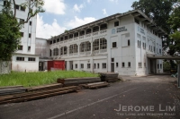
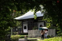
Across the road at Jalan Tiga Ratus, the buildings that were the Changkat Changi Secondary School (1st Photo) and Changkat Changi Primary School (2nd and 3rd Photo) built in the latter part of the 1960s still stand.

Across the road a big void greets the observer where once a bustling Somapah Road and Village had stood.

A gate stands across where Somapah Road had once run towards the coastal village of Mata Ikan.

What used to be Somapah Road near the junction with Upper Changi Road.

Where a village once stood ... now an empty field.


The little bit of Somapah Road that's left ... relegated to an access road for a car park.

A dead end for Somapah Road.

The view of the empty grassland from the south.


No longer the land that Fairy Tales are made of …

9 11 2010

Wandering around parts of the area to the west of Changi Village today, what greets you is the host of holiday facilities, housed in terraced, semi-detached and detached units that had once be given to use as the living quarters of senior servicemen with the British forces stationed in the area. It was back in the days when my very first impressions of Changi Village were formed, that I had first become acquainted with the area, which had lay well protected behind a fence and guarded by alert policemen who played sentry at the main entry point which was a gate just up Netheravon Road from where the village was. Those were the days when what marked Changi Village were the two rows of zinc roofed shop houses which had provided the area with not just a distinct flavour but a feel that made the village a place to escape to. The area up Netheravon Road had a somewhat different feel to the village, being laid out in the fashion of the other British bases found on the island, with much less clutter and wide expansive spaces. Set on the rolling landscape that extended westwards towards the coastline and Fairy Point were the houses that had been the quarters of servicemen, left vacant by that time, as well as several large holiday villas placed at prime locations overlooking the sea. There were also the military facilities for which the area had been guarded including the now infamous former Changi Hospital which had for a time been used as a military hospital as well as several military facilities.

A gate had stood on Netheravon Road at the entrance to what had been a protected area where the likes of the then Prime Minister, Mr Lee Kuan Yew, took his holidays.

By that time, many of the villas by the sea had been turned over for use by the most senior officers of the civil service for holidays, at a time when taking local holidays by the sea was seen as as a fashionable as a holiday in New York, Paris or Tokyo would be seen today. Some of the regular users of the bungalows in the area included members of the Cabinet, including the then Prime Minister, Mr Lee Kuan Yew and his family, who often took their holidays in a section that was further protected by another fence not far from where the Changi Sailing Club is today.

The fenced area seen was a protected area within the entire protected Changi Point area where members of the Cabinet would take their holidays.

Another view of the same fenced area along Netheravon Road.

Access to the area at that time would only have been possible by surrendering one’s identity card at the old style Police Post which was at the junction of Jalan Bekukong and Upper Changi Road … my parents would do that on each of the few occasions that we ventured into the area – as guests of one of their friends who were putting up at one of the bungalows there. My earliest impression of this was going to one which was at Fairy Point, at a large two storey bungalow, for a birthday party for one of the children of my parents’ friends, of which I have only vague memories of. What I do remember very well was the name of the area “Fairy Point” and with that, I had somehow associated the area with its large villas by the sea, one where I could imagine fairy tales being made of.

The area where the Police Post had been stood to the right of this ....

It was in the later part of the 1970s, at a time when Changi Village had already been cleared of the wooden shop houses and had been given the facelift that has made it what it is today, that I would frequent the land of fairy tales regularly. With the massive land reclamation project along much of the southern shores that started in the early 1970s, my parents and many other civil servants were deprived of the use of the wonderful holiday bungalows along the idyllic Tanah Merah and Mata Ikan coast that lay to the south east of Changi Beach, and many of the former quarters within what had been the protected Changi Point area were opened up for use by junior civil servants as holiday chalets, and my parents became regular users of the holiday units there. By that time, access to the area was also then opened to everyone, and we were free to come and go as we pleased, making it much easier to move around. The units that I first took a holiday in in the area is in a row of terraced houses fronting Netheravon Road, at its junction with Sealand Road, which still stands today. I remember that very well for the large airy rooms and the narrow staircase which led up from the entrance area that the door opened to. The units were furnished modestly – the living spaces had the old style rattan furniture with heavy foam cushions, and bed rooms had simple bed frames with mattresses lined with white bed linen. What was always nice to have was the well equipped kitchen which allowed us to self-cater, and my mother would often make her way to the new market at Changi Village to purchase what had seemed to be the freshest fruits of the sea one could then find in Singapore.

The terraced row of holiday units that I first stayed in at the junction of Netheravon Road and Sealand Road.

There were several other units that I had also holidayed at that are still there … one that I regularly found myself at were the semi-detached units which now appear to have been rented out off Sealand Road, which had a nice airy living room and rooms upstairs. Another was the single storey detached unit, Chalet L, off Sealand Road, which I would well remember for being the last unit in the area that I had taken a holiday with my parents at, as well as for being where I, with a few of my platoon mates, had our Run-Out-Date (ROD) party at the end of our fulltime National Service in 1987. It was around 1988 that I last took a holiday there … and following that, I guess life caught up with me and I haven’t really had the chance to walk around to the area since then until very recently … Taking a walk around, I found that much of it does still look the same, with the holiday units looking a lot more well maintained than they did before, being now run by a private entity on behalf of the Govenrment, and most of what had been there is still there. There are also some newer buildings and facilities around as well as additional fences which has somehow made the area seem more cluttered and seem less like that wonderful place I had many memories of … no longer the land perhaps that fairy tales are made of.

I was a regular visitor to the semi-detached units off Sealand Road - which now seems to have been leased out.

Another view of the semi-detached unit.

How the semi-detached unit had looked like in 1987 ... I have some more older photographs of the unit which I have not had the opportunity to scan ....

The inside of Chalet L in 1987.

Chalet L today.

The barbecue pit at Chalet L in 1986.

The barbecue pit today.


The Changi Village that I loved

29 10 2010

One of the places that I would always have a place in my heart for, is the Changi Village that had occupied the many weekends of my early childhood. It was a place that, like much of the Singapore that I had developed a fondness for in my childhood, exists only in the memories of those who had known it as had once been. It was a place which offered many an escape from the hustle and bustle of the expanding city, a world set far apart somehow from the rest of Singapore with a laid back attitude and a sense of calm that was starting to disappear from much of the rest of Singapore. The main street of the village was lined with the two distinctive rows of mainly zinc topped wooden shops, almost like a scene perhaps from the Wild West, offering more than an escape to some such as my mother, who often enjoyed a lazy Sunday afternoon stroll trawling through the often colourful displays of goods at the front of the shops before heading to the beach to bathe in the cool evening breeze. For many, there was the draw of chilling-out after the exertions of trawling the five-foot ways, not so much in Wild West styled saloons we might had imagined were there, but in the many chilling-out spots such as the Millie’s Coffee House, a household name in Changi Village in those days.

The five-foot way of a row of shops which one could take a lazy Sunday afternoon stroll along, c.1972 (photo courtesy of Derek Tait).

It would probably be hard to visualise how Changi Village might once have been without the photographs that exist, and what we do see of the remake of the village that (if we ignore the weekend crowds), still offers an escape from the concrete jungle that Singapore has become, bears little resemblance to that old laid back village. Now, four low-rise blocks of HDB flats that replaced the wooden shacks in the mid 1970s dominate the village. Despite the more urban feel that Changi Village now exudes, it is still for many, a place to chill-out, with the many food and beverage outlets and the ever popular hawker centre a big draw. There are also those little reminders of the good old days when the village was a hub of activity being a destination for the many RAF servicemen and their families stationed at the airbase in Changi. Some of the shops that had existed then are still present in one form or another. There are also similar shops that existed as before, offering supplies for the beach or for a spot of fishing, set amongst the new world shops such as the convenience stores that are more commonly seen these days, and the sight of inflatable floats and toys colouring the shop fronts, much as they did in the days gone by still greet the visitor today.

How Changi Village had looked like before the four low-rise HDB blocks of flats replaced the two rows of mainly zinc roofed wooden shop houses (source: http://www.singas.co.uk).

The village is today dominated by the four low-rise HDB blocks that came up in the later part of the 1970s, replacing the wooden shacks that were demolished in 1973.

The present hawker centre is popular with many visitors to Changi Village.

The colourful sight of displays of inflatable floats and toys still greet the visitor to the remake of Changi Village, much as they might have done in the good old days.

The memories that I have of the village come from my frequent trips there with my parents, and besides the lazy Sunday afternoon strolls, there were also many stopovers to pick up supplies for a beach picnic or the odd butterfly net with which we could harvest the fruits of the sea that the seaweed, sea cucumber and starfish decorated sandy seabed offered those who did not mind walking with a soggy pair of sneakers. On several occasions, trips there would have been on the excursions from the holiday bungalows that my parents often stayed at during the school holidays at Mata Ikan and Tanah Merah before the idyllic coastline they were set in was lost to land reclamation that allowed Changi Airport to be built. There are still some of the souvenirs of the strolls, which, in the form of the photo albums that hold some memories of not just my days in the idyllic coastline, but also of much of my childhood, are some of my most treasured possessions.

A shop in Changi Village shop c.1972 (photo courtesy of Derek Tait).

The cover of one of the photo albums that are souvenirs of the lzay Sunday afternoon strolls along the five foot ways of the wooden shacks that lined the main street of Changi Village.

One of the shops that I remember – possibly for the unusual name it had, was a shop named “L Gee Lak” – as kids, some of the children of my parents friends with whom we sometimes went on picnics with and I would often poke fun at the name, referring to the shop as “Lembu Gila“, Malay for “Mad Cow” – having one particular memory of sitting in the back seat of a yellow Saab 96 that one of the parents owned that was parked right in front of the shop and laughing along to the chorus of “Lembu Gila” that rang out from my companions seated beside me. There were also quite a number of shops that offered tailoring services as well – there would have been a big demand for such from the members of the British Forces that frequented the village … there was one that I remember – with a signboard that read “Singh Tailor” and at the bottom of the signboard, there were the words “Proprietor: Baboo Singh”. The tailor shop later moved into one of the shop units at the foot of the HDB flats just opposite the popular Changi Village hawker, with a signboard that till today still reads “Singh Tailor” – which of late has the word “Proprietor: Baboo Singh” removed.

L Gee Lak – not so much as how I remember it – I seem to remember a painted signboard with a white background with the words “L GEELAK” painted in red (source: http://www.singas.co.uk).

A survivor from the Changi Village of old.

Another thing that gave the village of old its distinct character were some of the older buildings around – the Changi Cinema, a 500 seat old style village cinema which stood at the site of the present bus terminus. Another was the old police station, at the junction of Lorong Bekukong and what was Upper Changi Road, one that had a distinct country flavour which served as a gateway to another world that lay to the north of the village – an exclusive area where senior civil servants holidayed at which would have only been accessible with a visit to the station, where one could get a pass to enter the restricted area by sitting across a wooden counter or desk from a police officer to whom the identity card of the person intending to make that visit would have to be surrendered. What lay beyond a fence that restricted access across Netheravon Road was certainly another world, maybe not quite the fairy land that the names of one of the places within the area, Fairy Point, would suggest, but one that was a wonderful world nonetheless  and one that I will certainly touch on in a future post.

Changi Cinema, which stood at the site of the current bus terminus, c.1972 (photo courtesy of Derek Tait).

The site of the present bus terminus is where the Changi Cinema once stood.


A photograph of Mr. Baboo Singh taken in 1995 by Mr. Peter Stubbs.