Sophia, Caroline and Emily, and the spiced up Hills of Babylon

18 08 2016

Just north of a hill of much history known to the early inhabitants of Singaporeans as the Forbidden Hill or Bukit Larangan, is a cluster of low hills that are known today as Mounts Sophia, Emily, and Caroline.  The hills, three sisters if you like, go back a long way and have a rather storied past.

The value of these elevations, rising some 30 to 35 metres above the plain which Raffles designated as the new settlement’s European precinct, and the harbour that was the very reason for which the settlement was founded beyond it, had certainly been recognised in the early days. Two of the protagonists of the new trading post soon had their hands on parts of them. In a letter written by Singapore’s first resident, William Farquhar, to Raffles on 23 December 1822,  Raffles is told that parts of the hills had been cleared at government expense, with 33 acres of “Silligie” Hill  occupied by Captain William Flint, the Master Attendant, and 20 acres of the next hill to the north, “Bukit Cawah”, that the Resident had himself taken possession of.

William Farquhar.

William Farquhar.

In the letter, Farquhar also describes the state of the hills at the time of the founding – the “commencement of the establishment” as he had put it. “Silligie” was “occupied in the western side by a Chinese planter who had formed a Gambier Plantation there”. Its eastern side had been “a primitive forest” and “Bukit Cawah” had been “totally unoccupied and covered with primitive forest trees”.

Gambier, an extract from the leaves of the plant is used in dyes and in the tanning of leather and also in the chewing of betel nut. Gambier was planted in Singapore by the Chinese even before the British arrived.

Gambier, an extract from the leaves of the plant is used in dyes and in the tanning of leather and also in the chewing of betel nut. Gambier was planted in Singapore by the Chinese even before the British arrived.

Raffles, who was at odds with Farquhar over his handling of the affairs of new settlement, had allegations made that Farquhar had appropriated more (land) than he was entitled to on Bukit Cawah. In an essay  “William Farquhar, First Resident and Commandant of Singapore”1, one of the foremost authorities on Raffles, John Sturgus Bastin, informs us that Raffles had referred to what Farquhar had his hands on as his “Hills of Babylon” – a reference to the hills in the Book of Revelations that one of the beasts of the end times, Babylon, rests on.

From a map of Singapore dated 1822-23. Cawah is probably misspelt as Rawa.

From a map of Singapore dated 1822-23. Cawah is probably misspelt as Rawa.

We know of Bukit Cawah today as Mount Emily and Silligie Hill (or Bukit Selegie) as Mount Sophia. Early maps and documents use several variations in the spelling of the names, the origins of which, seem rather obscure. An attempt is made by Victor Savage and Brenda Yeoh in “Singapore Street Names: A Study of Toponymics” to offer possible explanations. One relates to a Bugis chief with a band of followers called the “Orang Selegie”, while another gives Selegie, spelt Seligi, to be a reference to the nibong palm  used in the making of fishing stakes or of spears of the same name. There apparently is a sharpened wooden spear used by the Borneo based Iban tribe that is known a “seligi”. That is made of the trunk of the nibong palm.

From a map entitled "Part of Singapore Island", 1825, which identifies both Bukit Selegie and Bukit Kawah.

From a map entitled “Part of Singapore Island”, 1825, which identifies both Bukit Selegie and Bukit Kawah.

I should think that Selegie must have less exotic origins. A set of sketches of fishing implements employed by the Orang Laut seen in Cynthia Chou’s book on the Orang Suku Laut2, who were among the earliest inhabitants of Singapore, offers a possible clue. A multi-pronged tip of a fishing spear commonly used in “pre-settlement” daysis found in them, made not necessarily from the nibong palm that is identified as a “seligi“. How this seligi became mixed up with the hill is anybody’s guess. One explanation I can offer is that the two hills may have stuck out of the undeveloped pre-settlement landscape like the prongs of seligi.

Fishing spears employed by the orang laut.

Fishing spears employed by the orang laut.

As opposed to the Iban seligi, there should be little doubt that the seligi fishing spear would be ones that are readily recognisable in Singapura. Spearing of fish was the main method of fishing, as had been observed by Munshi Abdullah, a scholar and translator from Malacca, as is recorded in his autobiography, Hikayat Abdullah. The introduction of the hook and line by fishermen coming over from his native Malacca post-settlement put an end to the practice. It is not unimaginable that the two hills had collectively been referred to as Bukit Selegie. An indication of this is seen perhaps in G.D. Coleman’s 1836 Map of Town and Environs, which shows a Mount Sophia that had been marked in earlier maps as Bukit Selegie alongside a Mount Emily (Bukit Cawah) that is instead marked as “Bukit Selegie”.

From the 1836 Map of Town and Environs, based on a survey carried out by G D Coleman.

From the 1836 Map of Town and Environs, based on a survey carried out by G D Coleman (click to enlarge).

The name Cawah seems most obscure.

One explanation that has been offered is that Cawah is a variation in the spelling of Jawa or Java, and the hill was so named due to the proximity of a Javanese settlement at Kampong Jawa. The “C” in this case might have been pronounced as it is in modern Malay spelling, as a Ch. We do however see the name spelt with a K, Kawah, and what this means is that the name would more likely have been pronounced as Ka-wah rather than as Cha-wah.

The word Kawah finds widespread use in Indonesia to describe a volcanic crater. It also translates into English as a cauldron or even a large pot. As with the name Selegie, Kawah could have been a reference to the shape of a geographical feature, such as that of the depression found in between the two hills. But without no evidence to back this up, it would be hard to put a finger on it.

A crater, Kawah Sikadang, near Yogyakarta in Indonesia.

A crater, Kawah Sikadang, near Yogyakarta in Indonesia.

The hills’ modern day names are in themselves, a cause for much speculation. While it has been generally accepted that the Sophia in Mount Sophia was Raffles second wife Sophia Hull, who the Flints who moved up the hill were thought to have honoured;  there also are suggestions that it may have been one of several Sophias also connected with the hill, of which there are a few.

The Flints, Mary Ann, Raffles' sister and Captain William, the Master Attendant.

The Flints, Mary Ann, Raffles’ sister and Captain William, the Master Attendant.

One, is none other than the Flints’ daughter, Mary Sophia Anne, who was born in 1823, the year the Flints moved to their new address. The name Sophia Cooke also comes up. Cooke was an Anglican missionary who arrived in 1853 to run the Chinese Girls’ School on the hill that is now St. Margaret’s School. There is also Sophia Blackmore. Ms Blackmore founded Methodist Girls School in 1887. Although the school only moved up from Short Street to Mount Sophia in 1925, Ms Blackmore other connections with the hill date back to the 1890s.

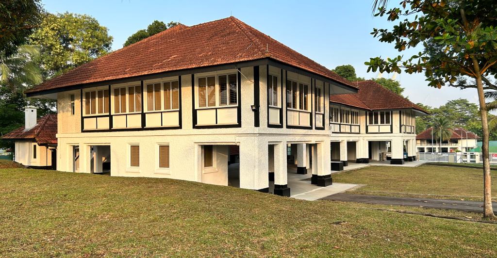
The Deaconess Home (later Nind Home), acquired in 1894, was used by Ms. as a boarding house. The site at No.6 Mount Sophia (later No. 11), based on the details of the lease, could possibly be where Flint had his house.

The Deaconess Home (later Nind Home), acquired in 1894, was used by Ms. as a boarding house. The site at No.6 Mount Sophia (later No. 11), based on the details of the lease, could possibly be where Flint had his house.

One rather interesting suggestion that comes up from time to time is that the hills along with Mount Caroline, are named after the three daughters of Charles Robert Prinsep. This may have its origins in a Straits Times article from 10 May 1936. Charles Robert Prinsep, a barrister with the East India Company based in Calcutta, was also a plantation owner and the man behind the second phase of the hills’ development. He may have first purchased Bukit Cawah from the Farquhar estate in 1831,  adding to it a huge tract of land that extended to Mount Sophia and Mount Caroline, soon after.

View today over the three hills.

View today over what had once been the Prinsep estate.

All 270 acres of Prinsep’s sprawling estate, roughly the size of today’s Gardens by the Bay. was given to the cultivation of nutmeg. The arrival of nutmeg as a crop to our shores, and before that to Penang, was prompted by the desire of the British to challenge the monopoly the Dutch had on a spice that was worth more than its weight in gold.

The nutmeg fruit, seen on a tree on Fort Canning Hill.

The nutmeg fruit, seen on a tree on Fort Canning Hill.

By 1848, Prinsep’s estate was among 20 such plantations that were to alter the landscape of the previously forested hills on both sides of what we know today as Orchard Road. The estate of 6,700 trees had one of the highest yields and at its height produced some 22,000 nutmegs daily. Besides nutmeg, another spice Mace, is obtained from the “nuts”, ground from the seed’s aril. The spice nutmeg is from the seed itself. The plantations, by the way, were what gave Orchard Road its name.

Nutmeg, the only plant from which two spices are obtained. Mace from the red aril covering its seed and nutmeg from the seed itself.

Nutmeg, the only plant from which two spices are obtained. Mace from the red aril covering its seed and nutmeg from the seed itself.

It was around the time of the establishment of the Prinsep estate in 1831 that the name Mount Sophia first crops up (this on the basis of newspaper articles, the archives of which do not go further back than 1831 but the manner in which it does crop up points to its adoption around the same time). This was some five years before Coleman’s 1836 map was published. The mention is found in a letter to the Singapore Chronicle and Commercial Register, published  on 26 May 1831, in which the writer makes mention that “Flint’s Hill”, the location named of a fire that was the subject of an earlier report, should have been referred to as “Mount Sophia”.

A letter from Willaim Farquhar to Lt. Jackson making a request to have the identified hills, including Bukit Selegie and Bukit Cawah, surveyed. The various parties who were in possession of the hills are also identified.

A letter from Willaim Farquhar to Lt. Jackson making a request to have the identified hills, including Bukit Selegie and Bukit Cawah, surveyed. The various parties who were in possession of the hills are also identified.

By 1839, Prinsep’s estate had apparently been quite well established. Mention of the estate, and more importantly the three hills by name, is made in a published account of a visit paid by the crew of the United States frigate Columbia, to the estate. The Columbia, on a well documented round the world voyage, made a stopover in Singapore in February 1839. The accounts of the voyage were to be published in two volumes in 1840. On the visit to the estate, the account states:

The first of these estates, that of Mr. Princeps, who resides in Calcutta, is laid out with excellent taste upon beautiful grounds. It occupies about two hundred and fifty acres, including three lovely hills, Mount Sophia, Mount Caroline and Mount Emily, each surmounted by a neat bungalow, from which avenues radiate and intersect all over the plantation.

When we were there, the superintendent, who politely show us every part and answered our inquiries, informed us that they had already planted four thousand nutmeg trees; twenty thousand coffee shrubs; two hundred orange trees; two hundred clove trees; and one hundred and fifty areka trees, besides a few of many other kinds.

– “Around the World: A Narrative of a Voyage in the East India Squadron under Commodore George C. Read”, Volume 2, 1840, Page 143.

The extent of the Prinsep Estate, seen in an 1870 map.

The extent of the Prinsep Estate, seen in an 1870 map. The 106 acres bought for Government House, is marked as “New Government Property”.

This account discounts that possibility of the hills being named after Prinsep’s daughters. The first, Sophia Catherine, only came into the world three years after the visit, in 1842. To add to the improbability of this, Prinsep, who married Louisa Anne White in 1837, was to have three other daughters, none of whom had the name Caroline. His other daughters were Annie Mary (b. 1848), Louisa Sophia (b. 1851), and Mary Emily (b. 1853). The account. plus the fact that Mount Sophia is mentioned as early as 1831, also puts paid to the suggestions concerning both Ms Cooke and Ms Blackmore.

Mary Emily Prinsep (Julia Margaret Cameron, photograph,1866). Could she have been the Emily in Mount Emily?

Mary Emily Prinsep (Julia Margaret Cameron, photograph,1866). Probably not the Emily in Mount Emily.

Further investigation does however throw up the possibility that a different set of sisters in the Prinsep family are behind the names. Charles Robert, it turns out, had three sisters who coincidentally, were named Sophia, Caroline and Amelia (affectionately known as Emily). There is every likelihood that it was this set of sisters, who had been born before Charles Robert’s plantation came into being, who lent their names to the hills. It could also have been the case that Prinsep, on finding that one of the hills had already carried the name of one of his sisters, had decided to follow on, naming the other two main hills of his estate after his other sisters. This is perhaps less likely as the report of 1831 tells us that the name Flint’s Hill for Bukit Selegie was very much still use three years after his unfortunate demise in 1828. Incidentally, there is also a less significant hill in the estate, Mount Louisa. This appears in some maps as Lock’s Hill and it is probable that the Louisa in the name is  that of Prinsep’s wife.

Nutmeg plantations in Singapore, mid 1800s..

Nutmeg plantations in Singapore, mid 1800s..

Prinsep’s plantation was to go the way of the island’s other nutmeg plantations. Despite thriving initially, disease was to dent the ambitions that the plantation owners held. By the time Prinsep had the lease on his estate extended in 1859, nutmeg as a crop had already been wiped out. This was to pave the way for the next phase of the development on the hills, one that saw it becoming an estate for the very well-heeled.

A sketch of a young Charles Robert Prinsep by his sister Emily, 1824.

A sketch of a young Charles Robert Prinsep by his sister Emily, 1824.

Sophia Charlotte Haldimand (née Prinsep) - another sketch by Emily Prinsep. Could she be the Sophia in Mount Sophia?

Sophia Charlotte Haldimand (née Prinsep) – another sketch by Emily Prinsep. Could she be the Sophia in Mount Sophia?

The estate was put up for sale in 1859 into the early 1860s, the evidence being advertisements placed in the newspapers. The sale in parts of the estate was allowed for and a familiar name in that of Mr (Lawrence) Niven features in the advertisements. Niven, after whom Niven Road at the foot of Mount Emily was named, is perhaps more well known for his efforts setting up of Singapore’s first UNESCO World Heritage Site, the Singapore Botanical Gardens, as its very first superintendent. He had been the superintendent of Prinsep’s nutmeg estate prior to his appointment to the Botanical Gardens position and must have held both appointments concurrently at some point in time.

For Sale

In the immediate neighbourhood of the town of Singapore, the very desirable property of C. R. Prinsep, Esquire, lying between the Orchard and Bukit Timah Roads, consisting of Hills and Low grounds daily increasing in value.

This lands may be sold in lots to suit purchasers and all further particulars may be learned from Mr Niven, the Superintendent of the Estate or Messrto to be & Co.

Singapore, 13th April, 1859.

Well documented is the sale in 1867 of 106 acres of the western section of the estate,, covering Mount Caroline and Mount Louisa, to the Governor, Sir Harry St. George Ord. This was for a new Government House (now the Istana) to be erected. The placement of the fort on the original Government Hill, Bukit Larangan,  had displaced the Governor’s residence. The new Government House on the top of Mount Caroline was completed in 1869. Mount Caroline had in fact been identified in the 1850s by Army Engineer Captain George Chancellor Collyer, as a possible location to move Government House to. This came with the recommendations he made a 1858 report to fortify Bukit Larangan. Mount Caroline, was described by Collyer, as the “most commanding spot on the island”. Together with Government House, the Colonial Secretary’s residence (now Sri Temasek), was also completed at the same time at Mount Louisa.

A photograph of Government House perched on Mount Caroline in the 1880s, seen from Fort Canning. Mount Sophia is in the background on the left.

A photograph of Government House perched on Mount Caroline in the 1880s, seen from Fort Canning. Mount Sophia is in the background on the left.

The remaining parts of Mount Sophia and Mount Emily were to be subdivided and sold. Their elevation, and prime location in the vicinity of the heart of the thriving municipality, made the plots being offered a very attractive prospect. It did not take long before the exclusive neighbourhood that was to boast some of the grandest residences to be seen on the island, started to take shape and by the 1880s, several large residences occupied prime positions across the twin peaks.

An 1881 map showing the tops of the hills of the former Prinsep estate populated by newly built residences.

An 1881 map showing the tops of the hills of the former Prinsep estate populated by newly built residences.

A view across Mount Sophia towards Mount Caroline and Government House. The building in the foreground is Olson Building - the only one of the buildings of the former Methodist Girls School that is being conserved.

A view across Mount Sophia towards Mount Caroline and Government House. The building in the foreground is Olson Building – the only one of the buildings of the former Methodist Girls School that is being conserved.

There is little doubt that one had to be someone of means to move up to the hills, which would have been most accessible by horse and carriage. One of the first grand residences to secure a footing on the hills would have been Carrington House around 1873. Little is known about the house except for the fact that a panther was cornered and shot in it sometime in December 1883. The very brave man credited with making the killing, Mr Maurice Drummond, apparently received a reward of $25 for his troubles.

Carrington House, as seen from Osborne House, 1880.

Carrington House, as seen from Osborne House, 1880.

Carrington House, we can see from the 1880 photograph, found a perch in quite a prominent location on the slopes of Mount Sophia. One can only imagine the views it must have offered in days when one’s gaze could be cast across the settlement for as far as the eye could see. It is no wonder that two of the grandest mansions Singapore has seen were to be built on its site. Carrington House was to be replaced by the ostentatious Adis Lodge and then an even grander Eu Villa. It is in the days of Eu Villa that were are able to get an appreciation of what the view must have been like from a 1936 Straits Times article:

From Eu Villa the view on three sides, out over the harbour and away to Keppel Hatbour on one side and Katong on the other, is simply breathtaking, especially in the evening when the city takes on an indefinite soft and delicate colouring. This is not the highest point on the hill, but, because the house juts out with no encumbrance on either side, the view is better than on the actual brow of the hill above Eu Villa … it is a magical place to be on a moonlight night, overlooking the lights of the city and the junk anchorage.

– The Straits Times, 10 May 1936

Eu Villa and the view from it.

Eu Villa and the view from it.

A view over Mount Sophia towards the harbour c. late 1940s. Eu Villa can be seen in the lower left part of the photograph.

A view over Mount Sophia towards the harbour c. late 1940s. Eu Villa can be seen in the lower left part of the photograph. Cathay building, which came up in the late 1930s, Singapore’s “first skyscraper”  was the first tall building to block the view one got from the top of the hill.

Adis Lodge, which came up in 1907, was built by Nissim Nissim Adis. Adis was the proprietor of very grand Grand Hotel de L’Europe at the corner of St. Andrew’s Road and High Street, the location today of the old Supreme Court wing of the National Gallery. It was after him that Adis Road on Mount Sophia was named. Opulently furnished and decorated, Adis Lodge carried the reputation of being one of the “most magnificent of mansions east of the Suez”. It did not last long however. It was sold to the “king of tin” Eu Tong Sen in 1912. Eu had the lodge replace in 1915 with Eu Villa. Eu Villa, which had a fairy tale like quality, survived for quite a bit longer. It was sold in 1973 for S$8.19 million and was only demolished in the early 1980s.

Adis Lodge in 1908.

Adis Lodge in 1908.

Mount Sophia was also a name that was synonymous with the Methodist Mission and Methodist Girls’ School (MGS). The Methodist presence took root in the 1890s with its purchase of several of the grand houses at the top of the hill. Methodist Girls’ School, which started as a Tamil girls’ school in a shophouse on Short Street, made a move up the hill in 1925, staying until 1992. It wasn’t the first school to be established on the hill. That would have been St. Margaret’s whose presence on the hill as Chinese Girls’ School goes back to 1861.

Wesley House, at No. 5 Mount Sophia, which was acquired by the Methodist Mission in 1894.

The Methodist Girls School complex, used as a centre for the arts while awaiting redevelopment.

The former Methodist Girls School complex, used as a centre for the arts in 2010 while awaiting redevelopment.

On the other peak, Mount Emily, its rather flat and elongated top must have made it a perfect spot to play host to a service reservoir. One was put there in the late 1870s to supply treated water to the municipality. It was to be made redundant by the much larger Fort Canning Reservoir in 1929. The reservoir was then turned into Singapore’s first public swimming pool around which the beautifully set Mount Emily Park was established. The pool opened in 1931 and was in use until the early 1980s with it serving as the setting for the qualification of Singapore’s very first woman lifeguard, Miss Ann Tay, in February 1952.

Lambert Mount Emily

A G R Lambert photograph of the reservoir on top of Mount Emily taken from Osborne House.

A large residence, humble by the standards of Eu Villa or Adis Lodge, Osborne House, made its appearance near the top of Mount Emily about the same time the reservoir was completed. The house does have its fair share of stories. Perched on a part of the hill that could be seen from Middle Road, it served for a while as a symbol to the sizeable pre-war Japanese community who were centered on Middle Road (Chuo Dori to the community) as the Japanese consulate. There also seems a connection to the Sultan of Siak. More about Osborne House’s rather intriguing past can be found in an earlier post, A Last Reminder of an Old-fashioned Corner of Singapore.

Middle Road when it would have been referred to as Chuo Dori in the 1930s. Osborne House which was to serve as the Japanese Consulate from 1939 to 1941 can be seen atop Mount Emily at the end of the street.

Middle Road when it would have been referred to as Chuo Dori in the 1930s. Osborne House which was to serve as the Japanese Consulate from 1939 to 1941 can be seen atop Mount Emily at the end of the street.

Osborne House today, known to us now as "Emily Hill".

Osborne House today, known to us now as “Emily Hill”.

Farquhar’s “Hills of Babylon”, Mount Emily and neighbouring Mount Sophia, have a very different beast now to contend with these days. Much of the magic that motivated the construction of residences such as Adis Lodge and Eu Villa has sadly, long been lost, taken away by the wall of glass, steel and concrete that now surrounds much of the hills. The “trees” of the new estate are ones that are mostly grey. The yields they give is gold that is of great value in the concrete plantation that much of Singapore has become.

Tower House at the top of the southern slop of Mount Sophia. A wall of concrete, glass and still has obscured part of the view it once commanded.

Tower House at the top of the southern slope of Mount Sophia. A wall of concrete, glass and still has obscured part of the view it once commanded.

On the hill tops are but a few survivors of the high life, one Tower House on Mount Sophia is a conserved structure. The future of Osborne House on Mount Emily, is much less certain and it may be a matter of time before it and the many connections it has with an especially interesting past are forever lost.

The wall around Mount Sophia seen from Prinsep Street.

The wall around Mount Sophia seen from Prinsep Street. Flint’s house may have been located in the area now blocked by the School of the Arts (SOTA).

Walls of concrete, glass and steel around Mount Emily.

Walls of concrete, glass and steel around Mount Emily. The roofs of Olson Building and Tower House at the top of Mount Sophia at the upper left part of the photograph can barely be seen. Mount Emily is in the centre of the photo and Mount Caroline on the extreme right.


Notes:


Published in “Natural History Drawings: The Complete William Farquhar Collection, Malay Peninusla 1803-1818”.


“The Orang Suku Laut of Riau, Indonesia: The inalienable gift of territory”.


The Ellison Building at the foot of one of the three sisters, Mount Emily

A report in this morning’s edition of the Straits Times reveals that part of the Ellison Building, a very distinctive conserved building at the corner of Selegie Road and Bukit Timah Road near the foot of Mount Emily, will be demolished and reconstructed due to the construction of the North-South Corridor. The part that will be affected is along Bukit Timah Road with units 235, 237 and 239 to be demolished. This follows on an earlier report in the Chinese language Lianhe Zaobao article on 7 August 2016 that first broke the news of the building being affected. In the earlier report, it was mentioned that only “part of the (building’s) façade” would be affected. The Ellisons, Issac and Flora, had their home at 87 Wilkie Road, another of the grand residences that found their way on the slopes of Mounts Sophia and Emily. The residence, was demolished in the 1980s and a multi-storey residential development was put in its place and the Ellison Building is what’s left to remember them.

A view over the Selegie Road and Bukit Timah Road junction with the part of the Ellison Building (the curved building in the lower right) that will be affected facing the viewer.

A view over the Selegie Road and Bukit Timah Road junction with the part of the Ellison Building (the curved building in the lower right) that will be affected facing the viewer.

Incidentally, the entrance to the upper level one of the units being affected, 237, is where one find the words “I. Ellison” or Issac Ellsion – the man who had the building constructed, on a sign above it. This makes the demolition of this part of the building, even if it is to be reconstructed, even more tragic.

The five-foot-way of the Ellison Building where one of the units that will be demolished and then reconstructed, No. 237. A sign on top of the gateway is marked with "I. Ellison" or Issac Ellison - the man who had the building constructed.

The five-foot-way of the Ellison Building where one of the units that will be demolished and then reconstructed, No. 237. A sign on top of the gateway is marked with “I. Ellison” or Issac Ellison – the man who had the building constructed.


The Old Vic’s ticking once again

22 07 2014

The Old Vic’s finally back. Having seen it look increasingly tired over the years, it’s nice to see that it’s not just been freshened up during a four year hibernation, but has also been done up very nicely for its role as a mid-sized performing arts venue for the future.

Ticking once again is the clock at the Old Vic.

Ticking once again is the clock at the Old Vic.

The Old Vic's definitely back!

The Old Vic’ made new.

A passageway regained by the side of the concert hall.

A passageway regained by the side of the concert hall.

I had the opportunity to have a quick glance at the newly refurbished Vic at an exclusive tour organised for a group of bloggers over the weekend of the Open House, with a visit to the top of what to me has always been the mysterious clock tower thrown in; and I must say, there isn’t anything there is to dislike about its latest makeover – except that is that everyone now seems to want to refer to the well-loved monument by its acronym VTCH (for Victoria Theatre and Concert Hall). We in Singapore do have a penchant for using acronym, but extending the practice to our well loved icons, doesn’t seem quite right.

The queue at the opening of the Open House.

The queue at the opening of the Open House.

We got a peek at the inside of the clock tower.

We got a peek at the inside of the clock tower.

It will always the old Vic to me, a landmark that we have long identified with our Lion City. It is where the founder of modern Singapore, Sir Stamford Raffles, has maintained his proud position – almost uninterrupted (the statue was removed from its position during the Japanese Occupation in 1942 and restored in 1946) since 1919, the centenary of him setting foot on the island at a point not far away on the river bank and setting the ball rolling on a chain of events that has brought us to where we are today. The chimes from its clock tower were ones that flavoured my childhood and it was something I looked forward to hearing on the many occasions I found myself in the area in the days of my childhood.

Inside the refurbished Old Vic - seen on the third level below the glass roof of the Central Atrium.

Inside the refurbished Old Vic – seen on the third level below the glass roof of the Central Atrium.

The refurbished theatre.

The refurbished theatre.

The section of the building that has served as the concert hall since the late 1970s was of course the Victoria Memorial Hall back in the days of my youth, a name I still have the tendency, as with many of my generation, to use in referring to the National Monument. There were several occasions when I did have a chance to pop into it – it had been the site of many exhibitions in the days before the former World Trade Centre and the former Harbourfront took over as Singapore’s main exhibition venues.

The entrance to the former Victoria Memorial Hall - the area below the concert hall where the box office is located.

The entrance to the former Victoria Memorial Hall – the area below the concert hall where the box office is located.

The concert hall, which served as the home of the Singapore Symphony Orchestra (SSO) from 1979 until the SSO shifted to the Esplanade in 2002, was actually a 1905 addition to the building, built in the memory of Queen Victoria. The original section, built as a town hall in 1862, was then remodelled to complement the memorial hall in a symmetrical fashion and reopened as a theatre in 1909. The clock tower, with chimes and clock by the Straits Trading Company, was completed in 1906.

A view from the clock tower.

A view from the clock tower.

Over the years, several modifications were made to the buildings. This included a significant makeover in the 1950s, which saw the two buildings air-conditioned, and the seating capacity of the theatre doubled. That makeover also saw the incorporation of the previously open courtyard between the two buildings into the structure with it being covered up – a modification that has to an extent, now been reversed.

The Central Atrium - where the courtyard between the two buildings had been.

The Central Atrium – where the courtyard between the two buildings had been.

A look through the old arches to the new relief etched panels of the theatre.

A look through the old arches to the new relief etched panels of the theatre.

A glass roof now allows light into a rather pleasant looking and air-conditioned courtyard, the Central Atrium, restored partially on the side of the concert hall. Not only does this allow a wonderful view of the clock tower, it allows it to serve as a through passageway from the front of the buildings to the back. At the back a magnificent view of Old Parliament House, now The Arts House, Singapore’s oldest government building, in its full glory awaits.

The Arts House - at the end of the passageway.

The Arts House – at the end of the passageway.

The Central Atrium is where we see a tasteful blend of old and new. The rolling back of the modifications made to maximise the capacities of both the theatre and the concert hall, sees the boundaries of both pushed back to the original locations, allowing the columns and arches to be brought out. On the side of the concert hall, we see how it may have been with its ornate archways and rusticated columns restored. It is however the side of the theatre that seems most interesting, it is there that we now see a reinterpretation of courtyard side of the old theatre, with the use of relief etched precast panels providing a modern and forward looking impression, partly to compensate for the absence of information relating to the original architectural details, in contrast to that on the side of the concert hall.

The precast etched relief panels.

The precast relief etched panels on the theatre side of the atrium.

It was also nice to see how Victoria Theatre has been redone – its seating arranged in the horseshoe shape as it might originally have been with a provision of an orchestral pit. This has reduced its capacity from 900  to 614, providing it with a more intimate setting. More importantly, the modifications must now give it much improved acoustics – one of the few impressions of the theatre that I have from watching Lea Salonga in a Singapore Repertory Theatre production of the musical “Into the Woods” sometime in the 1990s, was of its rather poor acoustics.

The refurbished theatre.

The refurbished theatre.

It is interesting to see that several items from the old theatre have been incorporated into the new – with the backs of the old seats decorating the entrance foyer, seen in a floating “Rubik’s Cube”. Frames and material from the old seating are now also seen in the remodelled theatre, such as the cast-iron components incorporated into the newly installed acoustic timber walls.

A re-used part of the frame of the old seating.

A re-used part of the frame of the old seating.

The 'Rubik's Cube' in the theatre's foyer and a reflection of it on a counter top.

The ‘Rubik’s Cube’ in the theatre’s foyer and a reflection of it on a counter top.

While some of us did not get to see the 673 seat concert hall, we did hear the glorious strains from Dr Margaret Chan’s masterful pipe-organ performance from the foyer where we got to see the suspended balcony – replacing the previously added balcony that had to be supported by intrusive structures, to free up volume and improve acoustics.

The refurbished concert hall (photo courtesy of Victoria Theatre and Concert Hall).

The refurbished concert hall (photo courtesy of Victoria Theatre and Concert Hall).

The suspended balcony.

The suspended balcony.

What we got to see that most visitors during the Open House didn’t was the clock tower (which incidentally has had its crown restored), which I had been curious about throughout  my childhood. The inside of the clock tower turned out to be quite different from what I had envisaged – the clock’s mechanism and the five bells seemed a lot smaller than what I had imagined as a child.

The chime bells and a clock face on the platform below.

The chime bells and a clock face on the platform below.

The writing on the largest bell: 'This clock and chime of bells were presented to the Queen Victoria Memorial Hall by the Straits Trading Company, 1905'.

The writing on the largest bell: ‘This clock and chime of bells were presented to the Queen Victoria Memorial Hall by the Straits Trading Company, 1905’.

The clock has seen an improvement during the refurbishment – an automatic winding mechanism was added. Prior to this, the clock had to be rewound manually, requiring the clock winder to climb 176 steps once a week at the top of which he would have had to spend up to an hour winding the clock.

The long road to the top - 176 steps for the winder who would have to ascend once a week.

The long road to the top – 176 steps for the winder who would have to make the acsent once a week.

An automatic winder has been added to the clock's mechanism.

An automatic winder has been added to the clock’s mechanism.

The clock’s chimes, so I am told, are audible as far away as the Esplanade. However, its sounded a lot softer than one might have would have expected it to, standing right by the bells. Beside the thrill of hearing the bells chime at 11 o’clock, there was also the bonus of taking in the magnificent views of the surroundings and the contrast of the old Padang surrounded by the architectural symbols of colonial power next to what architectural historian Lai Chee Kien, calls a new “liquid padang” – surrounded by the architectural symbols representing the new power.

The clock level.

The clock level.

The refurbishment of the old Vic coincides with an effort that will also see a renovation of the Asian Civilisations Museum and the transformation of the Old Supreme Court and City Hall into the National Gallery Singapore – all scheduled to be completed next year. That will complete the transformation of an area that had been at the heart of the colonial administration into an arts and cultural hub – what the Urban Redevelopment Authority (URA), in their 2014 Master Plan, terms as a “Civic and Cultural District by the Bay“.

For more information on what is envisaged for the Civic District as part of URA Master Plan 2014, do visit the following links:

More information on Victoria Theatre and Concert Hall and its recent refurbishment can be found on their website.


Some key dates relating to the Victoria Theatre and Concert Hall:

17 March 1855

The foundation stone for the new Town Hall was laid by the Governor of Singapore, Colonel W. J. Butterworth.

1902 – 1905

Victoria Memorial Hall was built in memory of Queen Victoria’s reign. Victoria Memorial Hall and Tower were joined to the existing theatre by R. A. J. Bidwell of Swan and Maclaren, with passageway between the two buildings.

18 October 1905

Victoria Memorial Hall was officially opened by the Governor of the Straits Settlements, John Anderson.

1906

The construction of the signature clock tower was completed. This was later than expected due to the delay in donation of the clock and chimes by the Straits Trading Company.

1909

The first performance that took place in the newly completed Victoria Theatre was Sirs William S. Gilbert and Arthur S. Sullivan’s well-known and amusing opera, The Pirates of Penzance, staged by the Singapore Amateur Dramatic Committee.

6 February 1919

On Centenary Day, T. Woolmer’s statue of Sir Stamford Raffles was moved from the Padang to Victoria Memorial Hall, taking the place of the bronze elephant presented to Singapore by King Chulalongkorn.

Early 1942

The Victoria Memorial Hall was used as a hospital for victims of bombing raids by the Japanese forces during World War II.

1946 – 1947

Victoria Memorial Hall was used as a location for war crimes courts.

21 November 1954

The inaugural meeting of the People’s Action Party was held at the Victoria Memorial Hall.

1954 – 1958

Major renovations were carried out including a complete restructuring of the interior of the theatre. Air-conditioning and sound-proofing was added and the courtyard covered up.

4 November 1957

The public had its first glimpse at television when William Jacks and Co presented a full length variety show on television at the annual Philips Radio Convention held at the Victoria Memorial Hall.

15 February 1963

Television Singapura (Singapore’s first TV station) was launched with a pilot monochrome service at the Victoria Memorial Hall.

1979

Victoria Memorial Hall was renamed the Victoria Concert Hall and named as the official home of the Singapore Symphony Orchestra.

1980s

A gallery was added to the Concert Hall, adding seating capacity and enclosing the second storey balconies on the front and back facades with glass.

1990s

Renovations were carried out to Victoria Theatre to make it a more efficient performing venue.

February 1992

Victoria Theatre and Concert Hall was gazetted as a national monument of Singapore.

2010

The Victoria Theatre and Concert Hall was closed for a $158 million renovation.

2014

Victoria Theatre and Concert Hall reopened its doors after a four-year renovation.


Coloured corridors

13 11 2013

Conceived by the founder of modern Singapore Sir Stamford Raffles, the five-foot-way was a feature that was stipulated in the Jackson Town Plan of 1822 and is seen today in the shophouses which once dominated the urban landscape of Malaya and Singapore. In Singapore today, over 6000 of these shophouses have been conserved and their five-foot-ways remain colourful spaces through which I often enjoy a walk through. The photographs that follow, are ones from some of the more colourful areas of Singapore in which clusters of shophouses with five-foot-ways, old and new, can be found. More on the five-foot-way and the idea behind them can be found in two of my previous posts, the links to which are at the end of this post.

JeromeLim 277A4494

JeromeLim 277A4489

JeromeLim 277A4497

JeromeLim 277A4519

JeromeLim 277A4516

JeromeLim 277A4145

JeromeLim 277A4012

JeromeLim 277A4013

JeromeLim 277A4141

JeromeLim 277A4123

JeromeLim 277A4121

JeromeLim 277A4116

JeromeLim 277A4486

JeromeLim 277A4483

277A4384c

277A4443

277A4446

JeromeLim 277A4460


Other five-foot-way adventures:


Kaki lima

27 06 2013

The kaki lima or the five-foot-way, is a feature of the shophouse, which was once dominant in the urban landscapes across much of British influenced South-East Asia. Sheltered from the blazing tropical sun and the frequent torrential downpours, they made an ideal communal space, as well as one in which many trades thrived.

A five-foot-way along Jalan Tun H S Lee.

A five-foot-way along Jalan Tun H S Lee.

The five-foot-ways I encountered in my childhood, full of bustle, colour and texture, were ones I found to be thoroughly fascinating. I never did have a dull moment walking along one, even in the evenings – the corridors, even those emptied of life and traders, found other uses. It was common to see bicycles and tricycles parked as well as other clutter. A common sight that we don’t see today is that of the jaga, more often than not an elderly turbaned Sikh man, seated on a charpoy – a wooden framed rope bed, outside the business premises he was to guard. It would also have been, especially in the smaller towns across the Causeway, common to hear a noisy chorus of swallows who built their nests overhead in the corners of the ceiling.

A five-foot-way along Jalan Sultan with a hole-in-the-wall shop still commonly found along many such corridors.

A five-foot-way along Jalan Sultan with a hole-in-the-wall shop still commonly found along many such corridors.

The kaki lima of today, particlarly those we find in Singapore, are much less lively versions of those of yesterday. They are still however wonderful places to explore and can often offer as enjoyable an experience as they might have in the days of my youth, throwing up a surprise every now and again. One area where I did find myself wandering through the kaki lima recently, was around the Jalan Sultan and Jalan Petaling area, in the heart of old Kuala Lumpur, where the set of photographs in this post were taken.

A five-foot-way along Jalan Tun H S Lee north of Jalan Pudu just outside a now quiet textile shop which must have once done a roaring trade.

A five-foot-way along Jalan Tun H S Lee north of Jalan Pudu just outside a now quiet textile shop which must have once done a roaring trade.

The shophouses in this part of the Malaysian capital once contained many traditional businesses. With many abandoned by the organic businesses which had brought much life to them and their sheltered corridors, the rows of shophouses seem to be in the throes of a slow death. It is a sense of sadness that I am filled with finding little reminders of what did once used to be as well as businesses still there for which time has obviously passed.

A five-foot-way along Jalan Petaling. A sign for a tailor shop which has closed reminds us of a time forgotten.

A five-foot-way along Jalan Petaling. A sign for a tailor shop which has closed reminds us of a time forgotten.

In Singapore, with over 6000 shophouses conserved, the more colourful shophouse five-foot-ways are still easy to find even as vast areas of its urban landscape are now populated with modern buildings. The ones around several conservation areas including in Little India, Kampong Glam, Geylang and Chinatown, are still rather interesting. These five-foot-ways were the subject of a contribution of photographs I made to a recently concluded three-month long exhibition on vanishing trades held at the National Museum of Singapore which looks at how spaces some of the early traders were commonly found it have evolved.

Another five-foot-way along Jalan Petaling where the remnants of an “old trade” was spotted.

The idea of the five-foot-way as an architectural feature was to provide a continuous sheltered walkway and as a space where trades could operate and has been attributed to Sir Stamford Raffles. He had it stipulated in the 1822 Jackson Town Plan that he oversaw, requiring that “all houses constructed of brick or tile should have a uniform type of front, each having a verandah of a certain depth, open at all times as a continuous and covered passage on each side of the street”. It is thought that Raffles’ got this idea from buildings in Dutch administered Batavia he had observed during his time as the Governor of Java, influenced it is suggested by verandahs found around squares in southern Europe. From Singapore, the five-foot-way spread to other parts of South-East Asia.

Watching time slowly pass on a five-foot-way along Jalan Sultan.

Watching time slowly pass on a five-foot-way along Jalan Sultan.

A five-foot-way along Jalan Panggong.

A five-foot-way along Jalan Panggong.


One hundred steps to Heaven

1 03 2011

If heaven was to be a place in Singapore, there would probably not be a better candidate for a suitable location than the Mount Sophia that previously existed. These days of course, Mount Sophia is associated more with sought after high-rise residential units in a prime location close to the heart of the city. However, back in the early part of the 20th century, it must certainly have been a truly magical and heavenly place, dominated by the magnificent Eu Villa that commanded a view of much of the surrounding areas of the fast growing city that lay on the areas some 100 feet below, and the many other grand bungalows and mansions, paticularly around Adis and Wilkie Roads. By the time I was going to school in Bras Basah Road and wandering curiously around the area, many of the heavenly places were still around, albeit in dilapidated condition – and mostly I guess crumbling to a point that it would have taken a monumental effort to preserve them. Still one could easily imagine how grand the area, which seemed a world apart from the rough and tumble of the mixed residential and commercial districts that lay below, would have been.

An aerial view of Mount Sophia and the surrounding area in the 1960s. It is easy to see why the well heeled would choose to build their magnificent mansions on the geographical feature which commanded an excellent view of the area around it. The Cathay Building can be seen on the south of Mount Sophia and the castle like Eu Villa to the top and right of it. The Istana and its grounds, which together with Mount Sophia and adjoining Mount Emily were part of Charles Robert Prinsep's huge nutmeg plantation can be seen on the left of the photo (Photo Source: http://www.singas.co.uk).

I was fortunate to be able to have seen all that I guess and place myself in that magical world, then accessible either via Sophia Road or by the so-called one hundred steps up from Handy Road. Given the choice of access options, the adventurous schoolboy that I was would certainly have chosen the latter route – after all, it was a shortcut we occasionally took to get to Plaza Singapura, then not accessible through Handy Road, which would involve climbing into the upper level of the car park at Plaza Singapore right next to western slopes of Mount Sophia, where Yaohan and a popular hangout for teens then, the Yamaha Music School run Do Re Mi cafe, beckoned. These days, much of that magic that I felt back then, is absent, with the manisons, most of which went in the 1980s and 1990s, with Eu Villa itself being demolished in 1981 after being sold by the Eu family for a princely sum of S$ 8.19M in 1973 to a property development company, having given way to a mess of monstrous apartment blocks, and it’s difficult to return to that magical world that I once wandered around.

The fairy-tale like Eu Villa, once the home of Eu Tong Sen. It was built in 1915 at a cost of S$1M on the site of Adis Lodge which Eu had purchase from Nissim Nissim Adis, the owner of the Grand Hotel de L'Europe in 1912.

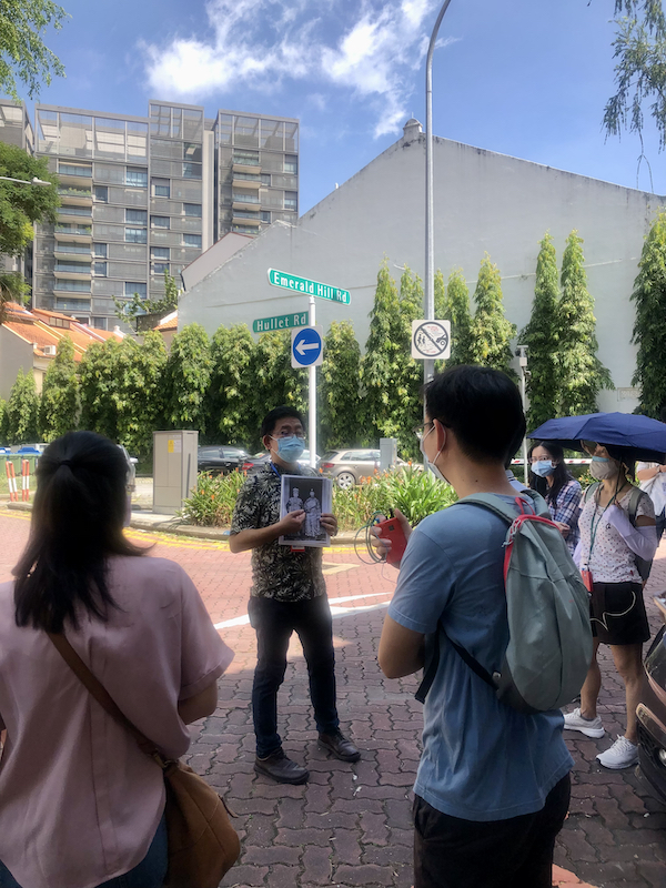
I had an opportunity to do just that, return to the magical world that is, taking a walk with the National Library Board around the area, and trying to transport not just myself, but also a group of 30 participants to that world that I once knew. It was good to have on board two ladies who attended two of the schools in the area, who were able to share their experiences as well of going to Nan Hwa Girls’ School and Methodist Girls School (MGS). Both described ascending the one hundered steps to get to their schools, describing how it rose precariously up the steep slope from Handy Road with no railings to speak of and the steps being uneven in height – far different from the reconstructed steps in the vicinity of the original we see today. The ex MGS girl described how her schoolmates and her would race down the steps … something I am sure many would have not been able to resist in impetuosity of youth. We also confirmed that there were actually 100 steps – something I never thought of trying to establish in the many occasions on which I ascended the steps.

The one hundred steps offered a short cut for the adventurous to Plaza Singapura (seen here in its very early days - source: http://www.picas.gov.nhb.sg).

The walk started with a short introduction at the library, after which we were transported to the magical hill not by the one hundred steps, but by air-conditioned coach to the top of Mount Emily, I guess in keeping with the new age. What we saw were some remnants of there area that I loved, including the former Mount Emily Girls’ home which for a while was used as the Japanese Consulate prior to the war, becoming a halfway house for underage street prostitutes before becoming the girls’ home in 1969 and later the Wilkie Road Children’s Home in the 1980s. There was also the location of the first public swimming pool in Singapore, built on the site of the waterworks on Mount Emily, a pool that I visited in my younger days, being one of my father’s favourite pools, across from which we could see the hoardings surrounding the former bungalow of the late Major Derrick Coupland who passed away in 1991. Major Coupland was well known as a World War II veteran and the President of the Ex-Services Association heading it for some 20 years prior to his death from bone cancer in June 1991. I understand from a reader that the bungalow has been left empty since and the deterioration from 20 years of abandonment was evident before the hoardings came up some time at the end of last year – I suppose that the building is being prepared for demolition right at this moment.

The hoardings havve come up around the crumbling former residence of Major Derrick Coupland.

From the original coat of arms, used during the years of self-govenrment that can be seen on the structure at the entrance to Mount Emily Park, we made our way down Wilkie Road, past the Sri Guru Singh Sabha Sikh Temple. The current temple with its distinctive white dome, is a later one, built in 1983, next to an old house which as a plaque indicates, was purchased in 1932 (I was told from a Jewish gentleman), and originally housed the temple. Most of the magnificent mansions, including one owned by M J Nassim, that lined Wilkie Road have been replaced by apartment blocks … one that remains is the Abdullah Shooker Welfare Home at 81 Wilkie Road which is described in a previous post.

Wilkie Road used to be lined with magnificent mansions including one that still stands - the Abdullah Shooker Welfare Home, left by the late Abdullah Shooker, a Baghdadi Jew who died during internment by the Japanese in 1942, to the Jewish community.

Further down Wilkie Road, the participants were introduced to the Sophia Flats, once the home of the illustrious F J Benjamin, across from which we could once get a glimpse of the roofs of the magical Eu Villa over a retaining wall which marked the edge of the table on which the villa and its huge grounds once stood. Sadly the wall has come down, perhaps the last reminder of the villa that was left, along with the table which is being levelled for what is probably a commercial/residential project.

And the wall came tumbling down ... the last reminder of Eu Villa comes down - a retaining wall that marked the edge of the table of land on which the villa once stood (as seen in January 2011).

The last bit of the wall next to Peace Centre on Sophia Road.

At the corner of Adis and Sophia Roads, the excited chatter of a former student of Nan Hwa Girl’s School was heard, as she reminisced about her schooldays. The building which was completed in 1941, before being used by the Japanese during the war and the British forces after before being returned to Nan Hwa in 1947, is now used as a student hostel – and as one participant on the walk pointed out, the flag poles in front of the basketball courts which also served as an assembly area were still very much in evidence. Besides this, we learnt of a popular ice-kacang stall that both the girls of Nan Hwa and MGS patronised after school which was at the corner opposite Nan Hwa.

The former Nan Hwa Girls' High School at the corner of Adis and Sophia Roads.

A former student at Nan Hwa Girls' School sharing her experiences of going to school outside the former Nan Hwa Girls' School.

The corner of Adis Road and Sophia Road at which the ice kacang stall that both girls of Nan Hwa and MGS patronised, was located.

Before we hit the new one hundred steps, we stopped by the Art Deco styled building which housed San Shan Public School which was built in the 1950s by the Foochow Association, which ran the school up to the 1970s when the running of it was handed to the Ministry of Education. The school after moving from its Mount Sophia premises in the 1980s has stopped functioning. Next was the former Trinity Theological College which was established in 1948. The cluster of buildings that belonged to the college including the church with the distinctive roof shaped to the Chinese character for people, 人 (Ren), were built in the 1960s. The college moved in the 1990s to its current location along Upper Bukit Timah Road – and the roof of the church there is identical to the one on Mount Sophia. Next to the college, the cluster of buildings (now Old School) that house MGS still stands. The former pupil of MGS spoke of how she could see the gardens of Eu Villa from her class window, and how the classes were organised, C being the best class and A for the weakest students, of the three classes that each form had in the 1960s.

A view of the former MGS.

From the hundred steps down, we made our way to the corner of what used to be Dhoby Ghaut and Bras Basah Road, now dominated by another monstrous piece of architecture which did not agree with most of the participants – one remarked that it “stuck out like a sore thumb”. Where that building which is the School of the Arts (SOTA) stand, there was what had been Dhoby Ghaut, gone as a road that carried the name in an area that once was used by the Indian Dhobis to gain access to the fresh water stream that has since become the Stamford Canal. What survives of that Dhoby Ghaut which hold memories of the row of shops which included the Red Sea Aquarium and an A&W outlet that I frequented as a schoolboy and another row of houses up behind on Kirk Terrace which included a Sikh temple, is only the name of the MRT station in the vicinity.

The row of shops at Dhoby Ghaut next to Cathay Building was where the Red Sea Aquarium as well as the A&W was. Today the SOTA building stands on top of the area where Dhoby Ghaut was (source: http://www.picas.nhb.gov.sg).

We then walked up Prinsep Street, named after Charles Robert Prinsep, the owner of the nutmeg plantation which once included Mount Emily, Mount Sophia and Mount Caroline and extended to the Istana grounds (100 acres were purchased in 1867 for the Governor’s House which became the Istana). There were suggestions that the three mounts were named after three daughters of Prinsep, but what is more likely was that when Prinsep purchased the land, Mount Sophia (which appears earlier as Bukit Selegi) would have already been named after the second wife of Raffles, modern Singapore’s founder, Sophia Hull, and if anything, Prinsep named the two adjoining hills after two other daughters, having been part of the former estate of Raffles’ brother-in-law and Singapore’s first Master Attendant, Captain Flint.

Kirk Terrace over Dhoby Ghaut (source: http://www.picas.nhb.gov.sg).

It was then a leisurely stroll back to the library via Middle Road, where we stopped by the site of the former POSB headquarters facing Prinsep Street and the Registry of Vehicles (ROV) facing Bencoolen Street, where Sunshine Plaza stands, but not before introducing the former Tiger Balm Building, the David Elias Building and the former Middle Road hospital. At Sunshine Plaza, we saw a few signcraft shops – remnants of those that featured in the area when demand for vehicle number plates existed due to the presence of the ROV in the vicinity. Then it was past the former Middle Road Church (now Sculpture Square), used as a motor workshop when I went to school in the area in the 1970s, and the former St. Anthony’s Convent, before hitting the site of the former Queen of the Mooncakes (Empress Hotel) – our destination where the Central Library building now stands.

Middle Road once featured sign craft shops serving the demand from the nearby ROV, including Rainbow Signs which I well remember from passing many times on the bus home from school (source: http://www.picas.nhb.gov.sg).

It was the end of a rather enjoyable walk for me, and I hope the participants had as good a time as I had. Before what was left of the participants dispersed, there was still time to exchange a story, one about the sighting of an Orang Minyak (translated from Malay as “Oily Man” – one that is said to be cursed to an existence as an dark oil coated being that possesses supernatural powers, but more likely as a participant Jeff pointed out, was a man coated in oil to ensure a smooth getaway), reputed as one that terrorises the fairer sex. I had heard about one which was reportedly known to lurk in the compound of St. Joseph’s Church across Victoria Street, through a reader Greg Lim, who lived in Holloway Lane in the 1950s. My mother who boarded at St. Anthony’s Convent in the 1950s could not confirm this, but did mentioned that there were rumours of one lurking in the stairwell. Jeff, who himself lived on nearby Cashin Street in the 1950s confirmed that there was indeed sightings reported, and he was in one of the crowds that had gathered to try to catch a glimpse of the Orang Minyak. Another participant, the mother of Ms Thiru (who is with the NLB and organised the walk), also confirmed that she was aware of the story. It was certainly an interesting end to the walk, one that took a little longer than anticipated, but one that was thoroughly enjoyable.

The Empress Hotel at the corner of Middle Road and Victoria Street which was demolished in 1985.