Celebrating Harmony

21 07 2023

Singapore, a melting pot of many cultures and religions, enjoys a high level of racial and religious harmony. Maintaining this does require some effort and every 21st of July – the anniversary of the first of two communal riots in 1964, schools in Singapore commemorate Racial Harmony Day. In conjunction with Racial Harmony Day this year, the National Heritage Board’s (NHB) Heritage Institutions (Indian Heritage Centre, Malay Heritage Centre, and Sun Yat Sen Nanyang Memorial Hall) have come together to bring the Racial Harmony Day Open House 2023. Themed ‘Let’s Walk – Celebrating Harmony’, the open house’s programmes will encourage participants to walk in the shoes of a person of a different cultural background.

More information on the programmes, which are being run this weekend (22 and 23 July 2023) at the Indian Heritage Centre, and Sun Yat Sen Nanyang Memorial Hall can be found at the websites and the social media pages of Indian Heritage Centre, Malay Heritage Centre, and Sun Yat Sen Nanyang Memorial Hall.

Some highlights:

Same Same But Different: A Theatrical Experience for Families
(Presented by Malay Heritage Centre, supported by The Solitude Movement)

Date: 22 & 23 July 2023
Time: 11am – 1pm
Venue: Sun Yat Sen Nanyang Memorial Hall and Indian Heritage Centre (Starts at Sun Yat Sen Nanyang Memorial Hall)
Admission: $24 per parent-child pair, purchase tickets via https://malayheritagecentre.peatix.com/
Theatre experience conducted in English and suitable for parents with children aged 5 – 10 years old.

Siti faces constant bullying for the person that she is, and this has affected her self-esteem. Yong, her best friend, is determined to help Siti discover how beautifully unique she is. Same Same But Different is a story about uncovering one’s uniqueness and the beautiful power of friendship. Through a journey of self-discovery, Siti and Yong find out what makes them special and, in the process, cherish their friendship with each other even more.

Teo Pei Si, founder of The Solitude Movement theatre collective, and Angelina (Anj) Teo, a theatre maker and educator, are uniting their passion for working with children and exploring themes of culture, heritage and identity. Joining them are multi-talented actors Suhaili Safari and Jodi Chan.

During this interactive storytelling session, participants will try their hands at various activities including creating their own hand mirror, henna art and other activities. Each parent-child pair will also get to visit two Heritage Institutions within the same day, with a bus ride bringing them from Sun Yat Sen Nanyang Memorial Hall to the Indian Heritage Centre.

This programme is recommended for children aged between 5 – 10 years old. Only one-way transport is provided from Sun Yat Sen Nanyang Memorial Hall to the Indian Heritage Centre. As a segment of the storytelling takes place during the bus ride, we would recommend for participants to take public transport, taxis, or private hire vehicles to the starting point.


Harmony Afternoon Tea

Date: 23 July 2023
Time: 11am & 2pm
Venue: Indian Heritage Centre
Admission: $15 per pax; purchase tickets via https://ihc-programmes.peatix.com/.
The workshop is conducted in English.

Indulge in a delectable journey of flavours at Harmony Afternoon Tea, a delightful event hosted at the Indian Heritage Centre. Immerse yourself in the vibrant tapestry of Singapore’s multicultural heritage as you savour local delights inspired by diverse cultures. Sample mouth-watering delicacies from Indian, Malay, Chinese and Eurasian cuisines, while discovering the fascinating stories and multi-layered traditions behind each dish.


Drop-in Craft Station: Perfumed Hanging Shoe Craft

Date: 22 & 23 July 2023
Time: 10am – 5pm
Venue: Indian Heritage Centre
Admission: Free

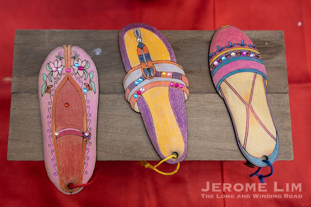
Join us for a free drop-in craft activity! Harness your creativity and learn something new as you create your own unique perfumed hanging shoe, inspired by the designs of traditional Indian, Malay and Chinese footwear. Activity is perfect for all ages and skill levels.


Live Performances @ Indian Heritage Centre

Date: 22 & 23 July 2023
Time: 10am – 5pm
Venue: Indian Heritage Centre
Admission: Free

yIN Harmony

Put on your dancing shoes and join us as we present an energising line-up of multi-racial cultural performances to usher in the Racial Harmony Day celebrations at the Indian Heritage Centre.

Performers’ Lineup:
22 July 2023
10am Mass Zumba!
11am Kids Chinese Dance by We Chinese Dance Tech
11.30am Bharatanatyam Dance by Soo Mei Fei
4pm Malay Cultural Dance by Sri Warisan
4.15pm Multi-ethnic Music Performance by yIN Harmony
4.30pm Dikir Barat by Kelana Purba

23 July 2023
3.30pm Cultural Performance by Eurasian Association


Permanent Galleries Guided Tour

Date: 22 & 23 July 2023
Time: 2pm – 3pm (English)
Venue: Indian Heritage Centre
Admission: Free; limited spaces available.

Come down to the Indian Heritage Centre for a free guided tour of our permanent galleries. Take a walk in the shoes of Indian pioneers to hear the rich history, culture and heritage of the Indian community in Singapore with our museum guide. You’ll also discover star artefacts that include the spectacular late 19th-century Chettinad Doorway and the mesmerising tiled Multan façade, and many more.


Soundscapes of Religions in Singapore
(Presented by Dialogue Centre & partners)

Date: 22 July 2023
Time: 10am – 5pm
Venue: Indian Heritage Centre
Admission: Free; with a refundable deposit of $10. Reserve tickets via https://ihcprogrammes.peatix.com/.

“What does religion sound like?”
Step into the vibrant and diverse religious tapestry of Singapore through a unique immersive “Soundscapes of Religions in Singapore” experience. Join guided tours with knowledgeable interfaith guides and delve into the acoustic environment of Singapore’s diverse religious landscape. Experience the quietude of meditation and encounter a variety of religious sounds such as Christian hymns and Sikh kirtan, and unravel the cultural and religious significance behind these sounds. This is a multi-sensory journey to discover what religion truly sounds like and uncover the unity that lies within the diverse symphony of soundscapes in Singapore. This Harmony Fund supported programme is curated by Dialogue Centre, in collaboration with Being Bridges, Interfaith Youth Circle, Centre for Interfaith Understanding, hash.peace and the Whitehatters.


Peranakan Beading Introductory Workshop
(Supported by The Intan)

Date: 22 July 2023
Time: 2pm – 3.30pm and 4pm – 5.30pm
Venue: Sun Yat Sen Nanyang Memorial Hall
Admission: $20 per pax; purchase tickets via https://wanqingyuan.peatix.com/.

Recommended for participants aged 13 years old and above. The workshop is conducted in English.

The elaborate craft styles of Nyonya beadwork and embroidery are connected to the Peranakan culture. In this 90-minute workshop, participants will understand more about the Peranakan culture and gain basic knowledge and hands-on experience of Nyonya beading work. All materials required will be provided for the workshop.


Children Multi-Ethnic Fusion Dance Workshop
(Supported by Kelly Koh, Badarudin bin Hassan and Surendran Rachandran)

Date: 23 July 2023
Time: 1pm – 3pm and 3.30pm – 5.30pm
Venue: Sun Yat Sen Nanyang Memorial Hall
Admission: $10 per pax; purchase tickets via https://wanqingyuan.peatix.com/.
Tickets available from 3 July 2023, 6pm onwards.
Recommended for children aged 5 – 12 years and above. The workshop is conducted in English.

What are some of the commonalities and differences in dance moves across cultures? In this short workshop, children will get to learn and understand some of the cultural meanings behind the dance movements that are unique to the Chinese, Malay and Indian cultures. At the end of the workshop, parents are invited to watch their children perform a mini choreographed multi-ethnic fusion dance performance.


Special Exhibition Guided Tour

Date: 22 July 2023
Time: 10.30am (Mandarin) and 1.30pm (English)
Venue: Sun Yat Sen Nanyang Memorial Hall
Admission: Free; limited spaces available

Hear from our docents and find out how the early Chinese mutual aid organisations played an important role to the early Chinese migrant community with the guided tour of Connections Across Oceans: Early Chinese Mutual Aid Organisations. Tours are brought to you by our Heritage Volunteers.


Permanent Galleries Guided Tour

Date: 22 & 23 July 2023
Time: 2.30pm – 3.30pm (Mandarin), 3pm – 4pm (English)
Venue: Sun Yat Sen Nanyang Memorial Hall
Admission: Free; limited spaces available.

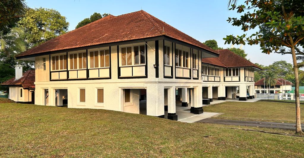
Join us for a guided tour of Sun Yat Sen Nanyang Memorial Hall and hear the stories behind this century-old villa that trace Dr Sun Yat Sen’s revolutionary activities in Southeast Asia. Gain valuable insights on the impact of the 1911 Revolution on Singapore, as well as Singapore’s contributions to the Revolution. Tours are brought to you by our Heritage Volunteers.


Destination Singapore — Experiencing Singapore through Travel

26 05 2023

Even before mass tourism took root with the arrival of the jet age, Singapore has fascinated would be travellers from the West. The romanticised depictions of the island penned by the likes of Rudyard Kipling, Joseph Conrad and Somerset Maugham, in the late 19th and early 20th century have more often than not, made Singapore out to be an exotic destination, as have travel guide books of the day. Singapore was after all a great port city, the crossroads of the East and West in more ways than one, and a cultural melting pot in which the well-heeled traveller could travel to and be accommodated in the lap of luxury in the days when the romance of travel seemed at its height, and yet have that experience of the exotic East.

It was in fact travel guide books that provided the inspiration for the curators of Now Boarding: Experiencing Singapore through Travel, 1800s–2000s, to bring Singapore out as a travel destination. One of two exhibitions opening at the National Museum of Singapore this last weekend in May, the exhibition will offer its visitors an experience of Singapore from the perspective of a traveller to the island.

Postcards and Posters on display.

The exhibition will have visitors explore four common travel themes or chapters if you like in a (modern) travel guide book, Getting Around, Places to Stay, Eating Out and Sights and Shopping. But before all of that, as in the case of the days of mass travel, one has that small matter of getting to the “airport” at the museum’s Rotunda — where one will be greeted the all too familiar sight of a Changi Airport flight information flip board (or at least a part of the decommissioned Terminal 2 flip board), and having to collect a “boarding pass” — which serves as an entry ticket and more at the check-in (museum ticketing) counter.

Exhibition Boarding Pass.
The former Changi Airport flip board.

Exploring the exhibition — especially in the first two sections, one is struck by how much getting here and its associated experiences — even today, has an emphasis that is placed very much on luxury. In Getting Around, depictions of long, luxurious and somewhat leisurely voyages on the passenger liners of old or even train journeys on the Malayan Railway seen in posters on display confronts the visitor. It seems no different when it comes to the modern day, with a unmissable Singapore Airlines’ A380 Suites Cabin in plain sight.

SQ A380 Cabin Suites

Once one is in Singapore however, there options of getting around the island that are on offer are a lot more down to earth. A trishaw on display, which has a rather interesting backstory to it, was an affordable means of conveyance for the person-on-the-street, as was its predecessor the rickshaw. It was also popular as a means to move around for tourists, for whom the trishaw was not only cheap, but a novelty!

A Trishaw.

In Places to Stay, the lure of the Raffles — an enduring Singaporean icon and the epitome of luxurious stays in Singapore — seems unescapable even in a museum setting. There are also other luxurious names of the past that will pop up such as the Adelphi (there is a small glass on display that tells yet another interesting story), and the Hotel de L’Europe.

Uniforms on loan from Raffles Hotel.

Eating Out at Singapore’s coffee shops, outdoor eateries and hawker stalls has undoubtedly been one of the must-dos for a visitor. It may not always have been the case given the issues we faced with hygiene in the past but this caught on in the 1950s and 1960s when street fare came to the fore. From a range of tools and kitchen utensils to kopitiam cups, drinking glasses, soft drink bottles and serving trays carrying advertisements of popular brands, to photographs and postcards featuring hawkers, visitors will get that sense of what the experience of eating out may have been like. In addition to this, there is an assortment of restaurant menus that can be viewed through an interactive display. The menus include one from A&W — the first fast food restaurant chain to set up shop in Singapore when it opened its first outlet at MSA (later SIA) Building in 1968.

Kopitiam memories.

Besides shopping at Orchard Road, a tourist draw since C K Tang opened its store in 1958 even if the shopping destinations then were at High Street and Raffles Place, Sights and Shopping also explores areas such the cabaret, night club and more recent clubbing scene. One popular and rather famous (or some say infamous) tourist spot — at least until the early 1980s, Bugis Street, is glaringly missing in the mix.

Recalling the club and cabaret scene.

To complete the exhibition experience, visitors can reflect on the portrayal of Singapore over the years and add personal impressions home at digital kiosks located within the gallery. Limited edition postcards featuring what’s on display from the National Museum’s collection are available with a donation to the museum. These can be sent to any address across the world by dropping them in at the Singapore Post mailbox placed just outside the exhibition gallery. Also, playing an accompanying Now Boarding mobile game will also yield a bonus digital gift. And if you have some energy left, there will also be pop-up rooms — with a disco room opening with the exhibition. In August, there are two other rooms to look out for that will feature transportation and a hotel-themed room.

The pop-up disco themed room.

The exhibition opens on 27 May 2023 and runs until 19 Nov 2023. For more information, including ticketing, please visit https://www.nhb.gov.sg/nationalmuseum/our-exhibitions/exhibition-list/now-boarding.

A second exhibition opening on 27 May 2023, Get Curious: All About Food! is aimed at families with kids. More information on this can be found at: https://www.nhb.gov.sg/nationalmuseum/cs2023.


Forbidden Hill spiced and demystified

27 08 2022

Fort Canning Hill, aka Bukit Larangan or Forbidden Hill, the place of many a schoolboy adventure for me, has always been a place of discovery and rediscovery for me, as well as a space that provides an escape from the urban world. An abode of the ancient kings of Singapura — the spirits of whom are said to still roam the hill, the hill is one steeped as much in history, as it is surrounded by mystery.

Fort Canning Hill, the Forbidden Hill is a place that has long been cloaked with an air of mystery.

The mystery of the place, was quite evident when the British first established their presence in Singapore in 1819. Col William Farquhar’s attempt to ascend the strategically positioned elevation, which commanded a view of the plain across which the settlement and Singapore River, was met with resistance by the followers of Temenggong Abdul Rahman who claimed that the sounds of gongs and drums and the shouts of hundreds of men could be heard, even if all that was present then on the hill were only the reminders of a long lost 14th century kingdom. The claim did not deter Farquhar from making his ascent, nor his colleagues in the East India Company, who would exploit the hill to place the seat of colonial rule in Singapore, as an experimental botanical garden, for the first Christian spaces for the dead, and as an artillery fort and barracks, for fresh water supply to the fast developing municipality and as a strategic military command bunker.

It has long been a place of escape for me.

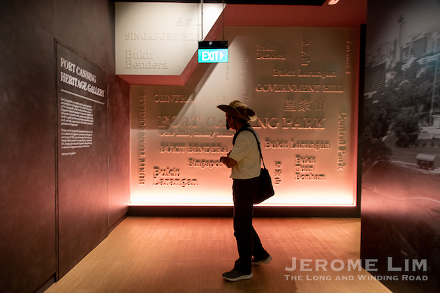
Much of that history, and mystery, is now wonderfully captured in the new Fort Canning Heritage Gallery — and in a book “Fort Canning Park: Heritage and Gardens” that was launched in conjunction with the gallery’s opening yesterday on 26 August 2022. The gallery is housed in a 1920s barrack block now known as Fort Canning Centre, that has seen use most recently as a staging point for the Bicentennial Experience and as the short-lived private museum, Singapore Pinacothèque de Paris. The centre, which also housed the “world’s largest squash centre” from the 1977 to 1987 during the height of the squash rackets craze in Singapore, sits quite grandly atop the slope we know today as Fort Canning Green and forms a magnificent backdrop to the many events that the former cemetery grounds now plays host to.

Fort Canning Centre, a 1920s barrack block in which the newly opened Fort Canning Heritage Gallery is housed.

Divided into five zones, the gallery provides an introduction to the hill, and through four themed zones, places focus on a particular aspect of the role that the hill has played through its own and also more broadly, Singapore’s history. The stories, told succinctly through information panels, archaeological artefacts excavated from the hill and interactive digital stations, provide just enough information to the visitor to provide an appreciation of the hill history and its heritage. There is also a condensed version of the “From Singapore to Singaporean: The Bicentennial Experience” video that plays in a mini-theatrette within the gallery.

Minister of National Development, Mr Desmond Lee, opening the new Fort Canning Heritage Gallery.

Also opened with the new gallery was an enhanced Spice Garden, which now extends to the 2019 pedestrianised section of Fort Canning Rise and a pedestrian ramp and underpass (that once led to the former car park at the rear of the old National Library). The pedestrian ramp and underpass now features the new Spice Gallery, which I thought was a wonderful and meaningful way to use a space that serves little other practical use today. The Spice Gallery, made possible by the generous support of Nomanbhoy and Sons Pte Ltd — a spice trader with over a hundred years of history, provides an appreciation of the significance of the spice trade to modern Singapore’s early development as a trading hub and also the role that Fort Canning Hill played in Singapore’s early spice plantations.

The newly opened Spice Gallery at the enhanced Spice Garden occupies a former pedestrian ramp and underpass.

A book, “Fort Canning Park: Heritage and Gardens”, authored by Dr Chng Mun Whye and Ms Sara-Ann Ang, which highlights the park’s rich heritage, was also launched together with the opening. This is available for sale Gardens Shop at various locations around the Singapore Botanic Gardens or online at https://botanicgardensshop.sg at SGD 29.90.

A book, “Fort Canning Park: Heritage and Gardens” was launched together with the opening.

Along with the permanent exhibition two galleries, there is also a “Kaleidoscope in Clay (I)” exhibition that features exhibits showcasing 5,000 years of Chinese ceramic history from 26 August to 11 September 2022 at The Gallery@L3, Fort Canning Centre. Also running is the 3rd edition of Festival at the Fort being held in conjunction with the opening and Singapore Night Festival, the programmes of which include movie screenings at Fort Canning Green, guided tours and children’s activities. The festival runs from 26 August to 4 September 2022 and more information can be found at https://www.nparks.gov.sg/activities/events-and-workshops/2022/8/festival-at-the-fort-2022.

Kaleidoscope in Clay (I) at Gallery@L3, Fort Canning Centre.

Fort Canning Heritage Gallery is opened daily from 10 am to 6 pm (expect for the last Monday of each month), while the Spice Gallery is opened from 7 am to 7 pm daily. Entry to both galleries is free to the public.


Photographs of Fort Canning Heritage Gallery during the opening on 26 August 2022.


Fort Canning Centre, various views


Fort Canning Spice Gallery / enhanced Spice Garden


The Kreta Ayer Heritage Gallery

14 07 2019

A peek at the wonderful little pocket of joy that Kreta Ayer Heritage Gallery is. Located at the at the Kreta Ayer Community Club, the 100 sq. m gallery opens today (14 July 2019).

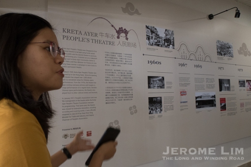
An effort by the National Heritage Board (NHB) and the Kreta Ayer Community Club, the gallery is a showcase of Kreta Ayer’s and Chinatown’s intangible forms of cultural heritage that have provided the area with much colour. This is seen through objects, photographs and personal effects of both practitioners as well as Kreta Ayer’s former residents, organised along five themes: Chinese opera, nanyin music, Chinese puppetry, Chinese painting and calligraphy, and tea drinking and appreciation.

Cantonese opera, a big part of the Kreta Ayer cultural scene is especially well represenred through the display of costumes, scores, stage objects and other memorabilia such as autographed photos. The displays also trace the evolution of the genre of Chinese opera from street performances to theatre based ones.

The gallery will open daily from 12 to 8 pm.


A set of six photographs featuring opera performers, undated On loan from Cindy Chat. This set of photographs forms part of Cindy Chat’s collection of opera-related paraphernalia. Cindy is an avid opera fan who used to follow her father backstage where she would meet opera performers. Fascinated by their dazzling costumes and elaborate make-up, Cindy would approach the performers for photographs and autographs.


Inside the new star of MacTaggart

29 11 2018

Uniquely shaped, the former Khong Guan factory stands out at the corner of MacTaggart and Burn Roads – especially so with a recent 8-storey extension that certainly added to the presence that its conserved façade has long commanded.

Having won an award for Restoration & Innovation at AHA 2018, its doors were recently opened for tours conducted by the URA, which provided an opportunity to have that much desired peek inside.

More on the factory and the restoration effort can be found at the following links:

2 MacTaggart Road : Stellar Landmark (URA)

The new star rising at MacTaggart Road

The fallen star of MacTaggart Road


Photographs of the interior and also of the restored exterior: 

The attention grabbing mosaic and iron grille work on the ground level of the triangular shaped building’s apex. The star is apparently a trademark of the maker of the iron grilles, Lea Hin Company (at the corner of Alexandra and Leng Kee Roads).

Inside what used to be a retail outlet that students from neighbouring Playfair School (across Burn Road) would frequent.

Iron grilles – very much a reminder of the days when the building came up in the 1950s. This one – a gate which the family used to gain access to their accommodation in the old building.

A view of the actual gate.

The reception – lit by a glass covered skylight.

The conjurer and his apprentice: Lee Yan Chang of URA showing the workings of the skylight’s blinds.

The skylight as seen from the terrace above.

Stairway to a new heaven.

The stairway, which leads from the lobby to the corporate offices of Khong Guan’s HQ.

The view from above.

A terrace on what used to be the roof deck of the old building.

A view of the extension from the terrace. Lightweight cladding, with aluminium honeycomb backing, is used on the exterior.

The former entrance to the building’s offices. What it looked like previously: please click.

A display window. What it looked like previously: please click.


Discovering Singapore’s Best Kept Secrets during the Singapore Heritage Festival

28 03 2018

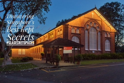
The Singapore Heritage Festival will see a repeat of three State Property guided visits from last year’s “Discovering Singapore’s Best Kept Secrets” series. Organised with the support of the Singapore Land Authority, the visits provides participants a rare opportunity to discover the little known about gems of sites and buildings hidden behind locked gates and no trespassing signs. The three sites that visits are being organised to are:

  1. 8 April 2018: The former Kinloss House at Lady Hill Road ,
  2. 15 April 2018: Old Kallang Airport, and
  3. 22 April 2018: The former Pasir Panjang ‘A’ Power Station 

Information on the visits for the Singapore Heritage Festival are available on the links above. Spaces are limited and registration is necessary via Peatix on 28 March 2018 (a link to the registration site can also be found below – already live as of 11 am 28 March 2018).

Registration links:

  1. Registration for Kinloss House at Lady Hill Road ,
  2. Registration for Old Kallang Airport, and
  3. Registration for Pasir Panjang ‘A’ Power Station

The former Pasir Panjang ‘A’ Power Station – a red brick gem of a building.

More information on the sites can be found at the following links:

Inside the former Kinloss House.

Photographs:

The Streamline Moderne Terminal Building of the former Kallang Airport.


The new star rising at MacTaggart Road

15 02 2018

What’s become of the “conserved” former Khong Guan Biscuit Factory at MacTaggart Road since my last post on it (see: The fallen star of MacTaggart Road) in September 2016:

The former factory – which also served as a warehouse for flour and a residence for the family that owns it, has seen a refreshing transformation with the addition of an eight-storey industrial building behind its distinctive three-storey conserved façade. The design of the quite un-industrial looking new extension seems to have been undertaken by Meta Studio (see: http://meta-current.strikingly.com/#khong-guan-flour-milling-ltd and https://www.facebook.com/meta.architecture/posts/777289939043015).


Photographs of the building before the addition of the new extension:

https://www.facebook.com/thelongnwindingroad/posts/2045557402136053


The real story behind Old Changi Hospital

11 09 2017

The real story behind Old Changi Hospital, isn’t about what the place seems to have got an unfortunate reputation more recently for.  The former hospital, which has its roots in the RAF Hospital set up after the war in 1947, is a place that many who were warded or who worked there remember with fondness.

The hospital, with a reputation of being one of the best military medical facilities in the Far East, is also well remembered for the wonderful views its wards provided of the sea and that it was felt aided in rest and recovery.

Members of the public got to learn about the background to the hospital and how some of the basis for the more recently circulated myths are quite clearly false during a visit to the site as part of the Discovering Singapore’s Best Kept Secrets series of State Property Visits organised with the support of the Singapore Land Authority. More on the visit and the series can also be found at the links below.

More on the visit:

More on Old Changi Hospital / Discovering Singapore’s Best Kept Secrets:

Also of interest:


Ten 100 year old places in Singapore and the little stories they hide

9 07 2017

Surprising as it may seem, places that go back more than a hundred years are not uncommon in the midst of urban Singapore’s gleaming modernity. Not unexpectedly, many of these places hide a story or two, stories that relate to their history, and also ones that speak of Singapore’s linkages with the wider world. Here is a pick of ten such places with rather interesting tales to tell:


(1) The pagoda supported by eight “dimwits” 

Telok Ayer Street, a landing point for early immigrants in days when the sea washed up to it, is littered with the reminders of the forgotten days of adventure. The street is dotted with religious structures aplenty. Now reconstructions of the simple prayer houses put up by those whom came from distant lands so as to permit thanks to be offered to their gods for the safe passage, they offer insights into the origins of some of modern Singapore’s early settlers.

A cluster of Chinese structures from the mid 19th century, with two well ornamented pagodas, is found in the middle section of the street. The structures, which display the distinctive Minnan style of architecture, tell us of two waves of Hokkien settlers not just to Singapore but also to the region.

One of the pagodas is the Chung-Wen pagoda. Built initially for the worship of the god of literature, and used later as a school, it displays a little noticed but a rather interesting ornamental feature that was introduced to Minnan architecture during the Tang dynasty that takes the form of craved wooden figures of men with distinctively non-Chinese facial features dressed in colourful robes. The carved figures, appended in a corbel like fashion to the junctions of the beams and columns supporting the topmost tier of the pagoda, appear to be propping the structure up. The pieces, of which eight are found on the pagoda, are referred to in a rather disparaging manner as “dim-witted foreigners” in the vernacular. They have no structural function and are apparently a fairly commonly used decorative element in Minnan architecture. Rather than being an attempt to belittle, they are thought instead to have been a commemoration of the efforts of non-native workmen during the Tang period.

More on the Chung-Wen pagoda at : What’s propping a mid 1800s pagoda up on Telok Ayer Street


(2) A mosque with a leaning church steeple

Now fronted by a recently planted grove of gelam or Eucalyptus trees of a type from which Kampong Gelam (or Glam) got its name, is a mosque with an untypical minaret built into its boundary wall, the Hajjah Fatimah Mosque.

While the minaret’s claim to fame may be its tilt of 6 degrees –  for which it is known as the “Leaning Tower of Singapore”, what seems more noticeable is the minaret’s resemblance to a church’s steeple. Strange as it may sound, it may actually have been the steeple of the original St. Andrew’s Church (now the Cathedral) that served as an inspiration. The church  got its steeple in 1842, just a few years before the mosque was built.

Now stabilised, the tilt of the minaret has been attributed to the settlement of the less compact structure of the hand-made bricks employed in its construction. The mosque finds itself in an odd position as a shophouse-lined road, Java Road, once ran along its walls.

More photographs of the mosque and its unique minaret can be found at this link.


(3) A temple with furniture “made in Ngau Che Shui” 

Close-up of characters carved on the table. The Chinese characters ‘牛車水’ indicate that there were furniture craftsmen present in Singapore at a time when a lot of such commissioned work would have been carried out in China.

The Mun San Fook Tuck Chee temple has its roots in the Cantonese and Hakka coolie community who settled around the banks of the Kallang River in the mid-1800s. Many in the community found work in the brick kilns near the village of Sar Kong (or Sand Ridge) and helped established the temple in the 1860s. The term “Mun San” found in the temple’s name, is thought to be a corruption of the Malay word bangsal or shed or workshop and points to the area’s industrial origins.

The temple, which moved to its current premises in the early 1900s, is also a rare example of Cantonese style religious architecture in Singapore. What is perhaps more interestingly, is its furniture. A table used in the temple has the words “牛車水” carved into it, as a mark of its origin. “牛車水”, or ngau-che-shui as it would have been pronounced in Cantonese, translates literally to “Ox-Cart Water” and means “Bullock Water Cart”. This of course is a local reference to what we know today as Chinatown. The table is rather unusual in the sense that such items were then more commonly imported from China and what it does show is that wood craftsmen were then already present in Singapore’s Chinatown.

More on the temple at : On Borrowed Time: Mun San Fook Tuck Chee


(4) The graveyard of the would be successors of the Riau-Lingga Empire

Keramat Bukit Kasita on the slopes of Bukit Purmei, surrounded by block of HDB flats, is quite a curious sight. The old cemetery, with walls that give it an appearance of a fortified compound, has graves dressed both in the yellow of Malay royalty and green of holy men. Although it is quite unlikely, there are those who believe that the graveyard dates back to the 16th century. Even less likely is the claim that one of the graves purportedly belongs to “Sultan Iskandar Shah”.

What seems evident however, is that the oldest tomb goes back to 1721, which is well before Raffles and the British arrived. The cemetery is also known to be the burial place of Sultan Abdul Rahman Muazzam Shah II, who was the very last sultan of Riau-Lingga, the Dutch influenced remnant of the once great Johor-Riau-Lingga empire. Uncooperative, Abdul Rahman II was driven out by the Dutch in 1911 and died a pauper in Singapore in 1930. Several of his descendants are also buried in the cemetery.

More at : A vestige of 16th Century Singapura?

The Riau-Lingga sultanate was formed in the wake of the death of Sultan Mahmud Shah III – the last ruler of the once great Johor-Riau-Lingga Sultanate. Supported by the Dutch, the half-brother of the would be Sultan Hussein Shah of Singapore – Abdul Rahman (I) was installed as its sultan; a move that would be cemented by the Anglo-Dutch Treaty of 1824. The sultanate would see five sultans reign before it was dissolved by the Dutch in 1911.


(5) The house of the rising sun

Emily Hill, a villa that dates back to the end of the 19th century, has had quite an eventful past. It has seen its ownership passed from the hands of the Sultan of Siak, first to a dentist and then to the Department of Social Welfare and its occupants include Managing Directors of a trading firm, dentists, the Consul-General of Japan and former prostitutes. In more recent times, the National Arts Council has taken over and it has been used as an arts school as well as a venue for the arts.

With the clutter that has been added to the area in the last 30 to 40 years, it is hard now to imagine that the house actually occupied a prominent position overlooking Middle Road. The road was the heart of a sizeable Japanese community in the early part of the 20th century, and was known as Chuo Dori (or Central Street) to the Japanese. Because of its position, it was chosen by an increasingly militant Japan to serve as a focal point for the community here as the office of its Consul-General in 1939. As the Japanese Consulate, it flew the flag of the rising sun from a position that was almost as lofty as Government House, perched atop nearby Mount Caroline. This continued until 1941 when the Japanese were expelled from Singapore.

Another aspect of the house that few seem to know about, was the misfortune that befell several of its early occupants in the form of a spate of premature deaths in the 1890s. One unfortunate victim was on of the Katz Brothers’s MDs who took up residence there, the 45 year old Mr Heinrich Bock. His death, from a fall off a balcony on 31 May 1896, occurred in rather mysterious circumstances and was ruled by the coroner to be due to “suicide whilst temporarily insane”.

More on Emily Hill at : A Last Reminder of an Old-Fashioned Corner of Singapore

Middle Road when it would have been referred to as Chuo Dori in the 1930s. Osborne House, the Japanese Consulate from 1939 to 1941 can be seen atop Mount Emily, beyond at the northwest end of the street.


(6) The Portuguese Bishop’s Palace

Built in 1912, the 3-storey rectory of St. Joseph’s Church, wears the appearance described as Portuguese Baroque. Intended to provide a parish hall and well as accommodation for the church’s clergymen, the house also has a room on its second floor and a small chapel on the third, reserved for the Roman Catholic Bishop of Macau. The church’s origins was in the Portuguese Mission. Rather uniquely in Singapore, it was a parish first of the diocese of Goa and later of Macau – both of which were Portuguese colonies. As such, the Bishop of Macau, visited regularly as the head of the diocese and this made it a palace of sorts for the Macanese Primate until the church’s links with Macau ceased in 1999 with the former colony’s transfer to China (the anticipation of Macau’s transfer to China saw St. Joseph’s Church transferred to the Archdiocese of Singapore in 1981, although the Bishop of Macau continued to appoint its priests until 1999).

More on Parochial House, as the rectory building is now known, at: A look into the Portuguese Church’s beautiful Parochial House


(7) A final hiding place among the old gravestones 

The Aljunied al-Islamiah Cemetery, is one of two old Muslim cemeteries from the 19th century that straddle “Grave Road” or Jalan Kubor in Kampong Gelam. It’s links go back to the prominent Yemeni-Arab Aljunied family with its patriarch, Syed Omar Ali having been buried on the grounds, which he bought and donated to the community as a burial ground, in 1852. The cemetery is also associated with an incident in December 1972 during which two gunmen at the top of Singapore’s most wanted list, who were brothers, took their own lives after being cornered by the police. This came at a time when gun crime was not uncommon in Singapore and when several gunmen were on the loose. The two brothers involved in this case, Abdul and Mustapha Wahab, were especially daring and trigger-happy and the incident brought to a one-and-a-half month reign of terror to a close.

More on this incident can be found in a previous post: When gunmen roamed the streets of Singapore: a showdown at Jalan Kubor.


(8) A grave that holds the remains of 10,000 fallen soldiers

With graves that date back to 1889, the Japanese Cemetery in Chuan Hoe Avenue counts as one of the oldest un-exhumed non-Muslim burial sites in Singapore. Established by Japanese rubber plantation owners who were also brothel keepers to allow hundreds of karayuki-san (women who came over from impoverished parts of Japan to work in the vice trade in the late 1800s and into the early 1900s), the cemetery has not just the simple headstones marking where these unfortunate women are buried but also the graves of several interesting characters. A charnel containing part of the remains of Singapore’s first Japanese resident, Yamamoto Otokichi or John M. Ottoson, is one. Otokichi had quite an eventful life. He survived a 14 month long ordeal in a drifting wreck of a ship to become the first translator of the bible into Japanese and settled eventually in Singapore.

The cemetery is also linked somehow to Singapore’s darkest of days. Besides being where Field Marshal Count Hisaichi Terauchi, the Supreme Commander of Southern Command of the Japanese Imperial Army during the war, was first buried; the cemetery is also where a grave containing the ashes of 10,000 Japanese soldiers who fell during the war in the Pacific is found. The ashes were moved to the site after the Japanese ritually destroyed a war memorial erected at the top of Bukit Batok at which the ashes were originally placed, the Syonan Chureito, in the days leading up to their surrender.

More on the cemetery at : Voices from a forgotten past.


(9) A church building occupied by Sin

Now occupied by Objectifs, visual arts centre, the oldest building now on Middle Road has distinctively church-like features. Built in the 1870s, it originally housed a Christian Institute before turning into a church, the “Malay Church”, from 1885 to 1929. It has for the longest of time however not been used as a church, housing a restaurant during the war before being used from the 1950s to the 1980s as – of all things – a motor vehicle workshop by the name of Sin Sin!
More on the building: A church once occupied by Sin,


(10) A bridge that was a tomb for over 20 years

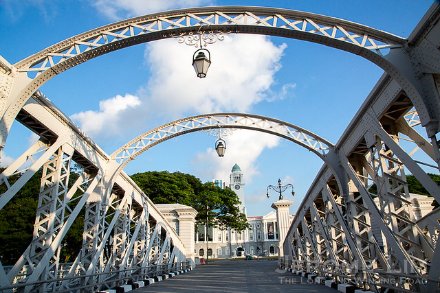
Anderson Bridge, completed in 1910 so that Cavenagh Bridge could be replaced, seems to have had quite a gruesome past. Known as the “Bridge of Death” in the 1950s for the spate of deaths from accidents involving motorcyclists, it was also one of several locations at which the heads of beheaded criminals were put on display in the early days of the Japanese Occupation to instill fear in the general population.

The bridge also became a tomb for over two decades from the mid-1960s to the late 1980s, without anyone knowing. The skeleton of a man, Mr Ong Choon Lim, was discovered  by a worker carrying out maintenance in February 1987.  Ong, who would have been in his 50s when he died, had last been seen alive by members of his family in 1960. The skeleton was found with two rings, a watch, $9 in currency notes issued prior to 1967, an identity card issued in 1948 and a certificate issued in July 1961. Ong was thought to have died sometime in between 1962 and 1967, which meant that his remains would have lain undiscovered for over 20 years.

The bridge is one of five bridges over the Singapore River that were given conservation status in 2009. More on its conservation: Singapore River Bridges


In search of love in the old GPO

14 04 2017

I loved the old GPO. It was a post office like none other in Singapore. Its main hall, which you entered after a climb up a short flight of stairs, was grand and airy. Stretching almost the entire length of the building, the hall was also where the long postal counter was found. That ran along the hall’s length and held the distinction of being the longest in the world.  Like all old buildings, the GPO – now the Fullerton Hotel has its collection of stories, including ones that tell of romantic liaisons.

In search of romance – a civil servant, played by Isabelle Chiam, gets everyone at the Minsitry of Finance involved.

An opportunity to discover the romances of the past, and also the building’s colourful history – in a fun and amusing way – presents itself with “A Fullerton Love Story Tour”.  Led by a resident tour guide, participants are taken on a search for romance – not of their own – but between a love struck postman at the GPO, played by Edward Choy, and his love interest – a civil servant with the Ministry of Finance housed in the same building – played by Isabelle Chiam. Participants also become part of the story as they move through various historic spots that include the Singapore Club, Fullerton Square, the Presidential Suite and the location of the Fullerton Building’s former lighthouse.

The love struck postman, played by Edward Choy.

View from the lighthouse towards what used to be the harbour.

Tours, which will be held from 8pm to 9.30 pm on 29 April, 6 May and 13 May 2017, are available for booking at http://afullertonlovestorytour.peatix.com. Priced at $78 nett for adults and $58 nett for children between 6 to 11, the tours will be followed by desserts at The Courtyard crafted by Executive Pastry Chef, Enrico Pezzelato.

The resident tour guide.

Besides the tour, which is being held in conjunction with the Singapore Heritage Festival 2017, the Fullerton Hotel is also bring back the TENG Ensemble for a showcase of brand new Singapore-inspired works. The showcase, “Where the River Always Flows II”, will include songs by P. Ramlee and Zubir Said and two East-West pieces specially commissioned  by the Fullerton Heritage.  Tickets for the concert, which will be held at the East Garden on 29 April 2017 at 7 pm, are available at $3 each at http://wheretheriveralwaysflows2.peatix.com.  More information on the concert and the tour can be found at the Fullerton Heritage’s website.

Enchanted Garden – one of five desserts guests on the tour will get to choose from.


A fiery September’s evening

12 09 2016

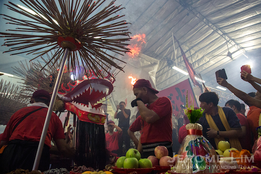
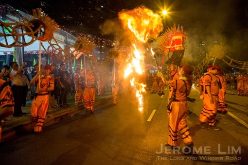
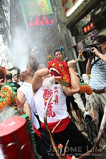
The fire dragon of Sar Kong came to life last night, making its way in a dizzying dance around the area of its lair at the Mun San Fook Tuck Chee temple.

jeromelim-2669

Last night’s dance of the fire dragon.

The dance of the dragon has its origins in Guangdong, from where many came from to work in the area’s brick kilns in the mid-1800s. The dance, rarely seen in a Singapore in which tradition has become an inconvenience, came at the close of the temple’s 150th Anniversary celebrations. The celebrations, held over a three day period, also saw a book on the temple’s history being launched. An exhibition on the history of the area is also being held in conjunction with this, which will run until 14 September 2016.

A book on the temple and the community's history was launched.

A book on the temple and the community’s history, A Kampong and its Temple, was launched.

Minister, Prime Minister's Office, Chan Chun Sing - a former resident of the area, being shown a model of the Sar Kong village area at the exhibition.

Minister, Prime Minister’s Office, Chan Chun Sing – a former resident of the area, being shown a model of the Sar Kong village area at the exhibition.

The parade of the straw dragon through the streets, is also thought to help dissipate anger caused by the disturbance of the land in the area of the temple being felt by the temple’s deities. The area, is once again in the midst of change – with a huge condominium development, Urban Oasis, just next door. The site of the development, incidentally, is linked to the current outbreak of the mosquito borne Zika virus in Singapore.

Lit joss sticks being placed on the straw dragon's body prior to the dance.

Lit joss sticks being placed on the straw dragon’s body prior to the dance.

There may perhaps be anger felt at the uncertainty for the future that temple itself faces. The land on which it sits on has long since been acquired for redevelopment by the Housing and Development Board (HDB) and the temple operates on it only through a Temporary Occupation License. The parcel of land it sits on is one shared with HDB flats that were taken back by the HDB under the Selective En-bloc Redevelopment Scheme (SERS) in the second half of the 2000s and it is left to be seen if the temple will be allowed to continue on the site when the area is eventually redeveloped.

The dragon offering respects to the altar prior to its dance.

The dragon offering respects to the altar prior to its dance.


The temple, Mun San Fook Tuck Chee (萬山福德祠), is thought to have its origins in the 1860s, serving a community of Cantonese and Hakka migrant workers employed by the area’s brick kilns, sawmills and sago making factories. The temple moved twice and came to its present site in 1901.

The dance of the fire dragon that is associated with the temple, although long a practice in its place of origin, only came to the temple in the 1980s. The dragon used for the dance is the result of a painstaking process that involves the making of a core using rattan and the plaiting of straw over three months to make the dragon’s body. Lit joss sticks are placed on the body prior to the dance and traditionally, the dragon would be left to burn to allow it to ascend to the heavens.

More information on the temple, its origins and its practices can be found in the following posts:


More photographs:

jeromelim-2612

jeromelim-2530

jeromelim-2556

jeromelim-2645


The fallen star of MacTaggart Road

6 09 2016

Long a landmark in the area, the Star at the corner of MacTaggart and Burn Roads – the former Khong Guan Biscuit Factory, is sadly, having its insides ripped out. The building, which was constructed in 1952 and given conservation status in December 2005. Sitting now behind hoardings, it seems that its face is all that is being conserved.

JeromeLim-2124

The Star and its delightful front grille gates in April 2013.

Described in a Straits Times report earlier this year as a three-storey modernist structure, the building also provided office space for the family owned business which has long been a household name in Singapore, as well as store spaces, a shopfront and accommodation to members of the family. The architect of the building and Khong Guan’s company architects since the 1950s, Chung Swee Poey & Sons, also had their offices on the second floor of the building.

Seen from MacTaggart Road in January this year.

Seen from MacTaggart Road in January this year.

More on the building can be found at the following links:


Photographs of the former Khong Guan Biscuit Factory

JeromeLim-2118

The former factory as seen from Burn Road in April 2013.

JeromeLim-2122

A display window at the former factory as seen in April 2013.

Entrance to offices along MacTaggart Road, Seen in January 2016.

Entrance to offices along MacTaggart Road, Seen in January 2016.

JeromeLim-2135

The front of the former factory as seen in April 2013.

JeromeLim-2137

JeromeLim-2152

The former factory behind hoardings in September 2016.

The former factory behind hoardings in September 2016.

It appears that all that is being conserved is the building's façade.

It appears that all that is being conserved is the building’s façade.


A dragon awakens

5 09 2016

The fire dragon of Sar Kong, in a rare reprise of the its smoking performance earlier this year, will come alive once again this September on the occasion of the 150th anniversary celebrations of the temple its lair is found in, the Mun San Fook Tuck Chee (萬山福德祠) . The temple has its origins in Sar Kong (沙崗) or “Sand Ridge, where a community of Cantonese and Hakka coolies had settled in.

JeromeLim-1434

The practice of parading the burning dragon has its origins in Guangdong – the origins of many in the community. Made of straw that has been imported from China, such a dragon would previously have been constructed for the feast day of the temple’s principal deity and sent in flames to the heavens.  In more recent times, such straw dragons would be paraded on an average of once every three years.  This particular dragon, which made for a more recent Chingay Parade, is not burnt but set alight only by the placement of joss sticks on its body.

JeromeLim-1402

More information on the practice, as well as the historic setting for the village and the temple, can be found in the temple’s heritage room. More on the temple and its history can also be found at the post: On Borrowed Time: Mun San Fook Tuck Chee.


Schedule for the Mun San Fook Tuck Chee 150th Anniversary Celebrations

A number of events held in conjunction with the 150th anniversary of the Mun San Fook Tuck Chee: Taoist priests from Ching Chung Koon in HK invited here to conduct rituals over 3 days, a seminar on Dabogong (Tua Pek Kong), a heritage exhibition, a book launch, and the finale – the one and only fire dragon dance in Singapore.

9 Sep 2016 (Fri)
0900-1145 Preparing ritual space
1400-1600 Rituals
1800-1900 Opening of heritage exhibition
1900-2100 Rituals

10 Sep 2016 (Sat)
0900-1145 Rituals
0930-1200 Seminar and discussion on Dabogong
1400-1600 Rituals
1900-2130 Rituals
2000-2100 Crossing the bridge for devotees

11 Sep 2016 (Sun)
0900-1145 Rituals
1000 Lion dance to welcome foreign visitors
1045-1145 Paying of respects by foreign visitors
1100-1400 Mid-autumn event for respecting elders in the community
1400-1600 Rituals
1600-1730 Salvation rituals
1930 Fire dragon performance / Book launch / Exchange of souvenirs with foreign guests


Photographs from the parade of the Fire Dragon in March 2016

JeromeLim-1532

JeromeLim-1427

JeromeLim-1417

JeromeLim-1410

JeromeLim-1392

JeromeLim-1351

JeromeLim-1575

JeromeLim-1572

JeromeLim-1569

JeromeLim-1563

JeromeLim-1560

JeromeLim-1556


Calling an end to one cycle of time for the Ellison Building

3 09 2016

As if to foretell the end in a cycle of time for the Ellison Building, and the beginning of another, the mayura, a peacock – a mythological representation of the cycle of time, has made an appearance just across Bukit Timah Road from it. In the peacock’s view is the side the building whose time is at it end; an end that is being brought about by the intended construction of the North-South Expressway right under it.

JeromeLim-1390

That a decision was taken to demolish a portion of a building that has been gazetted for conservation is hard to fathom. Protection through conservation, so it seems, counts for very little when the development of national infrastructure is a justification. Constraints of space due to what already exists underground has forced the authorities concerned to take this unfortunate decision. The section that will be demolished, which contains three units along Bukit Timah Road, will be reconstructed and reinstated to the building original design after the expressway is completed in 2026.

The decision caught the public unawares, first coming to light on 7 August 2016. The Chinese language daily Lianhe Zaobao, in an article on the construction of the expressway, made mention that part of the building’s “façade” was to be demolished and reinstated. Further information was then provided by a Straits Times 18 August 2016 report and much shock and disappointment has been expressed [see: Rebuilding parts of heritage building not the answer (Letter to the Straits Times, 18 August 2016), the Singapore Heritage Society’s 18 August 2016 Statement on Ellison Building, and ICOMOS Singapore’s 2 September Statement on the Proposed Demolition and Reconstruction of Part of Ellison Building].

The old style Hup Chiang kopitiam at the Ellison Building, now occupied by a Teochew porridge restaurant.

The news is also upsetting considering that the Ellison is one of the last survivors of the landmarks that once provided the area with its identity. Old Tekka Market, an focal point for many heading to the area in its day, has long since left us. Its replacement, housed at the bottom of a HDB built podium development built across the road from the old market, lacks the presence of the old  – even if the complex towers over the area. The complex sits on the site of another missing landmark, the Kandang Kerbau Police Station. One still there but now well hidden from sight is the Rochor Canal. Flavoursome in more ways than one, the canal would often mentioned in the same breath as any reference that was made to the area. Looking a little worse for war and dwarfed by much of what now surrounds it, the Ellison building with its distinctive façade, still makes its presence felt.

The Ellison Building as interpreted by the Urban Sketchers of Singapore.

The Ellison Building as interpreted by the Urban Sketchers Singapore.

The Ellison building is one of three structures found in the area on which the Star of David proudly displayed, the others being the David Elias building and the Maghain Aboth synagogue at Waterloo Street. Placed between the 19 and 24 on its Selegie Road façade that gives the year of its completion, it tells of a time we have forgotten when the area  was the Mahallah to the sizeable Arab speaking Baghdadi Jewish community. Described as having a feel of old Baghdad, the Mahallah was where the likes of Jacob Ballas and Harry Elias, just two of the communities many illustrious children, spend their early years in. Another link to its origins is an “I. Ellison” one finds over the entrance to No. 237 – one of the units that will be demolished. This serves to remind us of Isaac Ellison who had the building erected, apparently, for his wife Flora. 

The building seems also to have a long association with one of Singapore’s biggest obsessions, food. One food outlet that goes back as far as the building is Singapore’s oldest Indian Vegetarian restaurant, Ananda Bhavan (which still operates there). It was one of two vegetarian places that I remember seeing from my days passing the building on my daily rides home on the bus as a schoolboy. I would look out for the eye-catching displays of brightly coloured milk candy, neatly arranged on the shelves of wooden framed glass cabinets and also the restaurants’ old fashioned counters. Another sight that I never failed to notice was the mama shop along the five-foot-way and its stalk of bananas on display from which bananas would be plucked and purchased individually.

JeromeLim-1242

A lost reminder of the past, an old fashioned Indian Vegetarian restaurant that has since been replaced by a popular nasi lemak shop.

The units that housed the vegetarian restaurants are fortunately on the side along Selegie Road. This will not be affected by the expressway construction and is housed within a larger part of the building that is not being demolished. This is something that should perhaps be looked at positively as unlike the regretful loss of whole places and structures that we have become accustomed to – so that they can keep our world moving,  the Ellison, because of it conservation status will not totally be lost.

Previous instance of moving our world too far and too fast, and in a direction not everyone is comfortable with, we have bid farewell to well loved structures such as the people’s National Theatre, the much-loved National Library, and what probably counts as Singapore’s first purpose built hawker centre – the Esplanade Food Centre.

We have also parted company in more recent times with places such as the remnants of the historic Mount Palmer and  a part of the Singapore’s first polytechnic. Both were flattened earlier this year to allow the final phase of the Circle Line MRT to be completed. Another historic site, Bukit Brown cemetery, has also lost some of its inhabitants to a highway that is being built through it. There is also the case of the proposed Cross Island Line’s proposed alignment that will take it under what should rightfully be an untouchable part of Singapore – the Central Catchment Nature. Of concern is the site  investigation work that will be carried out and its potential for long term damage to the flora and fauna of the nature reserve.

The regret of allowing places such as the National Library and National Theatre to pass into history is still felt. Whatever is intended for the Ellison is something we similarly will regret. Let us hope that the regret is not also one of setting a precedent in the resolution of conflicts to come between conservation and the need for development.


Other views of the Ellison Building over the years found online:

Part of the Selegie Road face of Ellison Building, possibly in the 1980s (snowstorm snowflake on Panoramio).

The Ellison Building, seen from across the then opened Rochor Canal in 1969 (Bill Strong on Flickr).


Sophia, Caroline and Emily, and the spiced up Hills of Babylon

18 08 2016

Just north of a hill of much history known to the early inhabitants of Singaporeans as the Forbidden Hill or Bukit Larangan, is a cluster of low hills that are known today as Mounts Sophia, Emily, and Caroline.  The hills, three sisters if you like, go back a long way and have a rather storied past.

The value of these elevations, rising some 30 to 35 metres above the plain which Raffles designated as the new settlement’s European precinct, and the harbour that was the very reason for which the settlement was founded beyond it, had certainly been recognised in the early days. Two of the protagonists of the new trading post soon had their hands on parts of them. In a letter written by Singapore’s first resident, William Farquhar, to Raffles on 23 December 1822,  Raffles is told that parts of the hills had been cleared at government expense, with 33 acres of “Silligie” Hill  occupied by Captain William Flint, the Master Attendant, and 20 acres of the next hill to the north, “Bukit Cawah”, that the Resident had himself taken possession of.

William Farquhar.

William Farquhar.

In the letter, Farquhar also describes the state of the hills at the time of the founding – the “commencement of the establishment” as he had put it. “Silligie” was “occupied in the western side by a Chinese planter who had formed a Gambier Plantation there”. Its eastern side had been “a primitive forest” and “Bukit Cawah” had been “totally unoccupied and covered with primitive forest trees”.

Gambier, an extract from the leaves of the plant is used in dyes and in the tanning of leather and also in the chewing of betel nut. Gambier was planted in Singapore by the Chinese even before the British arrived.

Gambier, an extract from the leaves of the plant is used in dyes and in the tanning of leather and also in the chewing of betel nut. Gambier was planted in Singapore by the Chinese even before the British arrived.

Raffles, who was at odds with Farquhar over his handling of the affairs of new settlement, had allegations made that Farquhar had appropriated more (land) than he was entitled to on Bukit Cawah. In an essay  “William Farquhar, First Resident and Commandant of Singapore”1, one of the foremost authorities on Raffles, John Sturgus Bastin, informs us that Raffles had referred to what Farquhar had his hands on as his “Hills of Babylon” – a reference to the hills in the Book of Revelations that one of the beasts of the end times, Babylon, rests on.

From a map of Singapore dated 1822-23. Cawah is probably misspelt as Rawa.

From a map of Singapore dated 1822-23. Cawah is probably misspelt as Rawa.

We know of Bukit Cawah today as Mount Emily and Silligie Hill (or Bukit Selegie) as Mount Sophia. Early maps and documents use several variations in the spelling of the names, the origins of which, seem rather obscure. An attempt is made by Victor Savage and Brenda Yeoh in “Singapore Street Names: A Study of Toponymics” to offer possible explanations. One relates to a Bugis chief with a band of followers called the “Orang Selegie”, while another gives Selegie, spelt Seligi, to be a reference to the nibong palm  used in the making of fishing stakes or of spears of the same name. There apparently is a sharpened wooden spear used by the Borneo based Iban tribe that is known a “seligi”. That is made of the trunk of the nibong palm.

From a map entitled "Part of Singapore Island", 1825, which identifies both Bukit Selegie and Bukit Kawah.

From a map entitled “Part of Singapore Island”, 1825, which identifies both Bukit Selegie and Bukit Kawah.

I should think that Selegie must have less exotic origins. A set of sketches of fishing implements employed by the Orang Laut seen in Cynthia Chou’s book on the Orang Suku Laut2, who were among the earliest inhabitants of Singapore, offers a possible clue. A multi-pronged tip of a fishing spear commonly used in “pre-settlement” daysis found in them, made not necessarily from the nibong palm that is identified as a “seligi“. How this seligi became mixed up with the hill is anybody’s guess. One explanation I can offer is that the two hills may have stuck out of the undeveloped pre-settlement landscape like the prongs of seligi.

Fishing spears employed by the orang laut.

Fishing spears employed by the orang laut.

As opposed to the Iban seligi, there should be little doubt that the seligi fishing spear would be ones that are readily recognisable in Singapura. Spearing of fish was the main method of fishing, as had been observed by Munshi Abdullah, a scholar and translator from Malacca, as is recorded in his autobiography, Hikayat Abdullah. The introduction of the hook and line by fishermen coming over from his native Malacca post-settlement put an end to the practice. It is not unimaginable that the two hills had collectively been referred to as Bukit Selegie. An indication of this is seen perhaps in G.D. Coleman’s 1836 Map of Town and Environs, which shows a Mount Sophia that had been marked in earlier maps as Bukit Selegie alongside a Mount Emily (Bukit Cawah) that is instead marked as “Bukit Selegie”.

From the 1836 Map of Town and Environs, based on a survey carried out by G D Coleman.

From the 1836 Map of Town and Environs, based on a survey carried out by G D Coleman (click to enlarge).

The name Cawah seems most obscure.

One explanation that has been offered is that Cawah is a variation in the spelling of Jawa or Java, and the hill was so named due to the proximity of a Javanese settlement at Kampong Jawa. The “C” in this case might have been pronounced as it is in modern Malay spelling, as a Ch. We do however see the name spelt with a K, Kawah, and what this means is that the name would more likely have been pronounced as Ka-wah rather than as Cha-wah.

The word Kawah finds widespread use in Indonesia to describe a volcanic crater. It also translates into English as a cauldron or even a large pot. As with the name Selegie, Kawah could have been a reference to the shape of a geographical feature, such as that of the depression found in between the two hills. But without no evidence to back this up, it would be hard to put a finger on it.

A crater, Kawah Sikadang, near Yogyakarta in Indonesia.

A crater, Kawah Sikadang, near Yogyakarta in Indonesia.

The hills’ modern day names are in themselves, a cause for much speculation. While it has been generally accepted that the Sophia in Mount Sophia was Raffles second wife Sophia Hull, who the Flints who moved up the hill were thought to have honoured;  there also are suggestions that it may have been one of several Sophias also connected with the hill, of which there are a few.

The Flints, Mary Ann, Raffles' sister and Captain William, the Master Attendant.

The Flints, Mary Ann, Raffles’ sister and Captain William, the Master Attendant.

One, is none other than the Flints’ daughter, Mary Sophia Anne, who was born in 1823, the year the Flints moved to their new address. The name Sophia Cooke also comes up. Cooke was an Anglican missionary who arrived in 1853 to run the Chinese Girls’ School on the hill that is now St. Margaret’s School. There is also Sophia Blackmore. Ms Blackmore founded Methodist Girls School in 1887. Although the school only moved up from Short Street to Mount Sophia in 1925, Ms Blackmore other connections with the hill date back to the 1890s.

The Deaconess Home (later Nind Home), acquired in 1894, was used by Ms. as a boarding house. The site at No.6 Mount Sophia (later No. 11), based on the details of the lease, could possibly be where Flint had his house.

The Deaconess Home (later Nind Home), acquired in 1894, was used by Ms. as a boarding house. The site at No.6 Mount Sophia (later No. 11), based on the details of the lease, could possibly be where Flint had his house.

One rather interesting suggestion that comes up from time to time is that the hills along with Mount Caroline, are named after the three daughters of Charles Robert Prinsep. This may have its origins in a Straits Times article from 10 May 1936. Charles Robert Prinsep, a barrister with the East India Company based in Calcutta, was also a plantation owner and the man behind the second phase of the hills’ development. He may have first purchased Bukit Cawah from the Farquhar estate in 1831,  adding to it a huge tract of land that extended to Mount Sophia and Mount Caroline, soon after.

View today over the three hills.

View today over what had once been the Prinsep estate.

All 270 acres of Prinsep’s sprawling estate, roughly the size of today’s Gardens by the Bay. was given to the cultivation of nutmeg. The arrival of nutmeg as a crop to our shores, and before that to Penang, was prompted by the desire of the British to challenge the monopoly the Dutch had on a spice that was worth more than its weight in gold.

The nutmeg fruit, seen on a tree on Fort Canning Hill.

The nutmeg fruit, seen on a tree on Fort Canning Hill.

By 1848, Prinsep’s estate was among 20 such plantations that were to alter the landscape of the previously forested hills on both sides of what we know today as Orchard Road. The estate of 6,700 trees had one of the highest yields and at its height produced some 22,000 nutmegs daily. Besides nutmeg, another spice Mace, is obtained from the “nuts”, ground from the seed’s aril. The spice nutmeg is from the seed itself. The plantations, by the way, were what gave Orchard Road its name.

Nutmeg, the only plant from which two spices are obtained. Mace from the red aril covering its seed and nutmeg from the seed itself.

Nutmeg, the only plant from which two spices are obtained. Mace from the red aril covering its seed and nutmeg from the seed itself.

It was around the time of the establishment of the Prinsep estate in 1831 that the name Mount Sophia first crops up (this on the basis of newspaper articles, the archives of which do not go further back than 1831 but the manner in which it does crop up points to its adoption around the same time). This was some five years before Coleman’s 1836 map was published. The mention is found in a letter to the Singapore Chronicle and Commercial Register, published  on 26 May 1831, in which the writer makes mention that “Flint’s Hill”, the location named of a fire that was the subject of an earlier report, should have been referred to as “Mount Sophia”.

A letter from Willaim Farquhar to Lt. Jackson making a request to have the identified hills, including Bukit Selegie and Bukit Cawah, surveyed. The various parties who were in possession of the hills are also identified.

A letter from Willaim Farquhar to Lt. Jackson making a request to have the identified hills, including Bukit Selegie and Bukit Cawah, surveyed. The various parties who were in possession of the hills are also identified.

By 1839, Prinsep’s estate had apparently been quite well established. Mention of the estate, and more importantly the three hills by name, is made in a published account of a visit paid by the crew of the United States frigate Columbia, to the estate. The Columbia, on a well documented round the world voyage, made a stopover in Singapore in February 1839. The accounts of the voyage were to be published in two volumes in 1840. On the visit to the estate, the account states:

The first of these estates, that of Mr. Princeps, who resides in Calcutta, is laid out with excellent taste upon beautiful grounds. It occupies about two hundred and fifty acres, including three lovely hills, Mount Sophia, Mount Caroline and Mount Emily, each surmounted by a neat bungalow, from which avenues radiate and intersect all over the plantation.

When we were there, the superintendent, who politely show us every part and answered our inquiries, informed us that they had already planted four thousand nutmeg trees; twenty thousand coffee shrubs; two hundred orange trees; two hundred clove trees; and one hundred and fifty areka trees, besides a few of many other kinds.

– “Around the World: A Narrative of a Voyage in the East India Squadron under Commodore George C. Read”, Volume 2, 1840, Page 143.

The extent of the Prinsep Estate, seen in an 1870 map.

The extent of the Prinsep Estate, seen in an 1870 map. The 106 acres bought for Government House, is marked as “New Government Property”.

This account discounts that possibility of the hills being named after Prinsep’s daughters. The first, Sophia Catherine, only came into the world three years after the visit, in 1842. To add to the improbability of this, Prinsep, who married Louisa Anne White in 1837, was to have three other daughters, none of whom had the name Caroline. His other daughters were Annie Mary (b. 1848), Louisa Sophia (b. 1851), and Mary Emily (b. 1853). The account. plus the fact that Mount Sophia is mentioned as early as 1831, also puts paid to the suggestions concerning both Ms Cooke and Ms Blackmore.

Mary Emily Prinsep (Julia Margaret Cameron, photograph,1866). Could she have been the Emily in Mount Emily?

Mary Emily Prinsep (Julia Margaret Cameron, photograph,1866). Probably not the Emily in Mount Emily.

Further investigation does however throw up the possibility that a different set of sisters in the Prinsep family are behind the names. Charles Robert, it turns out, had three sisters who coincidentally, were named Sophia, Caroline and Amelia (affectionately known as Emily). There is every likelihood that it was this set of sisters, who had been born before Charles Robert’s plantation came into being, who lent their names to the hills. It could also have been the case that Prinsep, on finding that one of the hills had already carried the name of one of his sisters, had decided to follow on, naming the other two main hills of his estate after his other sisters. This is perhaps less likely as the report of 1831 tells us that the name Flint’s Hill for Bukit Selegie was very much still use three years after his unfortunate demise in 1828. Incidentally, there is also a less significant hill in the estate, Mount Louisa. This appears in some maps as Lock’s Hill and it is probable that the Louisa in the name is  that of Prinsep’s wife.

Nutmeg plantations in Singapore, mid 1800s..

Nutmeg plantations in Singapore, mid 1800s..

Prinsep’s plantation was to go the way of the island’s other nutmeg plantations. Despite thriving initially, disease was to dent the ambitions that the plantation owners held. By the time Prinsep had the lease on his estate extended in 1859, nutmeg as a crop had already been wiped out. This was to pave the way for the next phase of the development on the hills, one that saw it becoming an estate for the very well-heeled.

A sketch of a young Charles Robert Prinsep by his sister Emily, 1824.

A sketch of a young Charles Robert Prinsep by his sister Emily, 1824.

Sophia Charlotte Haldimand (née Prinsep) - another sketch by Emily Prinsep. Could she be the Sophia in Mount Sophia?

Sophia Charlotte Haldimand (née Prinsep) – another sketch by Emily Prinsep. Could she be the Sophia in Mount Sophia?

The estate was put up for sale in 1859 into the early 1860s, the evidence being advertisements placed in the newspapers. The sale in parts of the estate was allowed for and a familiar name in that of Mr (Lawrence) Niven features in the advertisements. Niven, after whom Niven Road at the foot of Mount Emily was named, is perhaps more well known for his efforts setting up of Singapore’s first UNESCO World Heritage Site, the Singapore Botanical Gardens, as its very first superintendent. He had been the superintendent of Prinsep’s nutmeg estate prior to his appointment to the Botanical Gardens position and must have held both appointments concurrently at some point in time.

For Sale

In the immediate neighbourhood of the town of Singapore, the very desirable property of C. R. Prinsep, Esquire, lying between the Orchard and Bukit Timah Roads, consisting of Hills and Low grounds daily increasing in value.

This lands may be sold in lots to suit purchasers and all further particulars may be learned from Mr Niven, the Superintendent of the Estate or Messrto to be & Co.

Singapore, 13th April, 1859.

Well documented is the sale in 1867 of 106 acres of the western section of the estate,, covering Mount Caroline and Mount Louisa, to the Governor, Sir Harry St. George Ord. This was for a new Government House (now the Istana) to be erected. The placement of the fort on the original Government Hill, Bukit Larangan,  had displaced the Governor’s residence. The new Government House on the top of Mount Caroline was completed in 1869. Mount Caroline had in fact been identified in the 1850s by Army Engineer Captain George Chancellor Collyer, as a possible location to move Government House to. This came with the recommendations he made a 1858 report to fortify Bukit Larangan. Mount Caroline, was described by Collyer, as the “most commanding spot on the island”. Together with Government House, the Colonial Secretary’s residence (now Sri Temasek), was also completed at the same time at Mount Louisa.

A photograph of Government House perched on Mount Caroline in the 1880s, seen from Fort Canning. Mount Sophia is in the background on the left.

A photograph of Government House perched on Mount Caroline in the 1880s, seen from Fort Canning. Mount Sophia is in the background on the left.

The remaining parts of Mount Sophia and Mount Emily were to be subdivided and sold. Their elevation, and prime location in the vicinity of the heart of the thriving municipality, made the plots being offered a very attractive prospect. It did not take long before the exclusive neighbourhood that was to boast some of the grandest residences to be seen on the island, started to take shape and by the 1880s, several large residences occupied prime positions across the twin peaks.

An 1881 map showing the tops of the hills of the former Prinsep estate populated by newly built residences.

An 1881 map showing the tops of the hills of the former Prinsep estate populated by newly built residences.

A view across Mount Sophia towards Mount Caroline and Government House. The building in the foreground is Olson Building - the only one of the buildings of the former Methodist Girls School that is being conserved.

A view across Mount Sophia towards Mount Caroline and Government House. The building in the foreground is Olson Building – the only one of the buildings of the former Methodist Girls School that is being conserved.

There is little doubt that one had to be someone of means to move up to the hills, which would have been most accessible by horse and carriage. One of the first grand residences to secure a footing on the hills would have been Carrington House around 1873. Little is known about the house except for the fact that a panther was cornered and shot in it sometime in December 1883. The very brave man credited with making the killing, Mr Maurice Drummond, apparently received a reward of $25 for his troubles.

Carrington House, as seen from Osborne House, 1880.

Carrington House, as seen from Osborne House, 1880.

Carrington House, we can see from the 1880 photograph, found a perch in quite a prominent location on the slopes of Mount Sophia. One can only imagine the views it must have offered in days when one’s gaze could be cast across the settlement for as far as the eye could see. It is no wonder that two of the grandest mansions Singapore has seen were to be built on its site. Carrington House was to be replaced by the ostentatious Adis Lodge and then an even grander Eu Villa. It is in the days of Eu Villa that were are able to get an appreciation of what the view must have been like from a 1936 Straits Times article:

From Eu Villa the view on three sides, out over the harbour and away to Keppel Hatbour on one side and Katong on the other, is simply breathtaking, especially in the evening when the city takes on an indefinite soft and delicate colouring. This is not the highest point on the hill, but, because the house juts out with no encumbrance on either side, the view is better than on the actual brow of the hill above Eu Villa … it is a magical place to be on a moonlight night, overlooking the lights of the city and the junk anchorage.

– The Straits Times, 10 May 1936

Eu Villa and the view from it.

Eu Villa and the view from it.

A view over Mount Sophia towards the harbour c. late 1940s. Eu Villa can be seen in the lower left part of the photograph.

A view over Mount Sophia towards the harbour c. late 1940s. Eu Villa can be seen in the lower left part of the photograph. Cathay building, which came up in the late 1930s, Singapore’s “first skyscraper”  was the first tall building to block the view one got from the top of the hill.

Adis Lodge, which came up in 1907, was built by Nissim Nissim Adis. Adis was the proprietor of very grand Grand Hotel de L’Europe at the corner of St. Andrew’s Road and High Street, the location today of the old Supreme Court wing of the National Gallery. It was after him that Adis Road on Mount Sophia was named. Opulently furnished and decorated, Adis Lodge carried the reputation of being one of the “most magnificent of mansions east of the Suez”. It did not last long however. It was sold to the “king of tin” Eu Tong Sen in 1912. Eu had the lodge replace in 1915 with Eu Villa. Eu Villa, which had a fairy tale like quality, survived for quite a bit longer. It was sold in 1973 for S$8.19 million and was only demolished in the early 1980s.

Adis Lodge in 1908.

Adis Lodge in 1908.

Mount Sophia was also a name that was synonymous with the Methodist Mission and Methodist Girls’ School (MGS). The Methodist presence took root in the 1890s with its purchase of several of the grand houses at the top of the hill. Methodist Girls’ School, which started as a Tamil girls’ school in a shophouse on Short Street, made a move up the hill in 1925, staying until 1992. It wasn’t the first school to be established on the hill. That would have been St. Margaret’s whose presence on the hill as Chinese Girls’ School goes back to 1861.

Wesley House, at No. 5 Mount Sophia, which was acquired by the Methodist Mission in 1894.

The Methodist Girls School complex, used as a centre for the arts while awaiting redevelopment.

The former Methodist Girls School complex, used as a centre for the arts in 2010 while awaiting redevelopment.

On the other peak, Mount Emily, its rather flat and elongated top must have made it a perfect spot to play host to a service reservoir. One was put there in the late 1870s to supply treated water to the municipality. It was to be made redundant by the much larger Fort Canning Reservoir in 1929. The reservoir was then turned into Singapore’s first public swimming pool around which the beautifully set Mount Emily Park was established. The pool opened in 1931 and was in use until the early 1980s with it serving as the setting for the qualification of Singapore’s very first woman lifeguard, Miss Ann Tay, in February 1952.

Lambert Mount Emily

A G R Lambert photograph of the reservoir on top of Mount Emily taken from Osborne House.

A large residence, humble by the standards of Eu Villa or Adis Lodge, Osborne House, made its appearance near the top of Mount Emily about the same time the reservoir was completed. The house does have its fair share of stories. Perched on a part of the hill that could be seen from Middle Road, it served for a while as a symbol to the sizeable pre-war Japanese community who were centered on Middle Road (Chuo Dori to the community) as the Japanese consulate. There also seems a connection to the Sultan of Siak. More about Osborne House’s rather intriguing past can be found in an earlier post, A Last Reminder of an Old-fashioned Corner of Singapore.

Middle Road when it would have been referred to as Chuo Dori in the 1930s. Osborne House which was to serve as the Japanese Consulate from 1939 to 1941 can be seen atop Mount Emily at the end of the street.

Middle Road when it would have been referred to as Chuo Dori in the 1930s. Osborne House which was to serve as the Japanese Consulate from 1939 to 1941 can be seen atop Mount Emily at the end of the street.

Osborne House today, known to us now as "Emily Hill".

Osborne House today, known to us now as “Emily Hill”.

Farquhar’s “Hills of Babylon”, Mount Emily and neighbouring Mount Sophia, have a very different beast now to contend with these days. Much of the magic that motivated the construction of residences such as Adis Lodge and Eu Villa has sadly, long been lost, taken away by the wall of glass, steel and concrete that now surrounds much of the hills. The “trees” of the new estate are ones that are mostly grey. The yields they give is gold that is of great value in the concrete plantation that much of Singapore has become.

Tower House at the top of the southern slop of Mount Sophia. A wall of concrete, glass and still has obscured part of the view it once commanded.

Tower House at the top of the southern slope of Mount Sophia. A wall of concrete, glass and still has obscured part of the view it once commanded.

On the hill tops are but a few survivors of the high life, one Tower House on Mount Sophia is a conserved structure. The future of Osborne House on Mount Emily, is much less certain and it may be a matter of time before it and the many connections it has with an especially interesting past are forever lost.

The wall around Mount Sophia seen from Prinsep Street.

The wall around Mount Sophia seen from Prinsep Street. Flint’s house may have been located in the area now blocked by the School of the Arts (SOTA).

Walls of concrete, glass and steel around Mount Emily.

Walls of concrete, glass and steel around Mount Emily. The roofs of Olson Building and Tower House at the top of Mount Sophia at the upper left part of the photograph can barely be seen. Mount Emily is in the centre of the photo and Mount Caroline on the extreme right.


Notes:


Published in “Natural History Drawings: The Complete William Farquhar Collection, Malay Peninusla 1803-1818”.


“The Orang Suku Laut of Riau, Indonesia: The inalienable gift of territory”.


The Ellison Building at the foot of one of the three sisters, Mount Emily

A report in this morning’s edition of the Straits Times reveals that part of the Ellison Building, a very distinctive conserved building at the corner of Selegie Road and Bukit Timah Road near the foot of Mount Emily, will be demolished and reconstructed due to the construction of the North-South Corridor. The part that will be affected is along Bukit Timah Road with units 235, 237 and 239 to be demolished. This follows on an earlier report in the Chinese language Lianhe Zaobao article on 7 August 2016 that first broke the news of the building being affected. In the earlier report, it was mentioned that only “part of the (building’s) façade” would be affected. The Ellisons, Issac and Flora, had their home at 87 Wilkie Road, another of the grand residences that found their way on the slopes of Mounts Sophia and Emily. The residence, was demolished in the 1980s and a multi-storey residential development was put in its place and the Ellison Building is what’s left to remember them.

A view over the Selegie Road and Bukit Timah Road junction with the part of the Ellison Building (the curved building in the lower right) that will be affected facing the viewer.

A view over the Selegie Road and Bukit Timah Road junction with the part of the Ellison Building (the curved building in the lower right) that will be affected facing the viewer.

Incidentally, the entrance to the upper level one of the units being affected, 237, is where one find the words “I. Ellison” or Issac Ellsion – the man who had the building constructed, on a sign above it. This makes the demolition of this part of the building, even if it is to be reconstructed, even more tragic.

The five-foot-way of the Ellison Building where one of the units that will be demolished and then reconstructed, No. 237. A sign on top of the gateway is marked with "I. Ellison" or Issac Ellison - the man who had the building constructed.

The five-foot-way of the Ellison Building where one of the units that will be demolished and then reconstructed, No. 237. A sign on top of the gateway is marked with “I. Ellison” or Issac Ellison – the man who had the building constructed.


Lost beauty

15 07 2016

I can’t help but feel a sense of loss wandering around the former Bukit Timah Railway Station. Set in one of the greener and isolated stretches of the rail corridor in the days of the railway, it was a magical place that had the effect of taking one far away from the madness of a Singapore that had come too far too fast. Now a sorry sight behind an unsightly green fence, its still green settings is an much altered one scarred by the removal of the railway’s tracks and ballast, turfing and maintenance work.

JeromeLim-9769

The station had a special charm. Built in 1932 as part of the railway deviation scheme, it wore the appearance of a rural railway station, especially in surroundings that were most unlike the post-independence Singapore we had come to know. A passenger station in its early days and a point where racehorses transported for races at the nearby turf club were offloaded, the station in its latter days functioned more as a signal box for the exchange of key tokens (the token handed authority to the passing trains for the use of the single track that ran south to Tanjong Pagar and north to Woodlands).

JeromeLim-8131

The world around station is due to be upset further. Work to lay a water pipeline that will supply Singapore’s future needs, will start in the area of the station, is due later this quarter.  It will only be at the end of the 2018 before the area is to be reopened, when it will, without a doubt, bear the scars left by the activity. There is however hope for its restoration, at least as a green space. This future, is now in the hands of the winning design consultants for the Rail Corridor concept plan.

JeromeLim-9789

As part of the concept plan, a detailed design exercise is being carried out for a 4 km signature stretch. This includes the area of the former station. Feedback obtained through engagement efforts with various stakeholders and the public is being taken into consideration for this. What is left to be seen is its outcome, which should be interesting to see. This should be made public in the months ahead. It would of course be impossible to recreate the world that once was, but what would be good to see in the detailed design is that it remains a place in which one can run far from a Singapore we already have too much of.

JeromeLim-0001

JeromeLim-8936

JeromeLim-8014

JeromeLim-0053

JeromeLim-8943

JeromeLim-9784

JeromeLim-9823


Revisiting Commonwealth and Holland Village

30 03 2016

Queenstown, where I spent the earliest days of my life, holds many wonderful memories for me. It is a place I enjoy going back to, which I regularly do in my attempts to rediscover memories the town holds of my childhood, discovering more often than not a fascinating side to Singapore’s first satellite town I had not known of before.

A window into a world in which one will discover the many layers of a rich and varied history.

A window into a world in which one will discover the many layers of a rich and varied history.

A chance to revisit Queenstown and learn more about it came recently when I participated in an introductory My Queenstown heritage tour of Holland Village and Commonwealth. The tour, which started at Chip Bee Gardens, took a path that ended in the unreal world of palatial homes that lies just across the town’s fringes at Ridout Road. Intended to provide participants with a glimpse into the area’s evolution from its gambier and rubber plantation days to the current mix of residential, commercial and industrial sites we see today, it also provided me an opportunity to revisit  the neighbourhood that I had spent my first three years in.

Jalan Merah Saga in Chip Bee Gardens.

Jalan Merah Saga in Chip Bee Gardens.

Adjacent to an ever-evolving Holland Village, Chip Bee Gardens – the starting point, is known today for its eclectic mix of food and beverage outlets and businesses, housed in a rather quaint looking row at Jalan Merah Saga. Many from my generation will remember it for a crêpe restaurant, Better Betters. In combining French inspired crêpes with helpings of local favourites such as rendang, the restaurant married east and west in a fashion that seemed very much in keeping with the way the neighbourhood was developing.

A view over Chip Bee Gardens.

A view over Chip Bee Gardens.

The shop lots, I was to learn, had rather different beginnings. Converted only in 1978, the lots had prior to the 1971 pull-out of British forces, served as messing facilities for the military personnel the estate had been built to accommodate in the 1950s. The growth of Holland Village into what it is today, is in fact tied to this development. Several businesses still found at Holland Village trace their roots back to this era.

Holland Road Shopping Centre, a familiar landmark in Holland Village.

Holland Road Shopping Centre, a familiar landmark in Holland Village.

The Thambi Magazine Store at Lorong Liput is one such business. Having its roots in the 1960s, when the grandfather of its current proprietor, delivered newspapers in the area, the so-called mama-shop, has grown to become a Holland Village institution. It would have been one of two such outlets found along Lorong Liput, previously occupying a space across from its current premises. Its well-stocked magazine racks once drew many from far and wide in search of a hard-to-find weekly and is now the sole survivor in an age where digital media dominates.

Sam, the current proprietor of the Thambi Magazine Store.

Sam, the current proprietor of the Thambi Magazine Store.

Magazine racks outside the store.

Magazine racks outside the store.

Lorong Liput would also have been where many of Holland Village’s landmarks of the past were once found. One was the Eng Wah open-air cinema, the site of which the very recently demolished Holland V Shopping Mall with its mock windmill – a more recent icon, had been built on. Lorong Liput was also where the demolished Kampong Holland Mosque once stood at the end of and where the old wet market, since rebuilt, served the area’s residents.

The windmill at Lorong Liput, which recently disappeared.

The windmill at Lorong Liput, which recently disappeared.

The rebuilt market.

The rebuilt market.

The site of the former Eng Wah open-air cinema and the Holland V Shopping Mall.

The site of the former Eng Wah open-air cinema and the since demolished Holland V Shopping Mall.

The Eng Wah open-air cinema (source: National Archives online).

From Lorong Liput, a short walk down Holland Avenue and and Holland Close, takes one to the next stop and back more than a century in time. The sight that greets the eye as one approaches the stop, which is just behind Block 32, is one that is rather strange of neatly ordered rows of uniformly sized grave stones of a 1887 Hakka Chinese cemetery, the Shuang Long Shan, set against a backdrop of blocks of HDB flats and industrial buildings. Visually untypical of an old Chinese cemetery – in which the scattering of burial mounds would seem almost random, the neat rows contain reburied remains from graves exhumed from an area twenty times the 4.5 acre plot that the cemetery once occupied.

A view across the grave stones to the roofs of the Shuang Long Shan Wu Shu ancestral hall.

A view across the grave stones to the roofs of the Shuang Long Shan Wu Shu ancestral hall.

Run by the Ying Fo Fui Kun clan association, Shuang Long Shan was acquired by the HDB in 1962. A concession made to the clan association permitted the current site to be retained on a lease. The site also contains the clan’s ancestral hall, the Shuang Long Shan Wu Shu Ancestral Hall and a newer memorial hall. The ancestral hall, which also goes back to 1887, is now the oldest building in Queenstown.

Offerings placed for the Ching Ming festival.

Offerings placed for the Ching Ming festival.

Ancestral tablets inside the hall.

Ancestral tablets inside the hall.

A close-up of the ancestral hall.

A close-up of the ancestral hall.

My old neighbourhood nearby was up next. Here I discovered how easy it was to be led astray in finding myself popping into Sin Palace – one of the several old shops found in the neighbourhood centre in which time seems to have long stood still.  The shops offer a fascinating glimpse of the world four, maybe five decades past, days when I frequented the centre for my favourite bowl of fishball noodles and the frequent visits to the general practitioner the coughs I seemed to catch would have required. The neighbourhood is where a rarity from a perspective of church buildings can be found in the form of the Queenstown Lutheran Church. It is one of few churches from the era that retains much of its original look.

Commonwealth Crescent Neighbourhood Centre and the Lutheran Church as it looked when I lived there (source: My Community).

JeromeLim-2524

Inside Sin Palace – an old fashioned barber shop.

Another area familiar to me is the chap lak lau chu (16 storey flats) at Commonwealth Close, which we also visited. A friend of my mother’s who we would visit on occasion, lived there at Block 81, a block from which one can look forward to an exhilarating view from its perch atop a hillock. The view was what gave Block 81 the unofficial status of a “VIP block” to which visiting dignitaries would be brought to – much like the block in Toa Payoh to which I moved to. Among the visitors to the block were the likes of Prince Philip, the Duke of Edinburgh and Indian Prime Minister Mrs. Indira Gandhi.

Also at Commonwealth Close, the space between Blocks 85 and 86 where the iconic photograph of Singapore's first Prime Minister, Mr Lee Kuan Yew was taken.

Also at Commonwealth Close, the space between Blocks 85 and 86 where the iconic photograph of Singapore’s first Prime Minister, Mr Lee Kuan Yew was taken.

Before visiting Block 81, a stop was made at Commonwealth Drive, where the MOE Heritage Centre and Singapore’s first flatted factories are found. The flatted factory, an idea borrowed from Hong Kong, allowed space for small manufacturers to be quickly and inexpensively created  during the period of rapid industrialisation and the block at Commonwealth Drive (Block 115A) was the first to be constructed by the Economic Development Board (EDB) as part of a pilot programme launched in 1965 (more on the development of flatted factories in Singapore can be found on this post: The Anatomy of an Industrial Estate). Among the first tenants of the block were Roxy Electric Industries Ltd. The company took up 10,000 square metres on the ground floor for the assembly of Sharp television sets under licence.

JeromeLim-2537-2

Block 115 A (right) – the first flatted factory building that was erected by the EDB in 1965/66 as part of a pilot programme.

JeromeLim-2540-2

A resident of Queenstown, Mdm Noorsia Binte Abdul Gani, found work assembling hairdryers at an electrical goods factory, Wing Heng, between 1994 and 2003. Wing Heng was located at Block 115A Commonwealth Drive.

Housed in a school building typical of schools built in the 1960s used previously by Permaisura Primary School, the MOE Heritage Centre was established in 2011. With a total of 15 experiential galleries and heritage and connection zones arranged on the building’s three floors, the centre provides visitors with an appreciation of the development of education and schools in Singapore, from the first vernacular and mission schools to where we are today.

The MOE Heritage Centre.

The MOE Heritage Centre.

A blast from the past - a schoolbag from days when I started attending school at the MOE Heritage Centre.

A blast from the past – a schoolbag from days when I started attending school at the MOE Heritage Centre.

Of particular interest to me were the evolution of school architecture over the years and the post-war period in the early 1950s when many new schools and the Teachers’ Training College were established. The centre is opened to the public on Fridays during term time and on weekdays during school holidays. More information can be found at http://www.moeheritagecentre.sg/public-walk-ins.html.

Inside the MOE Heritage Centre.

Inside the MOE Heritage Centre’s New Nation, New Towns & New Schools gallery.

The Ridout Tea Garden lies across Queensway from the Commonwealth Close area. The garden rose out of the ashes of what many would remember as a Japanese styled garden, the Queenstown Japanese Garden. Opened in 1970, a few years before the Seiwaen in Jurong, the garden would have been the first post-independence Japanese styled public garden (the Alkaff Lake Gardens, which opened in 1930 would have been the first). A fire destroyed the garden in 1978 and the HDB redeveloped it as a garden with a teahouse (hence Tea Garden) tow years later. Well visited today for its McDonalds outlet, it was actually a Kentucky Fried Chicken outlet that first operated at the tea house.

A brick wall, which once belonged to the Japanese Garden.

A brick wall, which once belonged to the Japanese Garden.

The Queenstown Japanese Garden (source: My Community).

The tea garden forms part of the boundary between Queenstown and a world that literally is apart at the Ridout Road/Holland Park conservation area. Home to palatial good class bungalows, 27 of which are conserved, many of the area’s houses have features that place them in the 1920s and the 1930s. This was the period which coincided with the expansion of the British military presence on the island, and it was during this time that the nearby Tanglin Barracks was built. Several, especially those in the mock Tudor or “Black and White” style – commonly employed by the Public Works Department, would have served to house senior military officers .

A mock Tudor bungalow at 31 Ridout Road.

A mock Tudor bungalow at 31 Ridout Road.

Besides the “Black and White” style, another style that is in evidence in the area is that of the Arts and Crafts movement. Several fine examples of such designs exist on the island, two of which are National Monuments. One is the very grand Command House at Kheam Hock Road, designed by Frank W. Brewer. Brewer was also responsible for the lovely house found at 23 Ridout Road. Distinctly a Brewer design, the house had prior to the war, been the residence of L. W. Geddes. A board member of Wearnes Brothers and a Municipal Commissioner, Mr Geddes left Singapore upon his retirement in late 1941. After the war, the house was used as the Dutch Consul-General’s and later Ambassador’s residence.

Distinctively Frank W. Brewer - an Arts and Crafts design that was once the home of L.W. Geddes at 23 Ridout Road. The house now serves as the residence of the Dutch Ambassador.

Distinctively Frank W. Brewer – an Arts and Crafts design that was once the home of L.W. Geddes at 23 Ridout Road. The house now serves as the residence of the Dutch Ambassador.

A recent addition to the area is the mansion at 2 Peirce Drive. Owned by Dr. Lye Wai Choong, the house is thought to have been modelled after the Soonstead Mansion in Penang. Other notable bungalows in the area include 35 Ridout Road, which sold recently for S$91.69 million and also India House at 2 Peirce Road, thought to have been commissioned by Ong Sam Leong in 1911. Mr Ong, who made his fortune from being the sole supplier of labour to the phosphate mines on Christmas Island, passed away in 1918 and is buried with his wife in the largest grave in Bukit Brown cemetery.

A more recent addition to the area, a mansion owned by Dr. Lye Wai Choong, which is modelled after another one in Penang.

A more recent addition to the area, a mansion owned by Dr. Lye Wai Choong, which is modelled after another one in Penang.

Soonstead Mansion in Penang.

Soonstead Mansion in Penang.

The good-class bungalow at 35 Ridout Road that was sold very recently for S$91.69 million.

The good-class bungalow at 35 Ridout Road that was sold very recently for S$91.69 million.

Ridout Road.

A very green Ridout Road.

The Commonwealth and Holland Village heritage tour runs every third Sunday of the month. Those interested can register for the free guided tour at www.queenstown.evenbrite.sg or via myqueenstown@gmail.com. My Community, which runs the tours is also carrying out a volunteer recruitment exercise to run their tours. Workshops are being held on 24 and 30 April 2016 for this and would be volunteers can email volunteer@mycommunity.org.sg to register.


The ghosts on Forbidden Hill

27 11 2015

Fort Canning Hill, the scene of many a schoolboy adventure, is a place I constantly find myself drawn to. The attraction of the hill, where mortals once feared to tread in its days as Bukit Larangan – the Forbidden Hill, is perhaps the air of mystery that surrounds it. Its slopes were believed to be the abode of the kings of ancient Singapura, in life and in death. Even with the interventions of the ever changing world, it still is where the ghosts of a Singapore well forgotten, are ever present.

Not a typical ghost seen at Fort Canning Green.

Not a typical ghost seen at Fort Canning Green.

The area of the forbidden hill (what Bukit Larangan, its name in Malay, translates into) that I find the greatest fascination for is its north-eastern slope. Here, the opportunities for an encounter with a ghost of the past, are plenty. The slope is where a mysterious a tomb is found, purportedly that of the last of the kings of old Singapura, Iskandar Shah.

The Keramat, which some believe to be the tomb of the last king of Singapura, Iskandar Shah.

The Keramat, which some believe to be the tomb of the last king of Singapura, Iskandar Shah.

This tomb, venerated as a keramat, gained the attention of John Crawfurd on his first visit to the hill, just three years after the East India Company’s settlement was established. Crawfurd, who was later to be appointed Singapore’s second Resident, made a note of his walk around the hill in his diary. The interest he had on the hill was motivated perhaps by the observation that the “only remains of antiquity at Singapore, besides the (Singapore) stone, are contained on the hill”.

On the eastern slopes of Fort Canning Hill.

On the eastern slopes of Fort Canning Hill.

Crawfurd describes the ruins that were observed on “a greater part of the west and northern side of the hill”. Going further , he takes note of “another terrace, on the north declivity of the hill … said to have been the burying place of of Iskandar Shah“, a claim he suggested was apocryphal for good reason.  It should be noted that Crawfurd was mistaken in his assumption that the long axis of the hill ran east-west instead of north-northwest to south-southeast and he would have been referring to the eastern slope of the hill in relation to the location of the tomb.

An artist’s impression of Parameswara, thought to also be Iskandar Shah (source: Wikipedia).

The tomb seemed already a place of veneration even then. Crawfurd also takes note of the “rude structure” raised over the tomb, to which “since the formation of the new Settlement … Mohammedans, Hindoos, and Chinese equally resort to do homage”.  The tomb has certainly added much to the mystery and superstition that has surrounded the hill over the intervening years. One rumour has it that unexplained events that led to occupying Japanese troops abandoning the British Military built barrack blocks on the hill during the war, had be due to the intervention of the tomb’s occupant.

The barrack block at Cox Terrace with the cemetery in the foreground (photo online at http://www.nas.gov.sg/archivesonline/).

The barrack block at Cox Terrace with the old Christian cemetery in the foreground (photo online at http://www.nas.gov.sg/archivesonline/).

One of these barrack blocks, lies just northwest of the tomb at Cox Terrace. A squash centre in my schooldays and and arts centre after, it now masquerades as the fancy sounding Singapore Pinacothèque de Paris, a private art museum. The museum overlooks what is today a most wonderful of space we know as Fort Canning Green. It comes to life occasionally when events such as theatre and musical performances under the stars, are held on it. And when it is kept clear,  it is a place, as it was in the days of my youth, where an escape could be found in.

Fort Canning Green today, well manicured, but still where many ghosts of the past are to be found.

Fort Canning Green today, well manicured, but still where many ghosts of the past are to be found.

A stage set for the spirits of a Shakespearean play, The Tempest, at Fort Canning Green.

A stage set for the spirits of a Shakespearean play, The Tempest, at Fort Canning Green.

There is much on and surrounding the green that will remind us of its previous use. A brick wall that encompasses most of the grounds around much of its perimeter give very clear hints of its days as an old Christian cemetery, as do the two cross adorned Gothic style gates intended as entry points. Information on the cemetery, the second Christian cemetery to be used in Singapore, is mostly contained in a 1912 register compiled by H. A. Stallwood. The register was published in the Journal of the Straits Branch of the Royal Asiatic Society (JSBRAS) and was an attempt to create on as no register of burials for the cemetery could then be found.

A general view of the cemetery in the 1912 JSBRAS paper.

A general view of the cemetery in the included with the 1912 register.

The south east corner of the cemetery in 1921 (The cemetery seen in 1912 (photo online at http://www.nas.gov.sg/archivesonline/).

The south east corner of the cemetery in 1921 (The cemetery seen in 1912 (photo online at http://www.nas.gov.sg/archivesonline/).

We see from the register that the cemetery was divided down its east-west axis by a wall. The cemetery’s Anglican section was located south of this division, with the northern half allocated to the burials of other Christian denominations. The background to the cemetery is also given:

The Cemetery stands on the slope of Fort Canning Hill, and is approached from the South by Fort Canning Road, through a gateway designed partly in the Gothic style of Architecture. It was opened in 1822 to take the place of the first Christian Cemetery which was situated close to where the flag-staff at Fort Canning now stands. It was closed when the Cemetery in Bukit Timah Road was opened in 1865.

One of the two gothic gates that serve as the entrances to the old Christian cemetery at Fort Canning (source: JSBRAS paper). The gates are still standing.

One of the two gothic gates that serve as the entrances to the old Christian cemetery at Fort Canning – also from the 1912 register. The gates are still standing.

Possibly one of the last burials to have taken place, that of young Ada Sutcliffe (year of death incorrectly recorded in the JSBRAS paper as 1865).

Possibly one of the last burials to have taken place, that of young Ada Sutcliffe (year of death incorrectly recorded in the 1912 Regsiter as 1865).

Close-up of a tomb, possibly taken in the late 1940s by Richard Stone (online: http://www.stone-family.info/stone-richard-photos.html).

Close-up of a tomb, possibly taken in the late 1940s by Richard Stone (online: http://www.stone-family.info/stone-richard-photos.html).

The register makes mention of the attraction of the grounds to “those who appreciate quiet, contemplative surroundings“, something that as mentioned above, is the case even today. We are also reminded of the cemetery’s historical value, what perhaps was the main motivation for Stallwood’s effort:

To those who feel an interest in Singapore and its history, few places in the Settlement offer so much of interest.  Many old residents lie buried here, and many tombstones testify to the number of lives sacrificed by members of the Civil Service, who were called to rest at a very early age, whilst taking their share in the administration of this Settlement, of which we are all so proud. The United Services also yield their quota of names, unfortunately, some well-known, if not illustrious, in the annals of their country.

Fort Canning Green is still an attraction for those who appreciate quiet, contemplative surroundings.

Fort Canning Green is still an attraction for those who appreciate quiet, contemplative surroundings.

The layout of the cemetery from the 1912 Register.

The layout of the cemetery from the 1912 Register.

The oldest tomb identified by Stallwood, one from 1821, belongs to a John C. Collingwood of the ship “Susan”. Its presence in the cemetery, which was only opened in 1822, was attributed to it having been relocated from the original cemetery. The last burial was however incorrectly identified as being that of two year old Marie Dominica Scott in 1868. A check against the register’s listing of graves has the child’s death occurring instead in 1858. The 1858 death was also confirmed by the brother of the deceased in a letter published in the Straits Times on 17 July 1912, written to point the error out.

A photograph from the JSBRAS paper. The memorial to the men of HMS Niger mentioned in the paper, is in the centre of the picture.

A photograph from the 1912 Register. A memorial to the men of HMS Niger that is also mentioned in the paper, is in the centre of the picture.

The cemetery seen in 1912 (photo online at http://www.nas.gov.sg/archivesonline/).

The cemetery seen in 1912 (photo online at http://www.nas.gov.sg/archivesonline/).

Within the walls, two noticeable structures that belonged to the cemetery remain. Both are in the southwest corner. The larger of the two, said to have been the largest in the former cemetery, is dedicated to the memory of James Brooke Napier, the infant son of William Napier. It was after William, a lawyer and the founder of the Singapore Free Press, that Napier Road was named.

A photograph of the memorial to James Brooke Napier from the JSBRAS paper.

A photograph of the memorial to James Brooke Napier from the 1912 Register.

The Napier Memorial and a former barrack block turned art museum at the top of Fort Canning Green.

The Napier Memorial and a former barrack block turned art museum at the top of Fort Canning Green.

William Napier was for a short while the Lieutenant-Governor of Labuan. He serve under Governor James Brooke, who is better known to us as the first of the white Rajahs of Sarawak. It was after Brooke that the infant was named. James Brooke Napier died at sea on 17 February 1848 at the age of 5 months and 24 days. His mother was Maria Frances Napier was the widow of the illustrious George D. Coleman, who Napier married not long after Coleman’s death in October 1844.

The memorial today.

The memorial today.

George Coleman, Singapore’s first public works architect, is best known to us as the man behind the beautiful Armenian Church and for lending his name to the street on which he had his house and to a bridge over the Singapore river. The cemetery is also one connected with Coleman in more than one way with the second set of the large structures mentioned, the two cupolas were thought to have been designed by him. Located just down the slope from the Napier memorial, the cupolas seem to have been of ornamental value and intended – it is suggested – to provide shelter for rest and for contemplation.

The southwest area of the cemetery with the cuploas clearly visible. Possibly taken in the late 1940s it is from a wonderful online collection of photographs taken in Singapore from 1948 to the mid-1950s by Richard Stone (online: http://www.stone-family.info/stone-richard-photos.html).

The southwest area of the cemetery with the cupolas and the memorial to James Brooke Napier visible. Possibly taken in the late 1940s, it is from a wonderful online collection of photographs taken in Singapore from 1948 to the mid-1950s by Richard Stone (online: http://www.stone-family.info/stone-richard-photos.html).

The cupolas today.

The cupolas today.

Coleman was also laid to rest in the cemetery. An Irishman, he was believed to have been a member of the Church of Ireland. A mausoleum to Coleman, who died in 1844, was located at the non-Anglican section, in the cemetery’s northwest corner. All that remains of that is its memorial tablet, which can be found embedded in the western wall of Fort Canning Green, not far from where his mausoleum was located.

Coleman's cupolas with a view towards the northern Gothic gate.

Coleman’s cupolas with a view towards the northern Gothic gate.

The tablet belonging to the grave of George D. Coleman on the western wall - just below Fort Canning Centre.

The tablet belonging to the tomb of George D. Coleman on the western wall – just below Fort Canning Centre.

George D. Coleman's tomb in the northwest corner seen in 1956. The tomb was one of about 120 graves retained when the cemetery was converted into a 'Garden of Memory' in 1954 (photo online at http://www.nas.gov.sg/archivesonline/).

George D. Coleman’s tomb in the northwest corner seen in 1956. The tomb was one of about 120 graves retained when the cemetery was converted into a ‘Garden of Memory’ in 1954 (photo online at http://www.nas.gov.sg/archivesonline/).

Coleman’s tomb was one of those that stood until the early 1970s. It was one of some 120 tombs identified for preservation by the Committee for the Preservation of Historic Sites when a decision was taken in the 1950s to turn the cemetery into a “garden of memory” in the early 1950s. The decision, prompted by the state of neglect and ruin the historic site was in, resulted in the exhumation of more than four hundred graves. An effort was also made to preserve the memory of those buried in the exhumed graves by embedding the headstones and memorial tablets of the removed graves into the walls of the cemetery. An extension to the existing wall had also to be constructed at then open eastern perimeter to permit this and the work was completed in 1954.

The garden, still with a scattering of graves, in 1974 ( (photo online at http://www.nas.gov.sg/archivesonline/).

The garden, still with a scattering of graves, in 1974 (photo online at http://www.nas.gov.sg/archivesonline/).

Another view of the former cemetery in 1974 (photo online at http://www.nas.gov.sg/archivesonline/).

Another view of the former cemetery in 1974 (photo online at http://www.nas.gov.sg/archivesonline/).

Gravestones embedded into the walls.

Gravestones embedded into the walls.

The writing on the walls now include grave stones from a mid-1970s exercise that saw all remaining graves exhumed and yields a rather interesting mix of stories from the former graves. In it we see many who came from far and wide bringing a diversity to the new settlement. We also see many names of notable personalities from the settlement’s earliest days. Examples of both include names such as Aristake Sarkies, who was Singapore’s first Armenian merchant, and also Jose D’Almeida, who was to be knighted by the Queen of Portugal and who was to become the first Portuguese Consul General to the Straits Settlements. D’Almeida Street is named after him.

The memorial tablets embedded in the walls tell us of many who came from far and wide in the early decades of British Singapore.

The memorial tablets embedded in the walls tell us of many who came from far and wide in the early decades of British Singapore.

A tablet belonging to the grave of Aristake Sarkies.

A tablet belonging to the grave of Aristake Sarkies.

From the grave of Charles Spottiswoode, a merchant after whom Spottiswoode Park is named.

From the grave of Charles Spottiswoode, a merchant after whom Spottiswoode Park is named.

There are also the stories of those who are less recognisable. One name that I could not help but notice on the walls is that of Emily Louisa Ottoson. Ottoson is a name that I am familiar with as that of Singapore’s first Japanese resident, John Matthew, also known as Otokichi Yamamoto. Behind the name is a fascinating tale that begins with Otokichi’s unitended departure from the country of his birth (a previous post on the Japanese Cemetery touches on the story). Emily Louisa it turns out, was John Matthew’s young daughter. She died in November 1852, a few months short of her fifth birthday.

The memorial tablet for Emily Louisa Ottoson, the four year old daughter of John Matthew Ottoson a.k.a. Otokichi. A resident of Japanese origin, Otokichi had a very eventful life out of Japan that started with him being lost at sea fro 14 months (see: https://thelongnwindingroad.wordpress.com/2012/12/18/voices-from-a-forgotten-past/).

The memorial tablet for Emily Louisa Ottoson, the four year old daughter of John Matthew Ottoson a.k.a. Otokichi. A resident of Japanese origin, Otokichi had a very eventful life out of Japan that started with him being lost at sea for 14 months (see: Voices from a Forgotten Past).

The young ages of many who were interred in the cemetery is also hard not to notice. Many names in the walls are those of children and infants. There are also many who passed on in their prime, which the 1912 register touches on, saying: “many tombstones testify to the number of lives sacrificed by members of the Civil Service, who were called to rest at a very early age, whilst taking their share in the administration of this Settlement, of which we are all so proud“.

A tablet from the grave of Edward Presgrave, a civil servant who passed away at the age of 35.

A tablet from the grave of Edward Presgrave, a civil servant who passed away at the age of 35.

One in this category was an Edward Presgrave. A contemporary of John Crawfurd, Presgrave served as the Registrar of Imports and Exports and concurrently as the Deputy Resident of Singapore. He reportedly died from a sudden attack of paralysis in 1830. On the basis of the register, he shared a vault with the Rev. Robert Burn. The Reverend, who died in 1833, was the first Anglican Resident Chaplain in Singapore and his appointment in 1826 is significant from the perspective that it marks the founding of the Anglican Church in Singapore.

A tablet belonging to Rev. Robert Burn, Chaplain of the Settlement, who apparently shared the same vault as Edward Presgrave in the Anglican section at the top of the slope.

A tablet belonging to Rev. Robert Burn, Chaplain of the Settlement, who apparently shared the same vault as Edward Presgrave in the Anglican section at the top of the slope.

There are many more stories that are to be found in the walls. Estimates of the number buried in the cemetery vary greatly. The 1912 register has list of over 550 names, while a Straits Times report in September 1952 has it as more than 700. The vast majority of those buried would have been of those of European descent. There are however a substantial number of Chinese, early converts to Christianity, who were also buried there, evident from the embedded grave stones with Chinese inscriptions. From these we can also see that the tradition was maintained in the manner the graves were inscribed, even with the embrace of a non-traditional faith.

A tablet in Chinese.

A Chinese head stone.

An example of an early Chinese Christian grave in which the Chinese tradition is maintained found another old cemetery in Singapore.

An example of an early Chinese Christian grave in which the Chinese tradition is maintained found another old cemetery in Singapore.

Mixed into the reminders of the old (Christian Cemetery), there are also the reminders of the new (Christian Cemetery). The “New Cemetery” or the Bukit Timah Christian Cemetery, replaced the Fort Canning cemetery as a Christian burial site and it was from the new cemetery that the cluster of gravestones seen in the northeast corner of the grounds had been moved from. The move was made when the graves in the new cemetery, located at what is today Kampong Java Park, were exhumed in 1970. The twelve graves stones that were moved were ones deemed to be of historical value by the then sub-committee on the Preservation of Buildings and Sites of Architectural and Historical Interest.

Gravestones moved from the 'New Cemetery' at the northeastern corner of Fort Canning Green.

Gravestones moved from the ‘New Cemetery’ at the northeastern corner of Fort Canning Green.

The exhumation of the remaining graves, undertaken in the mid 1970s, was part of an exercise to turn turn the hill into a huge park and green lung in the city. Named Central Park, it extended the reach of a previous public park, King George V Park on the west side of the hill, across to the east of the hill and incorporated parts of which had previously been used by the military, as well as the former cemetery site. Plans then included a roller skating rink, which was built, and also a cascading founding. The latter would have occupied the grounds of the cemetery and was fortunately not built, leaving us with a space in which the ghosts of the past are not forgotten.

King George V Park.

King George V Park.

A southward view through the James Brooke Napier memorial.

A southward view through the James Brooke Napier memorial.

JeromeLim-7938


The National Gallery Singapore: a sneak peek

23 11 2015

After five long years, the transformation of two of Singapore most recognisable National Monuments, the former Supreme Court and City Hall into the National Gallery Singapore, is finally complete. The new cultural institution, which oversees the largest collection of modern art in Southeast Asia, will open its doors to the public tomorrow – an event that is being accompanied with a big bash.

Visitors to the gallery can expect to see a display of Singapore and Southeast Asian art drawn from Singapore’s huge National Collection in the permanent exhibitions, Siapa Nama Kamu? – featuring close to 400 works of Singapore art since the 19th Century, and Between Declarations and Dreams, which features close to 400 works of Southeast Asian art from the same period.   There will also be two special exhibitions that can be caught from 26 Nov 2015 to 3 May 2016. One, Beauty Beyond Form, features the donated works of traditional Chinese painter, Wu Guanzhong. The other After the Rain, will see 38 works of one of Singapore’s leading ink painters, Chua Ek Kay on display. Also on display will be the beautifully restored interiors of the two buildings, and the stunning impact the architectural interventions have had on them (see also : The National Gallery, Naked).

More information on the National Museum’s opening celebrations and visitor information can be found on the celebrations brochure (pdf) and also at the National Gallery Singapore’s website. Admission to the National Gallery Singapore will be free for all visitors from 24 November to 6 December 2015.


A Sneak Peek at the National Gallery Singapore

The former Supreme Court, which houses the galleries of the UOB Southeast Asia Gallery

Art in a former courtroom.

Art in a former courtroom.

JeromeLim-7460-3

JeromeLim-7479-2

JeromeLim-7441

The former Courtroom No. 1.

JeromeLim-7436

JeromeLim-7447

JeromeLim-7449

JeromeLim-7518

Manit Sriwanichpoom’s Shocking Pink Collection.

JeromeLim-7478

JeromeLim-7476

JeromeLim-7556

Reflections on the Rotunda Dome.

JeromeLim-7432

The former Courtroom No. 1.

JeromeLim-7527

The spiral staircase to the main Supreme Court dome.

An art resource centre in the former Rotunda Library.

An art resource centre in the former Rotunda Library.

JeromeLim-7454

Inside the resource centre.

JeromeLim-7535

JeromeLim-7533


City Hall, which houses the DBS Singapore Gallery, the Singtel Special Exhibition Gallery, the Wu Guanzhong Gallery and several education centres

The Keppel Centre for Art Education.

The Keppel Centre for Art Education.

Chua Mia Te's Epic Poem of Malaya.

Chua Mia Tee’s Epic Poem of Malaya.

Liu Kang's Life by the River.

Liu Kang’s Life by the River.

The DBS Singapore Gallery.

The DBS Singapore Gallery.

Lots to think about ...

Lots to think about …

City Hall Chamber.

City Hall Chamber.

JeromeLim-7683

The red SG50 Steinway.

The red SG50 Steinway.

Not quite a permanent display.

Not quite a permanent display.


Miscellaneous Views (see also: The National Gallery, naked)

The columns of City Hall.

The columns of City Hall.

Corridors of the former Supreme Court - the original rubber tiles, which contained asbestos, had to be replaced.

Corridors of the former Supreme Court – the original rubber tiles, which contained asbestos, had to be replaced.

Another view.

Another view.

The former City Hall Courtyard.

The former City Hall Courtyard.

Roof terrace bars at City Hall.

The roof terrace bars at City Hall …

... provides stunning views of the cityscape.

… provide stunning views of the cityscape.

The view of the Padang, the Esplanade and Marina Bay Sands from the roof terrace.

The view of the Padang, the Esplanade and Marina Bay Sands from the roof terrace.


Celebrating SG50 and a heritage gem

14 08 2015

One of the joys of living in Singapore, a melting pot of immigrant cultures for over two centuries, is the diverse influences seen in the architecture on display across the city-state.  One area where a concentration of this can be admired is in and around Telok Ayer Street, a street once fronting the bay after which it was named and a point of landing for many of modern Singapore’s earliest immigrants.  Along the street, stand two gorgeously adorned pagodas, possibly the oldest in Singapore, both of which were erected by Hokkien immigrants, one of which takes one from earth to heaven and houses an altar to the Heavenly Jade Emperor within what was once the home of the Keng Teck Whay.

The former Keng Teck Whay, now the Singapore Yu Huang Gong.

The former Keng Teck Whay, now the Singapore Yu Huang Gong.

A second pagoda - Thian Hock Keng's Chong Wen pagoda, seen across the roofs of the Hokkien temple from the Keng Teck Way's pagoda.

A second pagoda – Thian Hock Keng’s Chong Wen pagoda, seen across the roofs of the Hokkien temple from the Keng Teck Way’s pagoda.

The Keng Teck Whay, a mutual-aid society, was founded in 1831 by 36 Hokkien Peranakan (Straits Chinese) businessmen from Malacca whose origins can be traced back to Chiang Chew (Zhangzhou), China. The association, membership of which passed from father to eldest son, erected what can be said to be a clan complex around the mid 19th century. Being a very exclusive association, the complex and the fine example of southern Chinese architecture found within it, was kept well hidden from the public eye for much of its long existence.

The ancestral hall where a tablet bearing the names of 35 of the 36 founders - one was apparently ejected. 36 places are however set at the table where food offerings to the ancestors are laid out during the sembayang abu or ancestral prayer sessions - a practice that is now continued by the Taoist. Mission

The ancestral hall where a tablet bearing the names of 35 of the 36 founders – one was apparently ejected. 36 places are however set at the table where food offerings to the ancestors are laid out during the sembayang abu or ancestral prayer sessions – a practice that is now continued by the Taoist. Mission

A National Monument since 2009, the former Keng Teck Whay building – the only surviving example of a Straits Chinese clan complex, has since been taken over by the Taoist Mission. The complex, which was in a state of disrepair when the mission took possession in 2010, was painstakingly restored over a two and a half year period by a team of experts appointed by the Taoist Mission at a cost of some $3.8 million. Having first opened its doors to the public as the Singapore Yu Huang Kong or Temple of the Heavenly Jade Emperor early this year, the newly restored complex was officially opened on 9 August, the day independent Singapore celebrated its golden jubilee.

A view of the central door and the door gods.

A view of the central door (reserved for the Deity) and the door gods.

A view through the opened Deity door.

A view through the opened Deity door.

The opening of the former Keng Teck Whay as the Yu Huang Kong, which was officiated by Mr Sam Tan, Minister of State, Prime Minister’s Office and Ministry of Culture, Community and Youth, was a celebration in many ways. Marking the the end of the restoration effort, the ceremony, which also included the commemoration of National Day, was also a celebration of Singapore’s unity in diversity with representatives from Singapore’s many faiths also in the audience.

JeromeLim-8601

JeromeLim-8529

JeromeLim-8533

JeromeLim-8546

JeromeLim-8548

There is also much to celebrate about the beauty of the complex and its traditionally constructed structures and decorations. Laid out along a north-south axis, the complex features two courtyards, separated by its rather interesting pagoda. The beautifully constructed pagoda, laid out on a square base with octagonal plan upper tiers, said to represent Earth and Heaven respectively, is thought to have been modelled after the pagoda structures seen in temples to Confucius. It is on the second level of the three tier pagoda that the altar dedicated to the Heavenly Jade Emperor is found. The ancestral hall, housed on the lower level of the rear two storey building, lies across the inner courtyard from the pagoda.

Another view of the pagoda.

Another view of the pagoda.

The entrance building.

The entrance hall.

The altar to the Heavenly Jade Emperor.

The altar to the Heavenly Jade Emperor.

The iron spiral staircase of the pagoda.

The iron spiral staircase of the pagoda.

Doors, frescos and architectural details of the pagoda, beautifully restored.

Doors, frescos and architectural details of the pagoda, beautifully restored.

The ancestral hall, would have been where the main focus of the gathering of members five times a year to conduct ancestral prayers or sembayang abu, was. The hall is where a tablet inscribed with the 35 names of the association’s founding members can be found. While the name of the 36th founder, who was ejected for reasons unknown, is missing from the tablet, 36 places were still somehow set at the sembayang abu food offering table – a practice that the Taoist Mission continues with. More information on the Keng Teck Whay and the sembayang abu food offerings be found at this link:  http://peranakan.s3.amazonaws.com/2005/2005_Issue_2.pdf.

The curved roof ridge of the entrance hall.

The curved roof ridge of the entrance hall.

The upper level of the rear hall.

The upper level of the rear hall.

Further information on the Keng Teck Whay can be also found at the following links:


More photographs of the Opening and SG50 National Day Commemoration ceremony

JeromeLim-8619

JeromeLim-8631

JeromeLim-8487

JeromeLim-8493

JeromeLim-8506

JeromeLim-8510

JeromeLim-8514

JeromeLim-8525

JeromeLim-8527

JeromeLim-8460


More photographs of the beautifully restored Singapore Yu Huang Kong

JeromeLim-8686

JeromeLim-8649

JeromeLim-8657

JeromeLim-8681

JeromeLim-8683

JeromeLim-8676

JeromeLim-8694

JeromeLim-8703

JeromeLim-8710