Fort Canning Hill, the scene of many a schoolboy adventure, is a place I constantly find myself drawn to. The attraction of the hill, where mortals once feared to tread in its days as Bukit Larangan – the Forbidden Hill, is perhaps the air of mystery that surrounds it. Its slopes were believed to be the abode of the kings of ancient Singapura, in life and in death. Even with the interventions of the ever changing world, it still is where the ghosts of a Singapore well forgotten, are ever present.

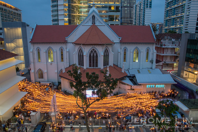
Not a typical ghost seen at Fort Canning Green.
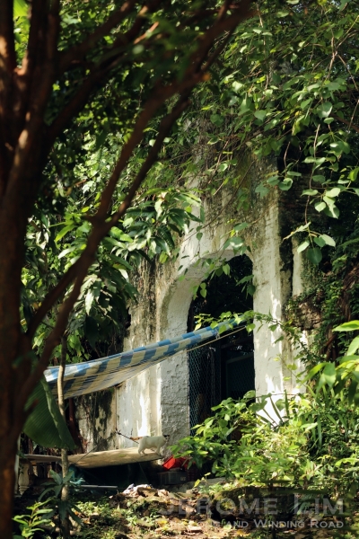
The area of the forbidden hill (what Bukit Larangan, its name in Malay, translates into) that I find the greatest fascination for is its north-eastern slope. Here, the opportunities for an encounter with a ghost of the past, are plenty. The slope is where a mysterious a tomb is found, purportedly that of the last of the kings of old Singapura, Iskandar Shah.

The Keramat, which some believe to be the tomb of the last king of Singapura, Iskandar Shah.
This tomb, venerated as a keramat, gained the attention of John Crawfurd on his first visit to the hill, just three years after the East India Company’s settlement was established. Crawfurd, who was later to be appointed Singapore’s second Resident, made a note of his walk around the hill in his diary. The interest he had on the hill was motivated perhaps by the observation that the “only remains of antiquity at Singapore, besides the (Singapore) stone, are contained on the hill”.

On the eastern slopes of Fort Canning Hill.
Crawfurd describes the ruins that were observed on “a greater part of the west and northern side of the hill”. Going further , he takes note of “another terrace, on the north declivity of the hill … said to have been the burying place of of Iskandar Shah“, a claim he suggested was apocryphal for good reason. It should be noted that Crawfurd was mistaken in his assumption that the long axis of the hill ran east-west instead of north-northwest to south-southeast and he would have been referring to the eastern slope of the hill in relation to the location of the tomb.

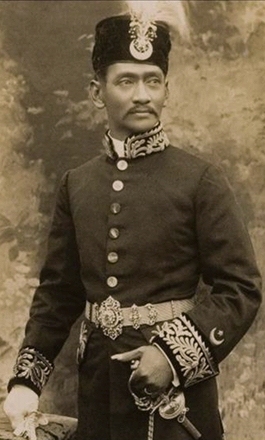
An artist’s impression of Parameswara, thought to also be Iskandar Shah (source: Wikipedia).
The tomb seemed already a place of veneration even then. Crawfurd also takes note of the “rude structure” raised over the tomb, to which “since the formation of the new Settlement … Mohammedans, Hindoos, and Chinese equally resort to do homage”. The tomb has certainly added much to the mystery and superstition that has surrounded the hill over the intervening years. One rumour has it that unexplained events that led to occupying Japanese troops abandoning the British Military built barrack blocks on the hill during the war, had be due to the intervention of the tomb’s occupant.
One of these barrack blocks, lies just northwest of the tomb at Cox Terrace. A squash centre in my schooldays and and arts centre after, it now masquerades as the fancy sounding Singapore Pinacothèque de Paris, a private art museum. The museum overlooks what is today a most wonderful of space we know as Fort Canning Green. It comes to life occasionally when events such as theatre and musical performances under the stars, are held on it. And when it is kept clear, it is a place, as it was in the days of my youth, where an escape could be found in.

Fort Canning Green today, well manicured, but still where many ghosts of the past are to be found.

A stage set for the spirits of a Shakespearean play, The Tempest, at Fort Canning Green.
There is much on and surrounding the green that will remind us of its previous use. A brick wall that encompasses most of the grounds around much of its perimeter give very clear hints of its days as an old Christian cemetery, as do the two cross adorned Gothic style gates intended as entry points. Information on the cemetery, the second Christian cemetery to be used in Singapore, is mostly contained in a 1912 register compiled by H. A. Stallwood. The register was published in the Journal of the Straits Branch of the Royal Asiatic Society (JSBRAS) and was an attempt to create on as no register of burials for the cemetery could then be found.

A general view of the cemetery in the included with the 1912 register.
We see from the register that the cemetery was divided down its east-west axis by a wall. The cemetery’s Anglican section was located south of this division, with the northern half allocated to the burials of other Christian denominations. The background to the cemetery is also given:
The Cemetery stands on the slope of Fort Canning Hill, and is approached from the South by Fort Canning Road, through a gateway designed partly in the Gothic style of Architecture. It was opened in 1822 to take the place of the first Christian Cemetery which was situated close to where the flag-staff at Fort Canning now stands. It was closed when the Cemetery in Bukit Timah Road was opened in 1865.

One of the two gothic gates that serve as the entrances to the old Christian cemetery at Fort Canning – also from the 1912 register. The gates are still standing.

Possibly one of the last burials to have taken place, that of young Ada Sutcliffe (year of death incorrectly recorded in the 1912 Regsiter as 1865).
The register makes mention of the attraction of the grounds to “those who appreciate quiet, contemplative surroundings“, something that as mentioned above, is the case even today. We are also reminded of the cemetery’s historical value, what perhaps was the main motivation for Stallwood’s effort:
To those who feel an interest in Singapore and its history, few places in the Settlement offer so much of interest. Many old residents lie buried here, and many tombstones testify to the number of lives sacrificed by members of the Civil Service, who were called to rest at a very early age, whilst taking their share in the administration of this Settlement, of which we are all so proud. The United Services also yield their quota of names, unfortunately, some well-known, if not illustrious, in the annals of their country.

Fort Canning Green is still an attraction for those who appreciate quiet, contemplative surroundings.

The layout of the cemetery from the 1912 Register.
The oldest tomb identified by Stallwood, one from 1821, belongs to a John C. Collingwood of the ship “Susan”. Its presence in the cemetery, which was only opened in 1822, was attributed to it having been relocated from the original cemetery. The last burial was however incorrectly identified as being that of two year old Marie Dominica Scott in 1868. A check against the register’s listing of graves has the child’s death occurring instead in 1858. The 1858 death was also confirmed by the brother of the deceased in a letter published in the Straits Times on 17 July 1912, written to point the error out.

A photograph from the 1912 Register. A memorial to the men of HMS Niger that is also mentioned in the paper, is in the centre of the picture.
Within the walls, two noticeable structures that belonged to the cemetery remain. Both are in the southwest corner. The larger of the two, said to have been the largest in the former cemetery, is dedicated to the memory of James Brooke Napier, the infant son of William Napier. It was after William, a lawyer and the founder of the Singapore Free Press, that Napier Road was named.

A photograph of the memorial to James Brooke Napier from the 1912 Register.

The Napier Memorial and a former barrack block turned art museum at the top of Fort Canning Green.
William Napier was for a short while the Lieutenant-Governor of Labuan. He serve under Governor James Brooke, who is better known to us as the first of the white Rajahs of Sarawak. It was after Brooke that the infant was named. James Brooke Napier died at sea on 17 February 1848 at the age of 5 months and 24 days. His mother was Maria Frances Napier was the widow of the illustrious George D. Coleman, who Napier married not long after Coleman’s death in October 1844.

The memorial today.
George Coleman, Singapore’s first public works architect, is best known to us as the man behind the beautiful Armenian Church and for lending his name to the street on which he had his house and to a bridge over the Singapore river. The cemetery is also one connected with Coleman in more than one way with the second set of the large structures mentioned, the two cupolas were thought to have been designed by him. Located just down the slope from the Napier memorial, the cupolas seem to have been of ornamental value and intended – it is suggested – to provide shelter for rest and for contemplation.

The southwest area of the cemetery with the cupolas and the memorial to James Brooke Napier visible. Possibly taken in the late 1940s, it is from a wonderful online collection of photographs taken in Singapore from 1948 to the mid-1950s by Richard Stone (online: http://www.stone-family.info/stone-richard-photos.html).

The cupolas today.
Coleman was also laid to rest in the cemetery. An Irishman, he was believed to have been a member of the Church of Ireland. A mausoleum to Coleman, who died in 1844, was located at the non-Anglican section, in the cemetery’s northwest corner. All that remains of that is its memorial tablet, which can be found embedded in the western wall of Fort Canning Green, not far from where his mausoleum was located.

Coleman’s cupolas with a view towards the northern Gothic gate.

The tablet belonging to the tomb of George D. Coleman on the western wall – just below Fort Canning Centre.

George D. Coleman’s tomb in the northwest corner seen in 1956. The tomb was one of about 120 graves retained when the cemetery was converted into a ‘Garden of Memory’ in 1954 (photo online at http://www.nas.gov.sg/archivesonline/).
Coleman’s tomb was one of those that stood until the early 1970s. It was one of some 120 tombs identified for preservation by the Committee for the Preservation of Historic Sites when a decision was taken in the 1950s to turn the cemetery into a “garden of memory” in the early 1950s. The decision, prompted by the state of neglect and ruin the historic site was in, resulted in the exhumation of more than four hundred graves. An effort was also made to preserve the memory of those buried in the exhumed graves by embedding the headstones and memorial tablets of the removed graves into the walls of the cemetery. An extension to the existing wall had also to be constructed at then open eastern perimeter to permit this and the work was completed in 1954.

Gravestones embedded into the walls.
The writing on the walls now include grave stones from a mid-1970s exercise that saw all remaining graves exhumed and yields a rather interesting mix of stories from the former graves. In it we see many who came from far and wide bringing a diversity to the new settlement. We also see many names of notable personalities from the settlement’s earliest days. Examples of both include names such as Aristake Sarkies, who was Singapore’s first Armenian merchant, and also Jose D’Almeida, who was to be knighted by the Queen of Portugal and who was to become the first Portuguese Consul General to the Straits Settlements. D’Almeida Street is named after him.

The memorial tablets embedded in the walls tell us of many who came from far and wide in the early decades of British Singapore.

A tablet belonging to the grave of Aristake Sarkies.

From the grave of Charles Spottiswoode, a merchant after whom Spottiswoode Park is named.
There are also the stories of those who are less recognisable. One name that I could not help but notice on the walls is that of Emily Louisa Ottoson. Ottoson is a name that I am familiar with as that of Singapore’s first Japanese resident, John Matthew, also known as Otokichi Yamamoto. Behind the name is a fascinating tale that begins with Otokichi’s unitended departure from the country of his birth (a previous post on the Japanese Cemetery touches on the story). Emily Louisa it turns out, was John Matthew’s young daughter. She died in November 1852, a few months short of her fifth birthday.

The memorial tablet for Emily Louisa Ottoson, the four year old daughter of John Matthew Ottoson a.k.a. Otokichi. A resident of Japanese origin, Otokichi had a very eventful life out of Japan that started with him being lost at sea for 14 months (see: Voices from a Forgotten Past).
The young ages of many who were interred in the cemetery is also hard not to notice. Many names in the walls are those of children and infants. There are also many who passed on in their prime, which the 1912 register touches on, saying: “many tombstones testify to the number of lives sacrificed by members of the Civil Service, who were called to rest at a very early age, whilst taking their share in the administration of this Settlement, of which we are all so proud“.

A tablet from the grave of Edward Presgrave, a civil servant who passed away at the age of 35.
One in this category was an Edward Presgrave. A contemporary of John Crawfurd, Presgrave served as the Registrar of Imports and Exports and concurrently as the Deputy Resident of Singapore. He reportedly died from a sudden attack of paralysis in 1830. On the basis of the register, he shared a vault with the Rev. Robert Burn. The Reverend, who died in 1833, was the first Anglican Resident Chaplain in Singapore and his appointment in 1826 is significant from the perspective that it marks the founding of the Anglican Church in Singapore.

A tablet belonging to Rev. Robert Burn, Chaplain of the Settlement, who apparently shared the same vault as Edward Presgrave in the Anglican section at the top of the slope.
There are many more stories that are to be found in the walls. Estimates of the number buried in the cemetery vary greatly. The 1912 register has list of over 550 names, while a Straits Times report in September 1952 has it as more than 700. The vast majority of those buried would have been of those of European descent. There are however a substantial number of Chinese, early converts to Christianity, who were also buried there, evident from the embedded grave stones with Chinese inscriptions. From these we can also see that the tradition was maintained in the manner the graves were inscribed, even with the embrace of a non-traditional faith.

A Chinese head stone.

An example of an early Chinese Christian grave in which the Chinese tradition is maintained found another old cemetery in Singapore.
Mixed into the reminders of the old (Christian Cemetery), there are also the reminders of the new (Christian Cemetery). The “New Cemetery” or the Bukit Timah Christian Cemetery, replaced the Fort Canning cemetery as a Christian burial site and it was from the new cemetery that the cluster of gravestones seen in the northeast corner of the grounds had been moved from. The move was made when the graves in the new cemetery, located at what is today Kampong Java Park, were exhumed in 1970. The twelve graves stones that were moved were ones deemed to be of historical value by the then sub-committee on the Preservation of Buildings and Sites of Architectural and Historical Interest.

Gravestones moved from the ‘New Cemetery’ at the northeastern corner of Fort Canning Green.
The exhumation of the remaining graves, undertaken in the mid 1970s, was part of an exercise to turn turn the hill into a huge park and green lung in the city. Named Central Park, it extended the reach of a previous public park, King George V Park on the west side of the hill, across to the east of the hill and incorporated parts of which had previously been used by the military, as well as the former cemetery site. Plans then included a roller skating rink, which was built, and also a cascading founding. The latter would have occupied the grounds of the cemetery and was fortunately not built, leaving us with a space in which the ghosts of the past are not forgotten.

King George V Park.

A southward view through the James Brooke Napier memorial.


#/media/File:Retrato_de_Parameswara.jpg)


")


")
")
")


")


