I have made a habit of getting up at ungodly hours of late. While I may not be alone on that in Singapore since the excitement of Brazil began last week, my motivation has little to do with the beautiful game and what I really am losing sleep over is a desire to acquaint myself with some of Singapore’s lesser known shores for a project I have embarked on.

One example of the colourful company one gets to keep that compensates for the lack of sleep: a noble volute – a variety of large sea snail.
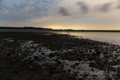
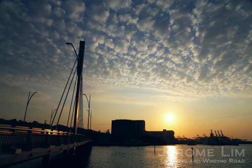
One of the magical moments I am losing sleep over: first light over a submerged reef on Beting Bronok, exposed at low tide.
Monday morning had me on a boat at 5 in the morning bound for a relatively remote and unheard shore north of the restricted military island of Pulau Tekong. A submerged reef with a rather curious sounding name, Beting Bronok, I did only hear of it when it came up as one of two nature areas identified for conservation in the 2013 Land Use Plan that was released in support of the hotly debated Population White Paper, which was confirmed in the recently gazetted 2014 Master Plan.

Another view of Beting Bronok at first light.

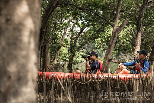
Marine conservationists carrying out a survey on the reef.
We have added Beting Bronok & Pulau Unum and Jalan Gemala to our list of Nature Areas, where the natural flora and fauna will be protected from human activity. Beting Bronok and Pulau Unum extend the Pulau Tekong Nature Area. These sites contain a wide array of marine and coastal flora and fauna. Of particular significance are two locally endangered mangrove plant species (out of 23 species from 13 families), three very rare and ten rare mollusc species (out of 36 species from 16 families). Some of the wildlife species found here are the Knobbly Sea Star (Protoreaster nodosus) and Thorny Sea Urchin (Prionocidaris sp.).
 Beting Bronok and Pulau Umun is one of two nature areas identified for conservation.
‘Beting’, as I understand, refers to a sandbar or a shoal in Malay. That sandbars were identifiable by names is perhaps an indication of the interactions that the people of the littoral might once have had with them. The opportunity for interaction today has of course been drastically diminished with the tide of development sweeping the people of the sea to higher and dryer grounds and many of the staging points for such being closed off.

The view across Beting Bronok to the gaping mouth of Sungai Johor.

A glass anemone.
The Bronok Sandbar and the waters around it, are ones once rich in marine life drawn to its reef, which is exposed only at low spring tides. The only submerged reef left in the northern waters, it unfortunately is in poor health due to the effects of nearby reclamation work. The indefatigable marine conservation champion, Ria Tan, with whom I had the privilege of visiting the reef with, likens what are her annual visits to reef, to watching a favourite grandmother “painfully, slowly fade away” (see her recent post Beting Bronok is slowly dying).

A deformed biscuit star.

Walking with a walking stick on water – Ria Tan.
Staring into the gaping mouth of Sungai Johor, the reef is fed by waters where a huge amount of fresh water is mixed in with the sea. The river, is one that does have a history. It was at the heart of the early Johor Sultanate that was established in the fallout from the loss of Malacca to the Portuguese, its waters disturbed by the movements of the floating instruments of colonialisation headed up river in the 16th and 17th centuries.

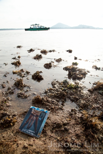
The incoming tide with a view of Pengerang on the left bank of Sungai Johor.

An octopus.
The cannons the waters hear today, are only imaginary. Fired from dry ground on nearby Tekong, in mock battles fought in that rite of passage required of young Singaporean men as reluctant recruits. The bigger battle for many on Tekong, would be fought in their minds as the young men, many fresh out of school, struggle to adapt to the rigours and physical demands of boot camp away from the comforts of home.

Another anemone.

And another.
The passage in the dark through knee deep waters from the boat to the dry ground on the sandbar, while it did not quite require a battle, was one that was filled with trepidation – the graphic accounts told on the boat of painful brushes with the not so gentle creatures of the shallows does have the effect of putting the fear of God in you (see also: Chay Hoon’s encounter with a stingray at Beting Bronok and Ivan Kwan stepping on a stonefish). The utterance during the passage of what did sound like “I see a stripey snake” did surely have added effect – especially in recalling an encounter from my youthful days that had a similarly decorated creature sinking its fangs into an ankle belonging to a friend of the family.

Probably a false scorpion fish I am told.
That encounter, wasn’t so far away, at Masai in the waters of the same strait, taking place in the confusion that accompanied a frenzied rush to vacate the waters, from which we had been harvesting ikan bilis, that followed shouts of “snake, snake”. The family friend was extremely fortunate. No venom was transferred in the exchange, and other than the shock clearly visible in the colour and expression that he wore, there were no other ill effects.

A Bailer Snail making a meal of another snail.
Standing on the sandbar at the break of day is as surreal as it is a magical experience, especially so at the moment when the luminescent early light reveals the sandbar’s craggy coral littered surface – the magic is especially in the sense that is does also give of space and isolation, a feeling that does seem elusive on the overcrowded main island.

A nudibranch.

A seahorse taking shelter.
It didn’t however take very long before I was reminders of where in time and space I was, the roar of the emblems of the new colonial powers of progress and prosperity on an angled path from and to one of the busiest airports in the world at Changi, was hard to ignore. The area lies directly below one of the the approaches to the airport located close to Singapore’s eastern tip and built on land that has come up where the sea once had been, sitting right smack over what had once been one of Singapore’s most beautiful coastal areas, and an area in which I had my first and fondest memories of our once beautiful sea.


As did the seemingly fleeting moments I did steal from the lost paradise of my childhood days, the fleeting moments discovering Beting Bronok’s fading beauty will leave a lasting impression on me. My hope is that, unlike the names of the places of the lost paradise that have faded into obscurity, the curious sounding Beting Bronok is a name through which our future generations are reminded of what had once been our beautiful sea.
The wild shores are perhaps a little wilder than you think.


")


