Life in Singapore can be maddening at times. One of the world’s most congested territories, the city-state has a population density that translates into there being less than 124 square metres for every person, a space no larger than a HDB five room flat! This becomes quite evident at rush hour, at lunch time, or before and after mass participation events when the use of the Chinese expression, 人山人海 (which can be translated to “a mountain of people, a sea of people”), would well describe the city’s pavements, underpasses, MRT stations, shopping malls, trains, and buses.
Thankfully, one thing that Singapore does also have are an abundance of spaces to find an escape in. This is the case even in the urban centre, where little nooks and crannies, quiet spaces to cool off, and even roof tops with a view can offer respite. There are also fabulous parks and gardens. Further afield, parts of the now well trampled former Rail Corridor can still provide that sense of isolation that it used to when the trains were running, as do a collection of nature parks and sections of Singapore’s nature reserves to which access is provided.
I am often drawn to the magical quality that these spaces exude. It could be provided by the calls of nature, the smallness that one feels amongst the trees, the play of light and shadow or the pure joy of seeing sunlight streaming through the trees.
Ten Magical Spaces
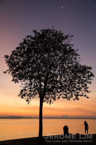
[1]
Under the Giant Rain Tree | Fort Canning Park

Rain trees, instantly recognisable due to the umbrella like shape of their crowns, offer shade from the intense tropical sun. Their crowns can spread up to a massive 30 metres across. Native to tropical America, they were introduced to Singapore in the 1870s and have been among the most commonly planted roadside trees.
[2]
The Tunnel of Trees | Marang Trail

The Marang trail starts at the foot of Mount Faber, taking a path through an area of secondary tropical forest, and ascends 70 metres to the top of Mount Faber. A tunnel of trees — formed by the lush canopy at the start of the trail can be a sight to behold.
[3]
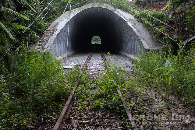
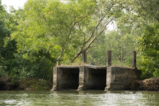
Walking amongst Giants | Former Rail Corridor at Kranji

Albizias, are another tree species that is not native to Singapore. Fast growing with thin trunks, they propagate rapidly across disused plots of land and pose a danger to walkers and hikers due to their frailty. They however grow to great heights and are thus used by birds as nesting sites. The rail corridor used to be lined with them, while some have been removed due to safety concerns, a section of the former corridor that will soon see development at Kranji is still lined with them, giving the impression of walking among giants.
[4]
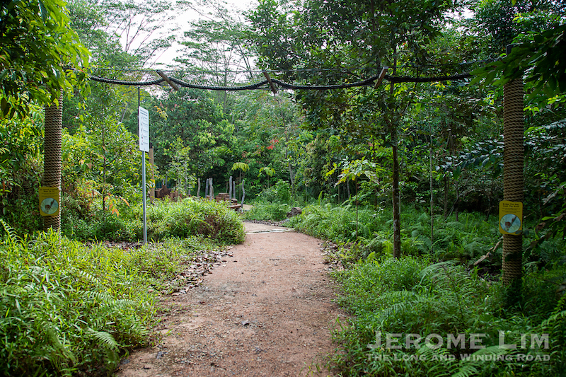
Into the Light | Thomson Nature Park

Thomson Nature Park was established in a narrow wedge of land sandwiched between Upper Thomson Road and Old Upper Thomson Road. It was once home to a settlement of immigrants from Hainan, some of whom cultivated rambutans. The villages were one of the last to be supplied with electricity. Lorong Pelita, one of the roads in the area, possibly reflects this fact as pelita is Malay for oil lamp. The park is especially beautiful in the early part of the day, especially on a misty morning with sunlight filtering through the trees.
[5]
A Feeling of Being Watched from Above | Lower Peirce Trail

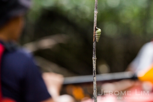
Colugos or flying lemurs are amongst the strange creatures that inhabit the forests of Singapore. They can be seen clinging on to trunks of trees and their ability to glide gives them a relatively long and wide reach. They have been spotted around the Central Catchment Reserve, Bukit Timah Reserve, Rifle Range Nature Park and above the boardwalk along the Lower Peirce Trail. Nocturnal creatures, they possess large eyes and whilst on the boardwalk you may get this feeling of being watched from above.

Besides that feeling of being watched, parts of the trail carry you past a stream by which you could be serenaded by a chorus that has been described as sounding like dripping water. A closer inspection of some of the low lying vegetation may reveal the source of the chorus — tiny copper-cheeked tree frogs no longer than the length of your last finger.
[6]
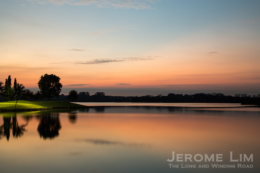
Lake District | Central Catchment Reservoirs

The development of Singapore’s first impounding reservoirs, MacRitchie, Lower Peirce (pictured above), and Upper Seletar — and also Upper Peirce later, created a series of water bodies close to the fringes of the Central Catchment Reserve. Parks and look out points offer beautiful vistas of what can be thought of as Singapore’s lake district.
[7]
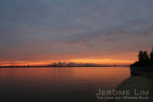
Changi Rocks! | Changi Point Coastal Walk

A place that has been close to my heart for much of my life, Changi was where I took many a holiday at as a child. Changi Point, west of Changi Village, is still very much how it was back when I first visited the area in the early 1970s. Mixed with old buildings of an almost intact 1929 to 1935 built Kitchener Barracks is still intact, as are many additions put in by the RAF when it took over after WW2. Some of these structures became additional holiday bungalows in the 1970s, others were used in various ways including as Commando Camp. Steeped in history and home to POWs in the early part of the occupation, many fascinating tales of the past are found in them. The biggest treat is the area’s unaltered natural beauty. A walk around the Changi Point Coastal Walk, is always a joy, taking me by a sea I knew well from my many childhood dips in it. The boardwalk also takes a route past rock formations that are stand out even in early 20th century postcards, natural elevations, and a set of cliffs that one might not expect to see in the manmade Singapore of today.
[8]
The Pier | Lim Chu Kang Nature Park

Cashin House in Lim Chu Kang Nature Park is always a joy to visit. The “house” — the sensitively rebuilt sea pavilion structure that the Cashins referred to as “The Pier” offers a perspective of living by the sea. Built as a pier for the export of rubber from Alexander Cashin’s Sungei Buloh Estate in 1906, rooms were added to the end to serve as quarters and later a holiday home. One of the first points of landing during the Japanese invasion of Singapore in February 1942, the site by the house was where an Australian battalion put up a heroic fight, holding position against the odds before eventually withdrawing.
The Pier would be enlarged and serve as the home of Alexander’s son Howard from the 1960s and vacated following Howard’s death in 2009. With the marine environment wreaking havoc on the structure of The Pier, a decision was taken to have it rebuilt for it to be useful in the longer term. Being in the house, puts you close to nature, and well within sight of the coastal mangroves that are currently being restored. At low tides, a crocodile or two may be spotted basking in the sun on the mudflats. Visiting the house once, stokes the desire to come back for more. While the house is not opened to the public, visiting it is possible through NParks organised tours and programmes to it.
[9]
The Gateway to the Past | Kampong Tengah, Sembawang

The presence of mysterious gate in Sembawang, one that seemingly leads nowhere, has made the area it is in the subject of much speculation. Imaginative tales are told of the gate. If some of these are to be believed, the gate, may be a portal to another dimension, or one that through which energy of a supernatural nature flows.
There is a less sinister explanation for the presence of the gate, having been the main gate of the seaside property of Chua Boon Peng of Cycle and Carriage fame. It was one of a small collection of seaside homes developed by Mr Chua, another of which was the home of architect and artist James Westwater Ferrie whose artistic endeavours included watercolours of the area’s seascapes.
The houses are long gone, as have the villages that once brought life to its surroundings. The rather forlorn gate is best visited in the mornings an hour or so after sunrise, when the place often takes on a magical quality given by the light of the rising sun filtering through the trees.
[10]
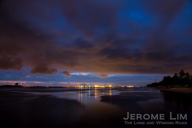
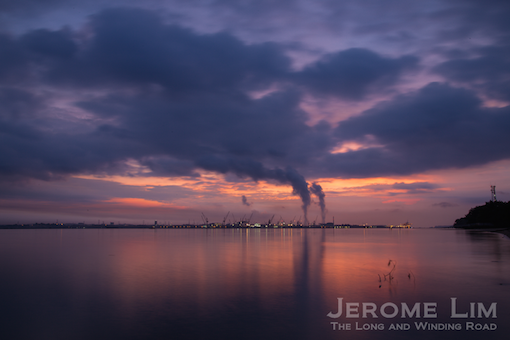
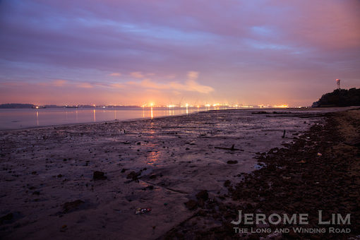
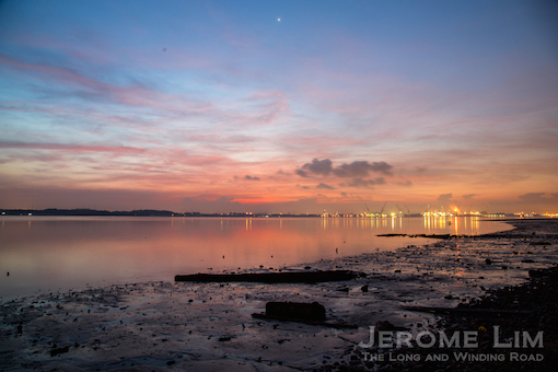
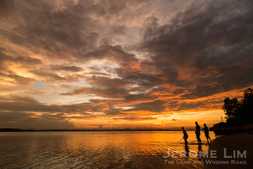
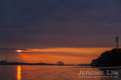
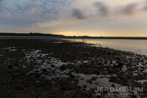
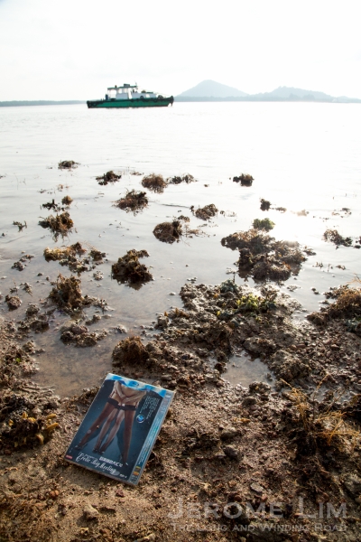
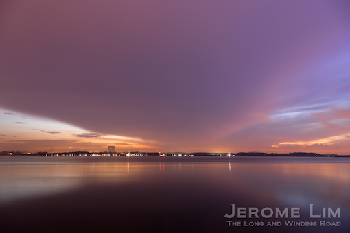
A Bar at which You Could Meet a Mermaid | Coastal Sembawang

Sandbars were and still are a common sight along many parts of coastal and even offshore Singapore. They often, especially the ones offshore, make for interesting photographs. One large sandbar can often be seen at the lowest of tides just east of Sembawang Park in the area close to Kampong Wak Hassan and the former Kampong Tengah. The sandbar provides opportunities for stunning photographs, especially during sunrise, as well as a great view of the ships being repaired at the former Sembawang Shipyard (now Seatrium Admiralty Yard), which will soon be shutting its doors. The yard, developed out of the former naval dockyard, together with the port facility operating in the former stores basin, is the last working remnant of the massive British naval base set up in the 1930s to defend British interests in the Far East.


 The first phase sees the restoration of two buildings on the site to accommodate a field study laboratory, seminar rooms for up to 100 people and basic accommodation facilities. An outdoor campsite is also being set up to take up to 100. The first users of the ULL will be students from the Republic Polytechnic and ITE College East who are looking at setting up roosting boxes in Ubin for insect eating bat species and nesting boxes for the Blue-throated Bee-eater as part of a biodiversity enhancement and species recovery programme.


 Beting Bronok and Pulau Umun is one of two nature areas identified for conservation.


")


