Northern journeys: where Admiralty Road’s East meets West

22 07 2020

Thought of as “ulu” or remote, Sembawang is still a place where much of the past seems still to be around. It is for this reason that it is still one of the prettiest area of Singapore even if some of its beauty spots — such as the once beautifully wooded hill on which old Admiralty House is perched, have since yielded to the march of urbanisation.

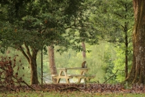
I always enjoy a walk around the lesser developed parts of the area and a stroll along its still natural shoreline. Mornings are especially pleasant by the sea, when it can serve as a very nice backdrop for an especially dramatic sunrise. The area’s lush greenery, found not only in Sembawang Park, but also in the areas where the residences of the former naval base still stand, should also be celebrated — especially with the threat of redevelopment now looming over it.

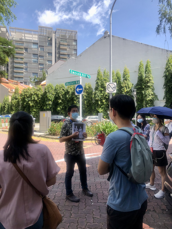
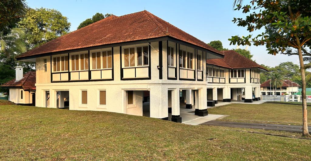
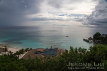
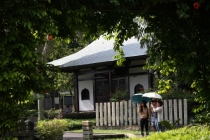
Where Admiralty Road East and West meets – an area around which some of the oldest residences built for the former naval base can be found.

An area that has been spared from redevelopment is the stretch of Admiralty Road East and Admiralty Road West that runs between Canberra Road and Sembawang Road.  Much of the area has been today marked out either for future residential redevelopment or as a reserve site (see Master Plan 2019). The use of the area to serve existing military arrangements, as a port and the continued use of the former naval base dockyard by Sembawang Shipyard has seen that its flavour has been kept, although some of its old structures fronting the road were lost to a road widening exercise that took place at the end of the 1980s. The end of the lease that the shipyard holds on the what it calls Admiralty Yard is however, on the horizon. That will expire in 2028, although the yard does intend to move its operations to Tuas by 2024. Detailed planning for the area will likely take place to coincide with this move and until then, it would not be known what the future for a still green area will hold.

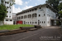
Among the earliest residences to be built for the naval base were these 1929 built dockyard chargemen’s residences along Wellington Road. Many of the area’s roads are named after cities in the Commonwealth.


More photographs:


A 2013 photograph showing the beautiful settings in which the old residences of the former naval base in Sembawang have been given.


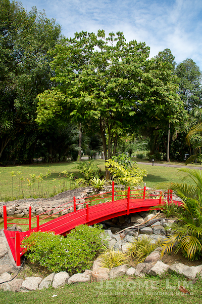
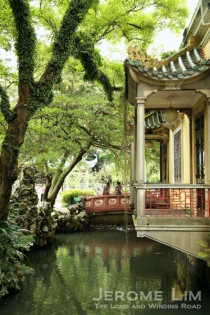
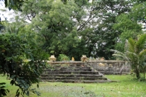
A bridge built by Japanese Surrendered Personnel on the grounds of the former residence of the dockyard’s Commodore Superintendent.


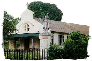
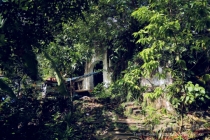
The former vicarage of the Dockyard Church of St Peter. The old church, which fronted this along Admiralty Road East, was consecrated in the 1950s and was demolished in the late 1980s to allow the road to be widened.


Timber walled residences – built in the 1940s.


Canada Road.


Many of the residences built in the 1930s are of designs adapted from PWD plans.


Another view of a 1930s built residence.


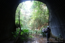
Admiralty Road West – there used to be visible entrances to underground bunkers in the area opposite the dockyard entrance.


Silhouettes of times soon to be forgotten

28 09 2013

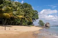
The silhouette of a coconut tree along the shoreline at Sembawang is seen against colours painted by the setting of the sun at 7.09 pm on 22 September 2013. Coconut trees bending to the sea, once a common sight along the shoreline, are becoming less common with development which has taken away much of Singapore’s natural coastline as well as the manicuring of many of our coastal areas. The beach at Sembawang is one of the last natural beaches left on the main island and is one of the few places left in Singapore where I am still able to find bits of that wonderful Singapore I grew up in.

JeromeLim 277A2675s

The area where the coconut tree is, just around the bend of Beaulieu Road leading to the jetty (we could once drive down to the jetty), is at the western end of the beach. The waters of the sea just beyond the little stretch of beach and rocks just below the tree was where, on the many nights I spent at the jetty fishing for crabs, I would had have a grand time in catching scooping pufferfish out of the waters and watching them inflate in the 1970s and early 1980s. The area is in the midst of change with both luxury residential housing just to the east of the beach and public housing developments fast coming up which will alter the area’s character. Another change which is imminent is the moving of the shipyard – a finger pier with its cranes and ships and floating docks moored along it is also seen in the photograph. The shipyard, Sembawang Shipyard, is a remnant of what was once a huge British naval base (the yard was the former naval dockyard)  which stretched all the way to the Causeway.


Singapore’s northern lights

27 07 2013

6.42 am 27 July 2013. The lightening sky at dawn is coloured by the bright lights cast from Sembawang Shipyard at which ship repair work goes on through the night. The two rows of ships and floating docks which can be seen are tied-up along a finger pier which is probably the northern most extension from Singapore. The shipyard, and previously the naval dockyard of the former British naval base which was turned over to Singapore in 1968, has been a feature in the  area since 1938. Under a Land Use Plan released early this year, the yard will be moving out to free the land it now occupies for future development, cutting one of the last links the area has with its past.

277A8145sb


The sun sets on the last working remnants of the Naval Base

27 04 2013

6.55 pm, 26 April 2013. The sun sets over an area which was once part of the huge British Naval base in the north of Singapore . The base which stretched some six and a half kilometres from where Sembawang Park is today across to the area close to the Causeway, was vacated in 1971. A commercial shiprepair yard, Sembawang Shipyard, was established in 1968, taking over the facilities of the former Naval Dockyard for a token sum of S$1. The yard, the north wall and finger pier of which is seen in the photograph, and the former Stores Basin – now used as a US Navy logistics facility and cargo berth, are the last working parts of the former base still with us. Based on the Land Use Plan recently released to support the somewhat unpopular Population White Paper, the yard will move its operations to the west of Singapore to free the land it now occupies for future development – a move which will erase a significant part of the memory of the  role the area played in Singapore’s economic development

277A9987


A final frontier

13 02 2013

One of the few places in present day Singapore that I am able to find myself at home in is the Sembawang area along the northern coast. It is an area which has in the last two and a half decades, as with much (if not all) of Singapore, undergone a huge transformation and also one that is still being transformed. Despite the transformation – Sembawang now plays host to a new public housing estate, it is still a place in which a Singapore we have forgotten about can still be found – at least for the time being.

An intermediate egret in flight.

An intermediate egret in flight over the canalised Sembawang River – the Sembawang area was one known in the past to be rich in bird life.

Sembawang is one of the last places left in which much of the past remains to be discovered. A past which perhaps with the planned future developments in the area, some for which preparations are already being made, is one which may soon be well forgotten. Best remembered for hosting a huge British naval base which was completed in 1938, Sembawang Shipyard which inherited the former Naval Dockyard in 1968 serves to remind us of that, as does the former Stores Basin, now used as a naval logistics base. It is however in several of the smaller reminders in which the past charms of the area can found in. These include the cluster of colonial bungalows (“black and white houses”) and in what is today Sembawang Park. Sembawang Park and perhaps the coastline east of it is where some of the old world does seem to have been left behind including what may be one of the last stretches of natural beaches in Singapore, the old jetty (sometimes referred to as the “Beaulieu”, prounounced “bew-lee” jetty, or “Mata” jetty), Beaulieu House, and a seawall which once belonged to Kampong Wak Hassan.

a

Sunrise along the northern coast – an undeveloped part of the beach east of Sembawang Park, and an area which despite the kampongs being cleared from it, retains much of a charm which is missing from the overly manicured and cluttered urban spaces in Singapore.

Besides traces that is associated with the former naval base, reminders do also exist of the area’s lesser known natural past. The area (as had much of the coastline around it) played host to a swamp. Much had already been cleared when the naval base was built with the course of two rivers around which the marshy ground formed altered. There were, however, remnants of the marshland that remained around an area of what is today the Sembawang River up to the 1980s when it was drained for the development of Sembawang New Town. This lay about a kilometre west of what was then Chong Pang Village, just north of the Ulu Sembawang area (an area of farms and freshwater ponds around where Gambas Avenue is today). It was known then to have been a fertile feeding ground for marsh birds, attracting herons, egrets, sandpipers and storks to it. While the swamps have all since vanished – HDB blocks of flats have risen where the wetlands had once thrived, the is today a canalised Sembawang/Senoko River which on the evidence of what we do see today, does see a return of some of the previously rich bird life. Besides the marsh birds, the area today also sees many other birds. These include common birds such as the yellow-vented bulbulblack naped oriolepied fantailashy tailorbirdgreen pigeon, starling, Asian koel, several types of kingfishermunia and sunbird. There have also been some less common sightings in the area including the Sunda woodpeckerbrown hawk owlmilky stork, and what is perhaps an escapee, a white-rumped shama.

A yellow-vented bulbul in a Simpoh Air bush along the banks of the river.

A yellow-vented bulbul in a Simpoh Air bush along the banks of the river.

A white-throated kingfisher.

A white-throated kingfisher in flight over the canalised river.

Sembawang is toady, a world in which the charm of a forgotten old world missing from most of the redeveloped spaces on the island, can still be found. It is a world which has thus far, managed to remain free from the crowds and clutter which now seems to dominate almost all of the urban world we now find around us. The area is one which had for a long while boasted of welcome pockets of greenery and un-manicured beauty. But all that I fear, is soon going to change. Sembawang Park for one is already in the midst of a “renewal” which I feel will see it lose the character and charm which attracted me there since the days of my childhood as it becomes just another well manicured park cluttered with paraphernalia which Singapore really has too many of.

A once beautiful area that is now being cleared for possibly what is the beginnings of the HDB's new Simpang estate.

A place where the sun would shine on an uncluttered space …

As I look around me, I also see huge tracts of land which were once held much beauty behind hoardings and in the midst of being cleared. That I understand is part of the effort to provide new homes. What that also means is that the crowds the area has hitherto been spared from would soon descend on it, attracted not just by the homes, but the inevitable as it now seems – a huge redevelopment effort which has been outlined in the recently released Land Use Plan intended to supplement the somewhat controversial Population White Paper. That speaks of “new waterfront land along the Sembawang Coastline being freed up once existing shipyard facilities are phased out” with the aim “of providing land for new business activities”. With that it will not just be the character and charm of the area that will be lost, but what it does also mean is that it will see the breaking of what may be the last links it has with its past.

Another part of the same area seen on a misty morning on 28 August 2012.

… and a space where once there were trees.

Inevitable as it may seem, that future  is one that I hope, perhaps for selfish reasons, is one that will never come. Development which has broken many of our links to our past as well as the more recent wave of immigration has without a doubt provided great economic benefit to us living in Singapore. For many of us however, it has also come at a huge cost, a cost which has also seen us lose the soul of who we are as a people. The country is today, one where I find it a struggle to feel at home in. Much of what once was familiar and a source of joy and comfort is no longer with us, creating in us that sense of longing for what has been lost, as well as a sense of loss … a feeling which perhaps can best be described by the Welsh word Hiraeth or  the Portuguese word Saudade

The final frontier?

Now perhaps the final frontier?

One of the positive things that did come out of the land use plan is that it makes mention of some of the more immediate future developments to provide public housing at Bidadari, Tengah and Tampines North. What that does mean is that for the time being at least, the large parcel of land reserved for the future Simpang New Town, an area by the northern coast part of which was once a land of idyllic coastal villages and prawn farming ponds will be left undeveloped. What that also means is that while the area will certainly become more crowded over time, it will for a while, be spared from an even bigger   one, remaining as a final frontier where not just the birds, but also free spirits such as myself can still find space to roam free.


The largest dock east of the Suez in the midst of a world that is to change

25 12 2012

Tucked in the far north of the island of Singapore is a huge 86 hectare shipyard which seems far out of place. Its location is far from the large concentration of shipyards and related industries which has grown in the far west of Singapore. The shipyard, Sembawang Shipyard, today stands as a physical reminder of a legacy left by the former colonial masters of Singapore. The British operated the yard as a Naval Dockyard which was an important component of a huge naval base which had stretched some six and a half kilometres along the northern coast from Woodlands (close to where the Causeway is) to Sembawang (the eastern boundary ran along the northern end of Sembawang Road from its junction with Canberra Road to where Sembawang Park is today).

An aerial view of the Naval Dockyard in 1962 (Image: Horatio J. Kookaburra on Flickr). The former Stores Basin can be seen on the lower left of the photo and the King George VI dock can be seen close to the top right. Three floating docks are today tied up along a finger pier constructed off the 850 metre northwall. The northwall is seen running along the lower edge of the photo.

An aerial view of the Naval Dockyard in 1962 (Image: Horatio J. Kookaburra on Flickr). The former Stores Basin can be seen on the lower left of the photo and the King George VI dock can be seen close to the top right. Three floating docks are today tied up along a finger pier constructed off the 850 metre northwall. The northwall is seen running along the lower edge of the photo.

The dockyard and the base was for a long time, an important source of employment in Singapore. A report in 1961 put the local workforce of the dockyard at 10,700, with the base accounting for as much as 20% of the Gross Domestic Product (GDP) of Singapore. What this did mean was that when the accelerated pullout of the British forces was announced in 1968, there were huge concerns, not only from a security viewpoint, but also on unemployment. As part of the arrangements made in the lead-up to the pullout, the dockyard was transferred to the Singapore government for a token $1 in 1968. Sembawang Shipyard Pte. Ltd. was established on 19th of June that year and a British commercial shipyard, Swan Hunter roped in to manage the transition of the yard to a commercial one.

The Dockyard's gates seen in the 1960s (source: www.singas.co.uk).

The Dockyard’s gates seen in the 1960s (source: http://www.singas.co.uk). The Naval Dockyard had been a major source of employment in Singapore. The local workforce in 1961 numbered some 10,700.

A key component of the transition was in training the local workforce, not just on the ground but also management staff to eventually take-over the running of the yard. Besides Swan Hunter, the British Ministry of Defence also seconded some 150 Naval Officers and civilians in the first year to ensure that the transition from a naval dockyard to a commercial one, over the three years it was to take the pullout to be completed, would go smoothly. The arrival of the first commercial ship came in March 1969 and by the time the year had ended, Sembawang Shipyard had docked some 66 merchant vessels and was well on its way to becoming a leading ship repair yard. The success of the shipyard was one of Singapore’s early success stories and by 1978, the tenth anniversary of the yard, a mainly local management team was in place to run the yard. The yard also introduced a highly successful apprenticeship programme in 1972 – from which many of the skilled labour and second generation supervisory staff were to come from and was key in not just raising skills levels, but also in improving productivity of the local workforce necessary to become competitive in the ship repair market.

The view of the northern area of the shipyard from the jetty at Beaulieu House. The three floating docks can be seen on either side of a finger pier off the northwall: KFD Dock on the outside on the extreme right; President Dock on the inside (with the ship on which the funnel is seen); and Republic Dock to the left of President Dock.

The view of the northern area of the shipyard from the jetty at Beaulieu House. The three floating docks can be seen on either side of a finger pier off the northwall: KFD Dock on the outside on the extreme right; President Dock on the inside (with the ship on which the funnel is seen); and Republic Dock to the left of President Dock.

The yard as we see today, has seen a huge expansion in its capacity with the addition of many facilities since it inherited the already well equipped dockyard in 1968. In addition to the King George VI graving dock (referred to affectionately as ‘KG6’), which when it was completed in 1938 was described as the largest graving dock east of the Suez (and the largest naval graving dock in the world – more on it can be found in a previous post on the Naval Base), the yard now has a huge 400,000 DWT capacity graving dock – Premier Dock built next to KG6, as well as three large floating docks. Premier Dock was an early addition to the yard, having been completed in 1975 at a cost of $50 million and opened by the then Prime Minister Lee Kuan Yew. Plans for the huge dock which measures some 384 metres in length and is 64 metres wide, built to meet a demand for the repair of huge Very Large Crude Carriers (VLCC) which were being constructed, were drawn up as early as in 1968, although the go-ahead was only given in 1972. The 150,000 DWT President Floating Dock which was one of the largest floating docks in Asia at the time was added in 1981.

A photograph of KG6 with the Queen Mary docked in it in August 1940 (source: Australian War Memorial  - 'Copyright expired - public domain').

A photograph of KG6 with the Queen Mary docked in it in August 1940 (source: Australian War Memorial – ‘Copyright expired – public domain’).

The sheer size of yard can probably only be fully appreciated attempting to walk from its entrance at Admiralty Road West to the far end of it located just west of the former Stores Basin of the Naval Base (now used by the US Navy as a logistics base) – an end which is visible from the old jetty at Beaulieu House. It does take a good half an hour to 45 minutes to do just that – an effort that I regularly had to make to get to Berths 8 and 9 of the yard during the six long months I spent undergoing training at the yard in 1983/1984 (so much so that many of us ended up bringing our own bicycles to reduce the effort). That six months is probably one that was for me best forgotten – the slump in demand for ship repair then meant many hours spent squatting in a designated area when there was no work assigned to the work gangs we were attached to. Tea-time was always a time to look forward to then – it provided that much needed break in monotony. As trainees, one of the tasks assigned was to head to kiosks located at strategic locations along the wharf sides to buy pre-packed packets of tea and coffee as well as snacks for the rest of the gang.

HMS Bulwark off the northwall of the Naval Base in the 1960s - the northwall is where the far end of the shipyard is today.

HMS Bulwark off the northwall of the Naval Base in the 1960s – the northwall is where the far end of the shipyard is today (source: http://www.acig.org/artman/publish/article_203.shtml).

The yard, besides being the location of a historically significant graving dock, is also where a conserved building in the form of the former Sembawang Fire Station can be found in. While it does look like the yard is a long time fixture in the area and so the future of this historical part of Sembawang is quite safe, we do know that the winds of change is right now sweeping across large parts of the area close by. The expansion of Yishun town and Sembawang town will bring high-rise developments that will do much to alter a unique character and charm that has been associated with the area since the days of the Naval Base. The area to the east of the yard is itself undergoing a tremendous change. A renewal programme will see the park feel a lot less like the quiet corner many like me had found an escape in, and more like any other overly manicured seaside spot in Singapore. That does I suppose does complement the private development just to its east. That development will see a shoreline where idyllic seaside kampungs could once be enjoyed and a shoreline I have continued to find an escape in, become a place in which that charm will no longer be found.

What will be one of the last escapes from the overly manicured world we now find ourselves in.

The shoreline along the former Kampong Wak Hassan is one of the last escapes from the overly manicured world we now find ourselves in we will soon lose.


Sembawang beyond the slumber

29 03 2011

Highlights of a heritage tour of Sembawang, “Sembawang Beyond the Slumber”, with a focus on the Sembawang that I was familiar with in the 1970s. This was conducted through the Sembawang Public Library on 27 March 2011. The two and a half hour tour included a visit to the last kampung mosque in Singapore, as well as to several other points of interest in Sembawang:


The Sembawang of the 1970s was a place that I spent many a happy moment at. Back then, it was a place that, as with many of the coastal areas of Singapore, had the air of a sleepy part of Singapore where one could escape from the hustle and bustle of the urban world that I had in brought up in. The Mata Jetty at the end of Sembawang Road had then been the focal point of many of the seemingly long journeys to the northern most area of Singapore, dominated then (as it is now) by the huge shipyard around which life seemed in those northern part, to revolve around.

The destination that first brought me in contact with the post Naval Base Sembawang of the 1970s, the Mata Jetty.

The shipyard was to many who lived in the area, a source of sustenance, having provided a living to many who settled in the area since it started life as the repair dockyard of the largest Naval Base east of the Suez (said to have enough berthing space to take in the entire Royal Navy fleet at that time) over the 1920s culminating in the opening of the dockyard’s graving dock in 1938. Opened by the then Governor of Singapore, Sir Shenton Thomas on 14 February 1938, the King George VI dock (fondly referred to as KG6), was then the largest ever naval graving dock, one which is still very much in use today. The establishment of the dockyard had been a godsend, coming at the time when a slump in rubber prices meant that many who worked in the area which had depended very much on the rubber plantations introduced by Lim Nee Soon would have had an uncertain future. The dockyard attracted many from far and wide and was responsible for the establishment of the largest community of Malayalees in Singapore in the north. The announcement of the pullout of the British forces in 1968 had cast a shadow of doubt on the future for many who worked there as well as in many of the military bases around the island, coming at a time when a newly independent Singapore was struggling to find its feet, with the bases combined contributing to 20% of Singapore’s GNP. The establishment of a commercial shipyard on the site of the dockyard (the dockyard was transferred to the Singapore government for a token fee of $1) on 19 June 1968, had however, secured the future for many.

The shipyard which was established on the site of the former naval dockyard brought much life to the areas around Sembawang in the 1970s.

The Dockyard’s gates seen in the 1960s (source: http://www.singas.co.uk).

By the time I started frequenting the jetty, the British had disappeared, and the ANZUK forces installed in place. By the time 1974 arrived, it was only the New Zealand Force SEA that was left with the withdrawal of the Australian Forces, and their presence didn’t go unnoticed in the area – with “The Strip” – a row of shop houses at Sembawang Village which contained several watering holes including the popular Nelson Bar being a popular hangout. Sembawang Village , established outside the Naval Base’s Sembawang Gate on Admiralty Road had several “makan stalls” including a row of Indian stalls that was popular for Mee Goreng as well as having hosted a bicycle shop that perhaps supplied the families of the many British, Australian and New Zealand military personnel that passed through the area, Cheap John’s which is still in the area – further down Sembawang Road close to Sembawang Shopping Centre.

Sembawang Village grew on the outside of the Sembawang Gate of the former Naval Base, catering to many who lived on the base (Courtesy of Mr Derek Tait).

“The Strip” around Sembawang Village, provided watering holes for the many foreign servicemen in the area, which included the popular Nelson Bar.

“The Strip” seen in the 1970s (Source: ANZ Military Brats of Singapore).

Sembawang Village was also where Cheap John’s – a popular bicycle shop started some 40 years ago, was located. The shop is still around, currently located further south along Sembawang Road close to Sembawang Shopping Centre (Source: ANZ Military Brats of Singapore).
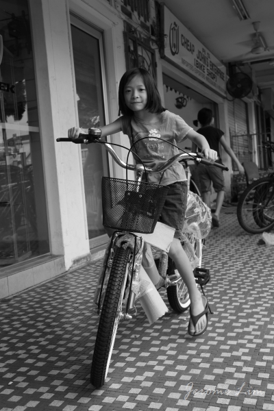
Cheap John’s at its current location is still very much a source of bicycles for Sembawang residents.

Despite the presence of the foreign military personnel, it was probably the workers of the shipyard that were responsible for perhaps rousing Sembawang from its slumber in the 1970s, bringing much colour and life not just to the villages that provided housing to many of them, but also to the streets around. One of the sights that greeted the early morning scene along the narrow Canberra Road that wove its way past the old Canberra Gate (another of the former gates of the Naval Base), of which one concrete pillar remained close to a bus stop that always looked busy with the comings and goings of the many schoolchildren who attended the few schools along the road, and the extended Chong Pang Village which grew to the west of Canberra Road all the way to the marshy land on the banks of the Sungei Sembawang, was that of the convoy of bicycles, their riders in the colourful overalls marked with the seahorses that Sembawang Shipyard had adopted as its logo.

Canberra Gate along Canberra Road in 1968 – near the junction with Sembawang Road. (Courtesy of Mr Derek Tait)

A scene reminiscent of the Sembawang of the 1970s and 1980s – the stream of bicycles along a part of Canberra Road that has remained relatively unchanged.

Along Canberra Road across from the area where Sembawang Mart is today, the sight of a Hindu temple set in a clearing would greet the traveller. That was what was the original Holy Tree Sri Balasubramaniar Temple built in the 1960s around an altar to Lord Murugan set up by a dockyard worker. It was at this temple where a annual festival which provided the area with much colour, Panguni Uthiram, involving a procession of a chariot and a kavadi procession, was first celebrated in the area in 1967, a tradition which continues till today, with the temple having moved to a new location in Yishun Industrial Park A in the 1990s.

The old Holy Tree Sri Balasubramaniar Temple off Canberra Road (source: http://www.picas.nhb.gov.sg).

The area still plays host to the annual Panguni Uthiram festival, which now takes a different route. The festival was first celebrated at the old temple in 1967.

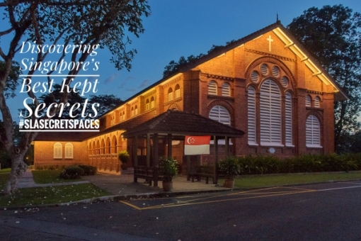
There were several other houses of worship which rose up prominently along some of the main roads of the area as well: the distinctive St. Andrew’s Church, built in 1963 to serve British Military personnel in the area along Admiralty Road close to what had been Sembawang Gate, which is still around; Masjid Naval Base which was close to the junction of Delhi Road and Canberra Road (since demolished); and the Church of Our Lady Star of the Sea (now in Yishun) at the corner where Canberra Road branched off from Sembawang Road. One that was in an obscure location – nestled in the wooded coastal kampung area to the east of what is today Sembawang Park, in the Malay Settlement, Kampong Tengah, established by the British to house Malay dockyard workers, the Masjid Petempatan Melayu, built from the 1960s right up to the 1970s when the bulk of it was completed, is also still around in a setting very much unchanged (except that the kampung around it has since deserted it), having been granted an extended lease of life on a temporary basis. What the future holds for the mosque, dubbed the “Last Kampung Mosque in Singapore”, no one really knows, as Mdm. Zaleha of the mosque’s management committee laments … Today, the mosque comes alive during the school holidays, with camps run by the mosque for Muslim schoolchildren being a popular activity. One of the participants of the walk thought that it would be a nice idea to set up a holiday campsite in the area for schoolchildren of other religions as well.

Masjid Petempatan Melayu Sembawang – the last kampung mosque in a kampung setting.

Mdm. Zaleha of the Mosque’s Management Committee speaking to two of the participants.

Around the St. Andrew’s Church is the area dominated by the stately residences of the military personnel, many of which were built in the 1920s and 1930s as the Naval Base came up, both to the north of Admiralty Road all the way to the coast, and to the south towards Canberra Road. Many of the houses, referred to as “Black and White” houses for the way in which they are painted, are still there today, housing military personnel from the US Navy’s Logistics Base which now occupies part of what was the Stores Basin of the Naval Base just west of Sembawang Park. The former Stores Basin is also occupied in part by the Sembawang Wharves, run by the Port of Singapore Authority (PSA), established in the 1970s when it was vacated by the British. Sembawang Wharves had since been associated with timber, rubber and container imports, as well as being at one time one of the entry point for cars imported to Singapore.
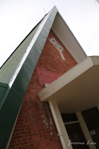
St. Andrew’s Church, built in 1963 for the British Military personnel and their families.

Sembawang has a generous distribution of “Black and White” houses built in the 1920s and 1930s to house military personnel and their families.

The Stores Basin seen in 1962 (source: http://www.singas.co.uk). Part of it is used as a US Navy Logistics Base and the rest is part of PSA’s northern gateway, Sembawang Wharves.

In the cluster of Black and White houses south of the park, along Gibraltar Crescent, there is an interesting find – an entrance to a bunker engulfed by a Banyan Tree that has grown over it – a scene similar to that which greets a visitor at the ruins of the Ta Prohm temple complex in Siem Reap. Bunkers were commonly found nestled amongst the houses – most have been covered over now, including one at Gibraltar Crescent of which the only evidence left is a grass mound, as is one that used to greet the eye behind Beaulieu House.
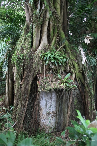
The entrance of a WWII bunker engulfed by a Banyan tree along Gibraltar Crescent.

Another view of the bunker’s entrance.

Speaking of Beaulieu House, it is one of a few buildings in the area with conservation status, having been granted that in 2005. Built as a seaside home of a wealthy plantation owner in the early 1900s, it was acquired by the British military as the Naval Base was being built, serving as a home for the engineers and later for senior naval officers and it is mentioned that from 1940 to 1942, an Admiral Geoffrey Layton, the Commander-in-Chief for Britain’s China station stayed at the house and the house was occupied by Senior Fleet Officers after the war. The URA’s write-up on the house mentions that the name was derived from a certain Admiral Beaulieu, a Chief of Staff of the Royal Navy, but makes no mention of whether he stayed there.

Beaulieu House started life as a seaside home of a wealthy plantation owner, before being taken over by the British as the Naval Base was being constructed in the 1920s. Beaulieu House was included URA’s conservation list in 2005.

Beaulieu House, overlooks what was referred to in the 1970s as the Mata Jetty, being located at the end of Mata Road, which took one past two Muslim graves at a bend under a tree close to the fence line of the former Stores Basin. The jetty brings with it many memories of the smell of rotting fish used as bait in square bamboo framed crab traps weighed down by lead weights wrapped at each of its four ends of the frame, tied to the jetty with nylon or raffia twine. What comes back as well to me are the burnt planks and the railing-less sides and end off which a car was driven off at high speed in 1975. The waters around the jetty were great for harvesting shrimps with butterfly nets while wading in the eel and puffer fish infested waters. The shrimps eyes stood out when a light was shone in the water and that enabled one with a quick hand to scoop them out with the net. These often ended up over an open fire which we often built on the beach – the smell of fresh seafood over the fire and the crackling sounds that accompanied them as they cooked are still fresh in my memory.

Beaulieu House overlooks the Mata Jetty which was built in the 1940s and is today a popular jetty for fishing and crabbing.

Other buildings in the area which have some form of conservation status include Old Admiralty House which has been gazetted as a National Monument in 2002, and the former Sembawang Fire Station which was given conservation status in 2007, both of which we did not visit due to physical limitations. Old Admiralty House on Old Nelson Road (just across Canberra Road from Sembawang MRT Station), a two-storey brick bungalow housed the Commodore, Malaya and Officer in Charge of His Majesty’s Naval Establishments in Singapore.Constructed in 1939, iIt was later used as was the official residence of the Commander-in-Chief, Far East Station from 1958 up until 1971, when it was named Admiralty House. The URA also provides some information on the former Sembawang Fire Station (which is now within the grounds of Sembawang Shipyard): “built in the 1930s, this two-storey concrete building is designed in a simplified Art Deco-Modern style and has an elegantly proportioned fire-hose tower. The building is a local landmark for both the Sembawang area and the Shipyard”.

Admiralty House, built to house the Commodore Superintendent of the Dockyard and later used to house the Commander-in-Chief of the Royal Navy’s Far East Station was gazetted a National Monument in 2002.

Another building with conservation status is the former Sembawang Fire Station built in the 1930s with its distinctive fire hose tower. The building is within the premises of Sembawang Shipyard.

The last stop was perhaps the highlight for many, a visit to the site of the hot springs that has long been associated with the area. The hot springs, dubbed “Sembawang Hot Springs” was for much of my younger days, associated with the Seletaris bottling plant that came up in 1967 under a subsidiary of soft drink giant Fraser and Neave (F&N), Semangat Ayer Limited. The existence of the spring, based on a heritage guide published by the HDB and the National Heritage Board, had been known as far back as 1908 (which a book written by Song Ong Siang, “One Hundred Years of the Chinese in Singapore” puts as 1909), when a Municipal ranger called W. A. B. Goodall discovered it. The land owner, a certain Mr Seah Eng Keong proceeded to start bottling the water under the brand “Zombun” soon after, after he had established that it was safe to drink, establishing the Singapore Natural Mineral Hot Springs Company. F&N bought the company over in 1921 and bottled the water right up to the war under several brands which included “Zom”, “Salitaris”, “Singa Water” and “Vichy Water” until the Japanese Occupation, during which the Japanese built thermal baths in the area. This was destroyed during an allied bombing raid on Singapore in November 1942 which interrupted the flow of the spring water to the surface and on advise of a geologist after the war, F&N left the spring until flow was naturally restored in the 1960s. When Semangat Ayer’s bottling plant was established in 1967, there had actually been plans to build a spa in the area – but that never took off, and bottling continued until the 1980s, when the land on which the spring was on was acquired by the Government to build an airbase. That would have sounded the death knell for the hot spring and if not for an outcry from the local community, we might have seen the last of the only hot springs on mainland Singapore. A corridor was built in 2002 within the perimeter of the airbase along Gambas Avenue leading to a concrete base with standpipes which channel the spring water to taps, allowing the public use of the hot spring which is thought to have curative properties for several ailments. As several of the participants were to find out, the water which reported flows out at 65 degrees Celcius, does, based on its acrid smell, have some Sulphur content which is said to be useful for the treatment of skin problems.
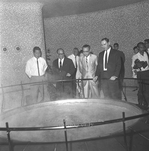
Sembawang Hot Springs was the source of Seletaris – a brand of mineral water bottled by F&N’s subsidiary, Semangat Ayer Limited up to the 1980s (source: http://www.picas.nhb.gov.sg).

The visit to the hot springs brought back memories of another part of Sembawang that I was fond of, one that was accessible through a road Jalan Ulu Sembawang that lay at the back of what is now the Seletaris Condominium complex, developed by F&N on the site of part of what had been the Seletaris Bottling plant. A little stub of the road is still left, but no more than that. The road had once provided access to a vast area of farmland and fishing ponds – rising up onto a crest of a hilly area that overlooked what had seemed like rolling plains of vegetable farms. My father had in the 1970s and 1980s been fond of driving along the road just for that view … one that I remember as being one of the most picturesque in Singapore. The road lead to the Lorong Gambas and Mandai area which many who did National Service in the 1970s and 1980s would remember for the training areas they contained. Like much of what was around Sembawang, that is now lost, as is the large Chong Pang village that dominated much of the are south of the Naval Base which was demolished in 1989 after residents moved out in 1986 or so. Much of the area now occupied by the new Sembawang HDB estate. The plot of land where the heart of Chong Pang was, the roundabout near which the Sultan Theatre stood and where some of the best food in Singapore could be found, still lies empty, with plans to build a sports complex over the area. While that has gone, there are still many reminders that remain – particularly the areas on which the Black and White houses are located, the jetty and of course the old kampung mosque. There are also some reminders of the traditions that existed, the stream (albeit a smaller one) of bicycles heading down Canberra Road being one … and there is the most colourful one of all – the procession of kavadis that still make its way down once a year … on a different route, but one that reminds us of what Sembawang is all about, beyond that apparent slumber.

The Ulu Sembawang area was very scenic with its rolling slopes of vegetable farms (source: http://www.picas.nhb.gov.sg)..

The area was also home to several fishing ponds (source: http://www.picas.nhb.gov.sg).


Forgotten with time: Chong Pang Village

17 01 2010

With the help of an old map, and some sketchy memories of the village at which we would stop over at to get our supplies for the fishing and crabbing trips we used to make to the jetty at Sembawang end, as well as some old photos of the area courtesy of Mr Derek Tait, author of “Memories of Singapore and Malaya” who spent some of his childhood years in Singapore in the 1960s, and some from the National Archives, I was able to get a better impression of what Chong Pang was like in the 1970 and early 1980s. Taking a walk around the area, I could perhaps retrace some of the steps I had taken down the streets of Chong Pang, as I must have done in the early 1980s with Paul, an apprentice with Sembawang Shipyard, whom I had befriended during a six month stint I had with Sembawang Shipyard. Paul had come over from Kulai in Southern Johor, as many of the shipyard workers once did, and rented a windowless room in a wooden shack, which he once showed me. The wooden shacks of Chong Pang, as well as of Canberra Road, housed the thousands of Malayalees and Malaysians who worked at the shipyard. In the mornings and evenings, Canberra Road would be filled with streams of these shipyard workers dressed in the light blue coveralls of the shipyard, cycling to and from the shipyard.

Chong Pang Village erased: An open field slated for the development of a sports complex where the once bustling village used to stand, while a new public housing estate Sembawang rises in the background.

Today, the area where Chong Pang once stood bears very little evidence of the bustling village that once occupied the area. Most of the roads associated with the village have disappeared: the main part of the village centered around Chong Pang Road and the roundabout where the Sultan Theatre stood and around which some sumptuous hawker fare could be found in the evenings, is now a clear plot of land, that is, based on plans for the area, to be used for the construction of a sports and recreation complex. The roads on the other side of the road, where I remember there was a market of sorts, have similarly disappeared, a “Land for Sale” sign sticking out prominently where wooden shop houses once stood.

Map of Chong Pang Village c.1978

Chong Pang Village as it used to be: Looking up Chong Pang Road towards the area where the roundabout with the Sultan Theatre was located.(Source: National Archives of Singapore).

The spot where the junction of Chong Pang Road with Sembawang Road once was, as it is  today.

A view of the junction of Chong Pang Road with Sembawang Road in 1968 taken northwards towards Canberra Road (Courtesy of Mr Derek Tait)

A view of the junction of Chong Pang Road with Sembawang Road southwards. (Source: National Archives of Singapore)

There is maybe some evidence of Kedondong Road – what appears to be remnants of a paved road peeps out from the grass where the road once joined Sembawang Road. Further north, what used to be a fork in the road, the right branch being the continuation of Sembawang Road, the left, Canberra Road – which led to the Naval Base and was later the road leading to the shipyard which inherited the former naval dockyard after the pullout of the British forces. The gate that stood on Canberra Road still stood for sometime after as evidence of the former Naval Base. Canberra Road has since been widened, bearing little resemblance to the Canberra Road of old. A Catholic church, Our Lady Star of the Sea, which has since relocated to the Yishun, used to stand at the corner, near the start of Canberra Road.

Evidence of where a village road once stood: What’s left of Kedondong Road?

Village Scene in 1985 (Source: National Archives of Singapore)

Village Scene in 1985 (Source: National Archives of Singapore)

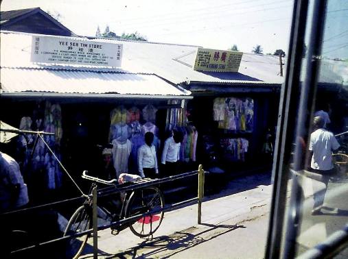
Row of Shops (Source: National Archives of Singapore)

Wooden Shacks that housed the many shipyard workers who lived in the area (Source: National Archives of Singapore)

Church of Our Lady Star of the Sea – a photo taken in 1992 (Source: http://www.veritas.org.sg/olss/history1.html)

Where the Star of the Sea once rose: the site of the old Catholic Church, Our Lady Star of the Sea

The Junction of Sembawang Road, Sembawang Avenue (new) and Canberra Road today, looking at Canberra Road. A hawker centre built in the 1970s used to stand in the area on the right of the bus. Canberra Gate used to stand a little further up Canberra Road.

Canberra Gate along Canberra Road in 1968 – near the junction with Sembawang Road. (Courtesy of Mr Derek Tait)

Where the market area once was … now a plot of land for sale

Jalan Sendudok, one of the few roads still left

Area around the market along Sembawang Road.

Area around the market along Sembawang Road (posted in the Old Sembawang Naval Base Nostalgic Lane Facebook group).

The only part of the area that is maybe still recognisable is just south of where the village was: the Jalan Tampang and Jalan Legundi area, where the rows of shop houses still stand. The row along Jalan Legundi used to house the Cola Restaurant, a popular place for steaks, which later became Jack’s Cola Restaurant.

View of the row of shophouses along Jalan Legundi, from Jalan Tampang in 1968 (Courtesy of Mr Derek Tait). The Cola Restaurant in the corner later became the Jack’s Cola Restaurant. At the other end of this row is the coffee shop which serves the popular Chye Lye Fish Head Curry. What stands on the field now is the hawker centre which once was the Yishun Village Seafood Restaurant.

A more recent landmark in the area, what used to be a rather run down looking Sembawang Shopping Centre, on the opposite side of Sembawang Road from JalanLegundi, was put up in the mid 1980s and was a popular destination for shoppers looking a bargain on music CDs. The shopping centre has since been rebuilt, and the chain that was build on the back of the sales of music CDs has closed, a victim of online music downloads. North of the area, a new public housing estate, Sembawang stands where the swamps around the Sungei Sembawang once stood. There is an area which is named Chong Pang in Singapore, left perhaps as a reminder of the old village, some 3 miles south of the village, bustling it is with a market popular with people living in the area, but nothing like how the old village was.

Map of the Chong Pang Village area, 1968 (extract of a 1968 HM Naval Base Map).More:

More: