When the region’s naval ships were being built at Tanjong Rhu

11 01 2020

Tanjong Rhu – the cape of casuarina trees and once known as “Sandy Point“, has had a long association with the boatbuilding and repair trade. Captain William Flint, Raffles’ brother-in-law as Singapore’s first Master Attendant, established a marine yard there as far back as 1822, for the “convenience of the building and repair of boats and vessels”.  That association would come to an end when the last shipyards relocated in the early 1990s, not so long after one of the larger establishments Vosper Pte. Ltd. Singapore, went into voluntary liquidation in 1986.

High and dry. A Point class U.S. Coast Guard WPB (left) used in Vietnam by the U.S. Navy, being repaired at Vosper Thornycroft. A Royal Malaysian Navy Keris class patrol boat is seen on the right (Kim Hocker Collection, 1969).

With links to Vosper Thornycroft (VT) – an established name in naval shipbuilding, Vosper Singapore was a major player in the domestic and regional naval market. It also had a long association with Tanjong Rhu that began with John I. Thornycroft and Company setting up its Singapore shipyard there late in 1926. Among Thornycroft’s successes were the construction of motor launches in 1937 for the Royal Naval Volunteer Reserve, a series that included the very first Panglima, a name that would acquire great meaning with the naval forces of a sovereign Singapore some three decades later.

A 1927 ad for Thornycroft Shipyards at Tanjong Rhu.

Thornycroft morphed into Vosper Thornycroft (VT) in 1967, following a merger the previous year, of Vosper Limited with Thornycroft’s parent company in Britain. VT would also merge with neighbouring United Engineers here, another long-time shipbuilder based at Tanjong Rhu, the same year. The expanded VT would find great success, especially in the regional naval market, obtaining contracts from the Ceylonese Navy, the Bangladeshi Government, and the Royal Brunei Navy – for which it built three Waspada class Fast Attack Craft.

A view towards a bakau laden Bugis pinisi on the Geylang River from Vosper Thornycroft (Kim Hocker Collection, 1969).

Locally, VT also supplied and serviced the Royal Malaysian Navy, as well as the fledging Singapore navy. A contract for six ‘A’ and ‘B’ Class 110 foot Patrol Boats with Singapore’s then Maritime Command in 1968 involved the lead vessel being constructed in the parent company’s yard in Portsmouth. This arrangement set the tone for how large naval procurement would be conducted here, although VT would play little part in the subsequent naval construction for what became the Republic of Singapore Navy, in the years that would follow.

The launch of the ‘A’ Class 110′ Patrol Craft at VT for the Maritime Command in 1969. Interestingly, the main deck of these steel hulled vessels were constructed from aluminium alloy (photo source: National Archives of Singapore).

The yard was also involved in commercial ship construction and repair, and naval repair and upgrading work. The U.S. Navy, which was involved in the conflict in Vietnam, sent several small patrol boats to the yard during this time. One of these boats was brought over from Danang by a Kim Hocker late in the fall of 1969. An officer with the U.S. Coast Guard, Kim was seconded to the US Navy. An extended stay in Singapore permitted Kim to put his camera to good use and his captures included bits of Raffles Place, the Meyer Road and Katong Park area close to where he was putting up, and also ones of the shipyard that are used in this post. One thing that is glaringly clear in Kim’s photographs of the yard is the absence of Personal Protective Equipment (PPE) such as hard hats, safety shoes and safety belts – a requirement in the shipyards of today.

Kim Hocker with the author.

No hard hats or safety shoes! (Kim Hocker Collection, 1969).

VT Singapore became Vosper Pte. Ltd. Singapore in 1977 following the nationalisation of its parent company. Despite contracts from Oman and Kuwait, and an investment in a Glass Reinforced Plastic (GRP) production facility that was partly motivated by a Marine Police Patrol Boat contract,  the next decade would see Vosper Singapore fall on hard times. This saw to its eventual demise as a yard here in 1986.  The closure of the yard came a a time when plans for the redevelopment of the Tanjong Rhu for residential use were being set in motion. The shipyard site was purchased by Lum Chang Holdings the following year for the purpose, and was in turn resold to the Straits Steamship Company (now Keppel Land). Together with DBS Land, the site, an adjoining site as well as land that was reclaimed, were redeveloped into the Pebble Bay condominium complex in the 1990s.

A view towards what would become the Golden Mile area from Vosper. The naval vessel seen here looks like one of the Keris class Royal Malaysian Navy Patrol Boat (Kim Hocker Collection, 1969).

At the time of Vosper’s demise, there were also several shipyards that were still in operation, including privately held ones such as Kwong Soon Engineering and another long time Tanjong Rhu shipyard, Singapore Slipway. Located at the end of the cape since the end of the 1800s, it was by that time owned by Keppel and would come to be part of (Keppel) Singmarine. The last yards moved out in the early 1990s allowing Tanjong Rhu’s redevelopment into what was touted a waterfront residential district, which incidentally, was where the first million dollar condominium units were sold.

More on Tanjong Rhu and its past can be found at “The curious ridge of sand which runs from Katong to Kallang Bay“.


More photographs taken at Vosper Thornycroft from the Kim Hocker Collection:

Painting the old fashioned way (Kim Hocker Collection, 1969).


One more … (Kim Hocker Collection, 1969).


The security guard or jaga … wearing a Vosper uniform (Kim Hocker Collection, 1969).


It was common to see pushcart stalls outside the gates of shipyards and factories in those days (Kim Hocker Collection, 1969).


A store? (Kim Hocker Collection, 1969).


Shipyard workers – again no hard hats (Kim Hocker Collection, 1969).


Welders at work (Kim Hocker Collection, 1969).


Lost in the rising sea at Telok Ayer

12 02 2016

It is hard now to imagine the sea coming right up to Telok Ayer Street where the original shoreline had once been.  The Telok Ayer Reclamation scheme of the 1880s moved the shoreline to where Shenton Way is today, adding some 1,808,028 square feet or 167,971. square metres of land where Telok Ayer Bay had been. A portion of the land, reclaimed at a cost of 51 cents per square foot, was sold initially (in 1896) for an average price of $1.13 per square foot.

One of the earliest structures to be erected in the land where the bay had been is what we now know as Telok Ayer Market or “Lau Pa-Sat” – meaning old market in the Hokkien dialect with pa-sat being a Hokkien loan word from Malay used locally. The “New Town Market” replaced a 1833 market that had been built along the earlier shoreline and would possibly be the only one of the reclamation’s early structures to have stood to this very day (it did disappear over a three year period in the late 1980s when it was dismantled to protect its structure from damage from tunnelling works for the MRT).

A National Monument, the former market and now a food centre, is a showpiece of exquisite Scottish ironwork. Although it still remains very recognisable for its distinctive octagonal plan and its clock tower, the old market has become a lot less noticeable now that it is lost in the new sea at the former Telok Ayer Bay; a sea not of water but of towering skyscrapers that has risen in the last four decades or so.

JeromeLim-7517-2

Lost in the sea of skyscrapers, the former Telok Ayer Market. This view of it is down Maxwell Link, running in between Robinson Road and Shenton Way, along which newer and taller buildings are now replacing the first generation skyscrapers of 1970s vintage.

The view from Mount Wallich

When the air was much clearer – a view from Mount Wallich, which was soon to be levelled, towards the Telok Ayer Reclamation, possibly in the late 1890s, soon after the “New Town Market”, also seen in the picture, was constructed. The road closest to the viewer would be Cecil Street, with Robinson Road running parallel and what would became Shenton Way just by the sea.

Carnival time on the reclamation – the Manila Carnival during the Malaya-Borneo Exhibition in 1922 where Shenton Way is today. The market can be seen in the background (National Archives of Singapore Photograph).


Finding romance on Terumbu Semakau

17 07 2014

At 4.30 am, less than 24 hours after the adventure or what perhaps was more of a near misadventure on Cyrene, on Sunday, I found myself once again on a boat headed south. The destination this time was another patch reef, Terumbu Semakau, which lies just east of the original Pulau Semakau – now part of an enlarged island of the same name that serves as an offshore landfill.

A view of Terumbu Semakau, looking across to the enlarged Pulau Semakau.

A view of Terumbu Semakau under the light of the moon, looking across to an enlarged Pulau Semakau.

Location of Terumbu Semakau relative to Pulau Semakau.

Location of Terumbu Semakau relative to Pulau Semakau as seen on a navigational chart.

Terumbu Semakau in the moonlight.

Terumbu Semakau in the moonlight.

The super moon seen setting over Pulau Semakau.

The super moon seen setting over Pulau Semakau.

Thankfully, the weather provided much greater joy than it did a day before, allowing the group I was with to take-in an almost magical view of the reef bathed in the light of the super moon and then in the early light of day. The setting was one that seemed perfect for romance – the chorus we could hear of romancing amphibians across on Pulau Semakau seemed to testify to that.

6.28 am, the lights of Singapore's southern seas, that of the ships at anchor is seen against the lightening sky.

6.28 am, the lights of Singapore’s southern seas, that of the ships at anchor is seen against the lightening sky.

The terumbu at sunrise.

The terumbu at sunrise.

Finding romance on Terumbu Semakau with the rising of the sun.

Finding romance on Terumbu Semakau with the rising of the sun.

The reef, as with many of southern Singapore’s once numerous patch reefs, bears the scars of the developments of the last five decades. Its once lush meadows of seagrass have all but disappeared, leaving the moonlit scene without the stars that illuminated our visit to Cyrene. The group did however, find a couple of stars that, so disguised, were ones I wouldn’t have recognised. Shaped as their common name suggests, these cushion sea stars are quite recognisable upturned – wearing the unmistakeable mark of a true star on their well hidden undersides.

A cushion star.

A cushion star.

The underbelly of a cushion star.

The underbelly of a cushion star.

A smaller and less richly coloured cushion sea star.

A smaller and less richly coloured cushion sea star.

The expense of the reef did, in the light of the silvery moon, reveal quite a lot more to the keener pairs of eye. Ria Tan in blog post Terumbu Semakau: still no seagrass recovery, does bring to light several interesting sightings. It was, however, as unlikely romance that might have been the highlight of the day – the romance of a pair of rare tiger cowries, taking place discreetly behind a large piece of coral.

A pair of rare tiger cowries, discreet in their romance.

A pair of rare tiger cowries, discreet in their romance.

Feeling crabby, early in the morning.

Feeling crabby, early in the morning.

A less than romantic find - a fish trap erected on the reef.

A less than romantic find – a fish trap erected on the reef.

The romance found on Terumbu Semakau, is one that may soon be lost, as foretold by the Land Use Plan that was released by the Ministry of National Development last year in support of the less than well received Population White Paper. In the plan, the reef is seen to be within an area that is potentially a future land reclamation site that will create an even larger Pulau Semakau – leaving very little of the patch reef systems that once shaped our southern waters left for us to find romance in.

Possible future reclamation poses a threat to the future of the reefs (and the islands).

Possible future reclamation poses a threat to the future of the reef (source: Land Use Plan 2013).

The incinerated waste receiving station at Pulau Semakau as seen from the reef.

The incinerated waste receiving station at Pulau Semakau as seen from the reef.

Branching Montipora corals in the middle of the terumbu.

Branching Montipora corals in the middle of the terumbu.

More views of the reef in the moonlight

JeromeLim-6330

JeromeLim-6336

JeromeLim-6405


The visit to Terumbu Semakau is part of a series of visits to some of the lesser known shores of Singapore, in search of words and sounds for an IRememberSG funded project, Points of Departure.


The forgotten stars of Singapore

15 07 2014

It is good to be reading about Dr Siti Maryam Yaakub’s work on Singapore’s unseen and unheard of seagrass meadows in Saturday’s edition of The Straits Times. We did, as Dr Siti points out in the article, once have lush meadows of seagrass, ones rich in life and ones which contributed to some of my happier childhood experiences off Changi Beach.

The star of our fast disappearing seagrass meadows.

The star of our fast disappearing seagrass meadows.

Common Sea Stars.

Common Sea Stars.

A sea hare - a type of sea slug.

A sea hare – a type of sea slug.

Coincidentally, I found myself in wading through another meadow, early in the morning of the day the article was published, found at one of offshore Singapore’s patch reef systems that is known collectively the Cyrene Reefs. The meadow, one of the larger surviving meadows in a part of the world where a certain emphasis has been placed on creating land where the sea is, is one that is teeming with life – the most noticeable of which are the huge red or pink knobby sea stars, which had also been prominent in the fields off Changi that featured in my youthful days.

A view across the sandbar at the Cyrene Reefs towards the new container terminal at Pasir Panjang.

A view across the sandbar at the Cyrene Reefs towards the new container terminal at Pasir Panjang.

An anemone.

An anemone.

And a false anemone.

And a cerianthid.

JeromeLim-6083

JeromeLim-6090

More Knobby Sea Stars at Cyrene.

More Knobby Sea Stars at Cyrene.

Surveying the landscape from the rather expansive sandbar at Cyrene at 4 in the morning, does provide that sense of the reef and its seagrass meadows having been put under siege by the industrial empire, one that has left its unsightly scars on much of Singapore’s western coast. To the north, the bright lights of a Pasir Panjang relieved of its “pasir” (sand in Malay) reveal that S$3.5 billion container terminal that is only a temporary one – port operations we hear would eventually be consolidated at Tuas. To the south lies Pulau Bukom, the first of Singapore’s islands to be committed to industrial exploitation and to its west Jurong Island, the monster of an island created by joining a cluster of lands through land reclamation has created; both dominated by stacks smoking in the cover of night.

What's smoking on Pulau Bukom at 4 in the morning.

What’s smoking on Pulau Bukom at 4 in the morning.

A fire worm.

A fire worm.

A shrimp.

A shrimp.

A sea cucumber.

A sea cucumber.

The visit to Cyrene, was perhaps to be remembered not for the opportunity it did provide to reacquaint myself with the seagrass adventures of my youthful days, but for the possible misadventure it might have turned into, as the quickening pace of the winds from the west – the much feared Sumatras, promised not just to cover us in rain but also threaten us with a show of light. The attempt the winds prompted to scamper off as quickly as we could from what would have been a location that was completely exposed, was one that Murphy seemed to want to intervene in when the inflatable boat that was to get us out floundered in the wind and the waves; the increasing frequency at which the flashes lit up the sky as well as the fast rising tide adding to the drama.

Before the storm ... an anemone.

Before the storm … an anemone.

The escape as captured by Juria.

We did somehow find ourselves in the relatively safety of the bigger boat. The “escape” is described as Ria Tan of the Wild Shores of Singapore saw it in her post “Near Death at Cyrene!“:

Fortunately, by some miracle, the Sumatras made a U-turn around Cyrene! The winds and waves died down. Kok Sheng redirected the dinghy to a less rocky spot, with Chay Hoon using the paddle to hold it away from the shore as every clambered on board. Eventually, everyone made it safely back to the big boat. Phew. Thanks to Alex and crew for making sure we don’t drown! (Why is it we often have a near death experience on Cyrene? During our last trip there in Aug 2013, Russel found a living cone snail!) 

The NEA weather map showing the u-turn of the storm.

The incident brought to mind a close encounter with lightning that I had as a child, the setting for which was provided once again by the waters off Changi Beach. That did teach me about the respect one has to show for the untameable forces of nature as did this new encounter. The incident did also heighten the respect that I have for the folks I was in the company of and the risks they expose themselves to. It is through their tireless efforts, that attention is drawn to the many offshore habitats we have, as well as the many threats to the habitats as Singapore looks to create more land from the sea.

The view towards Jurong Island to the reefs' west.

The view towards Jurong Island to the reefs’ west.

The news over the weekend of the creation of Singapore’s first marine park at Sisters’ Islands is a positive outcome of some of these and other similar efforts and hopefully, it with the efforts of researchers such as Dr Siti and enthusiasts such as the group I was with, we will see a lot more emphasis on the conservation and revitalisation of the once rich offshore habitats that have survived in the waters of Singapore.


The visit to the Cyrene Reefs is part of a series of visits to some of the lesser known shores of Singapore, in search of words and sounds for an IRememberSG funded project, Points of Departure.


Windows into Singapore: juxtapositions of time

27 03 2014

A view out of the window from the POD atop the National Library building, out towards what would once have been an almost clear view of the sea off the promenade that ran along Nicoll Highway.

JeromeLim 277A2967

Part of what has been a landmark along Beach Road since its completion in 1976, Shaw Towers, can be seen on the right of the photograph. Built over a site that had previously been occupied by the Alhambra and Marborough cinemas, the 35 floor Shaw Towers was at the point of its completion, the tallest kid on the block at Beach Road. It was also the first building in Singapore to house two cinemas, Prince and Jade, built in a decade when cinema going took-off in Singapore. Prince was at its opening, the largest cinema in Singapore with its 1952 seats. Prince occupied the second to the seventh floors of one corner of the building’s podium. Its screen, at 28 metres wide, was the widest in the Far East. Jade was to provide a more intimate setting, holding less than half the crowd Prince would have held. The cinemas were converted in the late 1980s to cineplexes – the first multi-screen cinemas to make an appearance in Singapore.

A close up of the boats in the Kallang Basin close to Nicoll Highway (posted in Facebook group, On a Little Street in Singapore).

Nicoll Highway, Singapore’s first highway, did once run along the coast right behind Shaw Towers. Completed in 1956 – after the closure of Kallang Airport permitted a much needed link to be built along the coast, it provided an artery to take vehicular traffic from and to the populated eastern coast into and out of the city. Offering a view of the sea and the scatter of boats up to the early 1970s,  a drive today provides a view of a scattering of trees and isolated structures that herald the arrival of a brand new world – where the wooded patch is in the foreground of the first photograph.

Nicoll Highway, the Merdeka Bridge, Beach Road and the Kallang Basin, 1967 – before the 1970s land reclamation (posted in Facebook group, On a Little Street in Singapore).

A view down Nicoll Highway. A new development South Beach is seen rising beyond Shaw Tower.

A view down Nicoll Highway. A new development South Beach is seen rising beyond Shaw Towers.

Another view down Nicoll Highway during peak hour.

Another view down Nicoll Highway during peak hour.

The body of water beyond which we can see the Benjamin Sheares Bridge rising, is itself one that has seen a significant change. Where it once was the sea, it now is a body of fresh water, forming a part of the huge Marina Reservoir, having been cut-off from the sea by land reclamation and the construction of the Marina Barrage. The barrage, closes up the channel between Marina East and Marina South, Marina East being land reclaimed off Tanjong Rhu, a cape once referred to as a “curious ridge of sand” on which shipyards, the charcoal trade and a flour mill had once featured.

An advertisement for Khong Guan Flour Mills. The grain storage silos once dominated a landscape at Tanjong Rhu now dominated by condominiums.

An advertisement for Khong Guan Flour Mills. The grain storage silos once dominated a landscape at Tanjong Rhu now dominated by condominiums.

A more recent landmark on Beach Road, the 41-storey The Concourse and a view toward Tanjong Rhu beyond it.

A more recent landmark on Beach Road, the 41-storey The Concourse and a view toward Tanjong Rhu beyond it.

Reclaimed land by Nicoll Highway, the Kallang Basin area of Marina Reservoir and Tanjong Rhu beyond it.

Reclaimed land by Nicoll Highway, the Kallang Basin area of Marina Reservoir and the Marina South area beyond it.

It is at Tanjong Rhu, where Singapore first million-dollar condominium units were sold, that the eastern end of the iconic 1.8 km long Benjamin Sheares Bridge comes down to earth. Opened to traffic on 26 September 1981, it provided the final link for a coastal highway that had been built to take traffic around and not through the city centre, the planning for which went back to the end of the 1960s (see The Making of Marina Bay).

Land reclamation in the Kallang Basin / Tanjong Rhu area in 1973 (posted in Facebook group On a Little Street in Singapore).

This stretch of that coastal highway, East Coast Parkway (ECP), did take up much of the traffic that was being carried on what was becoming an increasingly congested Nicoll Highway that had been built some 25 years before it. Now, some 32 years later, as with the highway it took traffic away from, it sees its role taken up in a similar fashion by a new highway, the Marina Coastal Expressway (MCE). Built at the cost of S$4.3-billion, the 5 kilometre MCE runs mostly underground and partly under the sea and see the series of coastal highways move with the shifting of the coastline. The MCE features a 3.6 km tunnel and has a 420 metre stretch that runs under the sea.

Tanjong Rhu and the Benjamin Sheares Bridge.

Tanjong Rhu and the Benjamin Sheares Bridge.

The expressway, which opened to traffic on 29 December 2013, was built so as to remove the constraints that the ECP, in running right smack through the centre of Marina South, had placed on the development of Singapore’s new downtown (the expansion of the city to Marina South that was really an afterthought, having come after urban planners had realised the potential that land, which had initially been reclaimed for the construction of the ECP, had in providing much needed space for the expansion of the city). The availability of new and undeveloped land through reclamation did allow parts of old Singapore slated for redevelopment, to be spared the wreckers’ ball.

A view over the Marina Reservoir and Marina East, with the Benjamin Sheares Bridge seen to the left of the capsule.

A view over the Marina Reservoir and Marina East, with the Benjamin Sheares Bridge seen to the left of the capsule.

The deceptively blue waters in the first photograph’s background, is that of the Eastern Anchorage. It is at the anchorage that ships lie patiently in wait, far removed from the frenzy at the wharves of what is one of the world’s busiest ports. It is one place in Singapore where time does seem to stand very still, at least for now. Time doesn’t of course seem to stand very still in a Singapore constantly on the move, and time will certainly bring change to shape of the distribution of the shipping infrastructure along the coast- with the journey to west for the city shipping terminals, at Keppel, Pulau Brani and Tanjong Pagar, due to completed by 2030.

The Eastern Anchorage.

The Eastern Anchorage – where time does seem to stand still.

There is of course the potential that developments away from Singapore has for influencing change. One possible game-changing development we in Singapore are keeping our eyes on is the possibility that of a dream long held by Thailand, the cutting of a shipping canal through the Isthmus of Kra, coming true. If a recent report, purportedly from the Chinese media, is to be believed, work is already starting. The cutting of the so-called Kra Canal is an idea that was first mooted back in the late 17th Century (see: How a Thai Canal Could Transform Southeast Asia on http://thediplomat.com) and talk of building it does crop up from time to time – the effort required and the associated costs in recent times serving as a huge deterrent. If built, the canal would save shipping a 1,500 nautical mile journey through the Straits of Malacca and around Singapore.

The proposed canal does have the potential to undermine Singapore’s so far unchallenged strategic position with regards to shipping, although it would probably take a lot more than a canal to do that. In the meantime, it is the change that is driven within that we will see add to another area in Singapore in which change does seem to always be a constant.


The new world rising from the sea

30 07 2013

A view along Singapore’s former waterfront at 7.37 pm on 28 July 2013. To the left of the photograph, a brand new world has grown on land reclaimed more recently from the sea, dwarfing the Asia Insurance Building, once the tallest building in South East Asia. What has been left behind from when the waters were those of the old harbour can be seen on the right side of the photograph. These include the Fullerton Building (former General Post Office) and Clifford Pier, both built along a bund that was in itself build on land reclaimed in the mid 1800s – one of the first land reclamation to take place in Singapore. The bund was completed in 1864 along with a road which has since been named Collyer Quay.

277A8304


Strange Horizons: A mound of sand where the sea once was

21 04 2013

A somewhat curious sight that greets a drive or a ride through Pulau Punggol Timor, is the mound that is seen in the photograph. The mound is one of two very obvious one found on a man-made island off the northeastern coast of Singapore, Pulau Punggol Timor. The island is one of two which came out of a huge land reclamation project along the Northeastern coastline of Singapore that took place from 1985 to 1990 to provide land primarily for future public housing, the other island being Pulau Punggol Barat.  The reclamation project which added a land area of some 685 ha. was also supposed to have seen Coney Island or Pulau Serangoon joined to the mainland, but that part of the project was deferred. The islands are located off the coast just north of the area where an old world, that of the former Seletar Camp, had once existed, between the mouths of the Sungei Seletar to the wast and Sungei Punggol to the east (both of which have since been dammed). The camp which came out of the former RAF Seletar was home to several army units including Combat Engineer units is in the midst of being transformed into the Seletar Aerospace Park.

img_1636

Since 2009, the otherwise undeveloped Pulau Punggol Timor, has played host to a construction aggregates receiving terminal (which moved there from Lorong Halus), as well a storage area for the aggregates. Besides the mound of sand – a mound of granite can also be seen.


A bay of plenty from which we came

7 03 2013

One of Singapore’s urban spaces in which there is always much to discover is what we have come to know as Chinatown. It may seem that Chinatown today, cleansed of the people and business that made it what it was, is without a soul. It does indeed seem in many parts like a neighbourhood that has been conserved and revived more to draw the tourist dollar than to preserve the memories it holds, but it is in some of the quieter streets of the area designated as a Chinese settlement by Raffles not long after modern Singapore’s founding, that we do find many traces, some still very much alive, of a world that for most part has ceased to exist.

Part of the Thian Hock Keng Temple on Telok Ayer Street.

Part of the Thian Hock Keng Temple on Telok Ayer Street – one of the traces left behind by a long forgotten time.

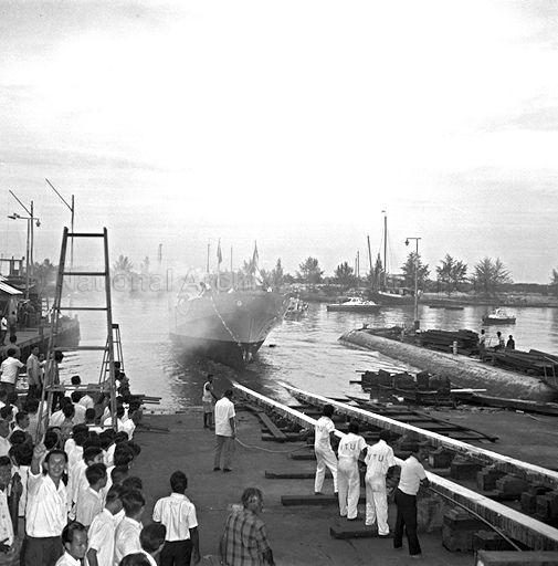
One especially quiet area, seemingly in an area cut off from the busier streets of the neighbourhood, is where there is a wealth of these reminders. It was on a street in the area, now caught between the past and the present, Telok Ayer Street, where in fact the first chapters in the story of Singapore from the perspective of our forefathers did in fact begin in the early days that followed the arrival of the British. The street’s name, Telok Ayer, suggests proximity to the sea – “telok” being Malay for “bay” and “ayer” the word for “water”, although a field of glass and steel and beyond that, the makings of a future city, puts some distance between it and the waters of the Straits of Singapore. Given that, it may surprise some that the land on which the street was built was one where waves of Telok Ayer Bay might have washed up to – and it was where many who made the long and perilous journey in search of fortune in the early days of Singapore, would have first set foot on the island.

Non-organic business now occupy many of the conserved shophouses in the area today.

Non-organic business now occupy many of the conserved shophouses in the area today.

Telok Ayer Street today would in all likelihood, look little like the street the early immigrants made landfall on. But despite the many changes that have come about including the land reclamation exercise that took place from 1879 to 1887 during which its lost its shoreline and more recent urban redevelopment and conservation efforts during which its residents and organic businesses were moved out, it still very much alive with many reminders left by our early founders and very much a living monument to their memory, one which perhaps can serve in place of that intended monument to our early founders that was never built.

The Jackson Plan of 1822 shows the location of Telok Ayer Street relative to the shoreline.

The Jackson Plan of 1822 shows the location of Telok Ayer Street relative to the shoreline.

A diorama of Telok Ayer Street in the early days of modern Singapore showing where the shoreline was. The low building across from the Chinese Opera stage is the Fuk Tak Chi Temple.

A diorama of Telok Ayer Street in the early days of modern Singapore showing where the shoreline was. The low building across from the Chinese Opera stage is the Fuk Tak Chi Temple built by Hakka immigrants and used by both Hakkas and Cantonese. It is now the Fuk Tak Chi Museum.

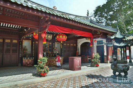
The most significant reminder that we find on the street would be the Taoist Temple the name in Chinese of which translates into of Heavenly Bliss (Thian Hock Keng, 天福宫, in the Hokkien or Fujian dialect). The temple is probably the most popularly visited religious site for tourists coming to Singapore and is a joy to behold. Dedicated to the protector of sailors and fishermen, the Taoist Goddess of the Sea, MaZu (妈祖), the temple’s origins can be traced to the earliest days of modern Singapore. It was built on the site of a joss house put up around 1820/21 by early Hokkien immigrants close to the first landing points to allow thanks to be offered to the goddess for protection provided over the long sea voyage.

The side of the main hall of the temple. The temple is a fine example of Minan arhcitecture, characterised by its curved "swallow-tail" roof ridge.

The side of the main hall of the temple. The temple is a fine example of Minan arhcitecture, characterised by its curved “swallow-tail” roof ridge.

The temple we see today, even with alterations made during a 1906 renovation in which western style floor and wall tiling was added), must be counted as one of the best examples of Southern Chinese Minan temple architecture (found on many Hokkien built temples such as the Hong San See) in Singapore. Distinctive features of Minan temple architecture are the curved “swallow tail” roof ridge and the intricate timber post and beam structure. Completed in 1842, the main altar (of which photographs of are not permitted) has two statues of Ma Zu. One – the darker and smaller of the two, which dates to building’s construction, is said to have been blackened by burning incense offered at the altar over the many years of the temple’s existence.

Lanterns for the Chinese New Year at the Thian Hock Keng.

Lanterns for the Chinese New Year at the Thian Hock Keng.

The temple is also home to several other deities and provides the visitor with a good appreciation of the folk religious practices the Hokkien (and other southern Chinese) immigrants brought in with them. One of the deities, is the popularly worshiped Bodhisattva of Thousand Hands and Thousand Eyes, more commonly referred to as the Goddess of Mercy, Kuan Yin. The altar dedicated to her is found behind the main altar, housed in a beautiful part of the temple complex. Other deities include Kai Zhang Seng Wang (The Sacred Governor Kai Zhang), Cheng Huang Ye (City God) flanked by the Da Er Ye Bo (The Two Great Generals, 大二爷伯), or, Qi Ye Ba Ye, 七爷八爷 (which translates to Seventh and Eight Lords). More on the deities can be found at the temple’s website.

The altar dedicated to Kuan Yin in the Thian Hock Keng.

The altar dedicated to Kuan Yin in the Thian Hock Keng.

Another view of the altar dedicated to Kuan Yin.

Another view of the altar dedicated to Kuan Yin.

The altar where Cheng Huang Ye (City God) is, flanked by the two Great Generals.

The altar where Cheng Huang Ye (City God) is, flanked by the two Great Generals.

A close-up of Ba Ye.

A close-up of Qi Ye.

The temple’s construction which started in 1839 could not have been done without the generous donations made by the members of the early Hokkien Chinese community. Chief among the donors was Tan Tock Seng, a well known philanthropist and an early immigrant from Malacca, best known perhaps for the paupers’ hospital he helped set up and which is now named after him. As was the case with many early temples, Thian Hock Keng served to also provide social support for the community. It initially housed the oldest Hokkien clan, the Singapore Hokkien Huay Kuan (Hokkien Clan Association), which has since moved across the street (it was apparently where a Chinese opera or wayang had been positioned in the early days of the temple). The Singapore Hokkien Huay Kuan still runs the Thian Hock Keng.

Two types of Door Gods guard the entrance to the Thian Hock Keng.

Two types of Door Gods guard the entrance to the Thian Hock Keng.

Two types of Door Gods guard the entrance of the Thian Hock Keng.

Besides the commonly found ones, there the the more passive looking eunuch Door Gods more to welcome the good – commonly found in temples where the main deity is a goddess.

On the temple’s right (seen from the deity’s perspective), on what is considered part of the temple complex is the beautifully built Chong Hock Pavilion and Chung Wen (or Chong Boon) Pagoda. Access is via a normally closed separate entrance, the Chong Boon Gate, on Telok Ayer Street. The pagoda (and gate) was built in 1849 and housed what is said to be the earliest Chinese private school in Singapore, the Chong-Wen Ge (or the “Institute for the Veneration of Literature”). The Chong Hock Pavilion, built in 1913, housed the Chong Hock Girls’ School which was set up in 1915. The school in 1930 was moved partly across the street (where the Hokkien Association Building is today). It has since been renamed Chongfu school and is now located in Yishun.

The entrance to the Chong Hock Pavilion and the Chung Wen Pagoda.

The entrance to the Chong Hock Pavilion and the Chung Wen Pagoda, the Chong Boon Gate .

The Chong Hock Pavilion.

The Chong Hock Pavilion.

The temple complex, which was gazetted as a National Monument in 1973, went through a major restoration effort from 1998 to 2000, during which craftsmen from China were employed. Those efforts won it an Honourable Mention for the UNSECO Asia-Pacific Heritage Awards in 2001. An important discovery made during that restoration was a calligraphic scroll, with the imperial seal of Emperor Guang Xu of the Qing Dynasty. Placed in a previously unidentified scroll holder on a panel, which incidentally is a display copy of the scroll placed above the main altar, the scroll was presented to the temple by the Emperor in 1907.

The Chong Boon Gate and the Chung Wen Pagoda.

The Chong Boon Gate and the Chung Wen Pagoda.

Besides the Thian Hock Keng, several other important religious or clan buildings established by the immigrants can also be found along the same street. One was a Hakka built temple, the Fuk Tak Chi temple, dedicated to the Earth God Da Bo Gong. Although the temple has since ceased to operate, its building can be still found and is part of the Far East Square complex and is a reconstruction built in the Hokkien style with a curved roof ridge. Its main hall and entrance is said to have been constructed in the style of a Chinese Magistrate’s Court as a symbol of power and authority.

The Fuk Tak Chi Museum.

The Fuk Tak Chi Museum.

The temple which dates back to 1824, served both the Hakka and Cantonese communities (which tells of the close relationship between the two communities in Singapore). Closed in 1994, it has since been restored and converted into a museum. A important artifact that is still housed in the building is a wooden screen found at its entrance. Just a few doors away from the Fuk Tak Chi, is another important link to the early Hakka immigrants, the Ying Fo Fui Kun. This is a Hakka clan association which was founded in 1822. “Ying Fo” translates into “mutual co-operation for peaceful co-existence” which provides a clue to why clan associations were established. The building which dates back to a reconstruction in 1843/44, underwent renovation in 1997 and was gazetted as a National Monument in 1998.

Inside the Fuk Tak Chi Museum.

Inside the Fuk Tak Chi Museum.

The wooden screen at the entrance of the Fuk Tak Chi.

The wooden screen at the entrance of the Fuk Tak Chi.

Odd as it may seem, being on the fringe of Chinatown, one finds on the very same street, two structures erected by Chulia Muslim immigrants who originated from the Coromandel Coast of India. The structures are of course not out-of-place – the Chulias, many of whom were merchants, very naturally found spaces to conduct their businesses amongst the Chinese traders along what was the seafront. The area would also have been close to the original area Raffles has set aside for the Chulia settlement just north of the Chinese settlement.

The Al-Abrar Mosque.

The Al-Abrar Mosque built by the Chulias.

One of these structures, the Al-Abrar Mosque which sometimes is referred to as Masjid Chulia or Chulia Mosque, is still in use (not to be confused with another Chulia Mosque Masjid Jamae in South Bridge Road). The mosque was first set up in 1827 by Tamil Muslim immigrants, and is also known in Tamil as the Kuchu Palli (kuchu means “hut”, palli means “mosque’). The current building was completed in 1855 and was gazetted as a National Monument in 1974.

The former Nagore Durgha Shrine.

The former Nagore Durgha Shrine.

The other structure built by the community, the former Nagore Durgha Shrine, is one that will certainly catch the eye. Sitting prominently at the corner of Telok Ayer and Boon Tat Streets, it had long been closed to the public. The former mashhad or memorial, has since May 2011 been reopened as the Nagore Dargah Heritage Centre. Built between 1827-1830, the Nagore Durgha was built as a memorial to a Sayyid Abdul Qadir Shahul Hamid, a holy man from Northern India based at Nagore in Tamil Nadu. The mashhad, originally known as Shahul Hamid Durgha, is rather distinctive from an architectural viewpoint. It features a mix of east and west – Palladian features on the lower part of the building, topped with an Islamic style upper part, and is thought to be an attempt to replicate the original Nagore Durgha shrine in Negapatnam (Nagapattinam) which is just south of Nagore. The heirtage centre is well worth a visit. Besides the insights it offers to the early days of the Indian Muslim community in Singapore, and their cultural and religious practices, there is also an opportunity to enjoy the beautiful column and arch lined interior that is illuminated by light streaming through its stained glass windows. The now beautifully restored Nagore Durgha has been a National Monument since 1974.

Inside the Nagore Durgha.

Inside the Nagore Durgha.

Walking around today, it would be easy to miss one of more recently gazetted monuments on the street, the last of the monuments I wish to mention. That, the former Keng Teck Whay, lies hidden behind hoardings, somewhere between the Nagore Durgha and the Thian Hock Keng. With a distinguishing three tiered pagoda which has octagonal plan upper floors on a square base, it would certainly be one to admire – if not for the much needed restoration work that is going on at the moment. Built to house the Keng Teck Whay, a self-help association set up by Hokkien-Peranakan merchants from Malacca in 1831, the buildings we see today came up between 1847 and 1875 and were constructed by traditional Chinese craftsmen in the Minan style. The building at the rear which is said to feature details borrowed from Teochew style architecture and was used as an ancestral hall. The Taoist Mission has since taken over the buildings which were in rather a dilapidated state. Repairs and restoration of the buildings are currently being done and the mission will run the complex as the Singapore Yu Huang Gong, 新加坡玉皇宫, or Temple of Heavenly Jade Emperor.

An aerial view of the former Keng Teck Whay (source: http://pictures.nl.sg). All rights reserved. Preservation of Monuments Board Singapore 2010).

An aerial view of the former Keng Teck Whay (source: http://pictures.nl.sg). All rights reserved. Preservation of Monuments Board Singapore 2010).

With the pace of change not just robbing us, residents of what has become an increasing congested island, of places and experiences that help us connect with a country we call home, but also replacing many familiar places with that brave new world we find hard to identify with, it is perhaps only in places such as this we can hold on to. While they perhaps do not hold the personal memories and experiences we may hold dear, they do hold the memory of who we are as a nation, of where we came from and how we got here, and most importantly, of what made Singapore, Singapore.


The anatomy of an industrial estate

1 02 2011

These days, industrial estates are very much a feature of Singapore’s landscape outside the city as much as the HDB public housing estates are. Many would not bat an eyelid at the clusters of uninspired high-rise industrial buildings that dot the landscape. Built to house light industries, these high-rise factory buildings, referred to as flatted factories, were “imported” to Singapore at the time of the rapid industrialisation programme of the 1960s.

JeromeLim-2537-2

Singapore’s very first flatted factory (right) at Commonwealth Drive.

Prior to the building of the first flatted factories, light industries such as metal working, shoe making, textiles and paper products manufacturing, had been accommodated in a mix of low rise units. Many operated out of pre-war shophouses or makeshift wooden and zinc -factories – some of which may have been squatting on state land.

Redevelopment, as well as the pressing need to develop new factory space for light industries to fuel growth, saw Singapore look towards Hong Kong, where the mainstay of the economy had been its small manufacturers. The building of multi-storey factory buildings, which provide large amounts of inexpensive factory space close to its urban centre – close to its source of labour and also where there was easy access to transportation, had proven a great success.

High rise industrial buildings, very much part of the landscape of today’s Singapore, were introduced in the 1960s. The idea was borrowed from Hong Kong, which pioneered the provision of low cost factory units housed in multi-storey buildings for the small enterprises that were a mainstay of its economy.

A pilot programme initiated by the Economic Development Board, gave us the first flatted factory buildings in 1966. Built at Tanglin Halt, Bendeemer, Kallang and Kampong Ampat, space in the five-storey flatted factory blocks were quickly taken up and many more were built.

This success also led to private investment in flatted factories. Along with those built by that were built by the Jurong Town Corporation (JTC), there were also many privately developed multi-storey factory blocks that have cropped up all over Singapore over the years.

The first flatted factories were rarely over 5 stories high and built without lifts, these days, they are typically higher.

Along with those built within the boundaries of public housing estates such as Queenstown and Toa Payoh, large clusters of flatted factories also came up in light industrial estates. One such estate is the Kolam Ayer Industrial Park, which features a rather interesting mix of private and JTC built flatted factory buildings.

The industrial park, is perhaps best known for the names of its roads. Some such as Tannery Lane, shed some light on the industrial  history of the area. There are others that have puzzling origins – such as one with the strangest of names, Kallang Pudding Road.

It is suggested that the pudding in the name originates from the pokok puding, Malay for the croton plant – a commonly seen shrub with variegated leaves. A road that served as a “shortcut” for my parents on their drives back from the Kallang area to Toa Payoh, where we lived, in my younger days; my overactive imagination had it as being a reference to the pudding I thought the swamp that once occupied the area had been.

The name of the area, Kolam Ayer, which was at the confluence of the Kallang and Whampoa Rivers, alludes to it having been a body of water (it means a basin, pond or pool of water in Malay). Old maps show it as a huge tidal swamp – part of a much bigger Kallang Basin than the one we know today and one around which industries such as sawmills thrived. The maps also show the municipal dump and an incinerator that operated in the area up until 1959.

A huge inland reclamation project in the area commenced at the end of 1961. Earth recovered from the major public housing project that was taking shape in Toa Payoh was apparently used. Carried out with the intention of transforming the basin, which covered a total area of some 405 hectares, into Singapore’s second industrial estate.

The first phase of the project was completed in 1969. At that point, some 3.8 million cubic metres of earth was used in filling up 154 hectares out of an area of 182 hectares that would have been submerged at high tide.

Kolam Ayer Industrial Park is a mix of private and government built flatted factory units and low rise light industrial building which was built on a site of a huge swamp at the confluence of the Kallang and Whampoa Rivers which was reclaimed in the 1960s using earth from Toa Payoh.

New buildings started coming up on the reclaimed land from the late 1970s , with the bulk, including those erected by the JTC, built in the early 1980s. The estate is probably one of the more interesting industrial areas to wander around. coloured by a mix of old and new factory buildings – some of which sit on seemingly small plots of land.

The mix provides a completely different feel to ones built at one go. It isn't the lack of uniformity or its regular warehouse sales where one can pick up a bargain or two that makes the estate interesting; if one looks hard enough, there are also some rather interesting culinary offerings that certainly will alter one's perception of what an industrial estate can be all about.

One of the flatted factory buildings which colour the Kolam Ayer Industrial Park.


The treble-carriageway by the Promenade

6 05 2010

As with many things in Singapore, names by which places or features that were once known by, have been lost with the passage of time and development. In some cases, the names would no longer be relevant, features after which the names were based on being altered by the wave of development that has swept over much of Singapore. There are many examples of this around the island, islands being lost – absorbed by larger entities, hills being flattened, and coastlines moving further into the sea. One of the victims of this is one of the prides of a self-governing Singapore, constructed through volunteer labour in an effort to reduce costs at a time when austerity was a necessity, the Peoples’ Promenade, also known as the Nicoll Highway Promenade, or The Promenade for short.

Nicoll Highway, seen in this photograph on the right with its centre carriageway, was built on land reclaimed in the 1920s. A promenade, dubbed the Peoples' Promenade, which ceased to exist due to further land reclamation in the area, was built using volunteer labour to save costs and was opened in 1959. (Source: http://www.singas.co.uk c. 1969).

The Promenade used to run along the coast by the Nicoll Highway, and started from where the Esplanade left off at the Stamford Canal, running along the length of what had been the coast to the Merdeka Bridge. The Promenade opened in 1959, and was a place where families could take evening walks and enjoy the sea breeze, or where one could do a spot of fishing. It was with us when I was growing up in the 1960s up to the 1970s when the commencement of land reclamation in 1971 saw the Promenade losing its appeal before being completely made irrelevant by the 67 hectares of land which was added to the area  of the sea where the Promenade was. This was part of a massive reclamation project which stretched from Prince Edward Road all the way eastward to Changi, giving Singapore a total of 1162 hectares of land along its southern coastline by the time it was completed in 1978.

Nicoll Highway and the Merdeka Bridge, looking westwards towards the city, seen here as a dual carriageway in the early 1960s. A third centre carriageway was added in the mid 1960s to cope with the increasing volume of traffic (Source: http://www.singas.co.uk).

The Nicoll Highway by which the Promenade ran along was itself constructed on land reclaimed in the early 1900s known as the Beach Road reclamation. It opened together with Merdeka Bridge in 1956 to provide a necessary arterial road from the East into the city to alleviate congestion on the roads bringing traffic from the heavily populated eastern shoreline to the city centre. Built originally as a dual carriageway, with two lanes on each carriageway, it later needed to be expanded in the mid 1960s to cope with the increased volume of traffic. Hence a third carriageway was built, right smack in the centre of the highway, providing three additional lanes on which flow could be reversed to regulate flow based on the direction of the peak hour traffic. The third carriageway was opened only to the faster vehicles, opened to city-bound traffic in the mornings and east-bound traffic moving away from the city in the evenings. The idea for a flow reversible centre carriageway on a highway wasn’t new by itself, with similar systems being mooted as far back as the 1930s in the more advanced countries. This system lasted right up to the early 1990s when Nicoll Highway was converted back into a dual carriageway that is it today.

The Nicoll Highway, Singapore

An aerial view of Nicoll Highway in 1958 over the area where the Golden Mile Complex stands today(Source: National Archives of Singapore).

The Golden Mile Complex seen from Nicoll Highway opened in 1973 as an integrated mixed use complex, to much acclaim within architectural circles.

Where you would have once seen the sea. The area south of Nicoll Highway and the Promenade is now reclaimed on which the Marina Complex has been erected.

The Merdeka Bridge opened in 1956 as part of the much needed Nicoll Highway, providing a link from the populated eastern shoreline of Singapore to the city centre over the Kallang River.

The Kallang Basin seen from the Merdeka Bridge, looking a lot cleaner than it would have when the bridge opened in 1956.