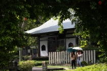
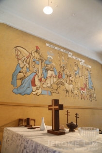
The former Police Coast Guard HQ at Kallang

5 08 2022

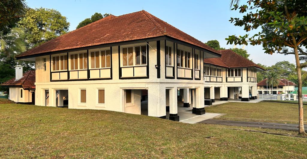
Seemingly uninteresting and rather unexciting, the cluster of buildings that were used by the Police Coast Guard (PCG) to house their headquarters from 1970 to 2006, now hide an interesting secret. Repurposed as the National Youth Sports Institute (NYSI), the buildings have not only found a new life, but have been repurposed with a minimum of intervention and have retained much of the fabric of its past.

NYSI at Kallang, occupies a space that was used as a flying boat reception and maintenance facility and later by the PCG as its headquarters.

The former base, which was carved out of the former Kallang Airport’s flying boat reception and maintenance facilities (its ramp/slipway is still there, except it is part of the National Cadet Corp (Sea) facility next to NYSI), was turned into a base for what was then the Marine Police in 1970 at the cost of S$1 million. Having been based at the congested Singapore River by what is now the Asian Civilisations Museum, a new base with a maintenance facility was much needed to permit enable a swifter repair turnaround time for its boats, improve response and also accommodate the Marine Police’s expanding fleet.

A piece from its days as the flying boat facility.

Amongst the structures that were put up during the development of the Kallang Marine Poilce HQ, was a two storey building that served as its nerve centre, which is the same building that NYSI has operated out of since November 2015. The building and an annex, which once housed offices, interrogation rooms, an armoury and even a lock-up, is now home to gyms, sports laboratories, accommodation, recovery rooms counselling rooms, and even chill out spaces. While that may have been expected, what is unexpected is the manner in which the building has been redone in a way that not only allows it to keep many of its reminders of its days as a Marine Police base, but also with little need for light and ventilation other than that which occurs naturally. This rather intelligent, sustainable, no-frills and rather affordable approach is a breath of fresh air and should really be a model for many of our developments in which old spaces and building are repurposed. Most projects, quite unfortunately, have gone down the path of being flamboyant and gimmicky.

Decently exposed.

The Marine Police, morphed into the Police Coast Guard in 1993 and vacated the base in 2006 due to the intended closing up of Marina Bay through the construction of the Marina Barrage. It is now based in Pulau Brani.


A walk around NYSI Kallang

Chin-up bars – a reminder of the past.
Inside the old electrical distribution box.
The former arms clearing station.
Recalling the armoury.
Exposing the dividing line between the main building and an annex.
A breath of fresh air, the non-air-conditioned gym.
Notice the manhole in the gym flooring (previously a wet space).
A performance lab.
Heaters to simulate hot dry conditions.
An “Endless Pool” for swimmers.
Another reminder of the past.
Maximising natural ventilation.
Dorms – a curtain separates the male and female sections.

Common spaces


The former lock-up


Other views around the facility


The “ruins” by Kallang Airport’s gates

16 07 2021

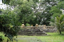
Right by the old gates of the former Kallang Airport, is a crumbling set of structures that pre-date the construction of Singapore’s first civil airport. With a little imagination, the sight of the rather mysterious looking structures could to transport the travel-starved observer to a place like Siem Reap. A closer inspection of the structures will however reveal that the crumbling walls belong not to an ancient temple … or for that matter anything like a palace or istana as recent suggestions have had it as, but to a raised burial plot.

The raised former burial plot, seen in August 2018.

The plot, which shared a boundary with the former Firestone Factory that was established in the 1920s (some may remember the former factory building on the banks of the Kallang River near Sir Arthur Bridge being used by electrical good and furniture retailer Courts in the 1990s), is marked in a 1930 survey map as a “Mohammedan Cemetery” and in a 1936 plan for the new Civil Aerodrome (i.e. Kallang Airport) quite simply as “graves”. An explanation as to why the graves were placed on a raised plot can be found in a 1939 letter to the Straits Times. The writer, who described its location to a tee in saying that an elevated plot of graves could be “seen just inside the entrance to the civil aerodrome, on the right”, recalled seeing them on small eyots or “patches of higher ground” in the mangrove swamp “before the place was reclaimed”. Reclamation work for the airport, it should be noted, was carried out in the 1930s.

The plot in January 2014, with the old airport gates in the background.

While there are no traces of the graves today — they were exhumed sometime in the late 1980s, there is still an item of physical evidence that still exists, if one looks for it along the base on which the structures rests. There, a tablet with inscriptions in the Tamil script can be found and that does in fact confirm that the site was indeed a burial plot — at least based on a translation provided by a local urban exploration group on Facebook in 2019. This translation dates the tablet to 1854, as a burial site for the “kith and kin” of Chinnakkani” — a descendant of “Hajji Ismail of Thiruvarur”.

The tablet seen in September 2018.
The plot in September 2018.
The plot shown in a 1930 survey map (NAS).
The plot shown in a 1936 plan for the aerodrome (NAS).


Discovering the former Kallang Airport (a repeat visit on 21 Sep 2019)

9 09 2019

A Discovering Singapore’s Best Kept Secrets visit organised with the support of the Singapore Land Authority (SLA).

Update : Registration is now closed as all spaces have been taken up.

More information on the series of State Property visits can be found at this link: Discovering Singapore’s Best Kept Secrets.


Constructed on land reclaimed from the swampy Kallang, Rochor and Geylang river estuary, Kallang Aerodrome impressed Amelia Earhart enough for her to describe it as being “the peer of any in the world” when she flew in just a week or so after the aerodrome opened.

As Singapore’s very first civil airport, Kallang was witness to several aviation milestones. This included the arrival of the very first jetliner to Singapore. The visit, which provides the opportunity to view the site through a guided walk and a short sharing of Singapore’s early aviation history, is supported by the Singapore Land Authority. There will also be the opportunity to have a look at and into the former airport’s lovely streamline-moderne former terminal building, and go up to its viewing deck and control tower.


When and where:

21 September 2019, 10 am to 11.30 am

9 Stadium Link, Singapore 397750

Registration:

Participants must be of ages 18 and above.

A unique registration is required for each participant (do note that duplicate registrations will count as one).

Registration shall be made using the form at this link (now closed).

A confirmation will be sent to the email address used in registration to all successful registrants one week prior to the visit. This email will confirm your place and also include instructions pertaining to the visit. Please ensure that the address entered on the form is correct.

The Streamline Moderne Terminal Building of the former Kallang Airport.


Discovering the former Kallang Airport

26 08 2019

A Discovering Singapore’s Best Kept Secrets visit organised with the support of the Singapore Land Authority (SLA).

Update :

The event is fully subscribed.

More information on the series of State Property visits can be found at this link: Discovering Singapore’s Best Kept Secrets.


Constructed on land reclaimed from the swampy Kallang, Rochor and Geylang river estuary, Kallang Aerodrome had the reputation of being “the peer of any in the world”. As Singapore’s very first civil airport, it bore witness to several of Singapore’s aviation milestones. The visit provides the opportunity to view the site through a guided walk and is supported by the Singapore Land Authority. Among the highlights will be a visit to the airport’s streamline-moderne former terminal building and its control tower.


When and where:

7 September 2019, 10 am to 11.30 am

9 Stadium Link, Singapore 397750

Registration:

Participants must be of ages 18 and above.

A unique registration is required for each participant (do note that duplicate registrations will count as one).

Registration shall be made using the form at this link (closed).

A confirmation will be sent to the email address used in registration to all successful registrants one week prior to the visit. This email will confirm your place and also include instructions pertaining to the visit. Please ensure that the address entered on the form is correct.

The Streamline Moderne Terminal Building of the former Kallang Airport.


The ghosts of Kallang’s past

12 05 2019

Like ghosts, a familiar pair of figures from Kallang’s past have made a reappearance. The pair, fibreglass replicas of the Merdeka Bridge Monument lions, were unveiled this afternoon at Stadium Roar as part of the launch of The Kallang Story, a Sports and Heritage Trail that uncovers many other aspects of the area’s rich and colourful history through 3 suggested walking routes featuring 18 heritage markers.

The unveiling of the replica lions at Stadium Roar at the National Stadium.

The lions, commissioned by the Public Works Department during the construction of the bridge, were designed based on sketches by Mr. L. W. Carpenter of its Architect’s Branch. The full design was completed by Signor Raoul Bigazzi (not by Cav. Rodolfo Nolli as has been widely reported), who had them made in Manila at a cost of $14,200.

The bridge, built at a cost of $8M, was touted as “the longest and largest of its type in South East Asia”. Its construction, along with that of Nicoll Highway was possible by the move of the civil airport from Kallang to Paya Lebar in 1955. The proposal to name the bridge “Merdeka” or “Independence” was made in June 1956 by the then Minister of Works and Communications Mr Francis Thomas under the Lim Yew Hock administration, “to express the confidence and aspirations of the people”. This came after the first round of Merdeka talks for full self-government stalled and Singapore first Chief Minister, David Marshall, resigned. Some 60,000 people crossed the bridge at its opening on 17 August 1956 – at which Mr Lim Yew Hock referred to it as a “Symbol of Our Path to Freedom”.

The monument, was placed at each end of the bridge with a lion at its base. The monument and the lions were removed during the widening and conversion of the Nicoll Highway from a dual to a treble carriageway in 1966. The lions were initially placed at Kallang Park and are now display out of sight to most of us at SAFTI Military Institute.


Will the (Kallang) roar now return?


A Wushu display during the unveiling of the replica lions.


The Royal Singapore Flying Club at Kallang

20 01 2015

It isn’t only a playable surface, the tolerance that both players and spectators had for the rain, and the roar that has been lost with the building of the new National Stadium at Kallang.

The Royal SIngapore Flying Club's clubhouse at the Kallang Civil Aerodrome in 1937.

The Royal SIngapore Flying Club’s clubhouse at the Kallang Civil Aerodrome in 1937.

Several structures around the old stadium, with their own links to the area’s history, have also been lost with the old stadium’s demolition, on of which was a little building that had been home to what had then been the “only flying club in the Empire to have received a royal charter”.

The new stadium with the silhouette of a dragon boat team in the Kallang Basin seen at sunrise.

The new National Stadium seen at sunrise.

The building’s life began in 1937, serving as a clubhouse that was also the headquarters of the Royal Singapore Flying Club. The move of the club, which was established in 1928 and counted many prominent figures of the community among its members, from its previous premises in Trafalgar Street to Kallang coincided with the opening of the new Civil Aerodrome, and allowed the club to expand its range of activities.

The building seen in 2009.

The side of the building, as seen in 2009.

A Straits Times article dated 12 June 1937 describes the building at its opening:

The new headquarters of the flying club are conveniently located between the terminal building and the slipway of the seaplane anchorage. The building is of reinforced concrete throughout and is carried on precast piling. Accommodation is provided on the ground floor for offices and dressing rooms with the principal rooms to be found on the upper floor. 

The club room is approximately 50 feet by 18 feet. A kitchen and bar are provided and a committee room is at the rear over the carriage porch. The club room opens to an uncovered balcony through large collapsible doors which will enable members to sit inside under cover if necessary and yet have a clear view of the landing ground.

The main staircase is continued from the upper floor to the flat roof, which commands a fine view over the aerodrome and seaplane anchorage.

The front of the building in 2009 with the balcony and an expanded third floor.

The front of the building in 2009 with the balcony and an expanded third floor.

Together with a hangar for seaplanes, it served the flying club for some 20 years. The move of the civil airport in 1955, prompted the club’s own move to Paya Lebar, which was completed in 1957. The clubhouse building was to survive for another 53 years. The construction of Nicoll Highway that the move of the airport allowed, cut it off from the cluster of aviation related structures close to the former airport’s terminal building, isolating it on a narrow wedge of land lying in the highway’s shadow.

The back of the building.

The back of the building.

With the conversation of what became Kallang Park for sports use that came with the building of the old stadium in 1973, the former flying club’s HQ came under the Singapore Sports Council and was last used, on the basis of the signs left behind, as a “sports garden”. Abandoned in its latter years, it lay forgotten, wearing the appearance of a well worn and discarded building.

The building's windows seen through a fence.

The building’s windows seen through a fence.

Demolished in late 2010, its site now lies buried under a road – close to the roundabout at the OCBC Acquatic Centre. And, while the club, which since became the Republic of Singapore Flying Club (in 1967), has not necessarily been forgotten; its association with Kallang, and the role the location played as a springboard for the expansion of recreational aviation, must surely have been.


Not quite the roar, but the new Kallang’s rocking

19 08 2014

Try as he might the stadium announcer at Saturday’s Singapore Selection versus Juventus football match couldn’t quite coax the crowd into reaching the decibel levels of the long unheard Kallang Roar. The roar, named after the thunderous noise of cheering supporters literally rocking the stsaium’s structure in days when the original National or Kallang Stadium was packed to capacity in playing host to Malaysia Cup matches (it would be packed with as many as 70,000 fans during its early years, before that was reduced to 55,000). Much feared by Singapore’s footballing opponents, much was made of it as the twelfth man in the many games Singapore played against the Malaysian State teams in the competition.

The impressive roof, a section of the crowd, and a view of the colours of the sunset.

The impressive roof, a section of the crowd, and a view of the colours of the sunset.

The new stadium with the silhouette of a dragon boat team in the Kallang Basin seen at sunrise.

The new stadium, seen at sunrise, just at the time of its completion.

The purr was, I guess, to have been expected. It is early days yet with the first football match being played a non-competitive one with terraces half-filled. And while the brand new stadium may have lacked the atmosphere of the old and the pitch showing obvious signs of not being completely play-worthy, it does impress, not just from a perspective of its architecture, but also in many areas that matters to the spectator – especially so the ventilation system and the seating.

There were obvious signs of bare sandy patches on the pitch.

There were obvious signs of bare sandy patches on the pitch.

Whether the roar will return is left to be seen. This we may have a sense of in a few months when Singapore co-hosts the Asean Football Federation (AFF) Suzuki Cup in November. What then is heard during matches involving the Singapore team, will perhaps serve a more accurate barometer of whether with the new stadium, the Kallang Roar will make its return.

Despite the goalkeeper's acrobatics, the Singapore Selection let in five goals without reply.

Despite the goalkeeper’s acrobatics, the Singapore Selection let in five goals without reply.

First match, first casualty ...

First match, first casualty …

Adoring Juve fans ...

Adoring Juve fans …

And the man they came to see, Andrea Pirlo.

And the man they came to see, Andrea Pirlo.

Numero cinque going in.

Numero cinque going in.


An oasis recreated?

8 07 2014

It is good to see that the long overdue Singapore Sports Hub has finally been completed. However, having been built over a part of Singapore that does hold many of my most memorable childhood experiences, seeing the new world complete with the seemingly indispensable shopping mall come up in place of a once familiar gentler world that existed, bring with it a tinge of sadness.

The new National Stadium seen from its south end, looking as if it is about to roar.

The new National Stadium seen from its south end, looking as if it is about to roar.

Reflections on Kallang Basin at dawn - the area where the once iconic Oasis was has since been transformed.

Reflections on Kallang Basin at dawn – the area where the once iconic Oasis was has since been transformed.

I liked that old Kallang, or properly Kallang Park, part of the area where the Sports Hub now stands. That was the Kallang that was shaped by the developments of the late 1960s and early 1970s that were not just to provide Singapore with the highs and lows that the old National Stadium in playing host to Malaysia Cup matches brought, but also a different set of highs-and-lows that the lion-headed roller coaster of the old-fashioned Wonderland Amusement Park did give to many of the younger folks of the era.

The National Stadium provided the setting for a football match in 1974 that left a lasting impression on me.

The odl National Stadium, which provided the setting for a football match in 1974 that left a lasting impression on me.

Beyond the stadium and the place that brought much joy to the children of the 1970s, it was a place where one could take a leisurely stroll by the waters of the Kallang Basin and perhaps watch the setting sun painted a scene made interesting by the silhouettes of boat against reflections off waters that might have been less than welcoming to the recreational boaters we see a multitude of in the Kallang Basin of today.

The new stadium with the silhouette of a dragon boat team in the Kallang Basin seen at sunrise.

The new stadium with the silhouettes of a dragon boat team at practice in the Kallang Basin seen at sunrise.

There was of course the places to dine at – the Oasis Restaurant complex, with its immediately recognisable octogonal shaped pods over the waters of the basin, having once being a popular dining and entertainment destination. Besides the Oasis, the fast-food craze of the 1970s brought with the arrival of fast-food outlets to Kallang Park, with A&W setting up a drive-in restaurant in September 1978. The opening of restaurant would best be remembered for a famous personality who was well-known from his appearances at the nearby stadium, footballer Quah Kim Song, making an appearance.

What used to be the Oasis over the Kallang Basin.

The pods of the once familiar Oasis over the Kallang Basin.

Over the years, we have seen McDonald’s and KFC being set up in the area with a UK based Fish and Chips chain, Harry Ramsden’s opening an outlet in the early 1990s. Over the years – the fast-food outlets have become a popular place for those heading to or from the stadium for a quick and convenient meal.

Another look at the waterfront around where the Oasis once was.

Another look at the area by the waterfront around where the Oasis once was.

The interactions I had with the area also include an episode in my life connected to a well forgotten industrial past, when shipyards lined the banks of the foul-smelling Geylang River on the area’s south-eastern fringe. That was in the 1980s, when I did see the last of Wonderland before it disappeared as many things do – having to make way in 1988 for a huge open-air car park meant to serve Kallang Indoor Stadium.

And another...

And another…

Kallang will of course never now be the same again. Apart from few industrial buildings from the era that have been put to alternative use and a couple of fast-food outlets, there is little left to remind me of a time that now seems so distant. While the much needed new stadium and the associated sporting facilities is much welcomed – I have made use of the competition pool at the OCBC Aquatic Centre and it is fabulous, it will never be the same again, especially without the Kallang Roar, when the old stadium became a cauldron of the collection of noise made by the crowd cheering, clapping and even stamping  that had its structure literally shaking.

An iPhone taken pano of the competition pool at the OCBC Aquatic Centre.

An iPhone taken pano of the competition pool at the OCBC Aquatic Centre (click to enlarge).

The roar had been what our Malaysia Cup opponents had feared most in playing at the old stadium. That, having long fallen silent with the days of the Malaysia Cup, as we knew it, well behind us, would probably never return.


At the end of the storm, there’s a golden sky …

19 06 2014

7.01 am, 18 June 2014. The new National Stadium at Kallang, set to host its first event this weekend, is seen against the colours of the new day breaking through on a storm tossed morning.

JeromeLim-4266


Dawn of the new Kallang

10 06 2014

A view of the soon to be opened new National Stadium from across the Kallang River at dawn – the dawn perhaps of a new “Kallang Roar”. The stadium, part of the newly redeveloped Singapore Sports Hub, is a long overdue replacement for the much-loved old National Stadium, which came down in 2010. The old stadium, was where the much feared “Kallang Roar” was born in, the collective noise that was heard from the cheers, chants and stamping of feet when as much as 70,000 packed the stadium during the days of the Malaysia Cup.  The stadium, which features a retractable roof, will open its doors on the weekend of 21/22 June when it hosts its first event, the World Cup 10s Rugby.

JeromeLim-3502s


Windows into Singapore: juxtapositions of time

27 03 2014

A view out of the window from the POD atop the National Library building, out towards what would once have been an almost clear view of the sea off the promenade that ran along Nicoll Highway.

JeromeLim 277A2967

Part of what has been a landmark along Beach Road since its completion in 1976, Shaw Towers, can be seen on the right of the photograph. Built over a site that had previously been occupied by the Alhambra and Marborough cinemas, the 35 floor Shaw Towers was at the point of its completion, the tallest kid on the block at Beach Road. It was also the first building in Singapore to house two cinemas, Prince and Jade, built in a decade when cinema going took-off in Singapore. Prince was at its opening, the largest cinema in Singapore with its 1952 seats. Prince occupied the second to the seventh floors of one corner of the building’s podium. Its screen, at 28 metres wide, was the widest in the Far East. Jade was to provide a more intimate setting, holding less than half the crowd Prince would have held. The cinemas were converted in the late 1980s to cineplexes – the first multi-screen cinemas to make an appearance in Singapore.

A close up of the boats in the Kallang Basin close to Nicoll Highway (posted in Facebook group, On a Little Street in Singapore).

Nicoll Highway, Singapore’s first highway, did once run along the coast right behind Shaw Towers. Completed in 1956 – after the closure of Kallang Airport permitted a much needed link to be built along the coast, it provided an artery to take vehicular traffic from and to the populated eastern coast into and out of the city. Offering a view of the sea and the scatter of boats up to the early 1970s,  a drive today provides a view of a scattering of trees and isolated structures that herald the arrival of a brand new world – where the wooded patch is in the foreground of the first photograph.

Nicoll Highway, the Merdeka Bridge, Beach Road and the Kallang Basin, 1967 – before the 1970s land reclamation (posted in Facebook group, On a Little Street in Singapore).

A view down Nicoll Highway. A new development South Beach is seen rising beyond Shaw Tower.

A view down Nicoll Highway. A new development South Beach is seen rising beyond Shaw Towers.

Another view down Nicoll Highway during peak hour.

Another view down Nicoll Highway during peak hour.

The body of water beyond which we can see the Benjamin Sheares Bridge rising, is itself one that has seen a significant change. Where it once was the sea, it now is a body of fresh water, forming a part of the huge Marina Reservoir, having been cut-off from the sea by land reclamation and the construction of the Marina Barrage. The barrage, closes up the channel between Marina East and Marina South, Marina East being land reclaimed off Tanjong Rhu, a cape once referred to as a “curious ridge of sand” on which shipyards, the charcoal trade and a flour mill had once featured.

An advertisement for Khong Guan Flour Mills. The grain storage silos once dominated a landscape at Tanjong Rhu now dominated by condominiums.

An advertisement for Khong Guan Flour Mills. The grain storage silos once dominated a landscape at Tanjong Rhu now dominated by condominiums.

A more recent landmark on Beach Road, the 41-storey The Concourse and a view toward Tanjong Rhu beyond it.

A more recent landmark on Beach Road, the 41-storey The Concourse and a view toward Tanjong Rhu beyond it.

Reclaimed land by Nicoll Highway, the Kallang Basin area of Marina Reservoir and Tanjong Rhu beyond it.

Reclaimed land by Nicoll Highway, the Kallang Basin area of Marina Reservoir and the Marina South area beyond it.

It is at Tanjong Rhu, where Singapore first million-dollar condominium units were sold, that the eastern end of the iconic 1.8 km long Benjamin Sheares Bridge comes down to earth. Opened to traffic on 26 September 1981, it provided the final link for a coastal highway that had been built to take traffic around and not through the city centre, the planning for which went back to the end of the 1960s (see The Making of Marina Bay).

Land reclamation in the Kallang Basin / Tanjong Rhu area in 1973 (posted in Facebook group On a Little Street in Singapore).

This stretch of that coastal highway, East Coast Parkway (ECP), did take up much of the traffic that was being carried on what was becoming an increasingly congested Nicoll Highway that had been built some 25 years before it. Now, some 32 years later, as with the highway it took traffic away from, it sees its role taken up in a similar fashion by a new highway, the Marina Coastal Expressway (MCE). Built at the cost of S$4.3-billion, the 5 kilometre MCE runs mostly underground and partly under the sea and see the series of coastal highways move with the shifting of the coastline. The MCE features a 3.6 km tunnel and has a 420 metre stretch that runs under the sea.

Tanjong Rhu and the Benjamin Sheares Bridge.

Tanjong Rhu and the Benjamin Sheares Bridge.

The expressway, which opened to traffic on 29 December 2013, was built so as to remove the constraints that the ECP, in running right smack through the centre of Marina South, had placed on the development of Singapore’s new downtown (the expansion of the city to Marina South that was really an afterthought, having come after urban planners had realised the potential that land, which had initially been reclaimed for the construction of the ECP, had in providing much needed space for the expansion of the city). The availability of new and undeveloped land through reclamation did allow parts of old Singapore slated for redevelopment, to be spared the wreckers’ ball.

A view over the Marina Reservoir and Marina East, with the Benjamin Sheares Bridge seen to the left of the capsule.

A view over the Marina Reservoir and Marina East, with the Benjamin Sheares Bridge seen to the left of the capsule.

The deceptively blue waters in the first photograph’s background, is that of the Eastern Anchorage. It is at the anchorage that ships lie patiently in wait, far removed from the frenzy at the wharves of what is one of the world’s busiest ports. It is one place in Singapore where time does seem to stand very still, at least for now. Time doesn’t of course seem to stand very still in a Singapore constantly on the move, and time will certainly bring change to shape of the distribution of the shipping infrastructure along the coast- with the journey to west for the city shipping terminals, at Keppel, Pulau Brani and Tanjong Pagar, due to completed by 2030.

The Eastern Anchorage.

The Eastern Anchorage – where time does seem to stand still.

There is of course the potential that developments away from Singapore has for influencing change. One possible game-changing development we in Singapore are keeping our eyes on is the possibility that of a dream long held by Thailand, the cutting of a shipping canal through the Isthmus of Kra, coming true. If a recent report, purportedly from the Chinese media, is to be believed, work is already starting. The cutting of the so-called Kra Canal is an idea that was first mooted back in the late 17th Century (see: How a Thai Canal Could Transform Southeast Asia on http://thediplomat.com) and talk of building it does crop up from time to time – the effort required and the associated costs in recent times serving as a huge deterrent. If built, the canal would save shipping a 1,500 nautical mile journey through the Straits of Malacca and around Singapore.

The proposed canal does have the potential to undermine Singapore’s so far unchallenged strategic position with regards to shipping, although it would probably take a lot more than a canal to do that. In the meantime, it is the change that is driven within that we will see add to another area in Singapore in which change does seem to always be a constant.


Changing Landscapes: The end of the roadway

29 01 2014

One of the remnants of Singapore’s first civil airport at Kallang, a dual carriageway roadway lined with reminders of a time that has been forgotten, is no more. The roadway, left behind perhaps as a reminder of lead-in and exit to and from the airport for over half a century after the airport ceased operations in 1955, seems now itself one Singapore wishes to forget. It is now cut-off from vehicular traffic that in times more recent, would have used it as an access to or from the National Stadium or Nicoll Highway, with a larger capacity and more direct road having been built to take traffic to the new National Stadium and the Singapore Sports Hub which is scheduled to be completed in May 2014.

The wonderful cover of trees over the old road.

The wonderful cover of trees over the old road.

The former entrance pillars to Singapore's first civil airport.

The former entrance pillars to Singapore’s first civil airport.

The now closed roadway seen today.

The now closed roadway seen today.

Looking towards the former junction with Geylang Road.

Looking towards the former junction with Geylang Road.

The roadway at the airport's opening in 1937 (source: http://archivesonline.nas.sg/).

The roadway to the airport in 1945 (source: http://archivesonline.nas.sg/).


Monoscapes: Death of a National icon

16 04 2013

6.56 pm on 8 February 2011. Descending storm clouds cast a pall of gloom over the last pieces standing of the National Stadium, the demolition of which was completed in the same month. Built at Kallang Park on a reclaimed plot of land which had once been used for Singapore’s first international civil airport, the stadium which was to become a National icon was completed in 1973. It was the year Singapore hosted its very first major international mass sporting event, the 7th South-East Asian Peninsula (SEAP) Games. The stadium also went on to be used as a home ground for the widely supported Singapore football team in the Malaysia Cup competition, packing as many as 70,000 spectators (its capacity was to later be capped at 55,000) and acquiring a fearsome reputation as the home of the “Kallang Roar”.

IMG_5520

Going the way of several other National icons from a less extravagant era in our history, its place will be taken by a new stadium which is being built as part of the new Singapore Sports Hub. The new stadium is scheduled to be completed in 2014.


The curious ridge of sand which runs from Katong to Kallang Bay

25 11 2012

Taking a walk by the waterfront by the Singapore Indoor Stadium these days, it would be hard to imagine a time not so long ago when looking across to Tanjong Rhu, a very different scene would have greeted one’s eyes. Where million dollar condominium units housed in cream coloured blocks now dominate the view across, the scene a quarter of a century ago would have been one of wooden boats, wooden jetties, slipways and drab looking structures running along a body of water the surface of which would have been littered not just by rubbish that had found its way into the three rivers that flowed into the basin, but also by carcasses of dead animals that floated down from the many farms that has once been located upstream.

Tanjong Rhu (left), seen across the Kallang Basin today.

Tanjong Rhu translates from Malay into the Cape of Casuarina (Trees). Once described as a “curious ridge of sand which runs across from Katong to Kallang Bay”, its tip, known as “Sandy Point” has had a long association with the boat building and repair trade, having been an area designated for the trade by Sir Stamford Raffles as far back as 1822, with Captain Flint being the first to set a company to do that in the same year. By the 1850s, the trade was already well established around Sandy Point and the trade continued to thrive in the area even after the first graving dock was constructed in New Harbour (Keppel Harbour) in 1859. Over the years, among the business that found their way to Sandy Point were the well established names such as British boatbuilder John I. Thornycroft which set up in 1926 and United Engineers – which had a longer history. Thornycroft became Vosper Thornycroft in 1967 following the 1966 merger of the parent company with Vosper Limited in the UK. Vosper Thornycroft’s Singapore operations in turn merged with United Engineer’s in 1967. The yard unfortunately got into financial difficulties due to the mid 1980s recession and went into voluntary liquidation in early 1986.

The end of Tanjong Rhu was home to several shipyards including Vosper Thornycroft (seen here), the parent company of which is an established builder of Naval craft in the UK and Singapore Slipway (which became Keppel Singmarine), established as far back as 1887.

A slipway of a boatyard on the Geylang River

A well established organisation involved in shipbuilding still around that can trace its history to Sandy Point is the newbulding arm of Keppel Corporation, Keppel Singmarine. The subsidiary of what is now Keppel Offshore and Marine is a merger of Singmarine and Singapore Slipway. It was Singapore Slipway that had been established at Sandy Point in 1887 when a group of merchants bought William Heard and partner Campbell Heard and Co’s slipway which was set up earlier in the decade and formed the Slipway and Engineering Company. Keppel Singmarine’s yard operated at Tanjong Rhu until the early 1990s.

A boat littered Kallang Basin in 1973 at the time of the completion of the National Stadium (Singapore Sports Council Photo). Land reclamation along the Nicoll Highway promenade can be clearly seen.

Besides the shipyards, another area of Tanjong Rhu a short distance away from its tip that wasn’t very pretty was at the area known as Kampong Arang. That had been an area that was dominated by wooden jetties, used by charcoal traders to offload charcoal from tongkangs (wooden lighters) coming in from Indonesia and Thailand. The charcoal trade was established in the area in 1954 when charcoal traders were uprooted from the waterfront along the reclaimed land south of Beach Road to allow for the construction of Merdeka Bridge and the Nicoll Highway. The once thriving charcoal trade operated at Tanjong Rhu up until January 1987 when the trade was already in decline. At its height in the late 1950s, as many as 300 tongkangs plied between the two countries and Tanjong Rhu, falling to 60 by the time the 1970s had arrived when demand fell as many households had by then already switched to using gas and electric stoves. The traders were relocated to Lorong Halus (only 15 of the 40 that operated at Tanjong Rhu continued at Lorong Halus with demand mainly from the reexport of charcoal than from the local market) in early 1987 at the tail end of the decade long Kallang Basin cleanup efforts.

Another view of Kallang Basin and Tanjong Rhu today.

Beyond the cleanup efforts, the face of Tanjong Rhu has also been altered by the land reclamation south of the cape which has increased its land mass. The land reclamation, started in the early 1970s, was originally intended to allow for the construction of the East Coast Parkway and was further expanded to give the area now referred to as Marina East – at the tip of which the Marina Barrage now closes the channel between it and Marina South which has turned Marina Bay and the Kallang Basin into a huge reserve of a much needed resource, fresh water. The shifting out of the trades from the area were complete by the time the mid 1990s had arrived and allowed much of the northern waterfront area of Tanjong Rhu to be developed into a residential area and the basin into a recreational area that it is today.

[see also: Where slipways once lined the muddy banks of the Geylang River: Jalan Benaan Kapal]


Taking flight from Old Kallang Airport

5 04 2011

No, it wasn’t flights of fancy that one might associate with the idealistic pursuit of expression that artists are sometimes inclined to have that took off from what was Singapore’s first civil airport, Old Kallang Airport. The former airport, still with us in the form of its iconic terminal building and control tower, along with a few auxiliary buildings around it, isn’t of course capable of hosting flying machines – something that we have not seen in the shadows of the simple terminal building for over half a century, with its runway and much of the land it occupied given to other uses.

The light is shinning on Old Kallnag Airport for the Singapore Biennale 2011.

One that certainly did not take to the skies .... parked where a flying machine might have been seen over half a century ago.

It wasn't just the flying of an imaginary flag up a flag pole that Old Kallang Airport saw on Sunday.

What did take off from the old airport were some of the simpler pursuits we once indulged in during our childhoods, something that both young and old were able to participate in – the flying of simple light paper and bamboo framed kites. It was a simple yet brilliant idea that provided a welcome distraction to many of the younger and otherwise bored visitors at Singapore Biennale Open House, which hasn’t really taken Singapore by storm as it should really have done. The kite flying was part of the craft activities that reached out to the young that included terrarium making, badge making, and paper aeroplane making. Children were allowed to decorate their own kites, have tails fixed on, and with a kite string on a small reel, the kites were ready to go.

The lack of a runway did not deter flights from taking off from Kallang Airport.

A child running with a kite ...

Even the older "kids" had a ball of a time.

Flights from Kallang Airport ...

A kite seen through a dangling cable.

The activities are all part of the Beinnale’s Family Day Out aimed at reaching out to members of the public offering not just a host of activities, but also free admission to all venues on Sundays and Public Holidays in April and May right up to the Beinnale’s last day on 15 May. For more information on the activities and the Family Day Out, do visit the Singapore Biennale 2011’s website at this link.

Despite the manifesto for bad music ....

... there was some good music in store for visitors to Old Kallang Airport with an enjoyable performance by Ling Kai.


Reflections on Old Kallang Airport (Singapore Biennale 2011)

18 03 2011

[Do note that if you are planning a visit to the Biennale at Old Kallang Airport, the entrance is at Stadium Link, off Geylang Road, a short walk away from Kallang MRT Station. A link to a Google Map with the specific location of the entrance can be found at the end of this post].


Glancing at the headline of yesterday’s article on page 2 of the Life section of the Straits Times, which read “Biennale’s Kallang site not ideal. Visitors say that Old Kallang Airport, one of four venues for the art event, is difficult to get to and very stuffy”, and the lack of interest that is apparent at the venue so far with the exception of Saturday’s Open House Opening Party, one certainly can’t help but have a feeling that the choice of the site of the Singapore’s first civil airport, Old Kallang Airport, wasn’t a good one. I for one, did not mind the absence of a crowd, as that provided me with an opportunity to explore the marked historic site at leisure taking in as much as I could, grateful for the opportunity to explore buildings that I had previously only glanced at from behind a fence. In walking around, I couldn’t help but feel that it was a brilliant idea to do so, not just from the perspective of providing the public access to what had for long otherwise been a closed-off site, but also that the site was ideal for such an event, providing the spatial requirements required that does not exist in the confines of the museum buildings and sites in the city centre. Yes, maybe the site does seem a world away from the convenience of the city, but it isn’t really too far away and readily accessible via public transport, with the Kallang MRT station being a short enough walk away from the entrance to the site. Perhaps what is lacking isn’t the convenience that some have voiced their opinions about, but the information that the public needs to know.

The sign at the entrance of Old Kallang Airport.

The entrance of Old Kallang Airport.

I guess I am one for old places, especially the few that reamin that I can identify in some way from the childhood I had in a Singapore time has erased. The distinctive terminal building of the old airport with its control tower, which by the time I arrived in the world, was used by the People’s Association (PA) as its headquarters, had always been one that I had associated with Kallang and the Nicoll Highway, rising on the left of the east bound carriageway of Singapore’s first highway built after the airport had ceased operations. That would be the approach to the old Guillemard Circus and the wonderful neon signs that I somehow associate with the roundabout. There were many times that I had passed the building on foot as well, cutting on the side of it through from Kallang Road on the way to the National Stadium to catch a match or in the two months that I would have walked by on an almost daily basis on the way to Jalan Bennan Kapal. The tower adorned with the rings of the PA’s logo, had always caught my eye, rising somewhat defiantly and proudly to remind us of its past as Singapore’s first civil airport all those years back.

The distinctive terminal building which is a landmark in the area.

Another view of the terminal building.

The entrance gate to the terminal building.

Perhaps the inspiration for this set of photographs ... a work on display in the terminal building.

The reminders of its previous role had been everywhere, with names such as “Old Airport Road” and Dakota Crescent around. So even with me not having seen it used as an airport, I had been aware of it since I could remember … The airport had I was to discover, was built as an airfield on the site of land reclaimed from the swampy Kallang Basin in 1937 at the cost of S$9 million. It was opened very grandly by the then Govenor of Singapore, Sir Shenton Thomas, who flew in from Seletar for the occasion with some 70 aircraft there to mark the occasion. The location next to the Kallang Basin proved useful as it also allowed seaplanes to land. It was used by the Japanese who built a paved runway during the occupation, and refurbished by the British on their return. And although there were plans to expand and upgrade the airport the the end of the 1940s and early 1950s, it was thought that effort involved would prove too costly and Kallang was abandoned for a new inetrnational airport at Paya Lebar. Paya Lebar started operations in 1955 and that saw the last of Kallang as a civil airport, with the PA moving into the site in 1960. On the evidence of old photographs, the hangars were used by the Public Works Department (PWD) after the airport closed. The bulk of the location of the main runway was then transformed into Kallang Park one which the Oasis Restaurant, Wonderland Amusement Park and later the National Stadium, Indoor Stadium and Kallang Leisuredrome was built.

The main hangar next to the West Block.

The West Block and the main hangar off the window of the terminal building.

A smaller hangar, once used as a second hand car showroom.

An auxiliary building.

Another view of the smaller hangar.

It was certainly nice to walk around the old site and reflect on this, and hence the theme of this post … much of the old airport grounds that are left have been left in not so much its original state, but in a state that perhaps the PA had left them in – which I thought wonderfully complemented the exhibits. That also meant a lot of the wear and tear was evident from not just the use of the buildings by the PA, but the hangars by used car dealers at some point in time – I remember seeing them still at the end of the 1990s passing by after a concert at the Indoor Stadium. That provided me with an alternative view of the buildings – reflected off puddles of water and off windows and mirrors. I certainly did not get enough of it on the two occasions that I visited and I will certainly return for more.

A Toast Box cafe set up in one of the smaller hangars.

The side of a hangar.

The roof of the smaller hangar.

The main hangar.
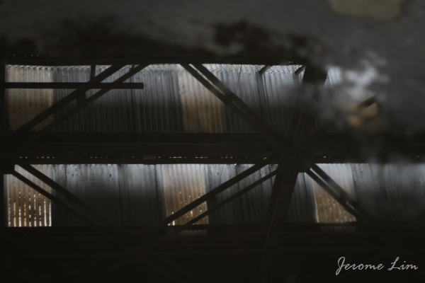
Ventilation openings on the side of the main hangar.

The inside of the main hangar.

Roof of the main hangar.

Windows on the side of the main hangar.

Windows on the side of the main hangar.

Some of the auxiliary buildings on the premises - I understand that these were used by the Singapore Chinese Orchestra in the 1990s.

A newer auxiliary building ... perhaps added in the 1950s as an expanded air traffic control centre.

A peek under a marquee.

Another view of the terminal building and an auxiliary building.

A reflection of the East Block on a mirror mounted on an auxiliary building.

A last look ....

This slideshow requires JavaScript.


What’s to become of Old Kallang Airport? Thankfully, we should see that it is conserved for our future generations – it would be nice to see it turned into some kind of aviation museum though:

URA Letter to the Strait Times, 5 Mar 2010

URA has plans for old Kallang Airport site

I THANK Mr Edwin Pang for his Forum Online letter last Friday, 'Turn site into civil aviation heritage centre'.

The former Kallang Airport is located within Kallang Riverside, which is envisioned to be a new lifestyle hub at the fringe of the city area under the Urban Redevelopment Authority's (URA) 2008 Master Plan.

The former Kallang Airport passenger terminal building with its distinctive art deco structure, as well as the office buildings, former hangar, Old Airport Square and other historical structures, was designated a heritage area and conserved in 2008 to preserve memories while allowing for a new lease of life.

In future, they will be adapted to new uses as part of a future development centred on the conserved Old Airport Square, offering a wide range of lifestyle, entertainment and retail facilities.

In January, the Singapore Biennale committee announced that it was considering the former Kallang Airport as a venue for the festival next year. URA and the Singapore Land Authority are glad that the artistic community has found heritage buildings to be suitable venues for contemporary art events. Past editions of the Biennale were also held in heritage environments.

The synergy between heritage buildings and contemporary arts is useful in bringing the awareness of our conservation buildings to the wider public and helps to endear our heritage buildings to Singaporeans.

Hwang Yu-Ning (Ms)
Group Director (Physical Planning)
Urban Redevelopment Authority


Getting to Old Kallang Airport:

The entrance to Old Kallang Airport is located at Stadium Link, off Geylang Road and is a ten minute walk from Kallang MRT Station. Please click on this link for the specific location.


The last stand …

15 02 2011

After dominating the Kallang skyline for some 37 years, and some five months after heavy equipment was moved in and four months after demolition work started, we have seen the last of the Grand Old Lady. As of today, all that is left is a pile of twisted steel and broken concrete which supported as many as 70,000 in the days when the Kallang Roar had been in its infancy. We can now look forward to what promises to a new and exciting Sports Hub which will include new facilities such as a new 55,000 capacity National Stadium with a retractable roof, a 6,000 capacity indoor Aquatic Centre, a 3,000 capacity multi-purpose arena, and a Water Sports Centre, as well as integrate the existing Kallang Indoor Stadium into the complex.

The sun sets on the former National Stadium (8 Feb 2011).

The final trio (10 Feb 2011).

Blocks 1, 2, and 3: the last to go ...

A heap of twisted steel and broken concrete is all that is left (15 Feb 2011).

A crane stands triumphantly over the defeated mess of steel and concrete.

Two new icons of Singapore waiting to be joined by another.

The phoenix that will rise out of the ashes - the Sports Hub is scheduled to be completed in April 2014.


The anatomy of an industrial estate

1 02 2011

These days, industrial estates are very much a feature of Singapore’s landscape outside the city as much as the HDB public housing estates are. Many would not bat an eyelid at the clusters of uninspired high-rise industrial buildings that dot the landscape. Built to house light industries, these high-rise factory buildings, referred to as flatted factories, were “imported” to Singapore at the time of the rapid industrialisation programme of the 1960s.

JeromeLim-2537-2

Singapore’s very first flatted factory (right) at Commonwealth Drive.

Prior to the building of the first flatted factories, light industries such as metal working, shoe making, textiles and paper products manufacturing, had been accommodated in a mix of low rise units. Many operated out of pre-war shophouses or makeshift wooden and zinc -factories – some of which may have been squatting on state land.

Redevelopment, as well as the pressing need to develop new factory space for light industries to fuel growth, saw Singapore look towards Hong Kong, where the mainstay of the economy had been its small manufacturers. The building of multi-storey factory buildings, which provide large amounts of inexpensive factory space close to its urban centre – close to its source of labour and also where there was easy access to transportation, had proven a great success.

High rise industrial buildings, very much part of the landscape of today’s Singapore, were introduced in the 1960s. The idea was borrowed from Hong Kong, which pioneered the provision of low cost factory units housed in multi-storey buildings for the small enterprises that were a mainstay of its economy.

A pilot programme initiated by the Economic Development Board, gave us the first flatted factory buildings in 1966. Built at Tanglin Halt, Bendeemer, Kallang and Kampong Ampat, space in the five-storey flatted factory blocks were quickly taken up and many more were built.

This success also led to private investment in flatted factories. Along with those built by that were built by the Jurong Town Corporation (JTC), there were also many privately developed multi-storey factory blocks that have cropped up all over Singapore over the years.

The first flatted factories were rarely over 5 stories high and built without lifts, these days, they are typically higher.

Along with those built within the boundaries of public housing estates such as Queenstown and Toa Payoh, large clusters of flatted factories also came up in light industrial estates. One such estate is the Kolam Ayer Industrial Park, which features a rather interesting mix of private and JTC built flatted factory buildings.

The industrial park, is perhaps best known for the names of its roads. Some such as Tannery Lane, shed some light on the industrial  history of the area. There are others that have puzzling origins – such as one with the strangest of names, Kallang Pudding Road.

It is suggested that the pudding in the name originates from the pokok puding, Malay for the croton plant – a commonly seen shrub with variegated leaves. A road that served as a “shortcut” for my parents on their drives back from the Kallang area to Toa Payoh, where we lived, in my younger days; my overactive imagination had it as being a reference to the pudding I thought the swamp that once occupied the area had been.

The name of the area, Kolam Ayer, which was at the confluence of the Kallang and Whampoa Rivers, alludes to it having been a body of water (it means a basin, pond or pool of water in Malay). Old maps show it as a huge tidal swamp – part of a much bigger Kallang Basin than the one we know today and one around which industries such as sawmills thrived. The maps also show the municipal dump and an incinerator that operated in the area up until 1959.

A huge inland reclamation project in the area commenced at the end of 1961. Earth recovered from the major public housing project that was taking shape in Toa Payoh was apparently used. Carried out with the intention of transforming the basin, which covered a total area of some 405 hectares, into Singapore’s second industrial estate.

The first phase of the project was completed in 1969. At that point, some 3.8 million cubic metres of earth was used in filling up 154 hectares out of an area of 182 hectares that would have been submerged at high tide.

Kolam Ayer Industrial Park is a mix of private and government built flatted factory units and low rise light industrial building which was built on a site of a huge swamp at the confluence of the Kallang and Whampoa Rivers which was reclaimed in the 1960s using earth from Toa Payoh.

New buildings started coming up on the reclaimed land from the late 1970s , with the bulk, including those erected by the JTC, built in the early 1980s. The estate is probably one of the more interesting industrial areas to wander around. coloured by a mix of old and new factory buildings – some of which sit on seemingly small plots of land.

The mix provides a completely different feel to ones built at one go. It isn't the lack of uniformity or its regular warehouse sales where one can pick up a bargain or two that makes the estate interesting; if one looks hard enough, there are also some rather interesting culinary offerings that certainly will alter one's perception of what an industrial estate can be all about.

One of the flatted factory buildings which colour the Kolam Ayer Industrial Park.


Wonderland and the thrill of Bangkok

6 01 2011

I guess the school of thrills for me was the roller coaster of the wonderful Wonderland Amusement Park in Singapore, back in my wonderful childhood in the Singapore of the 1970s. Then, Wonderland was the world to me and the roller coaster was where I spent most of my time at whenever I succeeded in pestering my mother to take me there. Wonderland offered no end of fun, and besides the roller coaster, I could also remember the kiddie train that went round a track and the Ovaltine cups that span around – ones which could be made to spin faster by turning a wheel in the centre of the cup (which I did very often, much to my younger sister’s discomfort).

A photo in the National Archives collection of Wonderland under construction in 1969 (source: National Archives of Singapore's online catalogue).

A view of Wonderland in 1970 with the tracks of my favourite roller coaster (source: National Archives of Singapore's online catalogue).

The park had opened in 1969, just in time for me to have the many thrills and spills as I sought as a primary school boy. It was a time when interest in the “Worlds” of Singapore was waning and Singapore needed a new amusement park to bring fun to its children. The park, built on reclaimed land that had once been part of the old Kallang Airport, in its time hosted many corporate events as well, probably being one of the first places which saw family days being held in Singapore. It was a place that I enjoyed until I guess I outgrew the rides as I entered secondary school in the early 1980s and it was after this, in 1984, that an accident occurred in which planes fell off a merry-go-round injuring 16 people – the first accident in my memory what had been 15 years of accident free operation up to that point in time. I can’t quite remember when and what had shut the park, but based on newspaper archives, the park closed in 1988 to make way for the large open air carpark meant to serve the Kallang Indoor Stadium, a car park which is still with us today, bearing nothing to remind us of the good old amusement park.

The merry-go-round of planes which also a favourite. An accident in 1984 in which planes fell off resulted in 16 injuries (source: National Archives of Singapore's online catalogue).

The Ovaltine cups were evil!

News on the Indoor Stadium's opening in 1989.

By that time, my idea of thrills had evolved and looking for something more than what Wonderland offered, I was soon to find that in Bangkok. It was in the year of the accident (and around the time of it) that while in the Thai capital, I came to hear of a water themed amusement park (possibly the first water themed park in South-East Asia and one that featured a wave pool), some 20 kilometres outside of Bangkok, Siam Park. The park, which had opened some 4 years before, featured a looping roller-coaster, the Loop-the-Loop, something that had been unheard of in this part of the world. Without knowing a word of Thai, I bravely set out on the public transport system (being on a shoestring) that carried me over the dusty streets out of Bangkok, and there I soon was, staring in awe at what was in fact South-East Asia’s very first looping roller coaster.

South-East Asia's first looping roller coaster at Siam Park, outside Bangkok, in 1984.

My first ride wasn’t actually the best of experiences. Getting into the prime front row seat, I was soon locked in by the safety bar and looking forward to what was surely going to be the ride of my life. In all the excitement, I had somehow forgotten (as well as not being reminded by the staff on hand) to remove my glasses and was soon caught up in the anticipation of the ride as the roller coaster rode up on end of the rail and prepared for its descent. Down it quickly went amidst a chorus of screams, up the loop, as I braced myself for what would be my first heads-down roller coaster experience. That feeling that came with the moment the world turned upside down I still remember very well, with my heart feeling as if it had fallen out of my chest. The moment that happened, I felt my glasses falling as well, and that being something that I would have been at a lost without (being shortsighted and not having a spare pair on me), I shot my arms out, managing to somehow grab my glasses out of the air, relying perhaps on the reflexes that my early days playing football as a goalkeeper had developed in me. I had several more rides on the roller coaster, taking a break from it only to have the occasional dip in the wave pool, during which I made it a point to remove my glasses, and it was only at closing time that I made my way back into Bangkok, tired from the thrills and glad to have survived my first ever looping experience.


An Oasis lost

3 10 2010

With the news carried by the local print media on Thursday that the demolition of the National Stadium has started, there has been much focus on the stadium itself and how it would remain in the hearts of the many Singaporeans who have sat on its terraces since it was built for the 7th South East Asian Peninsula (SEAP) Games in 1973. Having been a landmark in the Kallang area for close to four decades, the area would probably look a little bare once the grey icon and its four floodlight towers makes an exit from the landscape off Nicoll Highway and Mountbatten Road.

The Today report on the start of demolition at the National Stadium on 30 Sep 2010.

Demolition work has began in earnest and access to roads in the vicinity of the stadium are now restricted (seen on 1 Oct 2010).

For me, the stadium always seemed an invariable part of the landscape in the Kallang area, one that stood firm despite the many changes that have overtaken the area around it since the days when it first dominated the area. Some of the sights familiar to me that had kept the stadium company in the earlier days of the stadium had since abandoned the Grand Old Lady. One of these was the bright and lively Guillemard Circus that I had always been fond of passing … with its colourful neon signs that transformed it into a wonderland of light at night – one that somehow I recall being dominated by the huge Knife Brand Cooking Oil advertisement. There was of course the old Wonderland Amusement Park that had my favourite ride – a roller coaster that I would persuade my parents to return to the park for time and time again – the Wonderland was in fact how I had first become acquainted with the area. Years later, I was to spend a short period of time at a shipyard on the banks of the Geylang River just by the area where the Wonderland was located, walking past the stadium from a bus stop in Kallang everyday to get to the area around Jalan Benaan Kapal which has since been transformed in a way that makes it had to imagine slipways lining what were dirty and muddy river banks.

The newly constructed stadium was the most modern in South East Asia and provided an ideal setting for the birth of the Kallang Roar. The stadium had stood as a landmark in the area since it opened in 1973.

The stadium being prepared for demolition on 28 Sep 2010.

I have had over the 37 years had a love affair with the Grand Old Lady, one that started in 1974 with the first leg of the Malaysia Cup semi-final match played between Singapore and Penang. It was where I had first watched a football match live … and became part of the frenzied atmosphere that accompanied the matches played in the stadium featuring Singapore which became known as the much Kallang Roar. In its heyday, as many as 70,000 pairs of feet would stamp on the terraces combined with 70,000 voices that gave the stadium that thunderous blare that put fear in many visiting teams at the stadium.

A reflection on an icon that will soon be a mirage ...

The stadium had often in its life been referred to as the “Lions’ Den”, not after the pair of stone Merdeka Lions that had once stood guard at the ends of the span of the Merdeka Bridge, being moved to stand guard at the area on which Stadium Boulevard had been constructed, but after the national football team which besides being referred to as the “Boys in Blue” – a reference to the sky blue jerseys they wore in the 1970s and 1980s, were also referred to as the “Lions”. The pair of lions also abandoned the stadium – sometime perhaps at the end of the 1980s.

One of the floodlight towers that dominated the Kallang landscape.

A lion watches sadly from across Nicoll Highway as the former Lions Den is being torn down.

Whilst there were many that abandoned the Grand Old Lady, there had been a few that managed to stay with it throughout its life. Among those that have kept the stadium company were the nearby Police Coast Guard (Marine Police) headquarters which moved to Pulau Brani with the construction of the Marina Barrage, and a somewhat forgotten icon of the area: the Oasis Restaurant complex. The Oasis would be going the way of the stadium as well, having stood where it was for some forty years. Indeed the Oasis had been as much of an icon in the Kallang Park area since it was opened in 1969 as the Oasis Theatre Restaurant, Cabaret and Nightclub. Comprising a three storey main building and three auxiliary buildings built on stilts extending out some 100 metres over the Kallang Basin, the complex was a popular night spot for many years. The octagonal shaped auxiliary buildings which housed restaurants provided the complex with its distinctive character which Singaporeans immediately identified with the complex and provided a unique dining experience for many were completed in 1970 and operated until the closure of the complex a few years back. The octagonal shaped buildings and the three storey main building are also in the process of being torn down, and a feature that will also be missing from the area very soon.

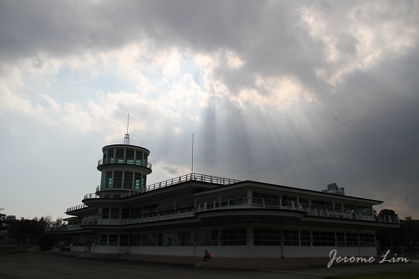
The former Police Coast Guard HQ near the stadium.

The distinctive octagonal structures on stilts that used to be part of the Oasis Restaurant complex over the Kallang Basin.

The 3-storey main building of the former Oasis being demolished (as seen on 28 Sep 2010).

The octagonal buildings being reflected off the Kallang Basin. Once giving a distinctive character to the basin, the reflections of the basin will soon reflect only the sky (as seen on 28 Sep 2010).

One of the octagonal buildings being demolished (as seen on 28 Sep 2010).

With the icons of its past being dismantled, Kallang will no doubt never look the same again. That change is inevitable in land scarce Singapore is something that we as Singaporeans have come to accept. In the case of Kallang, the change is certainly necessary – one that will give Singapore a sorely needed modern sports hub that is sorely lacking at the moment. Still, there is that part of me that doesn’t want to let go … the part that will always remember Kallang fondly for the roller coaster rides not just that Wonderland brought with it, but the ones that the Lions took us on in the thrills and spills that accompanied their exploits in the Malaysia Cup.

Vanishing scenes around Nicoll Highway.

The north east floodlight tower looks like it would be the first of the four to come down.

More views around the stadium and its environs taken on 28 Sep 2010: