One of the many life experiences that I am glad to have had is the opportunity provided to discover a world which might otherwise have remained hidden to me – that of the magical world of Coloane Village in Macau. The village is one I first got a glimpse of, on a stopover during a whirlwind trip to Macau with nine other bloggers, sponsored by the Macau Government Tourist Office (MGTO), as a prize for last year’s edition of the Singapore Blog Awards. The visit was brief, but enough to give me a yearning to return to the sleepy village and its labyrinth of narrow passageways and discover it in full.

Time seems to stand very still in Coloane Village on a sleepy afternoon.

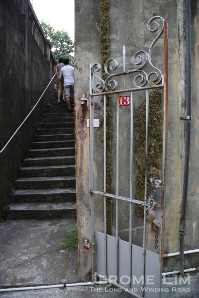
The labyrinth of narrow lanes provides many opportunities for little discoveries.
The opportunity for a quick return came with the prize I got for winning the blogging contest for the first trip, which again was sponsored by the MGTO. This allowed me not just to make a second trip, but also to time it to include two of the former Portuguese colony’s more colourful festivals and plan my own itinerary around it, such that I could have the experience of two of the faces that the normally sleepy village of Coloane wears.

Eduardo Marques Square.
Coloane is now perhaps more of a tourist destination as a stopover for the sweet and irresistible treat which the famous Lord Stow’s Bakery provides and at the same time to see Eduardo Marques Square (Largo da Eduardo Marques) and its little chapel, which is a popular spot for wedding photography. There is however certainly much more of Coloane, both the island as well as the village, for any visitor to discover.

Life in Coloane, like the village itself, seems to come very much to a standstill.

Villagers watching the world go by.
Just a short bus ride from the glitz of the Las Vegas like Cotai Strip, Coloane Village, tucked away in the rolling hills of the west of the island of the same name, does seem a world apart from the strip, and where time does seem long to have stood still. Much of the village is bathed in that old world charm that Macau seems to be slowly but surely losing, wearing the look of that the blending of east and west most of the first half of the century that has passed – when most of the village’s development did take place.

There is very much an air of the old world, just a stone’s throw away from the glitz of the Cotai Strip.

A house in Coloane.
Laid out along the shoreline which looks across a narrow channel to the Zhuhai area of China – seemingly an arm’s length away, the village’s many narrow passages reveal quaint rows of pastel shaded houses, making it a photographer’s dream. In all of this, one stumbles on Eduardo Marques Square (Largo da Eduardo Marques) where a lovely little chapel, St. Francis Xavier’s (see a previous post), can be found. The chapel once housed the relics of the Catholic saint it is named after, a saint who is very much revered throughout Asia for his pioneering ministry to an area of the world which has largely resisted the many attempts at its Christian conversion.

The view across the channel to Zhuhai.

The Chapel of St. Francis Xavier at one end of Eduardo Marques Square with a monument erected to commemorate the victory of the Portuguese over pirates in 1910.

Shutters of a shop.
Besides the Portuguese influence being very much in evidence, there is much that is also to be found of Coloane’s origins as a village. A walk along the northern reaches of the seaside promenade takes one along zinc walled shelters built on stilts – shelters used by the village’s folk who lived off the harvest from the sea. Their descendants of the village’s fishermen, are the ones perhaps who sit by the shelters, keeping watch on a world which may soon pass them by.

The Portuguese influence is very much in evidence.

A passage through the village.

Zinc shelters on stilts can be found along the water’s edge at the northern reaches of the village.
Across the road there is more evidence of the once thriving trade. The tiniest of temples – the Sam Seng or Kam Fa temple which is dedicated to the goddess Kam Fa can be found. The temple traces its origins to a time some two hundred years ago, when a statue of the deity brought to the village by its fisher-folk.

Smoke trails from incense coils at the Sam Seng Temple.

A window into the past.
Just up from the temple lies Coloane Pier (Ponte Cais de Coloane) around which several other reminders of the village’s past awaits. One is a coal tar coated anchor mounted on a circular pedestal close to the pier’s front. It is more however, the sight of salted fish on sale, which provides that link to the past which does sum the origins of the village up. Originally known as “Salt Stove Bay”, it was also where sea salt was farmed, as well as being a fishing village.

An anchor mounted on a pedestal near the Coloane Pier provides a link to the village’s maritime past.

Salted fish on sale also provides a link to Coloane’s origins – the village was where sea salt was farmed as well as a fishing village.
Turning right past the pier, I hear the sound of animated voices which punctures the calm and quiet on what was a sleepy afternoon. The voices are ones which come from a small crowd gathered in front of a building which has retained much of the flavour it must have had under the Portuguese. The women each bore loads of detergent and liquid soap, providing a clue as to why they had congregated by the building – one used by the Customs (Alfândega). The loads they bore were typical of mainland Chinese headed home, as the women must surely have been and were probably standing in queue to purchase tickets for the ferry across to Zhuhai.

Benches line the wall of the Customs building which transports one straight into the colonial era.

Coloane in the mid 20th century – taken off an exhibition of old photographs at the village square.
The road by the Customs building narrows running up an steep enough incline to have me huffing and puffing. It was an effort that was rewarded by the sight of rather a sad looking shack of wood and zinc. It is under this structure, one of several which dot the coastline as it runs north-east, where the sheltered slips and berths of an abandoned boat yard can clearly be seen along with chains and blocks dangling seemingly precariously from age worn wooden beams. This again, provides a reminder another side of the village’s past. The village had once had the proud distinction of being one of the main centres in the Pearl River Delta area for traditional wooden boat and junk building.

The sheltered slip of a abandoned boat yard. The village was a main centre for traditional wooden boat building in the Pearl River delta.
While there is of course much more to Coloane – I got to see a gaier and festive side of it during the Tam Kung Festival (of which I will devote another post to), it is this side I was able to discover that does appeal most to me. Coming from a part of the world where there is little left to remind me of a beautiful world that did once exist there, it is always nice for me to find a place such as this which does show how progress and the gentler side of life is able to co-exist.

The Tam Kung Temple.


+TPY_S4_SitePlan_10May2013.jpg)


 7.02 am
 7.09 am


")


