A Singapore in transition: SIT

23 10 2022

Among American photo-journalist Harrison Forman’s vast collection of some 50,000 photographs, found in the American Geographical Society Library of the University of Wisconsin–Milwaukee are the wonderfully captured scenes of a Singapore in 1941. The photographs, which include a number of rare colour captures, provide a glimpse of the bustling colony that Singapore was, just as preparations were being made for a war that many felt would not come to its shores.

A view of Hong Lim Green and the so-called “Suicide Flats” built in the early 1950s by the SIT (photo: Harrison Forman Collection, University of Wisconsin-Milwaukee)

The collection also contains a number of photographs taken in the 1950s and 1960s that show a Singapore in transition, as Singapore went from colony to state, and eventually towards merger with Malaya and independence. One of these photographs, taken in the mid-1950s, is seen here. It captures the then newly erected 9-storey blocks of flats at Upper Pickering Street / Upper Hokkien Street (a plot now occupied by Parkroyal Collection Pickering) that was put up by the Singapore Improvement Trust or SIT (the block in the middle was in fact built to house the SIT’s HQ).

Completed in 1952, the blocks were Singapore’s tallest public housing blocks and the tallest buildings in Chinatown. As with many tall public housing blocks over the years, they had an unfortunate association with suicides and became known as the “suicide flats” almost as soon as it came up. The blocks of flats, also acquired a reputation for being haunted. This was not without reason as there were a number of reports of hauntings. An ex-resident —  a former colleague of mine, who lived on the top floor of one of the blocks, described how he had resisted a compulsion to jump from the balcony at the urging of “a group of children” who were calling to him from the ground. He told his parents about the encounter and was never allowed out on the balcony again.

The SIT, which was established to carry out town planning and later took on the role of providing public housing, built Tiong Bahru Estate and also put up estates such as Princess Elizabeth Estate and Old Kallang Airport Estate (where Dakota Crescent is) and set what then was the largest public housing programme at Queenstown in motion. They were also responsible for putting up several smaller clusters or individual public housing blocks such as the Princess Elizabeth flats at Farrer Park, blocks in the Bugis area and in Kampong Kapor. SIT made initial plans and carried out the early land acquisition for Toa Payoh and built the old Kim Keat Estate as a prelude to Toa Payoh before being disbanded in 1960 —  when the Housing and Development Board (HDB) was formed. The rest, as they say, is history. HDB became one of Singapore’s great success stories and built twice the number of public housing units that SIT had managed to put up in its three decades of existence in a matter of just three years.

SIT built Tiong Bahru

While the blocks at Upper Pickering Street have been demolished, the legacy of the SIT can however still be found. The SIT built portion of Tiong Bahru has largely been conserved. There are also several blocks around Dakota Crescent that are being conserved following calls to keep the surviving part of the old estate. Beyond public housing, the back lanes behind shophouses, and the spiral staircases found behind them, could be thought of as another legacy of the SIT with the trust having been responsible for executing the scheme following their formation. There are also the estates that the SIT built and maintained that housed their senior staff. These are still very much with us and can be found at Adam Park and at Kay Siang Road.


Jurong’s “imposing shopping complex”

16 08 2021

It had been a while since I’d headed into Taman Jurong and I decided to drop by the area on National Day this year, having found myself in the vicinity. An area of Singapore in which I had my first experiences of watching a movies from a car and also, of skating on ice back in the 1970s, I only got to know it a little better in the early 1990s when I started working in the Jurong area. The estate became an occasional lunch destination and a place to get some banking done. Since I stopped working in Jurong in 2007, I had only been back once. That was in 2014 when I managed to get a few photographs of the estate’s now well-known “diamond block”. One of few constants in an area across which much has changed, the block was in the news last year when it was used during the height of the spread of Covid-19 through Singapore’s foreign worker dormitories, as temporary housing for non-infected dormitory residents.

A view from the inside of the diamond.

Even before 2020, the “diamond block”, or a set of four residential blocks (numbered 63 to 66) at Yung Kuang Road and so called due to the fact that they are arranged to form the four sides of the diamond shape in plan view, had a connection with Singapore’s transient workforce. A number of flats were used as quarters under the “Dormitory Housing Scheme” from the late 1970s — just a matter of years after they were built, which permitted approved companies to rent public flats to house members of their foreign workforce. A report in 1978, revealed that one-third of the blocks’ residents were not Singapore citizens or permanent residents, over half of whom were Malaysians.

Another view with the supermarket block.

Among the last structures of 1970s Taman Jurong left standing, the blocks offer us a glimpse of a time when the Jurong Town Corporation (JTC) took on the task of building homes for Jurong’s then fast growing workforce. Completed in early 1974, the oddly designed but immediately identifiable set of blocks were described as an “imposing 21-Storey shopping complex cum flats” by the JTC, with the agency envisioning it as “an attraction in Jurong”. As the tallest buildings in Jurong, they were intended to provide the estate with a focal point, much like what the ‘Y’-shaped block of flats that I grew up in was intended as in Housing and Development Board (HDB) Toa Payoh. Residents of the diamond block’s 456 3-room rental units also had the benefit of having an unobstructed view of the fast developing industrial west of the island. A “shopping centre” was also found at the blocks’ two lowest levels, the first tenants of which included a coffee house, a noodle shop, a textile shop, bookshops, and a barbershop. There were also banks and clinics found among the shopping centre’s 38 shop units.

The Taman Jurong radio taxi service cabin. Many working in Jurong at odd hours had to rely on the service as it was extremely difficult to get a taxi willing to come to the Jurong area.

The jewel in the crown of the shopping centre, was perhaps a two storey building found in its courtyard. Arranged right smack in in the centre of the diamond-shaped internal yard formed by the four blocks, which interestingly had their common corridors face it, it was where the Pioneer Industries’ Employees Union (PIEU) Multi-Purpose Cooperative Society’s opened its very first supermarket and emporium in December 1974. The supermarket was set up along similar lines as other supermarkets run by the cooperative societies of the National Trade Union Congress (NTUC) — NTUC Welcome — and the Singapore Industrial Labour Organisation (SILO), with the aim of countering profiteering in the wake of the 1973 Oil Crisis. A merger of these labour union run supermarkets in 1983, saw to the creation of NTUC Fairprice, now a household name in local supermarkets.

A view of the since demolished Jurong Stadium from the diamond block in 2014.

Built as the first residential area for Jurong Industrial Estate with its first blocks constructed in the 1960s, the task of developing Taman Jurong fell initially to the Housing and Development Board (HDB). This arrangement changed with the establishment of Jurong Town Corporation (JTC) in 1968, who then took over the task of housing the Jurong workforce. From this point on, the estate began to take on quite a unique quality in terms of its architecture. A commercial and recreational hub for the residents of Jurong, a host of amenities were also built in and around the estate, with the aim of improving the liveability of Jurong residents. Stand-alone bank buildings and cinemas soon appeared as did facilities for leisure. Some came up nearby along the banks of Jurong lake on the opposite side of Yuan Ching Road. The lake, formed by the construction of a dam to close off the upper stretches of the Jurong River in 1971, was among the generous set of green and blue spaces that Jurong was provided with to make it an attractive place to live in. Among the attractions were Singapore’s first and only drive-in cinema and a water adventure park in the form of Mitsukoshi Garden. Singapore’s first ice-skating rink was also established at Jurong Family Sports Centre and eventually in the 1990s the area would see a short-lived Chinese-style theme park and movie set, Tang Dynasty City. The lakeside attractions, have all since closed and the area that they were in has morphed into the wonderful Jurong Lake Gardens.

The former cinema at Taman Jurong.

The “diamond block”, which by the time I got to know Taman Jurong better in the 1990s, had quite a run down appearance. A New Paper report in 2003, described the blocks as a “ghost town” with just six units being occupied. The same report cited the 1997 Asian Financial Crisis as being the point at which the blocks began emptying of residents, with companies hit by the crisis sending many of the members of their foreign workforce back home. In 2001, the HDB (which took on the running of residential estates from JTC in 1982) began moving existing residents out with the six families still living in the blocks in 2003, resisting the move. The blocks were subsequently used to house flat-buyers under a interim housing scheme and were refurbished in 2014 for use under the HDB’s Parenthood Provisional Housing Scheme, before being used to temporary house healthy foreign workerslast year. While the blocks are still standing, it is not known what the future holds for the unfashionable and roughly cut, but yet unique diamond of Taman Jurong.


Views of the diamond block taken in 2014


A memory of the JTC flats at Kampong Java Teban

21 07 2021

Initially set aside for the resettlement of villagers displaced by the industrialisation of Singapore’s south-western coastline and its islands, Kampong Java Teban became the site of a Jurong Town Corporation or JTC developed housing estate that took on the name “Teban Gardens” in the course of this redevelopment. It was one of several major residential developments that the JTC undertook following its spin-off from the Economic Development Board or EDB in 1968 together with DBS Bank and Intraco. The JTC was given the task of real estate management and development, not just for industrial property, but also for housing in industrial estates; a task which had hitherto fallen to the Housing and Development Board (HDB), who constructed housing on behalf of EDB. This was before the management of JTC estates and their flats came under HDB’s purview on 1 May 1982, following the passing of the 1982 amendments to the Housing and Development Act.

Development work on Teban Gardens, Jurong Town’s third residential neighbourhood, commenced in 1973. By the third quarter of 1976, the estate’s first 625 three-room flats were put on sale through a ballot, with the bulk of the estate’s first 3776 units coming up for balloting through much of 1977. While the development was initially aimed at the industrial estate’s workforce, the anticipated demand fell short of expectations due to a slowdown in industrial expansion with the weak economic climate in the mid-1970s. This led to the sale of the flats in Teban Gardens being extended to the general public from June 1977.

The bulk of the flats in Teban Gardens being put on sale during this period were three-room flats. Comparable in size to HDB built three-room flats, the estate featured three-room flats that were quite unique in that they did not open to a common corridor unlike their HDB counterparts. The 10-storey slab-blocks with these flats had common corridors on the third, sixth and ninth levels, along which four-room flats were arranged. With a floor area of 766 sq. ft, the three room units were sold for $15,000, while the 866 sq. ft. four-room common corridor units went for $21,500. Along with the three and four-room units, there were also a number of slab blocks and point blocks with five-room units, measuring between 1147 and 1400 sq. ft. in floor area, which were sold between $30,000 and $35,000.

Among the flats from this first wave of Teban Gardens’ development, were a set of blocks that I last caught a glimpse of in the mid-2010s when they were already emptied of life, having come under HDB’s Selective En-bloc Redevelopment Scheme (SERS) in 2007. The flats, which numbered 2 to 11 and of which I had a passing familiarity with from my working days in Jurong and in the Pandan area from 1991 to 2008 and from my adventures along the former Jurong Railway line, are no more. All that I have to remember them by are these few photographs, which I captured in 2013.


Remembering Dakota (Crescent)

5 01 2021

Dakota Crescent — part of the Singapore Improvement Trust (SIT) 1958 development that was known as Old Kallang Airport Estate — will not be forgotten for two reasons. The first, is that six out of seventeen of its block that are representative of the former estate, including a 1970s playground that the six are arranged around, are being kept as part of a future housing development.

The second reason is the widely circulated myth that the fatal Dakota DC-3 crash that Dakota Crescent is said to have been named after, occured at Kallang Airport in a thunderstorm on 29 June 1946. While it can be established that DC-3 carrying 22 crew and Royal Air Force personnel that originated from Kallang on the date did crash in bad weather, it can also be established that where the crash happened was not at Kallang but in northern Malaya and after the aircraft had taken off at Butterworth on its way to Mingaladon.

How I will remember Dakota, is through the various visits that I made to the old estate and through the photographs that I took of it. My impressions of it was that the estate was worn, tired looking and had seen much better days. Still there was much to take in and much to capture and in this post are a few that I wish to share.


Remembering Dakota


Parting glances: the Siglap flats

25 05 2020

A final look at the set of four Housing and Development Board (HDB) built blocks of flats that have long been a curious sight at the junction of Upper East Coast Road and Siglap Road. Each five-storeys tall, the blocks were completed in early 1964 to rehouse families  displaced by a fire that had destroyed wooden dwellings on the same site during Chinese New Year in February 1962. More than 450 people from 82 families were rendered homeless by the fire. The four blocks, which contained some 119 units and 10 shop units when built, will be demolished under the Selective En-bloc Redevelopment Scheme (SERS) and were vacated some time in 2015.


How the blocks looked originally


Lost places: Woodlands Town Centre

24 10 2019

The old Woodlands Town Centre, with its proximity to the checkpoint and the causeway, could have been thought of as a border post.

It certainly felt like it, with scores of folks crossing the causeway from Johor Bahru – many on foot – thronging the busy bus terminal and the shops in the old centre.  Completed in 1980/81, the centre belonged to the generation of Housing and Development Board (HDB) designs that followed on the second generation Ang Mo Kio, Bedok and Clementi New Town projects.

A unique feature the town centre was given was a bazaar, which house 88 shops resettled from the length of Woodlands Road. The town centre’s air-conditioned shopping complex could also be thought of as a pioneering attempt by the HDB to venture into shopping complex development.

Vacated in 2017, its proximity to the causeway was probably a contribution to its demise – part the the site which the now demolished centre occupies will be used to build an extension to the especially busy Woodlands Checkpoint.

A plan of Woodlands Town Centre (source: HDB).


Photographs:


The old bus terminal.


Woodlands Cinema.


\


Gone-block: discarding Eunosville

11 09 2019

A look back at Eunosville, seen in its final days about a year ago …

The cranes and earth movers taking over Eunosville, a former HUDC estate built in the 1980s.

The almost empty estate seen in August last year.


Built by the Housing and Urban Development Company (HUDC) as it was in a period of transition in the mid-1980s, Eunosville differed from the HUDC developed estates that were built before it. Laid out – quite intentionally as part of a larger HDB development, the estate took on an appearance that made it a lot less exclusive as compared to the HUDC estates of the decade that preceded it.

Eunosville.

Among the last HUDC estates to be erected, it was privatised in 2011 with a view to a collective (or en-bloc) sale. The sale eventually went through in June 2017 for a price of S$765.78 million. The estate was vacated in August 2018 and has since been demolished for the Parc Esta condo development that is expected to be completed in 3 years time.

The divide. An amenity shared prior to its privatisation with the HDB side of the estate, split right down the middle.


The HUDC Scheme

The HUDC scheme was initiated in 1974. Its aims were to offer publicly developed housing to what may have been thought of as a sandwich class of middle-income wage earners who were not eligible for public housing and found private property out of reach. Among the first estates built were Farrer Court in 1976, Laguna Park, the first phase of Braddell View (1977) and Lakeview – all in 1977.

A shift in thinking, which saw a move to locate HUDC developments in areas of public housing rather than in private estates in the mid-1980s, saw estates such Eunosville being built before the HUDC programme was stopped altogether in 1987. The mid-1990s brought about the privatisation programme, which also saw all but one of the former HUDC estates go en-bloc. The last, Braddell View, relaunch a bid to go en-bloc in August this year.

Eunosville making its exit.


Discarding Eunosville – and seemingly, just about everything else …


Final Days


The “attractive” 1940 built public-housing block in Little India

23 11 2018

I have long admired the building that houses The Great Madras, a boutique hotel on Madras Street. The edifice in its incarnations as a hotel has brought a touch of Miami to the shophouse lined streets of a busy corner of Serangoon. The opportunity to have a look beyond the building’s gorgeous Streamline-Moderne façade came this Architectural Heritage Season with tours organised by the URA. The hotel won an Architectural Heritage Award for the efforts made in the restoration of the building,

Deliciously decorated, the hotel’s common areas on the ground floor provide a great introduction to its well thought of interiors. The lobby and a restaurant and bar, which opens up to the outside is what first greets visitors. There is also a barber shop and a utility area at the building’s rear. A sliding privacy door hides the hostel-like accommodation on the same floor. Here, its private sleeping spaces carry the names of established travel influencers.

The reception area.

The hotel’s rooms are laid out across the building’s two upper floors. Corridors decorated with quirky neon signs and ventilated through the steel-framed glass windows of a forgotten era, provide correspondence to the rooms. It is along a corridor on the second floor that a pleasant surprise awaits. This takes the form of an especially delightful and photograph-able view of the hotel’s retrofitted swimming pool, framed by a circular opening in the pastel pink party wall that separates the pool from its sun deck.

A corridor on the upper levels.

The alterations made in the building’s interiors does make it hard to think of the building having been put to any other use other than the current, and quite certainly not as a public-housing block of flats it was built as in early 1940, There is of course that Tiong Bahru-esque appearance and quality that may give the fact away but the standalone nature of the block will mask the fact that it was the Singapore Improvement Trust or SIT that built it. The SIT – the predecessor to the HDB – besides having had the task of addressing the demand for public housing, also took on the role of town planner. The public housing projects that it embarked on tended to be built in clusters, such as in the case of Tiong Bahru.

The rear courtyard.

The swimming pool.

There is however a good reason for the Madras Street block’s isolation. A 1940 report made by the SIT holds the clue to this. It turns out that the block – erected to take in the area’s residents displaced by the demolition of older buildings – was meant to have been part of a larger improvement scheme that the SIT had planned for the area. The scheme was to have seen the demolition of a dozen “old and unsanitary” buildings in the months that would follow  to provide for a southeasterly extension of Campbell Lane past Madras Street. There was also to have been the metalling of the area’s roads and the construction of much-needed drains. The orientation and alignment of the 70 by 60 feet block does suggest that it was laid out with the extension of Campbell Lane in mind.

A view of the surroundings through steel framed windows.

The scheme’s overall aim was to provide accommodation in greater numbers, make an improvement in (transport) communication and the layout of of the very congested area. There was also a need to address the area’s poor sanitary conditions. It is quite evident from what we see around that the scheme did not go much further. Perhaps it may have been a lack of funds, as it was with many public schemes in those days. There was also the intervention of the war, which was already being fought in Europe by the time of the block was completed.

Another view of the hotel’s windows.

From the report, we also get a sense of the “attractive” building’s original layout. Three flats were found on each floor, hence the three addresses 28, 30 and 32, giving the building a total of nine flats. Each flat contained three rooms, one of which would have been a living room that opened to the balcony. A kitchen cum dining room was provided in each flat, as well as a bathroom and a toilet – “in accordance with Municipal Commissioners’ requirements”.

A spiral staircase in the rear courtyard.

The report also tells us of how much the flats, which were fully booked before the building’s completion, were rented out for: $23 per month for ground floor units and $26 per month for the units on the upper floors.

More on the restoration efforts that won the Great Madras Hotel the award: 28, 30 & 32 Madras Street Charming Revival.

Restored granolithic (Shanghai Plaster) finishing on the column bases.


More photographs:


Dakota at the crossroads

12 12 2017

It is good to hear that some of Old Kallang Airport Estate, Dakota Crescent as it is now commonly referred to, is being retained. The estate is the last of those built by the Singapore Improvement Trust (SIT) in the 1950s in which the first attempts were made to introduce high-rise public housing. The preservation of a section of six blocks, four of which are arranged around a courtyard that with its playground, is also being retained, follows on calls made for the estate’s preservation in part or in whole by Save Dakota Crescent group and members of the public to which the Member of Parliament for the area Mr Lim Biow Chuan has lent his voice.

Dakota at the crossroads.

Built at the end of the 1950s, a chunk of the original estate has already been lost to redevelopment. What remains features four block typologies arranged mainly around two spacious courtyards with a Khor Ean Ghee designed playground that was introduced in the 1970s. The blocks were designed to contain a mix of units intended for residential, commercial and artisanal use – a feature of the SIT estates of the era.

Window from the past out to one that is more recent – Singapore’s last dove (playground).

It would have been nice to see a more complete estate being kept as an example of the pre-HDB efforts at public housing. Developmental pressures have however meant that only the central cluster, in which all four block typologies are represented, could be kept with the remaining site given to public housing. The blocks being retained will be repurposed for uses such as student housing or  for suitable social and community uses and will be integrated with the future public housing development.

Three-storey and seven-storey blocks.


More:


More Photographs:

A vacant unit.

The kitchen.

An empty hall.

Some of the units feature built-in storage.

A neighbourhood cat.

The kitchen of an upper floor unit.

The upper floor verandah of the two-storey block.

Another vacant unit.

A final dance with the Dove.

The dove from above.

The provision shop, before it became a hipster cafe.

The last song bird.

Ventilation openings.


Parting Glances: Pasir Panjang Power Station Quarters

29 05 2017

Thanks to the Singapore Land Authority (SLA) and Mr Morhan Karup, representing the families of the former Pasir Panjang Power Station (PPPS) quarters, I found myself at a huge gathering of the PPPS quarters’ ex-residents. It provided an opportunity not just to have a look at the former quarters,  but also to be reminded of the community spirit missing in the brave new world Singapore has been forced to become .

jeromelim-6570

A group photograph of the ex-residents. It was estimated that more than 600 former residents returned for the gathering.

The bonds of community were very much in evidence at the reunion, which attracted some 600 ex-residents from a total of 340 families who once called PPPS quarters home – despite a separation of over three decades. The former quarters, built in the 1950s and 1960s, comprised five high-rise blocks and another five 3-storey blocks and were vacated at the end of the 1980s when many were encouraged to apply for HDB flats. The quarters were for long one of the area’s landmarks, which also included the chimneys of the power station and the storage tanks of the BP (and former Maruzen Toyo – see: The tanks at Tanjong Berlayer) refinery. The refinery, which opened in 1962, was in fact well positioned, and had been where fuel for the power station’s prime movers, were supplied from.

jeromelim-6510

A parting glance.

What we see today of the quarters is one built to supplement accommodation originally erected in 1952 to 1953. The then new power station, built to supply the colony’s electricity needs for the two decades that were to follow, was to be further expanded from a an initial capacity of 25 MW at the end of 1952 to 175 MW in 1962 to meet surging demand. It did not stop there and a second station, B Station, was built adjacent to the first (A Station) in the mid-1960s, adding a total of 240 MW to the station’s capacity. All this required workers to be recruited from India and Malaya, all of whom needed to be accommodated. The erection of new and taller blocks in the 1960s, also allowed the families of the workers to be accommodated more comfortably. These had larger two-room, one-hall units, compared to single bedroom units in the older blocks. The larger units were then allocated to those with families and smaller ones (in the three-storey blocks) to newly married workers and those who were single. The units were rented out for some $10 to $16 to the families.

jeromelim-6603

An eight-storey block built in the 1960s. The layouts are very similar to some of the later SIT flat designs. The high-rise blocks had two-room, one-hall units and were allocated to married workers with families.

jeromelim-6560

Older 3-storey blocks with one-room, one-hall flats allocated to singles or workers who were newly married.

One who came from far was the father of Mr Selvam, a long-time former resident (1954 to 1986) who was born on the premises in 1954 (in a unit in three-storey Block D). Mr Selvam’s father, Mr Sockalingam, came over from India in the 1950s to work as a turbine driver and married a local lady. With a twinkle in his eye, Mr Selvam – known to those in the community as “Thambi’ (younger brother in Tamil), recalled days spent in the football field, at Labrador Primary School and taking a shortcut through World War Two tunnels to take a dip at the beach. The tunnels, remembered by all who lived there in the 1960s and 1970s, were apparently filled with the artefacts of war and included the rusty remnants of Japanese weapons. With Mr Selvam, was his friend Mr Yusof whose wife was a former resident. Mr Yusof described the estate as a “concrete kampung”, a description that seemed to be used by many of the estate’s former residents.

jeromelim-6544

L – R: Ex-residents Mr Thangavelu, Mr Omar, Mr Selvam (a.k.a. ‘Thambi’), and the husband of an ex-resident, Mr Yusof. Mr Thangavelu, lived with an uncle who worked at PPPS, while Mr Omar was a turbine driver who was transferred from Jurong Power Station in 1970.

One of the memories Mr Selvam and his friends who were sitting around him were especially keen to talk about, were of the row of food stalls across the road just outside the compound. It was there where many would gather, share a meal or a drink in the evening break out into song – something that the gathering yesterday, also seemed to encourage with quite a few joining in an impromptu song and dance with many in the crowd cheering on.

jeromelim-6616

The organising team, with Mr Bernard Loh of the SLA.

The get-together, at which the bonds forged over the years were very much in evidence despite the length of time the community ‘s members have been kept apart, follows on another organised in 2014 that was attended by 300 ex-residents. The 2014 reunion was prompted by re-connections made possible through social media, after many in the community had lost touch with each other after moving from the quarters, and also with the decommissioning of the station (A-Station in mid-1980 and B-Station in 1997). The group is planning a dinner at the end of the year, which on the basis of what was seen – would certainly not be the last.

jeromelim-6679

Sisters Manchula and Sita posing at the same spot a photo was taken of them in 1975.

jeromelim-6527

Two of three Chia sisters, whose family lived in the quarters from 1956 to 1971.

jeromelim-6524

Last reflections.

jeromelim-6688_34942528445_o

The gated compound of the estate provided security, although none seemed to be needed and residents often left their doors opened or unlocked.

jeromelim-6648_34942531325_o

The winds of change are sweeping through the area.

jeromelim-6592

The proximity to the power station allowed workers to come home for lunch.

jeromelim-6620_34099459154_o

An area once occupied by older flats, which were demolished.

jeromelim-6551

Old estates often have nice shady trees, something that new estates lack and it is a shame to see them go.


Video of Ex-Residents breaking out in dance


A last look

jeromelim-6550_34902183806_o

jeromelim-6681_34942530385_o

jeromelim-6669_34902184266_o

jeromelim-6667_34099458474_o.jpg

jeromelim-6533-2_34812208341_o.jpg

jeromelim-6535_34556813500_o

jeromelim-6539-2_34812207151_o.jpg

jeromelim-6541_34556812910_o.jpg

jeromelim-6585_34812206481_o

jeromelim-6564_34555085810_o.jpg

jeromelim-6557_34942532965_o.jpg

jeromelim-6589_34555085170_o

jeromelim-6614_34942531405_o.jpgjeromelim-6629_34942531075_o.jpg


Signs of More Recent Times

jeromelim-6608_34555084550_o.jpg

jeromelim-6640_34099458954_o.jpg

jeromelim-6656_34902184416_o.jpg

jeromelim-6649_34099458624_o

jeromelim-6645_34099458834_o.jpg


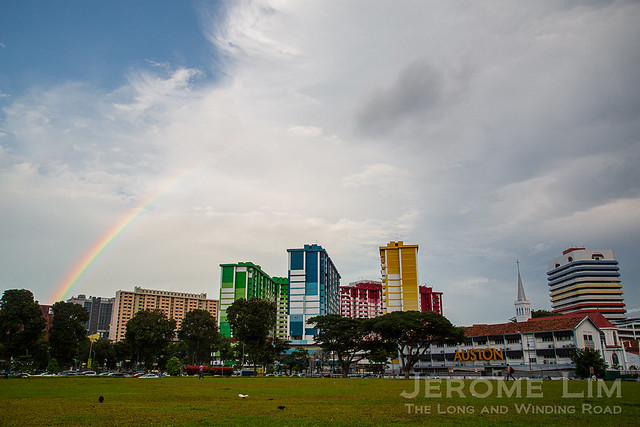
The rainbow connection

16 09 2016

A rainbow appears over the “Rainbow Flats”, as Rochor Centre is sometimes referred to, as if to say goodbye on the morning of 14 September 2016. Built to house residents and business displaced by urban redevelopment in the late 1970s, the Housing and Development Board built podium residential cum commercial development is due to make way very soon for the construction of the North-South Expressway.  For more on the complex and its last days, do visit an earlier post: Parting Glances: Rochor Centre in its last days.


The last pelican

12 08 2016

I was going through my archives of photographs last weekend when I came across this photograph I took sometime in February 2012 of the last pelican playground; its backdrop a sea of greenery that left untamed brings a sense of calm that is missing in the manicured green spaces we in Singapore now seem to have too much of.

The last pelican, which went in June 2012.

Sadly, there seems little place in a Singapore that has little place for surroundings such as these. The pelican, which became a symbol of the loss many here feel for their well-loved places that no longer exist, is no more; demolished some four months after the photograph was captured. One of the more used themes adopted in the terrazzo and mosaic playgrounds introduced from the late 1970s, it served the children of Blocks 30 to 39 Dover Estate for some three decades before the death knell was sounded for it when the estate was taken back through a Selective En bloc Redevelopment Scheme (SERS) exercise.

I had several encounters with a similar pelican themed playground in Ang Mo Kio where I had moved to in the second half of the 1970s. Small compared to the one in Toa Payoh where the better part of my childhood was spent in and with rather static implements, and for the fact that I had outgrown playgrounds by that time; I never found much fun in them. I found the all metal merry-go-round, with its chequered steel deck, especially hard to move as compared to the

The last pelican was among a handful that also includes a dove at the soon to go Dakota Crescent, that survived a cull of the locally designed playgrounds. Designed by a Housing and Development Board (HDB) team led by Mr Khor Ean Ghee, the series also included other animal based themes, the grandest of which was the mythical dragon. There were also elephantsfruits and vegetables, twakows and even fairy tale type clocks.

At least one of the playgrounds, which would have been most familiar to the children of the 1970s, 1980s and early 1990s, will have its life extended. That, now sits abandoned by those whose lives it was a part of. Several of the blocks around it, including the twenty-storey tall Block 28, which was itself a landmark have since been demolished for redevelopment. In renewed surroundings that will include blocks of flats that will even be higher than Block 28, the orange dragon will at least stand tall, a reminder of the efforts of a dedicated team of designers who provided a generation of Singaporeans with something to remember that childhoods by.

See also:


Parting glances: Rochor Centre in its last days

19 05 2016

Renewal and redevelopment are words that some in Singapore dread hearing. They often translate to the loss of places we lived in or grew up with, and the break-up of communities associated with those places.  One such place that will soon join the growing list of disappearing communities is Rochor Centre (photographs below). One of several city-centre podium complexes put up by the Housing and Development Board (HDB) from the mid-1970s into the 1980s, it seems to have served its purpose and will now have to make way so that an underground expressway can be built.

Fading light, Rochor Centre, May 2016.

Many will remember the complex for the multi-coloured coat of paint it has in more recent times been given. For much of its 39 year history however, it has worn a less attention grabbing coat, looking its part as an aesthetically unappealing mid-1970s public housing development, lost in the confused clutter of structures built to replace the one-time shophouse dominated landscape of the area.

Rochor Centre in less colourful days (source: Online Forum / Berita Harian)

Rochor Centre in less colourful days (source: Online Forum / Berita Harian)

Built in a hurry to take in residents and businesses being displaced by the huge wave of redevelopment that was sweeping across the city, mixed-use podium complexes sprouted in double quick time across densely populated districts of the city. A feature of such complexes is the multi-level podium block in which shop and office lots, or in some instances, wet markets and food centres are housed. Residential blocks of flats, built in the same mould as the HDB flats of those days, sit on top of the podiums with the well-proportioned podium roof decks providing space to serve residents’ recreational and social needs.

Rochor Centre features a podium with three levels of shop lots.

Rochor Centre features a podium with three levels of shop lots.

As is typical of HDB podium developments = the roof deck of the podium provides space for the recreational needs of the residents.

As is typical of HDB podium developments = the roof deck of the podium provides space for the recreational needs of the residents.

A kindergarten at roof deck level.

A kindergarten at roof deck level.

One of the larger complexes in the area, the diverse mix of businesses that Rochor Centre’s podium housed, brought much more of a buzz to it than nearby complexes such as Bras Basah Complex and Waterloo Centre. Both the latter complexes housed a concentration of specialised trades; bookstores, stationery shop and watch dealers from the North Bridge Road and Bras Basah Road area in the case of Bras Basah, and motor spare parts dealers from the Rochor area in the case of Waterloo.

Not the first supermarket at Rochor Centre, Fairprice will be one of the last shops to go.

Not the first supermarket at Rochor Centre, the Fairprice outlet, which is still operating, will be one of the last shops to go.

Rochor Centre, after its completion in 1977, saw three banks, POSB, DBS and Tat Lee, set up shop. A branch of Oriental Emporium and its supermarket also moved in, as did a post office, which shifted from Queen Street. There were also many other shops, food outlets, pawnshops, goldsmith shop and due to its proximity to the popular Kwan Im Thong Hood Cho Temple down Waterloo Street, shops dealing with religious offerings. While many shops and businesses came and went over the year, there are several that either kept relevant or managed to adapt to changing times that have stayed on.

Another of the original occupants of the shop lots - Tenpo Goldsmith and Jewellers, showing obvious signs of adapting to changing times.

Another of the original occupants of the shop lots – Tenpo Goldsmith and Jewellers, showing obvious signs of adapting to changing times.

A reminder of the centre's DBS Bank branch - one of the original occupants of the podium block.

A reminder of the centre’s DBS Bank branch – one of the original occupants of the podium block.

With the death knell being sounded on Rochor Centre, much of the buzz it was once known for has been replaced by a deafening silence. Having been acquired by the government in November 2011 as its stands in the way of the construction of the future North-South Expressway, many of its occupants have moved out well ahead of the third quarter 2016 deadline to vacate the complex.

Many businesses have moved well in advance of the deadline to vacate.

Many businesses have moved well in advance of the deadline to vacate.

The emptiness and silence that has replaced the buzz.

The emptiness and silence that has replaced the buzz.

Demolition is expected to start soon after its last tenants move out and all that will remain of it will be memories; memories that, as with those of the flood-prone but colourful Hokchia dominated neighbourhood that occupied the site before Rochor Centre, time will surely erase.

A site soon to be recycled.

A site soon to be recycled.

Possession Notice pasted on the door of a residential unit.

Possession Notice pasted on the door of a residential unit.


What occupied the site before Rochor Centre:

Rochor Centre was built over a neighbourhood with streets such as Tiwary Street, Muar Road and Angullia Road. Despite the diverse origins of its street names, the area where members of the Hokchia (also Futsing or Fuqing) community settled into. Many in the community found work as trishaw riders or coolies and as with others involved in the trades, found solace in opium and in gambling. The area, as a result, gained notoriety for its opium and gambling dens.

An extract of a street map of the area, 1969 (source: SLA Singapore Historical Map).

An extract of a street map of the area, 1969 (source: SLA Singapore Historical Map).


Parting Glances: Photographs of Rochor Centre in its last days

JeromeLim-5999

Daybreak over Rochor Centre on which the sun will soon set.

Last flights at sunrise.

Last flights at sunrise.

A last delivery.

A last collection.

Last light.

Last light.

A last morning walk.

JeromeLim-4480

A last walk to kindergarten.

A last ride.

A last ride.

A last wait.

A last wait.

The last roasts.

The last roasts.

A last cup of coffee.

A last cup of coffee.

A last breakfast.

A last breakfast.

A last haircut.

A last customer.

A last reflection.

A last reflection.

Last shops.

Last shops.

Last cups of coffee.

Last chill-outs.

A last elevator ride.

A last elevator ride.

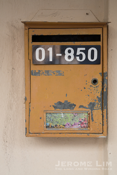
A last check of the letterbox.

A last check of the letterbox.

A last Christmas.

A last Christmas.

A last Chinese New Year.

A last Chinese New Year.

A last wash.

A last wash.

Last ;pieces of laundry.

Last poles of laundry.

A last offering.

A last offering.

A last reunion dinner.

A last reunion dinner.

Last Chinese New Year visits.

A last Chinese New Year visit.

A last ride.

A last ride.

A last hamper.

A last hamper.

A last mail delivery.

A last mail delivery.

A last delivery.

A last delivery.

A last look at the basement.

A last look at the basement.

A last look before the colours fade.

A last look before the colours fade.

A last twilight.

A last twilight.


Last(ing) impressions

6 10 2015

Sunday, 4 October 2015, was the day we said our farewells to an old neighbourhood at Blocks 74 to 80 Commonwealth Drive, which will soon be demolished. The farewell to neighbourhood built at a time of great need during the transition from statehood to nationhood and known affectionately as the ‘Chap Lau Chu’, Hokkien for ‘Ten Storey House’ for its 10 storey flats, would have left a last and perhaps lasting impression on the large numbers of people who turned up for Sunday’s farewell party

JeromeLim-4444

A last stroll.

JeromeLim-4467

A last hurrah.

JeromeLim-4502

A last peek.

JeromeLim-4489

A last song.

JeromeLim-4691

The last photographs.

JeromeLim-4619

A last hello.

JeromeLim-4479

A last toss.

JeromeLim-4586

A last pat.

JeromeLim-4506

A last sit down.

JeromeLim-4528

A last reflection.

JeromeLim-4612-2

A last look (1).

JeromeLim-4635

A last look (2).

JeromeLim-4606

A last look (3).

JeromeLim-4611

A last visit.

JeromeLim-4655

The last hydrant.

JeromeLim-4580

The last hydrant.

JeromeLim-4643.jpg

The last tall tree.

JeromeLim-4673.jpg

A last descent.

JeromeLim-4677.jpg

A last show.

JeromeLim-4698

A last walk.

JeromeLim-4578

The last days.

JeromeLim-4552

A last boundary (the boundary wall between the former Malayan Railway land and Singapore).

JeromeLim-4562

A last look at Block 75.

JeromeLim-4644.jpg

A last sunset.

JeromeLim-4689.jpg

The last smiles.

JeromeLim-4718

A last glance.

JeromeLim-4694

A last gathering.

JeromeLim-4728-2

A last stop.

JeromeLim-4740-2

A last laugh.

JeromeLim-4770-6

The last goodbye.

JeromeLim-4791

A last shot.

JeromeLim-4797-2

The last game.


More winds of change blowing through Queen Street

7 02 2014

Besides the stretch of Queen Street at the Cathedral end, another section of the street in the midst of change is the stretch between Bras Basah and Middle Roads. It is one that although is already much changed from the street that I was familiar with in my younger days, which is littered with reminders of a past when the European missionaries left what did once seem like an indelible mark on it.

A view of part of the area from the (new) National Library - the three blocks of Waterloo Centre can be seen at the top left of the photograph. St. Joseph's Church and the former St. Anthony's Convent can be seen in the foreground.

A view of part of the area from the (new) National Library – the three blocks of Waterloo Centre can be seen at the top left of the photograph. St. Joseph’s Church (the Portuguese Church) and the former St. Anthony’s Convent can be seen in the foreground.

One new addition to the stretch that will definitely leave a mark on the street will be the China Cultural Centre that is fast coming up (which got a mention in a post in March of last year). The centre, built as an effort on China’s part “to help people understand Chinese culture and deepen ties with the host country”, is one that will certainly change the character of an area once flavoured by schools which have since been moved out and two beautiful churches – legacies of the important contributions made by the French and the Portuguese missionaries to modern Singapore.

The China Cultural Centre  is seen rising up just beyond the burnt siena coloured Oxford Hotel.

The China Cultural Centre is seen rising up just beyond the burnt siena coloured Oxford Hotel.

The centre stands on a plot of land that once had been occupied by the Stamford Community Centre, a place that I had been familiar with in my school days in nearby Saint Joseph’s Institution. The centre was where in May 1978, a balloting exercise was held for would be residents of the three residential Housing and Development Board (HDB) blocks of flats built over a lower podium block – a public housing complex that has for some 35 years now, dominate this stretch of the street. 

The former Stamford Community Centre. I had climbed over the gate a few times with several of my classmates to play street football on the basketball court.

The former Stamford Community Centre.

The development of Waterloo Centre, which was completed in 1978, could be considered to be a significant one from a public housing perspective. It was one of several mixed commercial and residential built in the city centre at the 1970s and in the early 1980s that were built to accommodate some of the many residents and businesses that were being displaced by what was a huge wave of redevelopment sweeping across urban Singapore. 

The Waterloo Centre Podium with its mix of old and new.

The Waterloo Centre Podium with its mix of old and new.

Taking a walk around Waterloo Centre’s podium these days, one can’t help but feel the sense of time standing very still there; the podium is one that still contains many remnants of its shop lots’ first occupants – the motor spare parts dealers that were moved into it having been displaced from the redevelopment of the Sungei Road and Rochor areas. 

Shops housing motor spare parts dealers.

Shops housing motor spare parts dealers.

Another look at the podium.

Another look at the podium.

Although there now is a mix of newer business with some of the original occupants, Waterloo Centre does seem a lot quieter compared to similar urban podium block complexes such as the nearby Albert Complex with its wet market and popular food centre, and Bras Basah Complex with its mix of bookshops and art supply shops and printing business. And that is perhaps why the complex is being given a makeover into Arts Place – a centre that perhaps fits into the vision set out for the area as a destination for the arts and culture.

Waterloo Centre seems to be in the middle of a transformation into ArtsPlace.

Waterloo Centre seems to be in the middle of a transformation into Arts Place.

SAM @ 8Q - formerly  the Catholic High School - now an extension to the art museum.

SAM @ 8Q – formerly the Catholic High School – now an extension to the art museum.

On part of the plot where Waterloo Centre stands today was where a private school, the Mercantile Institution did once stand. The school, which was started in the late 1920s, was where my father did once enroll in, in the mess that came with the end of war when many publicly run schools were still shut and places were in short supply. It was only to be for a short while though, my father did eventually get a place in Monk’s Hill Boys School. There were a couple of things he did tell me of his experiences in the Mercantile Institution – one was that as the war had disrupted the education of many, there were many older boys who had to enrolled into the entry level classes. Another was that the name of the school was often mispronounced – coming across sounding like “Makan-tahi Institution” – “makan tahi” many in Singapore would know as Malay for (pardon the crudeness) “eat shit”.

Area where Waterloo Centre is today, as seen in 1959 - the Mercantile Institution, a private school established in the 1920s, can be seen on the left right next to Nantina Home (ex Nantina Hotel) (photo source: http://archivesonline.nas.sg/).

Area where Waterloo Centre is today, as seen in 1959 – the Mercantile Institution, a private school established in the 1920s, can be seen on the left right next to Nantina Home (ex Toyo Hotel) (photo source: http://archivesonline.nas.sg/).

Further along from the Mercantile Institution, there were two other buildings that many familiar with the area would remember. One was the former Nantina Home, which functioned as the Japanese owned Toyo Hotel before the war (it was the second Toyo Hotel – the first was demolished in 1937 to make way for Cathay Building) . As the Nantina Hotel after the war, it was used to accommodate returning European internees who came back via India, before it was handed over to the Department of Social Welfare who turned it into a home for the aged and destitute. That operated until 1959 when the building was taken over by the Trades Union Congress.

The area in 1975 with the former Nantina Home still standing next to Queen Street Post Office (photo source: http://archivesonline.nas.sg/).

The area in 1975 with the former Nantina Home still standing next to Queen Street Post Office (photo source: http://archivesonline.nas.sg/).

Right next to Nantina Home was another building many might remember – the Queen Street Post Office, housed in a four storey building. The building was demolished after the post office was closed in May 1978. What stands in its place (or at least partly in its place) today is the five storey Bylands Building of 1980s vintage, right next to Middle Road.

Queen Street Post Office which was to close in May 1978 is seen next to the already demolished former Nantina Home (photo source: http://archivesonline.nas.sg/).

Queen Street Post Office which was to close in May 1978 is seen next to the already demolished former Nantina Home (photo source: http://archivesonline.nas.sg/).

The part of Queen Street where the Mercantile Institution, the Nantina Home, and Queen Street Post Office was, is where a spectacle does takes place once a year on Good Friday. That is when part of the street and the compound of Saint Joseph’s Church next to it, becomes a sea of candlelight as part of a procession. That is a time when the rich religious traditions of the Portuguese missionaries, who did leave us one of the most beautiful churches on the island, does manifest itself – a celebration that does serve to remind us of what the area should really be remembered for.


The ‘sunken temple’ of Toa Payoh

18 09 2013

A curious sight that greeted anyone travelling down Lorong 6 close to the Temple / Kim Keat Estate area of Toa Payoh in its early days and one I well remember was a temple that at road level, appeared to be have buried in the ground. The temple, Poh Tiong Keng 普忠宫 (Pu Zhong Gong), which I would refer to as the ‘sunken temple’, was one which went back to the village origins of the area, well before the towering public housing blocks of flats arrived.

The only photograph I have managed to find of the Poh Tien Keong with Block 33 seen behind it (online photograph at http://aliciapatterson.org/stories/aged-singapore-veneration-collides-20th-century).

The area where the 'Poh Tien Keong was as seen today.

The area where the ‘Poh Tien Keong was as seen today.

The Block 33 view of the area where the 'sunken temple' was.

The Block 33 view of the area where the ‘sunken temple’ was.

Set in what would have been an undulating area, the levelling of the surrounding ground to put up blocks of flats in the late 1960s, it found itself in a hole in the ground with the 11 storey block 33 towering above it, surrounded by retaining walls put up by the Housing and Development Board (HDB) to protect the temple from being buried. The temple was one of three existing temples which were left untouched by the HDB in clearing the land in the area for the development of the new housing estate. The other two were the Siong Lim Temple and the  Seu Teck Sean Temple.

The temple finding itself in a hole in the ground as work on the new public housing estate of Toa Payoh was being carried out in 1968.

The temple finding itself in a hole in the ground as work on the new public housing estate of Toa Payoh was being carried out in 1968 (Source: online catalogue of the National Archives of Singapore http://www.nas.gov.sg/archivesonline/).

Another photograph taken during the development of Toa Payoh in 1968.

Another photograph taken during the development of Toa Payoh in 1968 (Source: online catalogue of the National Archives of Singapore http://www.nas.gov.sg/archivesonline/).

Sadly the sight is one we no longer see. The temple was demolished in late 1977, not long after I moved out of Toa Payoh. The area where the temple was will now also see a huge change – the block of flats behind where the temple was along with several others in the area – some of which were leased out temporarily to Resorts World Sentosa to house their workers after residents were moved out, are due to be demolished (one of the blocks which will be demolished is Block 28, in front of which the iconic dragon of  Toa Payoh can be found).

The hole in the ground after the temple was demolished in 1977 (Source: online catalogue of the National Archives of Singapore http://a2o.nas.sg/picas/)

The hole in the ground after the temple was demolished in 1977 (Source: online catalogue of the National Archives of Singapore http://www.nas.gov.sg/archivesonline/)

A last look around Block 33

JeromeLim 277A2174

JeromeLim 277A2170

JeromeLim 277A2189

JeromeLim 277A2190

JeromeLim 277A2193

JeromeLim 277A2196

JeromeLim 277A2199


Afternote:

It has been brought to my attention that the Poh Tiong Beo (普忠庙) located diagonally across the road from this site was built to replace the ‘sunken temple’ as drainage was poor in the recess the original temple sat in and that would get flooded everytime it rained heavily.


Don’t miss the boat

11 09 2013

A bumboat sits high and dry, resting on a bed of sand in Pasir Ris, seemingly out of place in a sea not of water, but one of the concrete structures which now dominate much of Singapore’s suburban landscape. The boat is itself made of concrete, built not to carry the loads that the wooden vessels it is modelled after over water, but to provide a place where children of the neighbourhood it finds itself in can find amusement.

The bumboat of Pasir Ris.

The bumboat of Pasir Ris.

The boat, designed to resemble the bumboats or twakows – the workhorses of the once busy Singapore River, is one of several unique playground designs that hail from a time we seem to have forgotten. It was a time during which the Housing and Development Board (HDB) had a department within their Landscape Studios, dedicated to developing playground designs to complement the landscape of the public housing estates that were fast coming up, during which several notable playground designs were developed.

The starboard side.

The starboard side.

The efforts go back to the mid-1970s, when Mr Khor Ean Ghee designed the original dragon (playground) of Toa Payoh. That stood in a pit of sand at Toa Payoh Town Garden. This design was to serve as a basis for the sand-pit mosaic-faced dragons, pelicans, doves, elephants and spiders which would have been a familiar sight to the child of the late 1970s, the 1980s and perhaps the 1990s, with a vast number built together with the huge second public housing building wave which started in the mid-1970s which was to see the monster estates such as Ang Mo Kio, Bedok and Clementi being built. Several of these playgrounds were also installed in the older estates, of which a few are left. One is the orange dragon of Block 28 Toa Payoh and another, the last dove standing at Dakota Crescent.

Climbing the dragon at Toa Payoh Town Garden, 1975.

Climbing the dragon at Toa Payoh Town Garden, 1975.

Moving into Ang Mo Kio in the late 1970s, it was the pelican that I encountered not far from where I lived in Block 306. These playgrounds also marked a shift in playground layout. Whereas the ones I played on in the late 1960s and early 1970s, many with tubular steel structures on a hard concrete ground, were set expansively such that children playing seemed to have no boundaries, the new designs were a lot more compact sets of concrete with terrazzo and mosaic finishes placed in a a raised pit of sand, had well defined boundaries. Perhaps I had by the time outgrown playing at the playground, but having spent most of my childhood climbing on metal waves and globes, swinging from swings suspended by long lengths of chains, and sliding down high steel slides, the new playgrounds offered  a lot less enjoyment to me.

The playground with Lorong 4, the Lorong 4 market, and Lorong 3 in the background (scan of a postcard courtesy of David Jess James - On a Little Street in Singapore).

The playground I derived the most pleasure from – the one in front of Block 53 Toa Payoh when I lived there (scan of a postcard courtesy of David Jess James – On a Little Street in Singapore).

The last pelican which has been demolished.

The last pelican which has been demolished.

From the animals of the early 1980s, the designers explored fresher themes during a two year period from 1983 to 1985. These efforts yielded designs which revolved around well-known fables such as the tortoise and the hare and also familiar local objects such as kampung houses and trishaws. It was from the next creative wave from 1986 to 1990 that the bumboat was designed. One of 23 designs from the period, the bumboat was one of several which included a kelong designed to represent elements of our multi-racial heritage – the bumboat a representation of Chinese heritage (the twakows were wooden boats used by Chinese traders to carry goods from the ocean-going ships anchored in the inner harbour to warehouses up river).

JeromeLim 277A9573

JeromeLim 277A9567

The period also yielded other rather interesting designs which included those which revolved around nursery rhymes such as Humpty Dumpty and the  Old Woman who lived in a Shoe; popular childhood games such as snakes and ladders; designs inspired by fruits and vegetables such as the watermelon, mangosteen, pineapple, mushroom and egg plant; and also insects such as ladybirds. A few of these can still be found including a watermelon and mangosteen in Tampines and a double clock in Bishan. Other interesting structures put up during the time included everyday objects, of which the clock is one example, a telephone, a lorry, and not so common (at the time) items such as a bullock cart.

The passing of time. A last clock stands in Bishan.

The passing of time. A last clock stands in Bishan.

During the same period, attempts were also made to provide the newer estates being built with their own identity. Playground designs were also selected for new towns on the basis of this identity. An example of this is the use of fruits and vegetable themed playgrounds in Choa Chu Kang – developed from what was a rural and farming area of Singapore. While the selection of playgrounds were very much left to the architects responsible for the designs of each neighbourhood, an attempt was made to allow for some variety across each estate in which playgrounds were distributed such that there was one for every 400 to 800 dwelling units by limiting the use of any design to maximum of five per estate.

The more complete face - with the hands intact.

The more complete face – with the hands intact.

The death knell for many of the homegrown playground designs was probably sounded with the advent of modular play equipment in the 1990s. This, coupled with safety concerns raised by a Canadian playground safety expert which followed an incident in 1993 in which a five-year old boy had his thumb severed whilst sliding down a poorly maintained metal slide in an older playgrounds (fortunately his thumb could be reattached) saw a change in direction on the part of the HDB. While there was probably a conflict of interest on the part of the expert who also represented a Canadian modular play equipment manufacturer, the safety concerns could not be ignored.

The watermelon.

The watermelon.

While some of the older playgrounds were upgraded to improve their safety including having sand pits which were thought to be too shallow replaced with rubber mats which provided a soft landing, a massive wave of upgrading efforts which swept through many of the older HDB estates in the 1990s and 2000s did see many of these playgrounds demolished in favour of modular equipment which were also a lot easier to maintain and the population of the distinctive mosaic faced structures dwindled over time to the handful we find today.  Although there is hope that at least one, the dragon of Toa Payoh (see news report dated 19 May 2013)  will be kept for some of us to remember a time which will soon be forgotten, there probably is not much time left for some of the others for children of the 1980s and 1990s to catch the boat to bring them back to their childhoods (a dove, one of two that did remain, was very recently demolished) before these structures along with much that is familiar is erased from our ever evolving suburban landscape.

Mangosteen.

The mangosteen.


Old playgrounds:


Critically endangered

29 08 2013

With the recent death of the neglected but beautiful dove in the island’s west, there is only one that’s left to remember one of several terrazzo and mosaic creations that many who grew up in the 1980s and 1990s would have had fond memories of playing in. The dove, is one of several playground designs – the work of the Housing and Development Board’s Mr Khor Ean Ghee, with a uniquely and very distinctly Singaporean flavour that decorated Singapore’s public housing estates in the late 1970s and through the 1980s and 1990s.

Beyond a wall with decorative ventilation openings from a bygone era lies a critically endangered dove.

Beyond a wall with decorative ventilation openings from a bygone era lies a critically endangered dove.

The surviving dove at Dakota  Crescent.

The surviving dove at Dakota Crescent.

The dove at Dakota Crescent is one which although well worn and exhibiting obvious signs of age, is remarkably preserved – a testament perhaps to play structures put up in times when they were built to last. Still with its sand-pit, a feature of the playgrounds of  the era, it does also feature rubber tyre swings and a slide. There are several more of these structures left behind, including the well-loved dragon of Toa Payoh, which many hope will be preserved, not just to preserve the many memories there are of happy childhood moments, but also because they are structures which we can quite easily identify with Singapore, from a time when we did not yet forget to express who we are.

The dove's last surviving sibling was reduced to rubble very recently.

The dove’s last surviving sibling was reduced to rubble very recently.

What is also nice about the very last dove, is that it resides in a rather charming old neighbourhood, one Singapore Improvement Trust (SIT) built flats which came up in the late 1950s, well before the dove was put there. The estate it is in, Kallang Airport Estate, was developed in the area at the end of the extended Kallang Airport runway – land which was freed after 1955, when the airport was closed. Some 21 seven-storey and 20 four-storey blocks were built from 1956 to 1959. The estate was officially opened in July 1958 and the cluster of flats the dove finds itself in the midst of, are amongst the few that have survived.

JeromeLim-9441

JeromeLim-9440

JeromeLim-9438

JeromeLim-9436

JeromeLim-9435

JeromeLim-9433

JeromeLim-9424


A quick glance around the dove

JeromeLim-9452

JeromeLim-9454-2

JeromeLim-9455-4


Final days for the dove?

20 08 2013

It does look as if the dove, on which I put in an entry on just last week (see: A dove that’s dying), may be in its final days. Work is commencing on a Neighbourhood Renewal Programme (NRP)in the area it has resided in for some three decades or so and hoardings have already come up around what is one of two remaining dove playgrounds designed by Mr Khor Ean Ghee in Singapore. A notice relating to the work being carried out does not give any clues to the fate of the long neglected playground, other than stating “the upgrading works includes the construction of facilities such as Covered Linkways, Drop-off Points, Pavillion, Recreation Park, Playground, …”

20130820-091752.jpg

It would be a shame if the dove is indeed going as it does stand as a reminder of a significant point of time in the evolution of Singapore’s highly successful public housing programme. It also is one of the last of the much celebrated playgrounds built using Mr Khor’s uniquely Singaporean designs left for us to admire.

20130820-092241.jpg


Update on 21 August 2013

Work to demolish the playground commenced on 20 August 2013 …

s seen on the morning of 21 August 2013.

As seen on the morning of 21 August 2013.


A dove that’s dying

13 08 2013

One of possibly two of a kind left in Singapore, the dove, is one in danger of extinction. Wearing the look of having been used, probably abused, and possibly neglected, it lies forgotten, unwanted by a Singapore obsessed with  the need to renew, even where renewal is not required or appreciated.  The dove I speak of, is a playground design – one of several with a distinctly Singapore flavour designed by the Housing and Development Board’s Mr Khor Ean Ghee in the late 1970s, put up in public housing estates from 1979. Probably not as well known as its iconic cousin, the orange Dragon of Lorong 6, the dove does have some of the very distinctive features of Mr Khor’s designs – the dominant terrazzo and mosaic structures that give the playgrounds a unique flavour.

JeromeLim-9204

What’s missing in this particular dove, is the sand pit which was another feature of the play areas, play areas which did seem rather sedate compared to the ones I never could get enough of in my childhood.  Those to me were the real playgrounds, ones in which having the wonderful scent of rust, and a few splinters in my shorts, was all part of the fun.

JeromeLim-9215

What I miss most of the playgrounds of my early years is probably the slide, with its slideway of steel, polished smooth by the numerous times the slides did get used – the polished steel surface making for a much smoother and quicker (and very often steeper) ride down the slide as compared with the  ones on slides of terrazzo.

JeromeLim-9207

It is probably that those in their thirties who would have grown up with these playgrounds – which were found throughout the island, that there has been a that wave of remembering playgrounds such as these we most of Singapore wants to forget, now that only a few are left.

JeromeLim-9208

It will probably be a matter of time before the dove and several other of such playgrounds which are left are replaced as they probably are terribly out of fashion in the brave new world we now embrace, There is hope that the dragon is saved, and hopefully with it a few more, if not for anything else, at least to remember an important era in our public housing story, having coincided with a time when the monster estates such Clementi, Bedok and Ang Mo Kio were at the peak of their development.

JeromeLim-9210

JeromeLim-9211